I
discovered a number of co-workers share my interest in the outdoors,
photography and Geocaching. I don't know who can take credit but
between us we also spread the Geocaching bug to another co-worker.
We have spent some coffee-break time talking about caches, time spent in
the outdoors, cameras, and so on.
Mike has already come along 4-wheeling. We hit a cache on that
trip and had a pretty good time. He came over to my desk one day
and asked about going out to set up a special cache. We kicked it
around a bunch and came up with a plan. Now all we had to do was
find a place to put it! We eventually managed to find a weekend
where both our schedules lined up and the weather would be great.
I should quickly add that what means "great" weather to some people is
not what Mike and I consider "great weather". And what we might do
in that weather is probably not everyone's idea of how to spend the day.
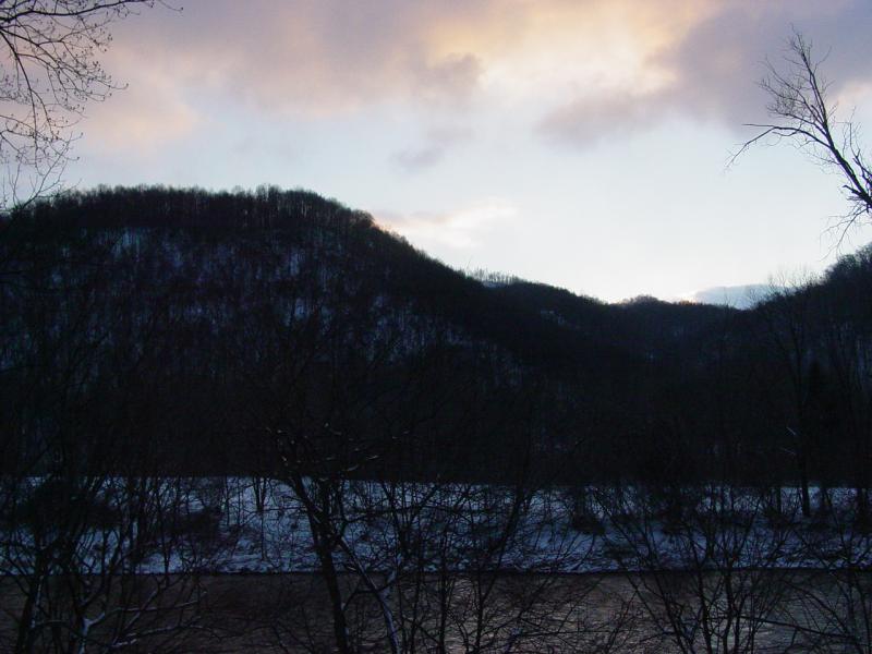
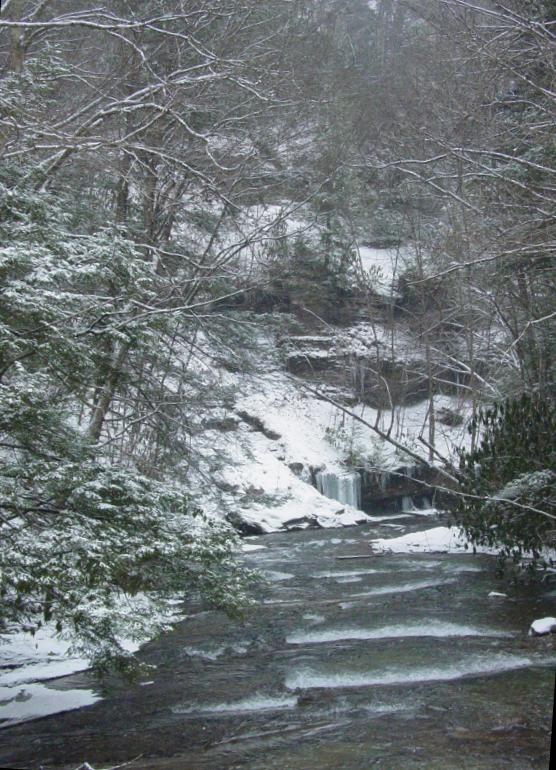
Mike sent me a map coordinate and suggested I locate it. I looked
it up and found the origin point of Judy Run where at least one and
maybe two intermittent streams turn into a regular stream, in a very
interesting place off Route 33. It's about .8 mile in and part the
way is probably marked by a trail of some sort.
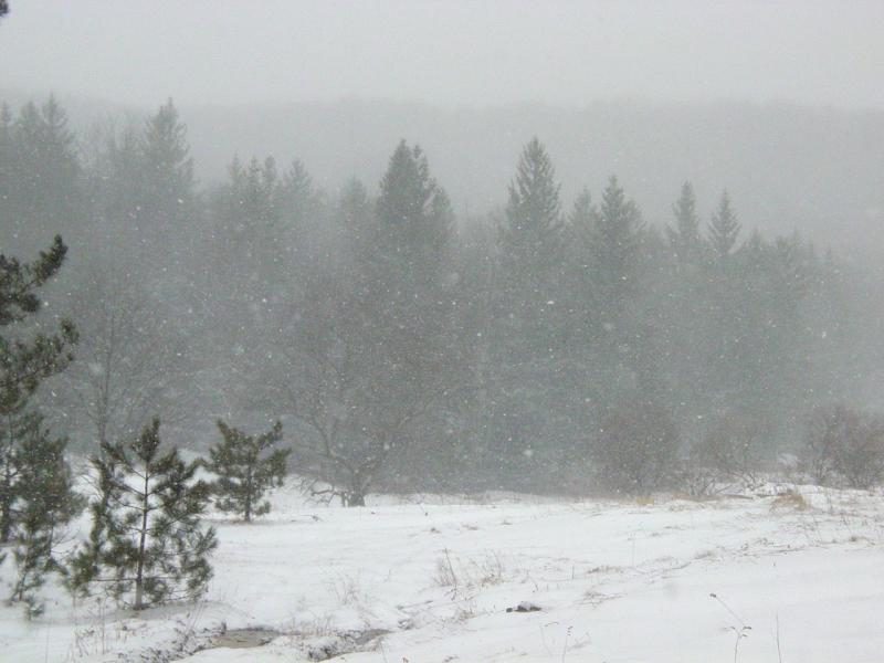
The weather we were expecting was snow and rain, with ice. Great!
Here's the thing. The woods is interesting, but sometimes for
really terrific scenery you need some snow to make it better. Then
there's that feeling of walking in the woods when it's snowing.
It's quiet. Everything is clean. You can see animal tracks,
probably new if they're on the snow that just fell. So we agreed
this would be a good combination. I decided that walking in deep
snow or in freezing rain probably wouldn't mix well with my 6- and
8-year old boys, so I made arrangements to get out alone for the day.
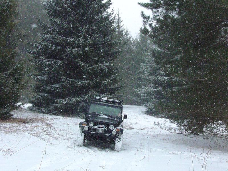
This
really isn't a trail ride in the classic sense of things. Really,
Mike and I were mainly taking a road trip to get down to a couple spots
he'd been thinking about and take a walk in the woods. I figured
there had to be at least one opportunity to put the Jeep in 4-LO.
I wasn't planning on airing down or disconnecting, but you never know...
We drove
down past Clarksburg and then took Route 20 headed south and east.
At one point we stopped so I could fumble with my Blackberry to see if a
nearby cache was within easy reach. The cache turned out to be
perched on the top of a large hill so we continued along. During
the drive we encountered a car on its roof in the ditch with a bunch of
helpers standing around. It appeared nobody was seriously injured
and they didn't seem to need any more lookers-on, so we continued on our
way.
I was
snowing and the roads had more or less been left untouched. We
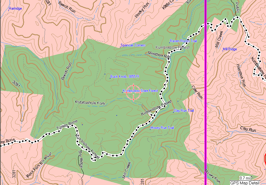
took our time and pretty soon we reached the entrance to
Kumbrabow State
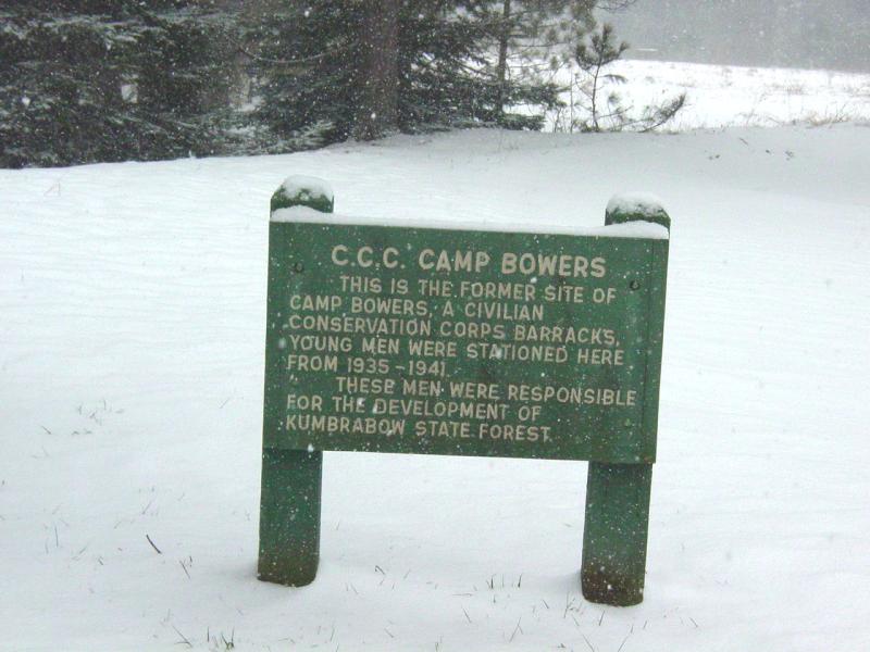
Forest. A little way in we saw a sign that marked the location
of the Civilian Conservation Corps (C.C.C.) Camp Bowers. (More
information about the C.C.C. may be read
here or
here.)
I
decided to go further in and see what the camp looked like. There
is one near my home and I was interested to see what similarities might
be observed.
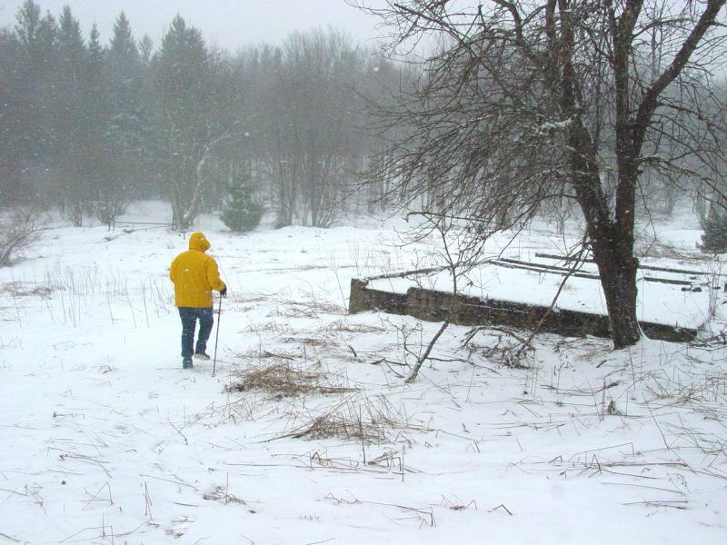


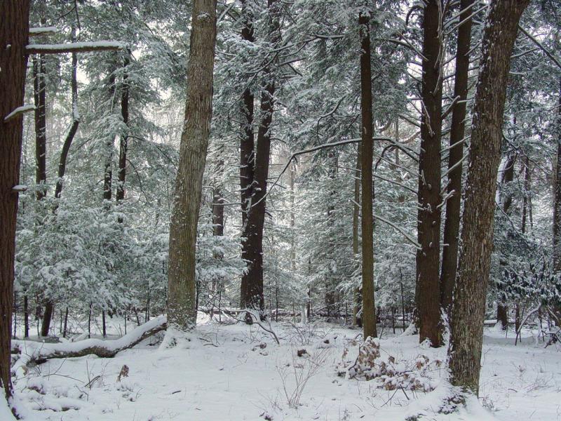
By now
the now was falling though not as heavily as I had hoped. We
parked off the main road and walked in a ways.

There
are some areas marked with signs as Wildlife areas.


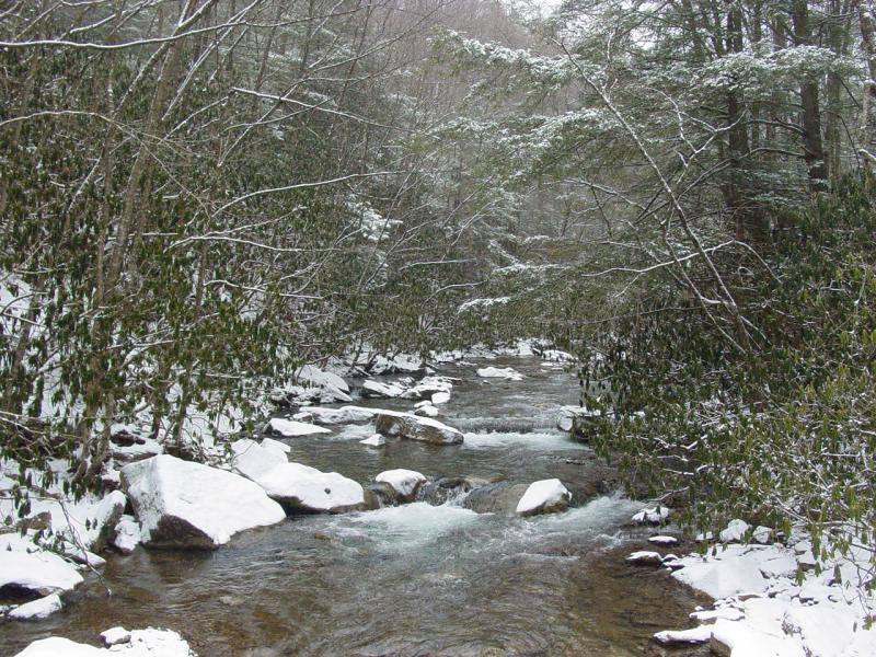
We
crossed a stream and walked up into the woods a ways. It was quiet
and peaceful. The woods was pretty.


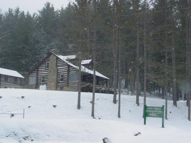
After
looking around for a few minutes, we headed back to the Jeep and drove
further down the main road to the Headquarters. Mike got a couple
trail maps and we continued down the road until we reached the main
road.


Along
the way I stopped because I heard something funny up front. I was
hoping the new u-joint I just installed wasn't acting up. I found
simply that the front axle ends were encrusted in ice from driving
through a deep puddle. I carefully chipped it away and found
everything back to normal when we continued.


Back on
pavement, we drove into Elkins where we stopped at Pizza Hut to eat and
check the maps. After a good pizza and a break, we took a short
side-trip to get a Geocache.
This one
was fairly easy once we got past the brier patch. We went back to
the Jeep and I set a course for
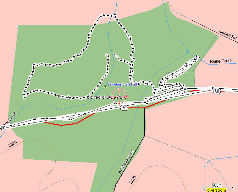
Cathedral
State Park.
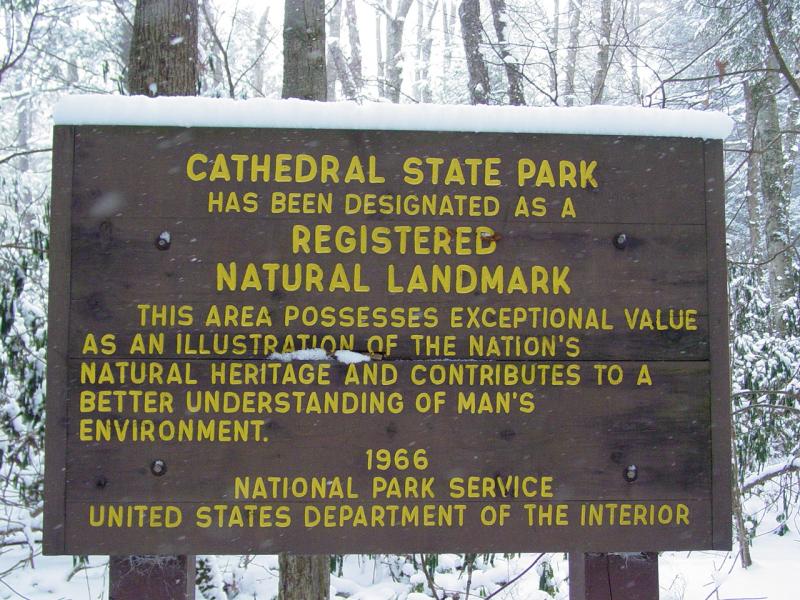

I had
driven past the park on one of my trips out to Brandywine. I was
surprised to find when we stopped this time, that there was more than
meets the eye. From the road there is a modest sign and not much
indication that there is anything going on. Perhaps that's as it
should be.
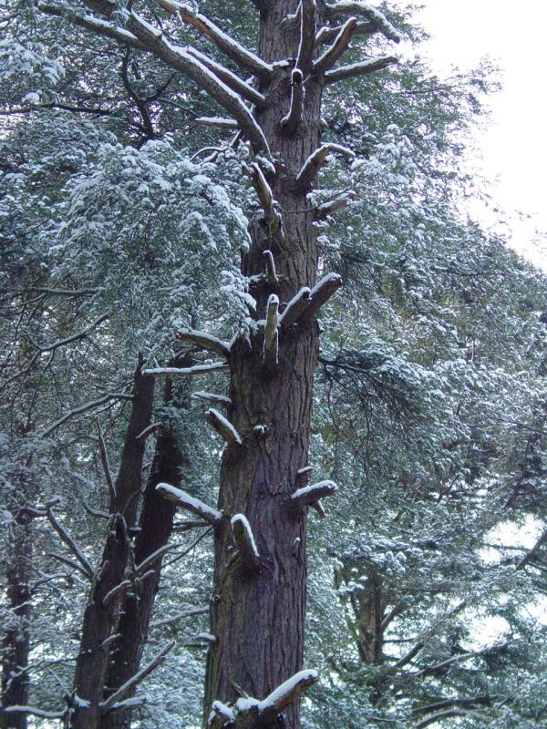
What we
found is a beautiful wooded plot, albeit somewhat small, but full of the
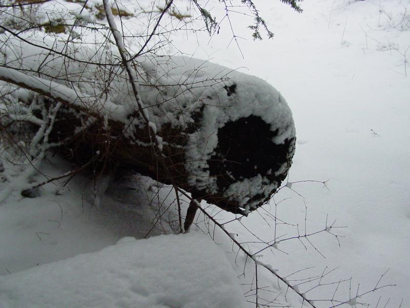
most grand trees. It appears that many have succumbed to the harsh
weather over the last few years as many have lost their tops and some
have fallen down. Still, it was a lush landscape that had a
wonderful feel.


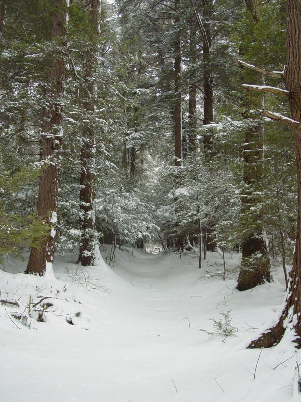


We
walked a good part of the park then got back on the road.
I
noticed that my Jeep had developed a vibration that it did not have on
the way down. I would later learn that the rear u-joint on the
rear drive shaft had expired. Fortunately it held up long enough
to get us home with no excitement or roadside repair!