The Geocache
description is good. It warns against taking a 4WD vehicle down the
trail because of the steepness and the need for clearance. This
information turned out to be accurate enough, though most experienced
wheelers would find this trail to be fairly easy.
But that is not to
say that there are not a few pitfalls that needed to be observed.
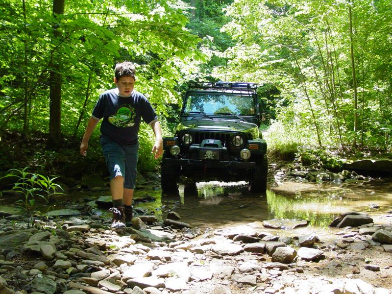
A few little
crossings were pretty shallow and quiet for us, but I could see them
being a little more wet after several days rain.


There were several
places where the ruts were so deep that they had become eroded and
tricky.

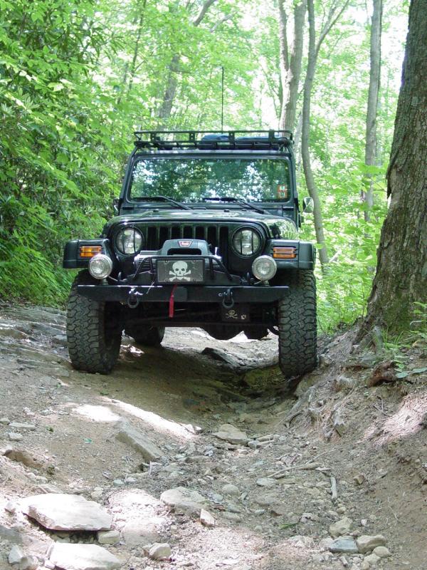
With good tires and
the correct approach, these are no problem. We decided to air down and
disconnect.
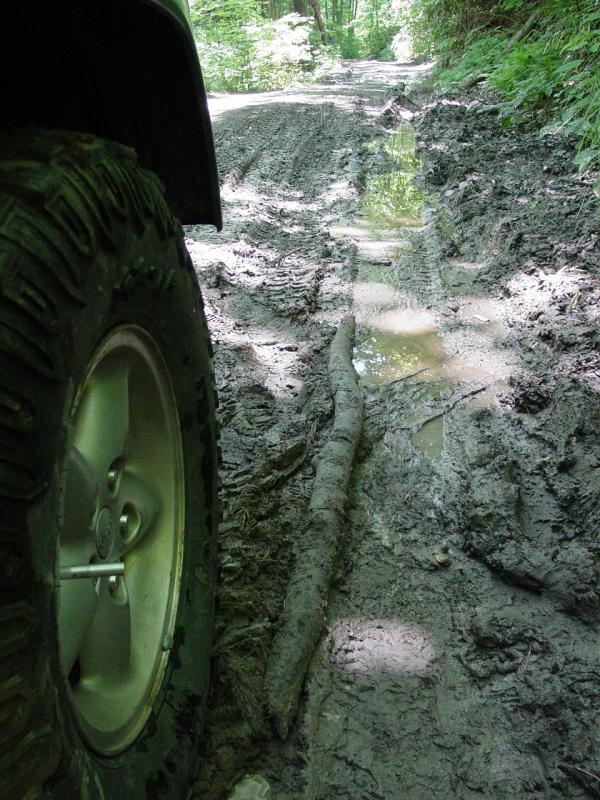
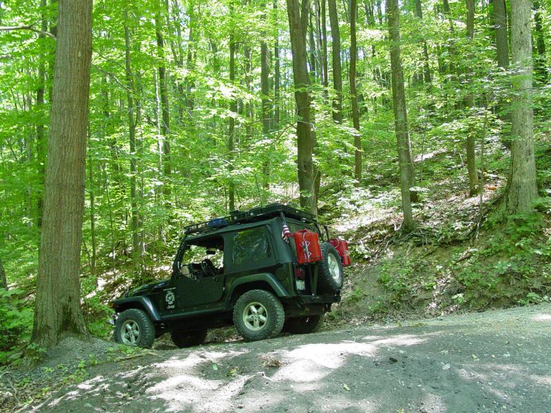
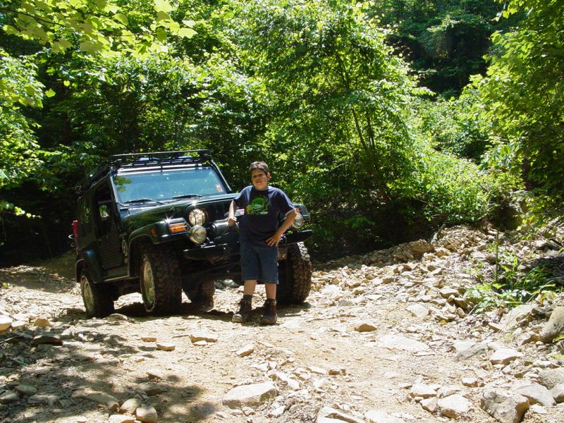
More deep ruts.
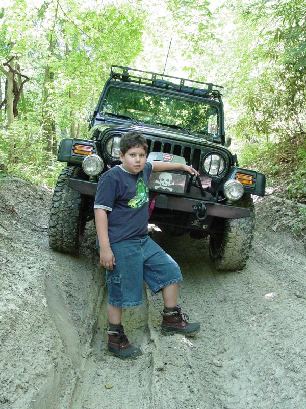
Ted is about five feet tall. I guess that puts his waist at about
2.5 feet. Check out the bumper height with him standing in the
rut!
We crossed the DNR
Boundary.

We saw what looked
like Roses growing on the side of the trail.

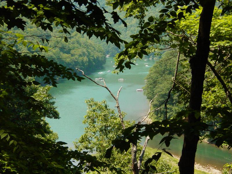
When I caught my
first view of the other side of the river, it stunned me.
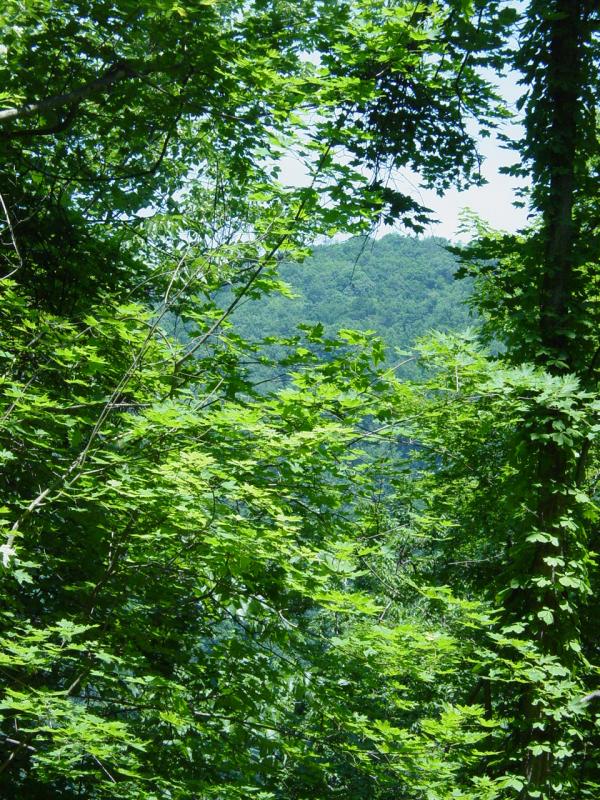
The trail was not
very far from the river but the slope off the side was quite steep!
Then there are the slips. One was quite large, with several yards of
river rock washed through.


It looked quite
stable but it warned of the possibility of having the road just slide
out from under. In a couple spots the trail was narrow but again,
nothing an alert, experienced, well-equipped driver could not handle.
Minivan drivers should walk. Driving down would not be pretty…
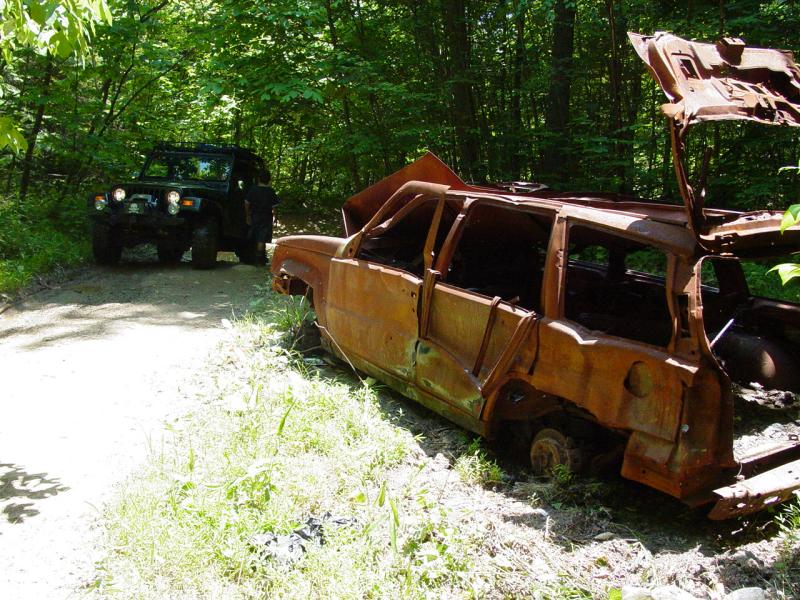
We came to what was
once a Jeep Cherokee. It is completely burned out and maybe even
was stripped before the fire...


More rutted trail,
more fun!

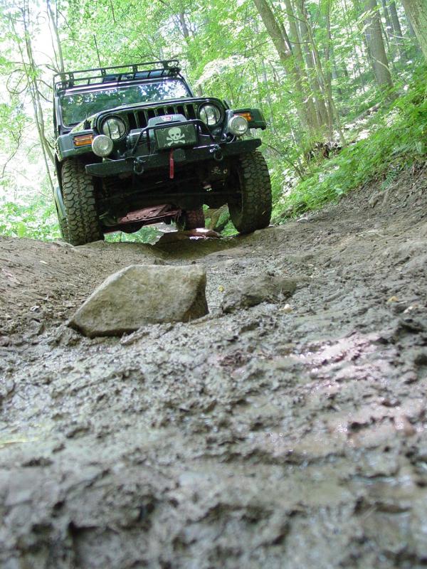
At one point the
overhead clearance between my rack and a rock on the side of the trail
was close...

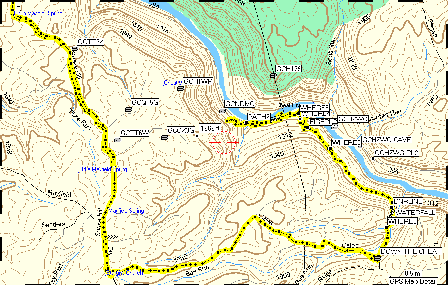
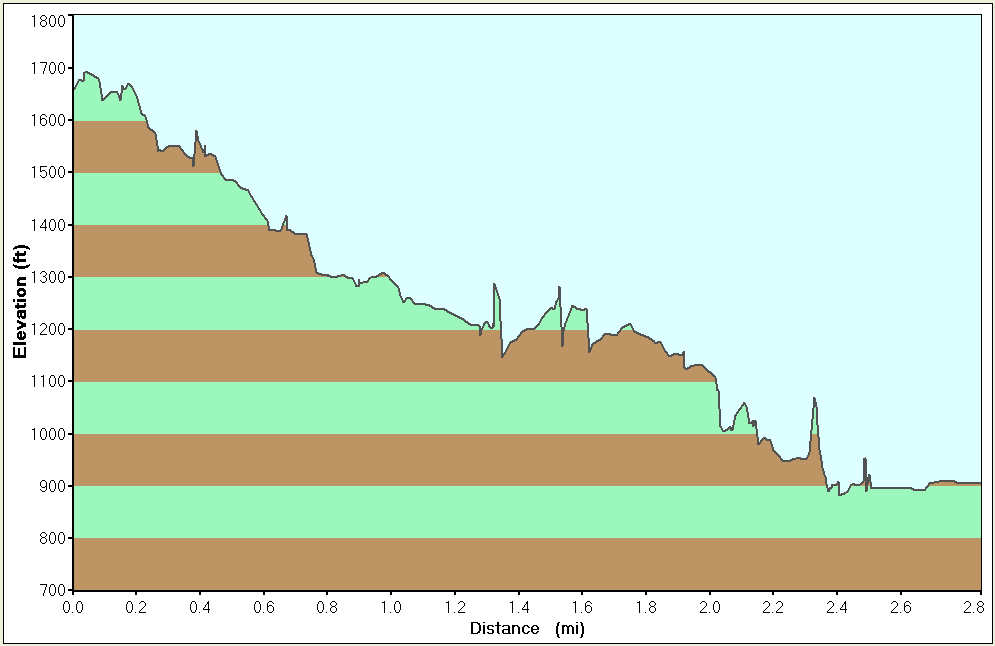
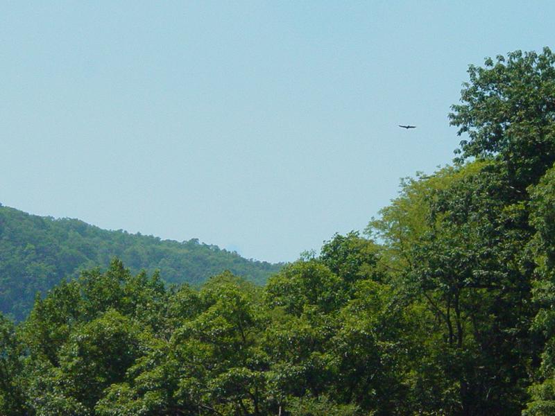
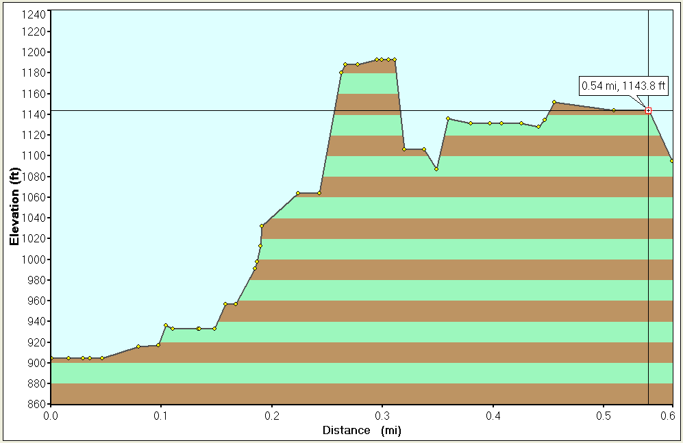
After a while, we
reached the trail at the bottom of the canyon. Here's what the
descent looks like on paper (click):
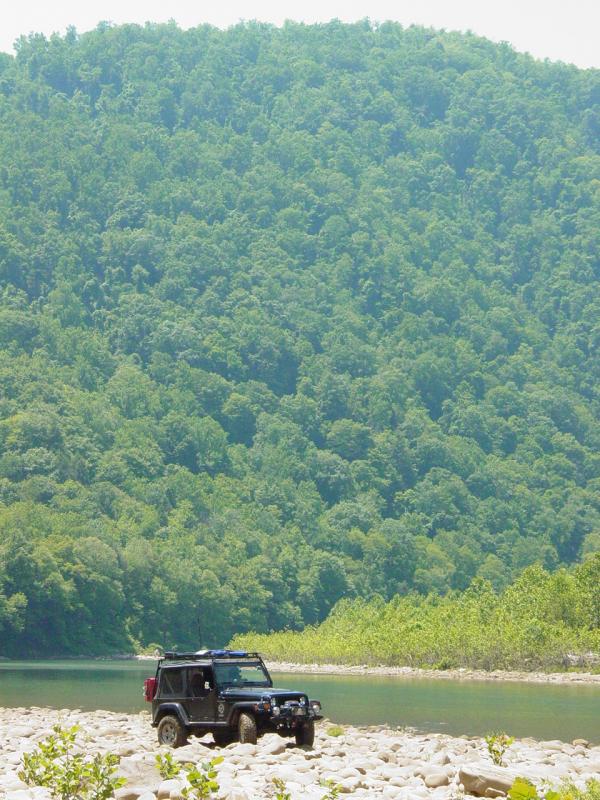
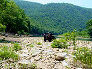
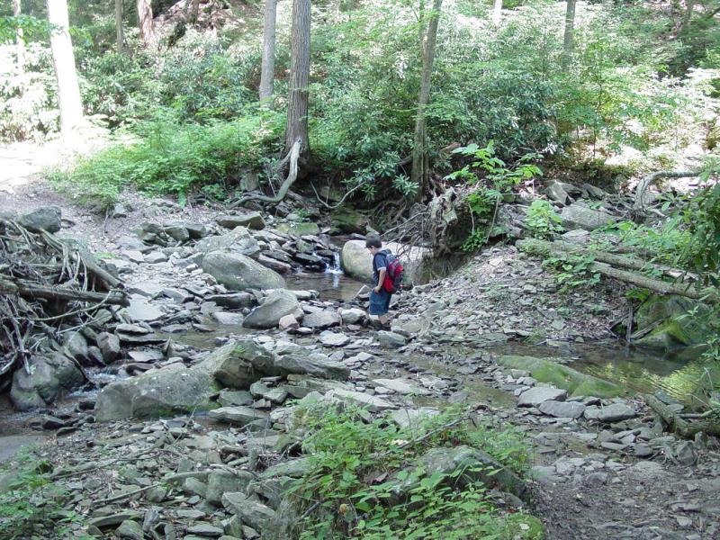
The weather was
spectacular! I took the Jeep down to the rock field on the side of the
river.
Movie
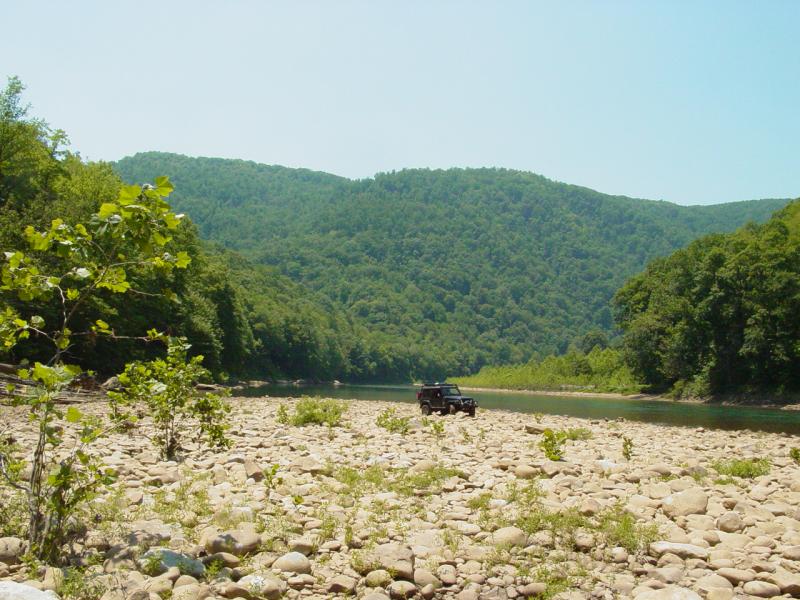
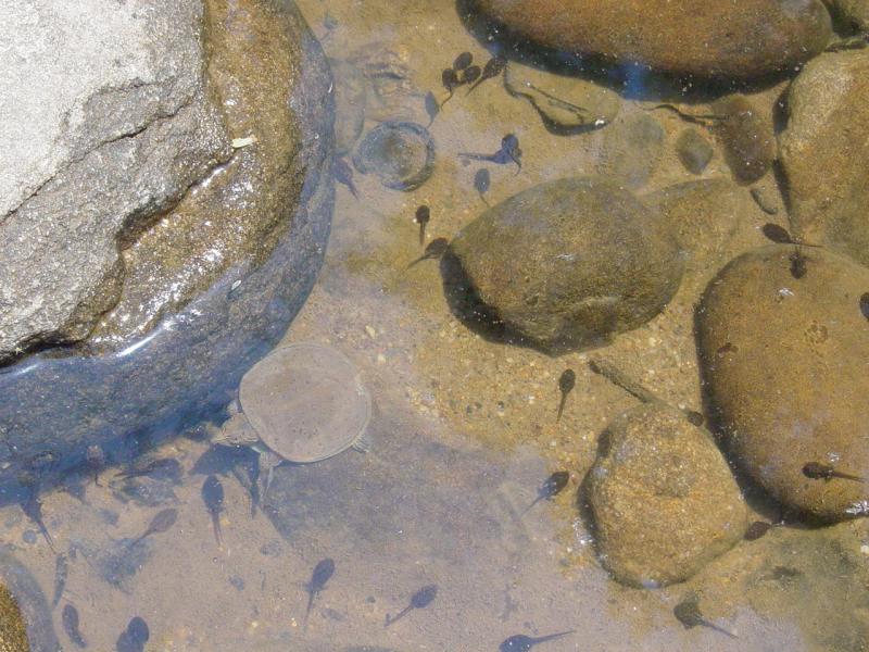
There, we took a
break and enjoyed the views, the wildlife, and the river itself.


We scouted out the
river between here and Beaver Hole and quickly saw that there was too
much water to get across… It would have been interesting if the river
had been lots lower…


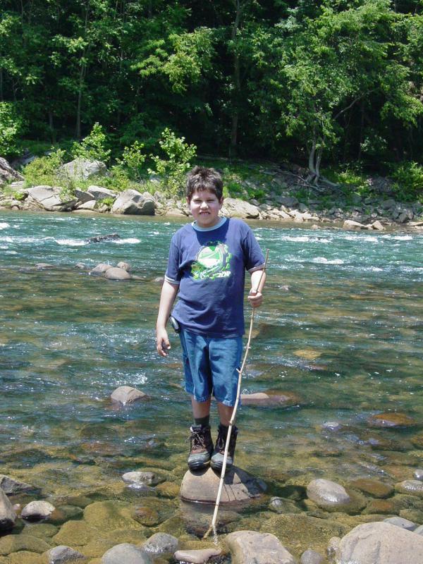
Ted overbalanced
and slipped on the rocks and went down into the water, walkie-talkie
first, so we quickly took the batteries out of it, left it taken apart,
and shook the water out of it. We will see later if it still works...
When we finished
looking around, Ted and I got back in the Jeep and climbed back up to
the trail. We turned in the direction of the cache and soon reached a
point where the trail necked down to ATV width.
It was
theoretically possible to continue, and indeed, I considered it for a
moment. But the thought of dragging the Mountain Laurel brush down the
side of my Jeep for another mile just didn’t sound like a good idea.
Not that the paint isn’t already well scratched, but I just wasn’t in
the mood for it today.
So we packed up a
knapsack, secured the Jeep, and set out on foot. It was nice. The
trail was shaded, it was sunny but not real hot. We were very happy
walking along headed in the general direction of the cache. It seemed
like nothing could go wrong…
Hindsight is
20-20. I can always look back and see where I screwed up, where I
should have made different choices than the ones I did. For us, I
would say we should have re-read the cache description a little more
carefully and thought about what it said:
“PLEASE
DO NOT ATTEMPT THIS CACHE FROM THE CHEAT VIEW CACHE. THIS CACHE MAY ONLY
BE ABOUT .50 MILES AWAY BUT IT IS 1100 FEET LOWER. THE MOUNTAIN HERE IS
VERY STEEP AND TREACHEROUS. NO SAFE BUSHWHACK ROUTE EXISTS TO THIS CACHE
FROM THERE.”
Now to be fair to myself, we weren’t
coming down from Cheat View Cache so reading this casually (which was a
mistake) I missed the part that said “THE
MOUNTAIN HERE IS VERY STEEP AND TREACHEROUS.”
I missed
it completely.
And that was a big mistake.
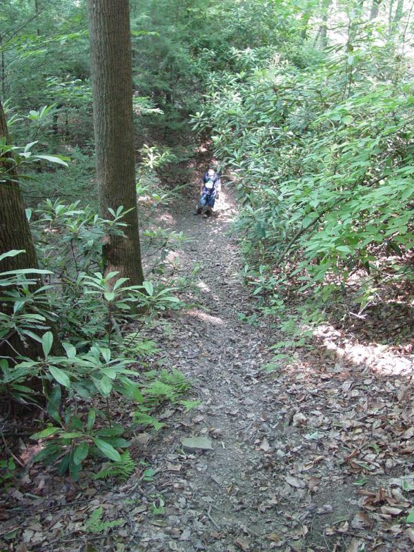
So we reached the
bottom and had the .6 mile hike ahead of us. We packed water and
snacks, and set out. Pretty soon we reached a washed out stream
crossing.

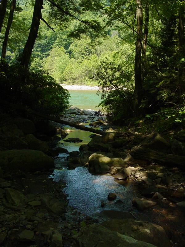
Just after that, on
the left, was a well-defined path that went up the side of the hill
quite steeply. I looked at the GPS. The cache was about .2 mile away
and according to my display, a few hundred feet higher in elevation. So
I deduced that this well-defined path must be a good way to get up this
steep mountain and level off at the cache.
I could not have
been more wrong. But at the time it seemed to make perfect sense. So
Ted and I started up this path. Pretty soon we came to some fallen
branches, not much more that twigs really, across the path. So we went
around it and continued up the path.
Except at that
point the “path” reduced to nothing more than an animal trail, or
perhaps even a trail of where water had run down the steep hill. Still
it seemed to make sense and we continued. But now the ground was
crumbly-loose and the footing was very insecure.
When we reached the
elevation of the cache, about .16 mile away, we started to traverse the
hillside. And that’s when it got really hairy. There was no trail.
There was no path. There was no evidence that anything had walked this
way. And it quickly became apparent that the going was going to be
extremely tough. But still it seemed do-able. What a dolt I am.
By the time we got
to the point .14 mile from the cache, still at the same elevation as the
cache, we were fair clinging to the side of this canyon by anything that
proved to be truly anchored.
Most everything I
reached for either came uprooted or crumbled. Almost every step I took
required first establishing how stable the ground was, then removing the
deep leaf deposits, then scrubbing down to dirt, then finding something
to grab onto in case I was to slip. That was every step, a foot at a
time!
The hill is nearly
straight down with little to stop one from falling all the way into the
bottom of the canyon. The trees are quite sparse, and most are not much
more than a one or two inch sapling.
At this point I had
Ted holding onto my belt very solidly and I was constantly coaching him:
“Are you OK?”
“Are you holding on?” “Stay leaning into the hill.” “Stay in my
tracks.”
And other
situational comments to keep him alert:
“That tree is
no good to hold onto – it’s rotten.” “That rock is loose and will
not hold us.”
Pretty soon it
became clear that even with only .13 mile to go, we had no idea what we
were headed for terrain-wise. And that’s when it happened –
I reached a point where the gap between the next
foothold was too far; the next tree to hold was out of reach; the
footing was completely unstable, and worst of all, the hill was
nearly vertical.
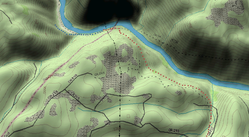
I stopped to assess
the situation and nervously realized that we had reached the end of the
line. I was already over-extended as it was, and I had an
inexperienced, 105-pound kid hanging onto my belt. I had my fingers
plunged into the dirt and I was basically using them for spikes to keep
us both from sliding off the hill to uncertain fates at the stopping
point below… Here's what it looks like on paper (click)
This made real some
dreams I’d had over and over again as a kid, and even into adulthood.
They were those falling dreams where strange situations conspire to
bring you to a place so unlikely you’d never believe it when you’re
awake. But asleep you might fall for it and soon enough find yourself
free-falling to the bottom, where you might land with a huge thump,
waking up sweating and wondering if you really were still alive.
I stopped to
think. There wasn’t much to think about. We could not continue on.
That stupid “gotta go anyway to find that cache” even then echoed in my
head. I shook it off and concentrated on how to keep holding onto this
mushy hill and get around Ted without taking us both to the bottom in
one horrible move.
Ted was standing on
the roots of a 1-inch thick sapling that had proven stable. I traversed
back the foot between us (the length of his hand on my belt, remember?)
and told him to lay on the side of the hill (which meant he was more or
less standing up straight) and I would be putting my foot on his foot
and it would probably hurt for a second while I crawled over him. He
understood and soon I was back in the lead now retracing our steps back
out the way we had come.
I should stop and
talk about Ted for a moment. Here he is a four years ago in his third
season of going out in the woods with me. He was about to turn
five years old at the time. He's been going into the woods for a
long time. He may very well have more time in the woods than some
adults.
Here's a lot bigger
now, but he's still a kid. This kid was solid through this
situation. He did every last thing I told him to do, without so much as
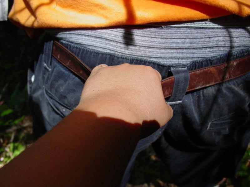
a second thought. I felt the grip of his hand on my belt and it never
loosened, never wavered. Ted took this picture for me when we got back
to sure footing but it makes sense to show it here because this is what
we had been reduced to at this point. That's Ted's hand and my
belt.
He tended to stand
too upright and once nearly overbalanced. But he always snapped
back when I reminded him. There was no whimpering. He never froze. He
maintained a relaxed conversation with me in between the constant work
we were doing to stay on the canyon wall.
We rested often,
checking the GPS frequently to be sure we were retracing our steps.
This posed a problem because I had also brought the camera and a pair of
binoculars. On top of that the signal coverage was very sparse and we
pretty much lost signal every time I put the GPS in my pocket, which was
most of the time because I needed both hands constantly.
At one point we
caught a view of boats on the river.

It was almost like
watching a movie. We could see them down in the canyon; even hear them
yelling and the motors and so on. But they might as well have been on
the moon. I had left the FRS radio I was carrying in the Jeep and I had
Ted’s disassembled, water-logged one in my camera bag. The cell phone
had no coverage.
I literally sat
(more like laid) on the side of the canyon wall and thought about SAR
(Search and Rescue). How would I get them to come find us? What would
happen if we had to stay all night? Would there be any way to get the
boaters attention way down below. It was clear that we were on our own.
We had to get back out the way we came, and we had to do it by
ourselves.
By the time we
started back-tracking, we had been up there for 50 minutes. We’d only
covered .5 mile and we’d struggled for every foot. We’d finished the
water. We’d eaten the two snack bars we had. And we were both tired,
stinging, and really anxious to get on some solid level ground.
The half mile back
was every bit as difficult as it had been going in. Ted held onto my
belt the entire way. At times it was tough because I had to span some
gap or other and my stride and reach is much greater than his. So we
had to time it so that he knew I was going to make the reach and he was
basically going to be getting dragged along.
When I was doing
this, I had to be absolutely certain that what I was aiming for was
going to hold both of us because we would not have any other options
available.
Did I say hindsight
is 20-20? I can hear you now and you’re right. It was a colossal
mistake to be here doing this. The combination of scenarios that
ran through my head were terrible. But I put it aside to mull over
later so that I could get us out of this mess.
Pretty soon we
reached the point where the whole ordeal had developed – the place where
the “path” had dwindled to nothing. We climbed up the mound onto it and
stopped to catch our breath for about the 100th time. Then
we started down.

It was a blessing
by comparison and soon we were within sight of the clearing where we had
started. Look at the scale of this place!

We had been on that
path since 2:20pm. It was now 4:15pm. We’d been hanging off the canyon
wall for nearly two hours! It seemed like an
eternity and it seemed like 5 minutes both at once. Ted and I
slowly walked out on the trail to where we parked the Jeep. We were
both exhausted and grateful to finally be “back”. We pulled out the
rest of the water (that I wish we had brought along) and took our time
refreshing ourselves.
We talked about a
few basic things that could have happened. I didn’t want to do it on
the hill, though it might have made more sense. I wanted to see what
Ted would have done if I had fallen off the hill (with or without
injury). He did pretty well, though I have a feeling we would have gone
down together. We discussed the different situations and different
options. I don’t think it would have been pretty but if he made it off
the hill, he pretty much knew what to do.
I didn’t spend too
much time drilling him because it was already overload. When we
recovered from the hike, we started the Jeep and started back up the
trail to the road. We went back down to the rocks to look around a
little and then continued.
We drove some of
the side trails and found a hunters cabin.


A little further,
some nice campsites and more derelict autos.


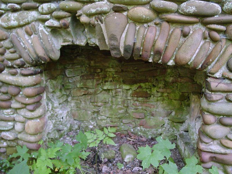
Coming back up out
of the canyon, we came upon a fireplace standing in a spot that might
have been host to a house at one time.


Coming back through the
slip I took a picture from the driver's seat.

In an attempt to
give a feel for the trail, I made a movie as I drove but it’s pretty
painful to watch because the camera moves so much. But it does show the
trail well.
Movie
A little further, what
looked like a cave or rocky overhang, and a waterfall.


The trail beckons a
mini-van (NOT!)
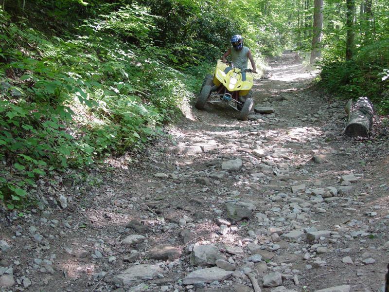
Finally we got to the trail head, meeting an ATV driver
who was coming in as we were leaving.