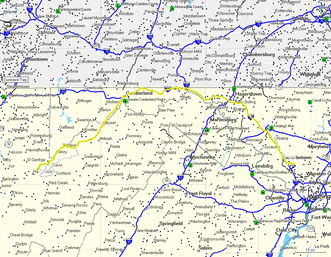
So with these details out of the way, I
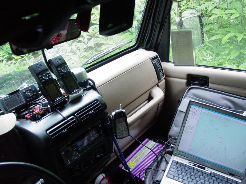
removed the back seat of the Jeep, packed all my stuff inside, fired up the GPS and
laptop, got cash and supper, and hit the road at 8:30pm. The road trip to Blackwater
Canyon was long and driven mostly after dark. I left the laptop on, running off the
power inverter, tracking my route as I went. The large screen was a huge improvement
over the 1 x 2 screens of the GPSs. I ran the laptop connected to one of the GPS
12's and ran tracks on the other two GPS's.
I hopped on 270 and then 70, heading west
for Cumberland. Caught 68 near Hancock and made a brief stop at Sideling Hill at
10:22 PM. Eventually I got to the general area of the cache, past Keyser and Mt
Storm. I had a brief moment in Gormania where GPS coverage was spotty and coincided
with a bizarre road intersection, so I got a little turned around. But I reverted to
paper maps and compass and oriented myself in a matter of seconds, and got back on
track. Except for that few minutes, I was on-route the entire weekend.
I have always liked the soft glow of
electronic devices in the car at night. On this trip, with three GPS receivers, the
CB, the stereo, the cell phone, the power inverter, and the laptop, I was in doo-dad
heaven.
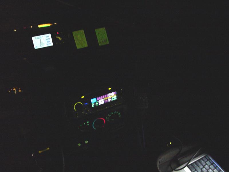


I had to flip the laptop screen down to
keep it from distracting me as I drove. And every so often, the screen saver kicked
in and I would have to log in again if I wanted to see where I was. I half expected to get
stopped by a police officer for watching TV but didn't.
I had set a GPS course to take me to Olson
Tower from my house. It worked perfectly. I arrived at the tower at 1:13
AM. It was too dark to climb it, so I turned back down the road and soon found the
primitive campsite the ranger had described to me on the telephone. I left the Jeep
running with the lights on while I set up camp, then hit the sack. I like the glow
of the cyano light sticks that I give the kids when we go camping - it's a handy night
light - so I cracked one of them on before I fell asleep. I figured maybe the bears
would see it and mistake my tent for a fire and leave it alone...
A couple times before I got up, I woke to
answer the call of nature. The quiet and solitude that I found outside is hard to
describe. It had been a long time since I realized how much noise we tune out in our
daily lives. This place is so far from anything that the silence there is
profound. The only thing that interrupted it in the early morning hours was the
occasional airplane flying high above. But for that it was just the birds and the
bees singing the primordial tune they know so well. At that hour, everything in the
fog comes through in black and white, giving a very soft and surreal quality to the
woods. I felt like I was standing in a painting and if I were to turn away, I would
find myself back in line at the Hirshhorn
lamenting the crowds. But it was real and I had it all to myself and the animals
around me that I could not see.
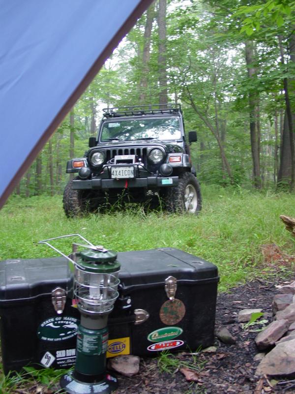


Later in the morning, when I got up, I
moved the tent to a better location and put my large tarp (that I had packed at the last
minute,) over the tent and surrounding area.
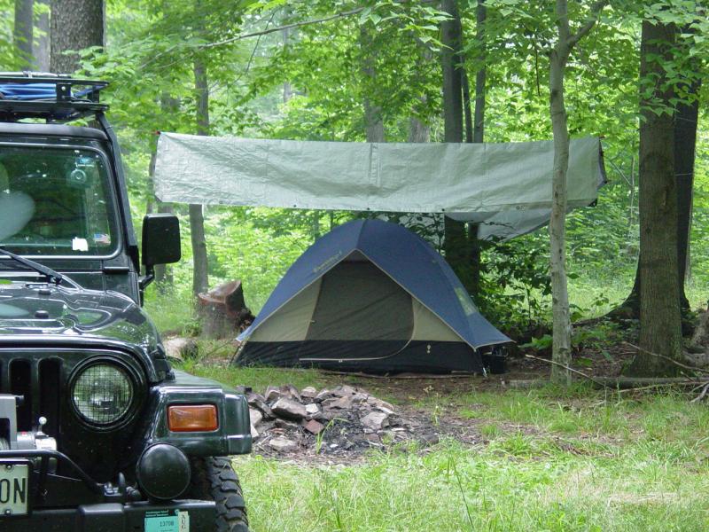
I figured it would be good protection
against dew fall and rain, and didn't take much time to set up. On this trip I chose
to use the two-man tent I bought the kids because I didn't need all the space of the large
tent and didn't want to spend the extra time it takes to set up. This proved to be a
good choice, and except that the only thing that fits in the tent is the full-sized air
mattress, it was very comfortable.
I made some coffee and had something
simple for breakfast, then broke down my stuff and stored it in a locked trunk in the
tent. I didn't really expect anyone to come along and steal my stuff, but figured if
that was going to happen, then I'd make it a little bit less worthwhile. I
downloaded my GPS tracks from the night before to the computer and reviewed my plans for
the days ahead. I was pleased that my trip in the night before had gone so well.


The drive to the trail head was
short. I outfitted myself for a four mile hike. I packed food and took canteen
belt, map and compass, the instructions for the GeoCache, and the camera. I parked
the Jeep at the trail head and took two GPS receivers, locking everything else up.
This trip represents a departure from
normal habits for me. I didn't bring the kids or anyone else. And more
significantly, a big part of this outing involved hiking instead of driving. The
location of the GeoCache is not accessible by vehicle (well, my assessment of the trail is
that with the exception of breaking the law, and one spot where the edge of the canyon rim
and boulders on the side of the trail are too narrow to drive through, one could
get a vehicle down the trail with significant paint scraping and general anti-social
behavior.
I would have no way of knowing about the
tight spot but it was academic - I came here to hike the trail to the GeoCache and like to
obey the rules with regard to trail use. I do NOT recommend attempting to drive this
trail - there are lots of trail users, and as I said previously, it is not open to
motorized vehicles. Mountain bikes are welcome, but that's it. And if you
still had much of a vehicle left when you reached the pinch, you might not be so lucky if
you thought of trying to squeeze by...
I realized after setting off that I had
forgotten my sunglasses, so I walked back to the Jeep and retrieved them. Then I set
off down the trail in the direction of the cache. I soon realized that I had chosen
the "easy drive/long walk" option described in the GeoCache description.
Instead of driving down the rocky road that requires high clearance and perhaps 4WD,
followed by a short hike, I had chose to drive up the smooth dirt road and hike 1.83 miles
to the cache location. DOH! But I reasoned that I was not in any hurry to get
anyplace and the walk would do me good. Also, I would run the rough road later after
completing the hike.

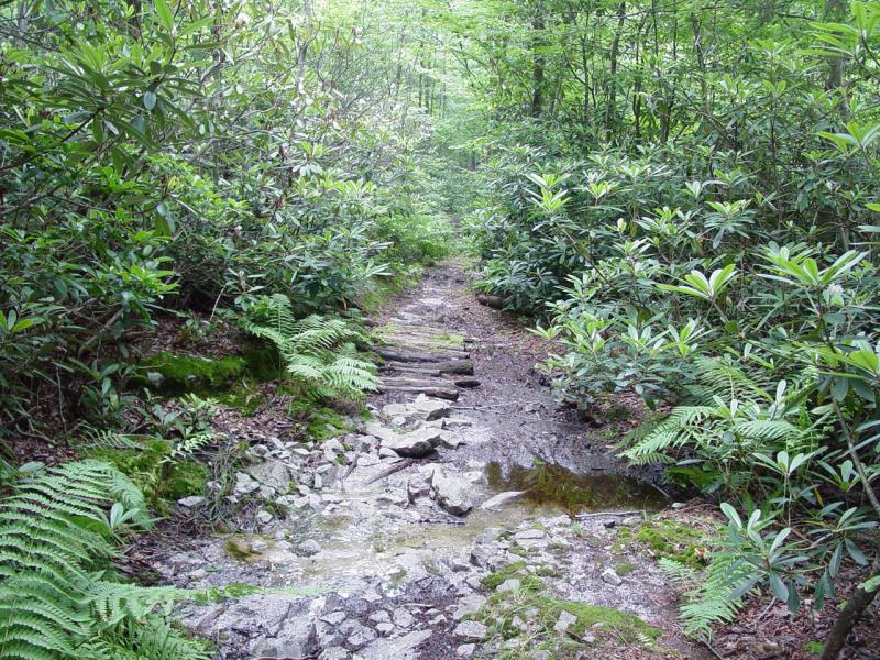
The walk along the trail was very
pleasant. It reminded me of the many hikes I took in Vermont. I noticed that
the trail ran downhill most of the way to the cache and mentally noted that I would have a
hard walk back to the trail head.
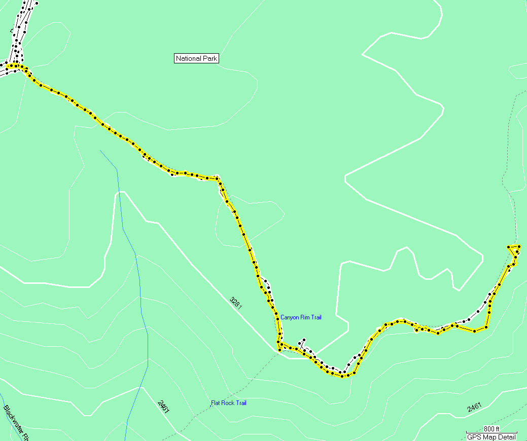
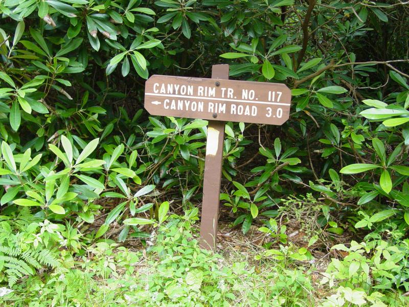
Another trail intersects with the Canyon
Rim Trail (Flat Rock Trail) and sure enough, at the designated spot, I peeked through some
pine branches and discovered a well hiked trail descending steeply down the canyon
rim. Had I not know of the trail and without the GPS to mark the spot, I would have
walked right past this junction without even knowing another trail was here!
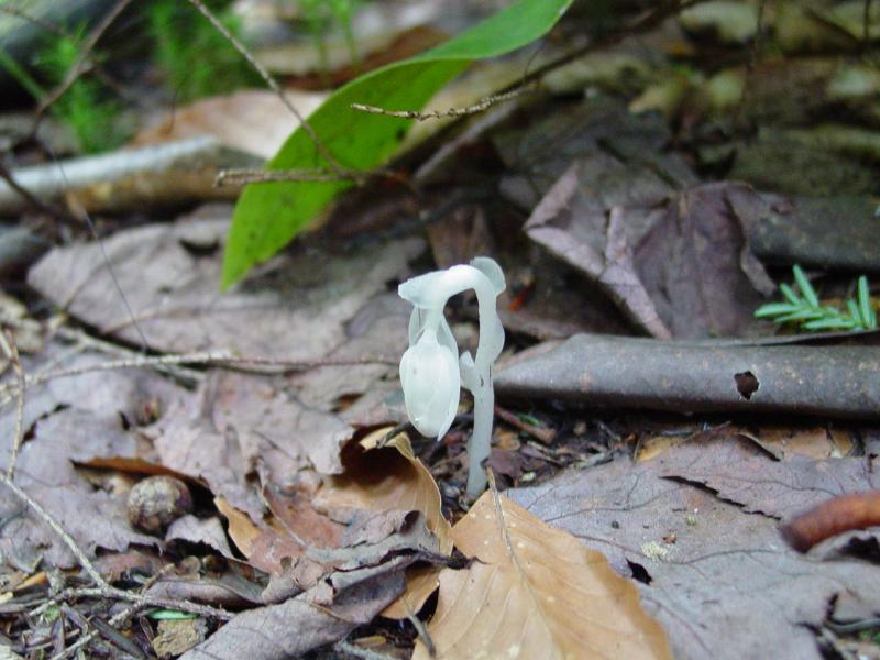
There were lots of plants and other
things to look at along the way. The Mountain Laurel were almost past their
prime. Most of the flowers were looking pretty ragged, but a few were still pretty
enough to photograph. I saw some Indian Pipe fungus and mushrooms as well.


Hiking along the more or less level
portion of the trail that runs roughly east-west to the cache, I noted a small cairn of
rocks and a few sticks arranged like an arrow.
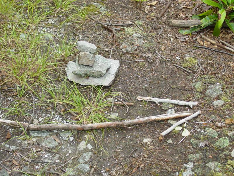


Looking in the direction indicated, I saw
sketch of a path leading to the rim of the canyon. I followed it to an outcrop of
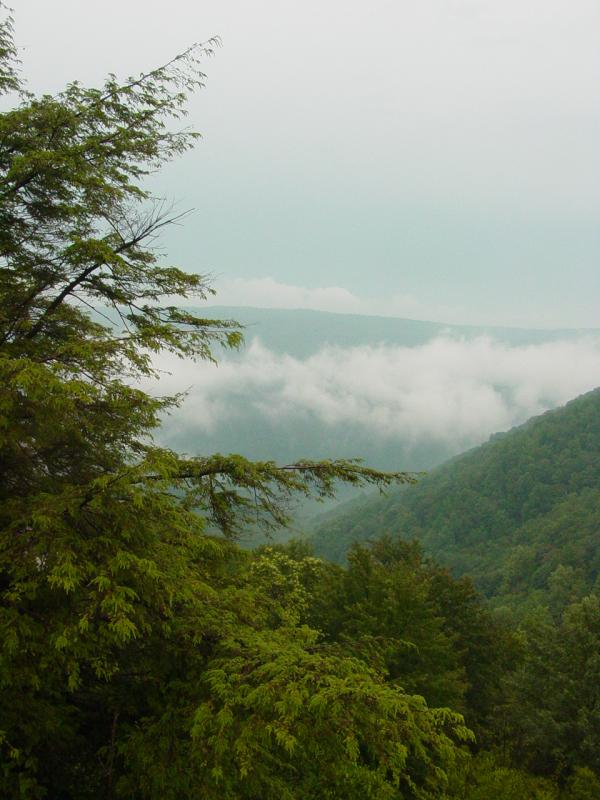
rocks and a staggering view. The sky was very hazy and the air was quite moist so
the view was not what it would be on a cool fall day, but it was still worth the side
trip.
GeoCache
Eventually I got to the spot that was
marked on the GPS as the cache location. To my left, an large rock pinnacle rose
from the trail.
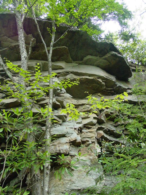

I climbed around behind it and then up
onto it. This was tricky business and was not necessary to locate the cache.
In fact the footing and hand-holds were marginal; I probably took a big chance climbing
it. I would not recommend climbing the pinnacle without gear as a fall would be
life-threatening, and even if you lived, you'd be out there for some time before someone
found you (or your bones...).
Descending from the pinnacle, I re-read
the GeoCache instructions only to learn of my folly, and climbed the correct rocks to the
cache location. As expected, it was hidden casually, but given that the spot was
well off the path, it is unlikely that someone just out hiking is not going to find it by
accident. I didn't find any snakes but do not doubt that they could be living in the
many rocks strewn all about.
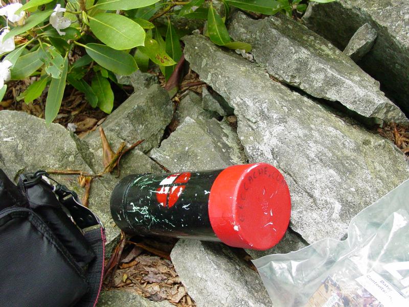

The tube contained a number of
trinkets. As I went through the cache, I could hear thunder moving closer from the
north, and the sky was darkening. I ate lunch here, taking some time to rest and
catch my breath from the climb. Then I logged the cache contents, signed the log,
and then made my way back down to the trail.
Hiking Back
By the time I was back underway, a
little after noon, it had started to rain. At first it was light and the trees kept
me from getting wet. But in anticipation of heavier rain, I packed all my electronic
devices (camera, one GPS, phone, Blackberry) into my pack where I hoped they'd stay
dry. I kept one GPS out because it is waterproof and I wanted to be sure to stay on
the trail. I turned tracking off and followed the track I had made coming in.
It gradually rained harder and harder
until finally I was hiking in a driving rain. It was uncomfortable to be soaked to
the skin, but I wasn't cold or hungry, I so pressed on. I was so lost in my own
reverie that I was startled by a metallic rattling noise, a squeak, and someone saying
"Sorry!". A mountain biker had been descending the trail and materialized
out of the foliage immediately in front of me, requiring him to stop short of hitting me
head-on. I was less surprised that I would have expected, but still a little
rattled. I told him all was well, good thing neither of us were bears, and we
continued each his own way. He advised me his companion was following behind him and
shortly I came upon her walking her bike through some rough terrain.
I had contemplated bringing my bike on
the trail, but not knowing what the trail looked like decided that it would be an
impediment if I could not ride it most of the way in both directions. Given my lack
of improved physical conditioning, I would indeed have walked the bike most of the way and
hated life for it. The hill up to the trail head was taking its toll on me, and the
rain showed no signs of abating. But with the knowledge of how close the trail head
was, I didn't lose perspective and around 2 PM was back at the Jeep, stowing stuff out of
the rain, and trying to find a way to make my soggy self comfortable.
I snapped all my electronic devices back
into place, downloaded the GPS tracks into the laptop, and set a course to drive the rough
road described in the GeoCache description.


(Legend)
With everything all set, and my course
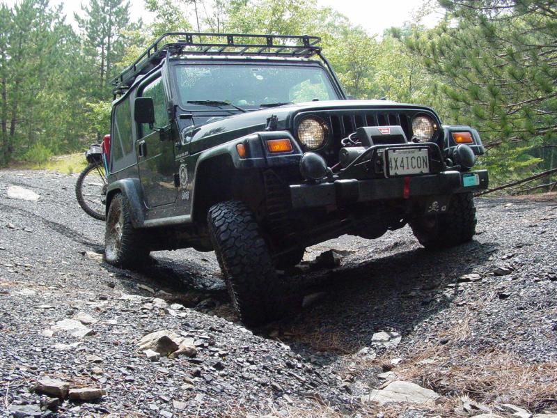
identified, I drove back down the trail past my camp and turned in to FR 18. The
road was rough in spots and would be a hard route to follow in a car. For me, it was
the mildest of wheeling but the woods and later down the road, the views were worth the
trip.
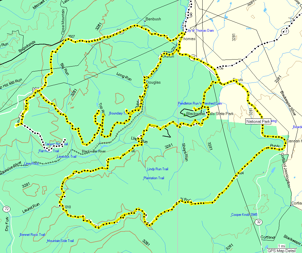
GPS coverage was spotty but the road was
easy to follow. I passed the landmarks shown on the map and also the vehicle and
bikes of the people I had encountered on the trail. They must have ridden their
bikes up FR 18 to the same trail head I used, then rode the trail all the way through,
coming out on FR 18 again - the same entrance I could have taken if I had opted for the
short route to the cache.
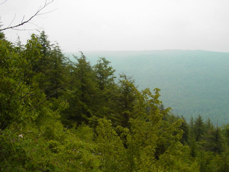
A little further down the road, I came to
the Big Run Scenic Overlook. The view was much as before, now a little more hazy
owing to the rain. But I stopped and took it in, finding a pleasant view and great
solitude.


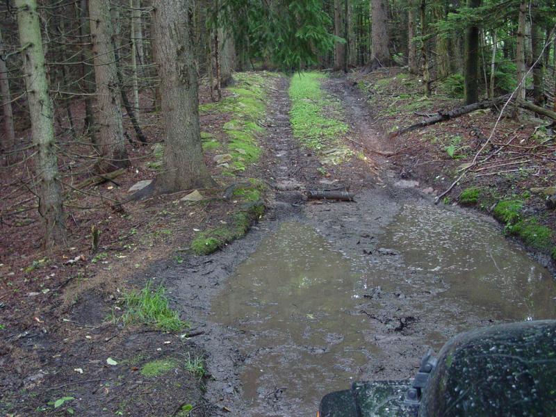
The rain stopped. Further down the
road I came to a spot that was washed out. It was a typical crossing over a trickle
of water that was slowly going to erode the terrain. It certainly was not an
obstacle, but it made for a good picture or three.


Noting a road on the map that ascended up
and away from FR 18 on the map, I watched and soon spotted it. The entrance was
severely rutted and looked a bit difficult owing to the depth of the ruts and the height
of the center. I was able to spot a line to one side and climb past the rough
section. Now we're wheeling! The road climbs into the woods and runs right,
leveling off and passing through a nice little pine grove, and disappearing into an old
strip mine area.


There were very few signs of activity and
I suspect it has been some time since the mine was active. I stopped to walk around,
take pictures, and after driving to the other end of the general area, took down a chair
and had an afternoon snack. Following the lead of a book I have ("Manifold Destiny"), I had placed a couple vacuum packs containing
Beef Stew MRE's in my engine compartment next to my radiator overflow bottle. I have
observed that it gets very hot there and should bring food to a good temperature for
eating. It is not hot enough for cooking, but pre-cooked foods like the MRE's should
work great. Sure enough, I opened the hood and found a nice hot meal waiting for me!
I ate them right out of the package and was very satisfied. The book is funny
but also gives some great tips about cooking with your engine, the best engines to use
(got a spare Jaguar XK engine laying around?) and dispels some of the fears you may have
about combining food and engines. I recommend it!


Then I drove around the area, playing on
some of the rough spots and taking it easy on the terrain and my vehicle. No sense
breaking something way out here!


I backtracked down to FR 18 following
the same route I came in on. I came to another washout like one before and made a
couple more images. It wasn't really an obstacle though a car driver might think
twice before attempting to cross.


Another road going up into the woods
presented itself. This one was fairly well traveled so I poked in to see where it
led.
After following it for a while I came to
a gated area that was marked by a hunting club as their private domain. I turned
back and went down to FR 18 once again. The road was interesting for the views and
gave me some time to relax and just enjoy the woods.
When I reached pavement I stopped to make
pictures of some of the road signs. I discovered that my front number plate had come
free and was dangling by the tether that I had installed for that purpose.

Thankfully I did not have to backtrack in
the vain hope of finding my number plate! I snapped it back in place and finished
taking my pictures.


I came to a little "town"
called Douglas though I must say, it looked more like a small neighborhood than anything
else. It was wrapped in lush vegetation and gave off a serenity that is pretty rare
back where I live.

Pretty soon I came to a nice little house
that is for sale. I stopped to record the info and make a couple images of the
area.


After that I reached the little town of
Thomas, where I got fuel and bought some firewood so that I could have a fire at camp
later in the evening.

Then I drove up the road to the town of
Davis, making note of the location of the car wash as I passed. I couldn't find the
entrance to the Canaan Loop
Road on my maps so I went to the Blackwater Falls State Park for directions.

I got a map and directions and soon found
the trail head.
Canaan Loop Road
Movie
By all accounts, the Canaan Loop Road is
rough in a couple spots, and most of the references I found suggest a high-clearance
vehicle, with 4WD. Additionally, one of the write-ups said that part of the road
belongs to a lumber company and requires permission if you want to drive on it. I
contacted the lumber company and they said they do share ownership of a road in the area,
but the Canaan Loop Road is public and does not require permission to be used. And
again, the woman I spoke to warned of the need for a high-clearance 4WD vehicle. So
needless to say I was looking forward to what this road had to offer.
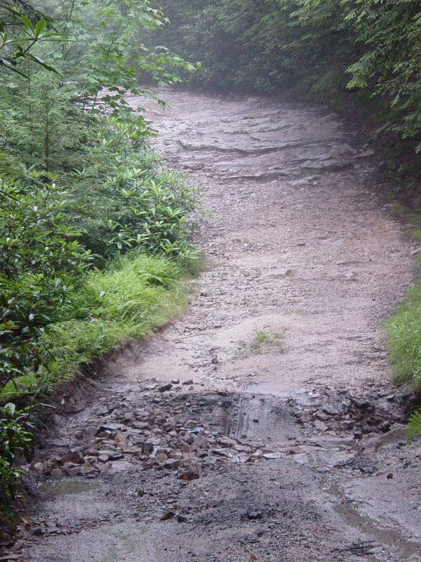
The beginning of the road is like any
other forest road. It is well marked and fairly smooth - nothing to write home about
in terms of four-wheeling territory. But soon enough the surface deteriorates and
the promised rough spots become obvious. I can't say that they are so bad that a
motivated car driver could not get through. But it was interesting to drive it in
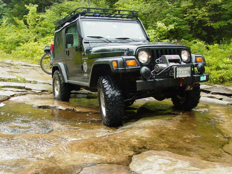
the Jeep. I came upon a family of four playing in a stream that crosses the
road. They looked at me like I just landed from Mars when I appeared. I very
slowly crawled across the stream and up the rough climb out the other side. I didn't
get a look at their reaction to my decision to continue past this point but I suspect they
were happy they didn't take their PathFinder or whatever it was past the stream.
The rest of the trail was very scenic
with some interesting but easy rough spots thrown down for good measure.

At one point I came to a side trail that
went across Red Run stream. A guy and his companion had parked partially blocking
the trail and set up camp next to the trail on the other side of the crossing. At
first I wasn't going to go across, but it looked so interesting that I could not
resist. The rocks were calling my name and the trail promised a nice climb to the
top of Mozark Mountain.
I had to crawl down through a craggy
section of rock to get past the car on the trail. As I did, the fellow at the
campsite across the stream noticed me. I crossed the stream as quietly as possible
and climbed up the rocky bank on the other side without any drama, though the vehicle did
reveal its underside to the guy watching. He seemed interested and not at all
disturbed. When I got to where he was standing I stopped and passed the time of day,
and indicated my plan to drive up the mountain. He asked me to tell him about it
when I returned. But a few yards down the trail I encountered a gate and had to turn
back. I told him what I found and crossed back to the main road. The climb up
the rocks to get past his car was looking iffy but I got by without any problems.
From here on out it was an easy
drive. Any vehicle could pass this part of the road without any trouble. I
stopped to take a break and discovered some huge reddish-purple blueberries that were just
ripening. I felt like a bear standing there gulping them down. There was lots
of vehicle and pedestrian activity as I got closer to the other end of the loop where it
connects with the road. Lots of people were set up in campsites and most of them had
mountain bikes strapped on the vehicle or parked nearby.


Returning to Davis around 6:45 PM, I
stopped at the Dollar General in search of Jeep toys. I was rewarded with some cool
CJ5's with trailers and either motocross bikes or jet skis.
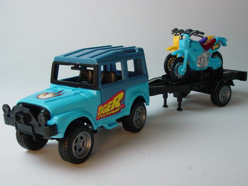
I bought one of each color for myself and
one for each of the boys. Next door, I picked up some easy starting fire logs and
charcoal lighter fluid. I figured it would be a lot easier to get the fire going
using these things than the wet brush that was waiting for me back in camp.
I inquired about good and inexpensive
restaurants in town and was told that there were a few good ones but that none were
cheap. I went down the main drag in Thomas (not the historical section) looking for
a place and decided to stop at one that looked promising. I went in and got seated
at the bar - it sucks to be eating in the dining room alone - and ordered a nice meal that
came fast and was excellent. Well, when they say "Not Cheap", they aren't
kidding. Don't think that just because you're in West Virginia that you're going to
get a meal at bargain prices. Let's just put it this way - for what I paid for that
meal, I fed my family well a few days later at a major chain restaurant!
After paying the check, I headed back to
the campsite. On my way, I passed a windmill farm, with several, very large units
that were turning and ostensibly generating power. I had read in accounts of the
area the controversy that these had stirred. One account lamented a rare species of
bats that were killed by the windmills. On seeing them in actual practice, I have a
hard time conceiving that the bats would have had any trouble avoiding them...
Some of the pictures here do not do them justice - they are incredibly large.


It was almost dark by the time I got back
to the tent, so I got the fire going and kicked back to relax for a while. It was
very peaceful there.


Movie
Only one or two cars passed the site the
entire weekend. My thoughts turned to the bears. I decided if they were going
to eat me, they would just go ahead and do it. But I doubted they'd bother me.
I recall a time hiking in Vermont when we had been in the woods for days. As we
walked along we began to smell hints of engine exhaust. We hiked another mile or two
before coming upon a logging operation and the skidders that they use. If we could
smell the trappings of man from a couple miles away, I suspect bears can smell it even
sooner. Since they are hunted here, I figure they know that getting in the same
neighborhood with men is not a good move. But just the same I did not cook bacon and
eggs for breakfast. Nor did I leave any food or garbage lying about.
Most of the rain had not reached my
tent. The tarp I put up kept it nice and dry and even provided a wide perimeter
around it that was also dry. A little bit had blown onto one corner and it wasn't
until the next morning that I discovered that a small spot of the tent had gotten went,
but the moisture was beneath the air mattress so it was a moot point.
In the morning, I struck camp after
brewing and drinking most of a pot of coffee. The smaller tent and absence of
children made for a much quicker take-down that I am accustomed to. With everything
stowed, I drove back up to Olson Lookout Tower, around noon time. I had not had a
chance to check it out the morning I arrived, and was busy all the next day with hiking
and driving.
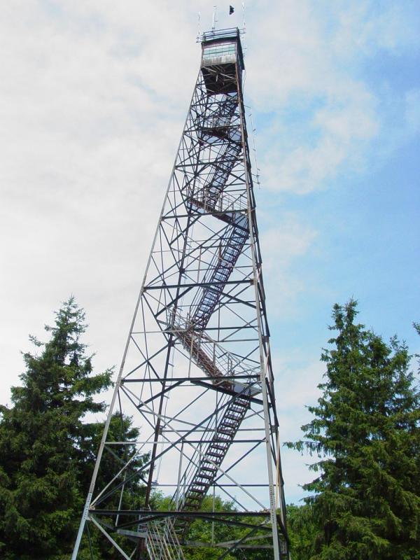
Back home we used to visit a fire tower
much like this one. It had wooden steps and landings where this one has steel
gratings. This one has smaller landings, triangle-shaped platforms alternating
corners of the structure. I climbed to the first landing and there remembered my
dubious trust of structures that go high in the air with see-through steps and
floors. I get uncomfortable walking over steel gratings in the city, and could not
step on the glass floor in the CNN tower in Toronto to save my life. So upon making
the turn to go up the next flight of stairs, I paused to contemplate my fear of heights.
I reasoned that this tower was safer than
the one back home because it was all steel and nothing appeared rotten. A careful
study of the railings and hand-rails convinced me that even if I fell down while climbing
the steps, it would be very unlikely that I would actually be able to fit through any of
the spaces and fall to the ground. And the structure itself was rock-solid with no
rattling, swaying or any other warning signs. So I put my fears away and climbed the
remaining distance to the landing below the observation deck, which is closed to the
public.
The view from the top is
incredible. You can see to the horizon in all directions.


I made some images and stayed for a
little while to read the graffiti and look around.


This place will be well worth another
visit in the fall to see the foliage and catch a view when the air is clearer and cooler.
The drive home was the usual thing.
Going back through Thomas, near the historical area, I spied a few old Willys Jeeps parked
near a run-down looking building.


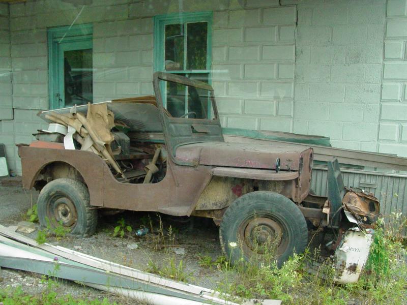
One had some sort of drilling device on
the back and they were all well past resurrection. The little historical section on
the one-way street down near the railroad grade was interesting but I decided I wanted to
get home, and didn't want to spend any more money.
I drove to Davis and hit the car wash to
get rid of the mud from the trail, and to set my mind for driving the long ride
home. I took Route 93 instead of 90, and found it a seemed a little bit faster than
they way I came in. I drove past Mt Storm and the area where we had visited with Rob
and Lucky when they were looking at a piece of property. I kept moving all the way
into Keyser, where I stopped at the Wal*Mart around 2:00 PM. I checked for Jeeps in
the toy section then got some gas nearby. I grabbed something to eat at Burger King
and kept on moving.
My ride back was brightened up by a
number of Hot Rods that I saw along the way.


I reached Sideling Hill around 3:30 PM,
but didn't stop. About an hour later I reached the Sheetz on Route 85 near Frederick
where I stopped for gas. I took the back way home and arrived about 5:00 PM.
I got everything I wanted out of this
trip: I found the GeoCache that had made me aware of this place; I successfully
navigated to the location without getting seriously lost; the snakes and bears didn't eat
me; and above all, I got some peace and quiet for a couple days and got to see some of the
prettiest terrain on the planet. It wasn't a killer extreme wheeling experience, but
that's not all it's cracked up to be, is it?
