Prologue
Keith dropped me a line and told me he
was planning a trip out to Canaan Loop and Dolly Sods. He asked if I would like to
go.
| -----Original Message----- From: Keith
Sent: Tuesday, September 21, 2004 10:37 PM
To: Paul Provencher
Subject: Dolly Sods in October
Hey! How have you been?
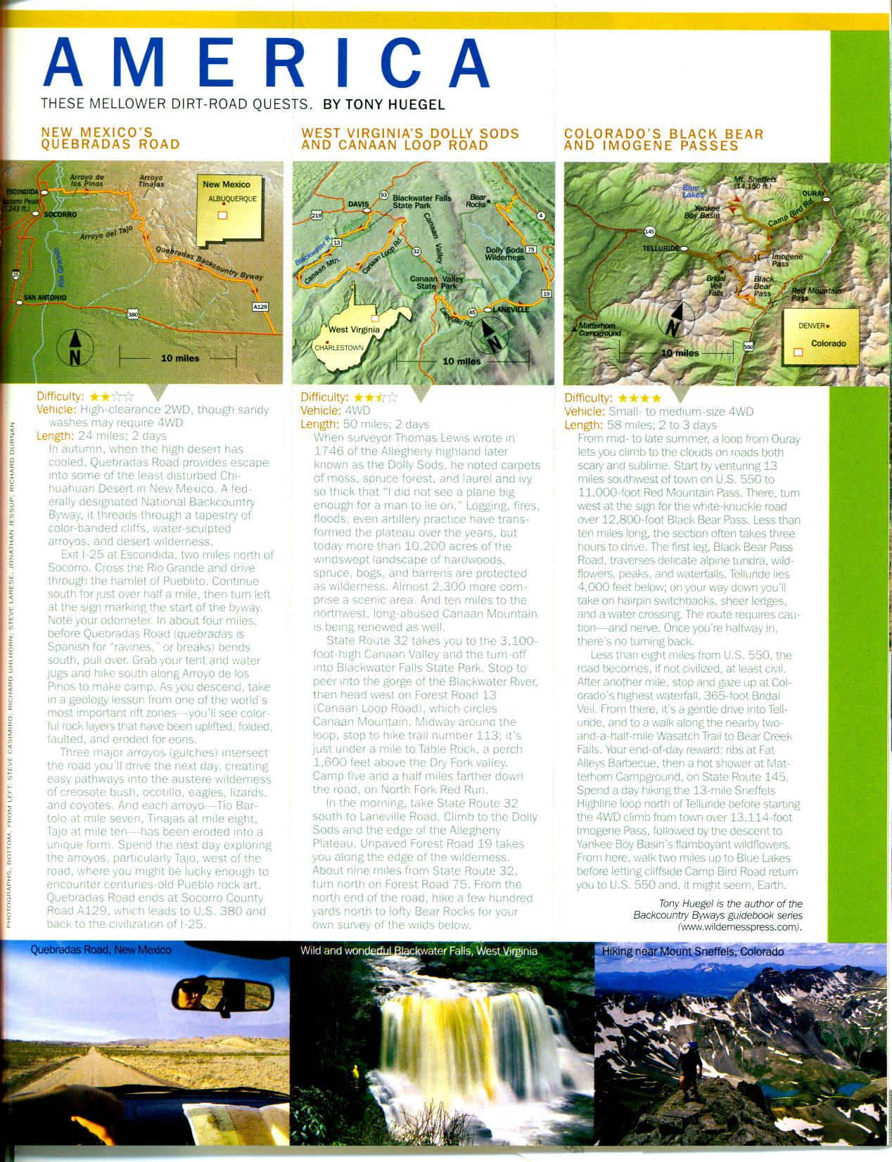
I'm planning a trip to Dolly Sods and Canaan Valley in October, probably the weekend of
Oct 9-10 (Columbus Day weekend) or possibly the following weekend (Oct. 16-17). The trip
is based on the attached clip from National Goegrphic's Adventure magazine August issue.
It has recently been pointed out to me that you have made a similar (maybe even the
same) trip in July. Would you be interested in going again with CORE? Let me know as
you're welcome to come along with us.
Also, any other tips/tricks besides what shows on your website?
~Keith |
Does a Bear... nevermind...
So I checked out the write-up he sent me about some trips and did
the usual homework to get ready - study maps of the area and configure a GPS
mapset/waypoint collection. I leveraged my trip data from the recent Blackwater
Canyon trip and soon had what I needed.
| -----Original Message----- From: Keith
Sent: Friday, September 24, 2004 8:50 PM
To: Capital Off Road Enthusiasts - General list; Paul Provencher
Subject: Re: [Core4x4-list] October Dolly Sods Date!
The trip to Dolly Sods and Canaan Loop is set for October 9 and 10. This is
expected to be an overnight camping trip in a primnitive camping area so pack accordingly.
This is an exploratory trip and all indications are that it will be rather mild wheeling
but there has been a significant amount of rain and wind this fall. Safety is always our
first consideration. Prep your vehicle and pack as if you're staying for longer than you
plan to in harsher territory than we expect. Also recall that October in the mountains
ain't usually warm! I also do not expect cellular service to be very reliable in these
areas so a CB or other communications device is highly recommended.
Right now the list looks like this:
Gil and Sherrie
Keith (~100%)
Ian Kluge
Jeremy Albrecht
Mike V. and Donna
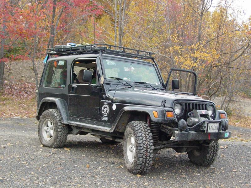
Paul Provencher (friend of mine, you have seen him on the web as 4x4Icon)
Paul recently went over part of this trail (see http://www.4x4icon.com/offroad/071004_blackwater_canyon/index.htm)
There are some spots for hiking which we will likely take advantage of and the fall colors
will likely be at least starting to show through.
Right now, I plan on at least two meeting spots. The first will be the South Mountain
rest area west of Frederick MD on I-70 which may be useful and probably also the West
Virginia welcome center at milepost 30 on I-68. If there are several coming up from VA,
you may want to set another spot to meet and caravan together. Times for meetings will be
announced later. All CORE members and guests are welcomed to join in for this ride.
Guests are reminded to bring a signed waiver of liability from the CORE4x4.org website
with you. Please give a rough percentage of your certainty of coming along. I'm
headed to Florida in the morning (Mother decided to invite us to the cleanup from the
hurricane party!) and will return the weekend of October 2-3. (Actually this is just a
visit as the family thankfully had no structural or personal damages from Ivan's first
pass through the FL Panhandle.)
I'll check back next week.
~Keith |
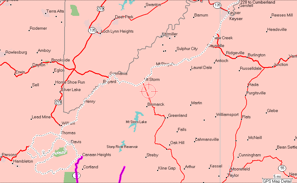
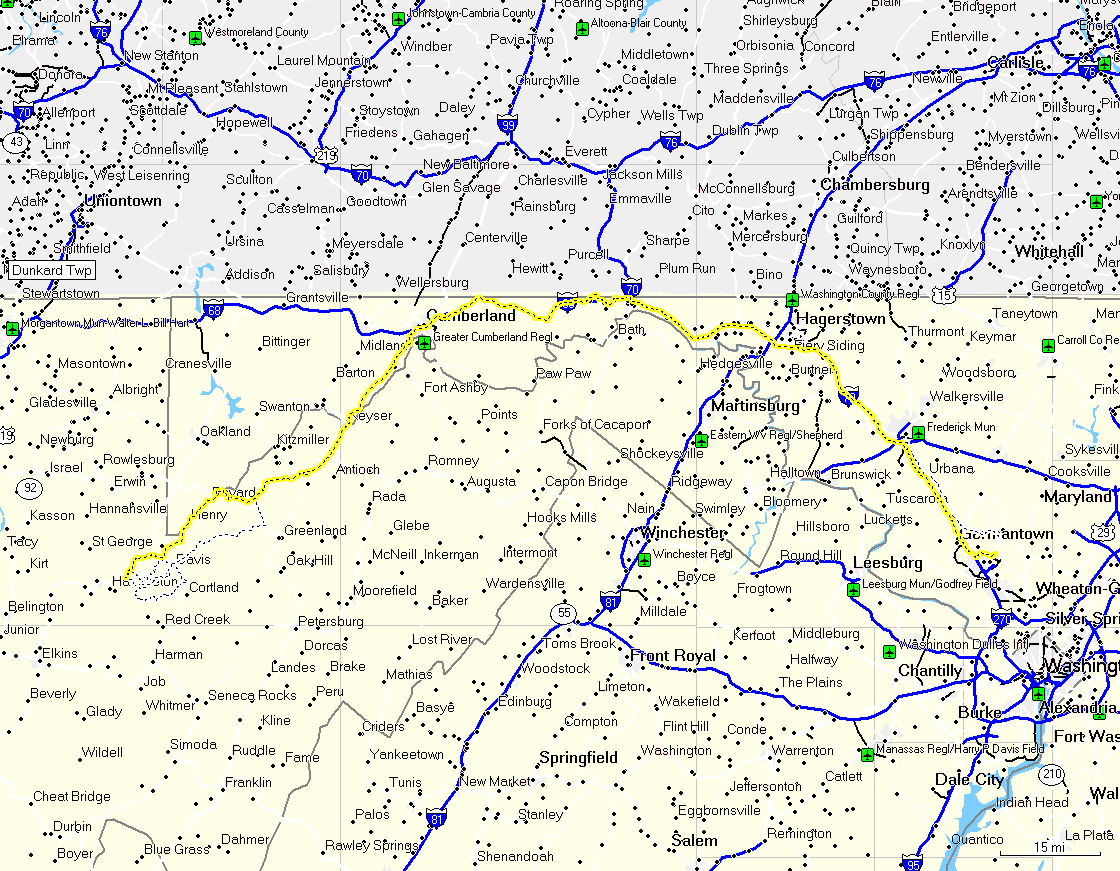
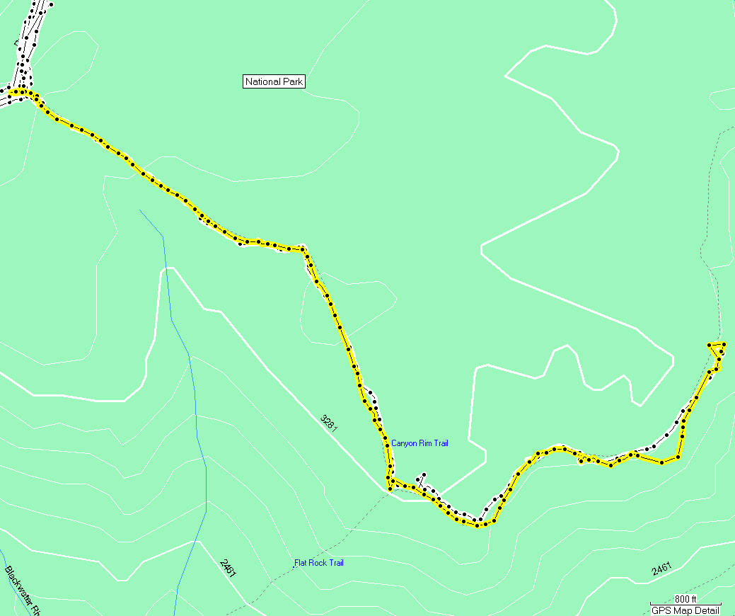
Topozone Map
Red Creek Campground
Dolly Sods Scenic Area
I prepared the camping gear
and got the kids briefed. We'd bring the bikes as usual, and otherwise try to travel
light and prepare for cool weather.
Muster
The kids had been looking
forward to the trip since Keith first wrote. Earlier in the week we went shopping for new
boots since they'd both outgrown their boots from last year. I too found that my
boots had finally reached the end of their serviceable life. So I did something that
is generally not recommended: I bought new boots a couple days before my plans to
use them. I wore them to work on Friday and found them to be tolerable so made no
plans to carry spares.
I spent most of Friday
evening packing the trunks and loading the Jeep so that we'd be able to just climb aboard
and leave first thing in the morning. With the kids fairly intense, anything more is
sheer folly.
I woke the kids at dawn and
got them dressed. We jumped in the Jeep and hit the road, headed for the South
Mountain Rest Area near Frederick. This happens to be the rest area that the Snipers were
arrested after being spotted by truckers and blocked in while the police came. Our
visit was far less dramatic, but I had several conflicting bits of information about the
location. I left a message on Keith's cell telling him where to find us if we did
not find the rest area. When I noticed a rest area coming up I got on the CB and
raised Keith. It was the correct one so we pulled in and parked with Mike and Donna
and Keith.
   
The kids got out and
stretched, hit the facilities and talked their heads off. Soon Jeremy came
along and we were ready to go. We hit the road on the way for Route 220 just past
Cumberland.
The drive went well and soon
we had made our exit and driven down to the Wal*Mart in Keyser where we met Gil and
Sherrie, and Ian.
 
Everybody got gas, etc, and
we continued on down Rt 220 to the various turns that led us to the exit for Canaan Loop.
 
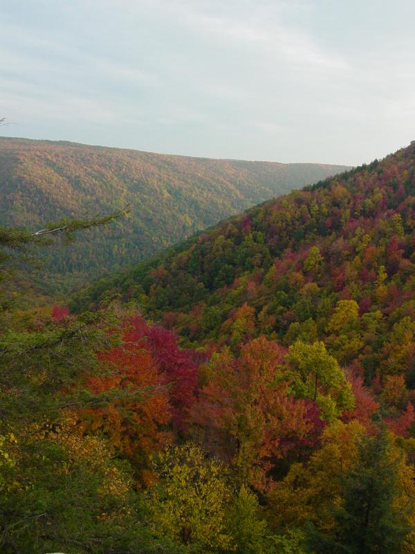
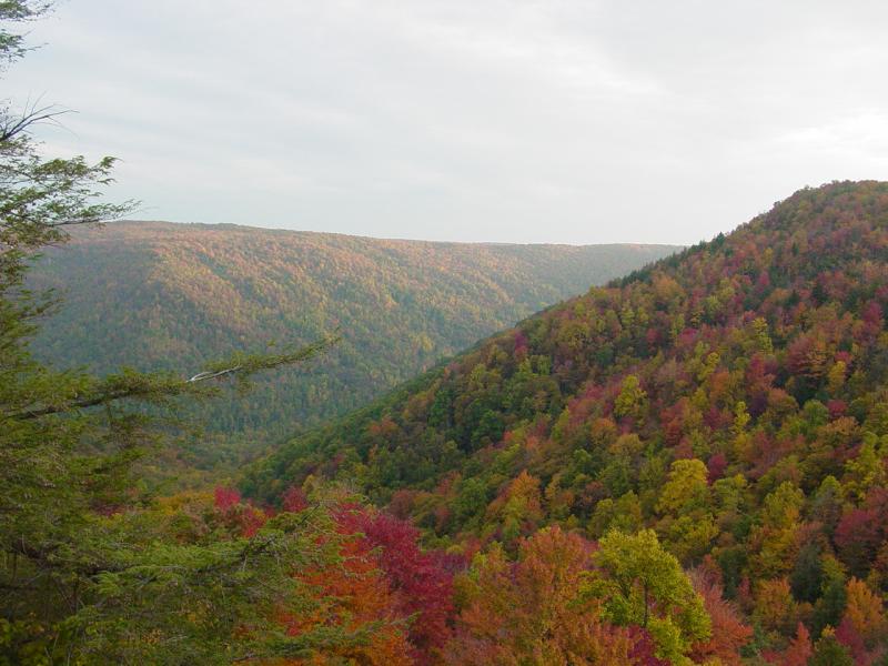
It was clear when we got to
the general area that the foliage was almost peaking and weather permitting, we'd have
some incredible sight-seeing.
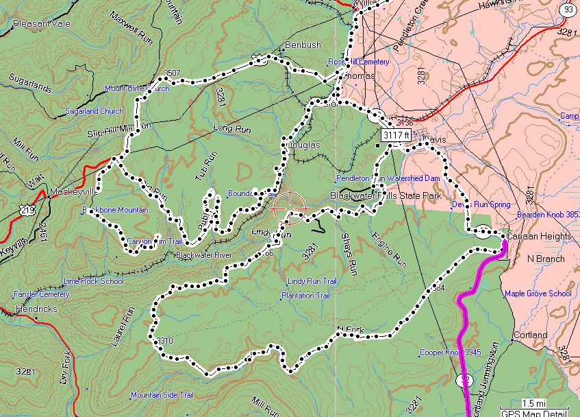
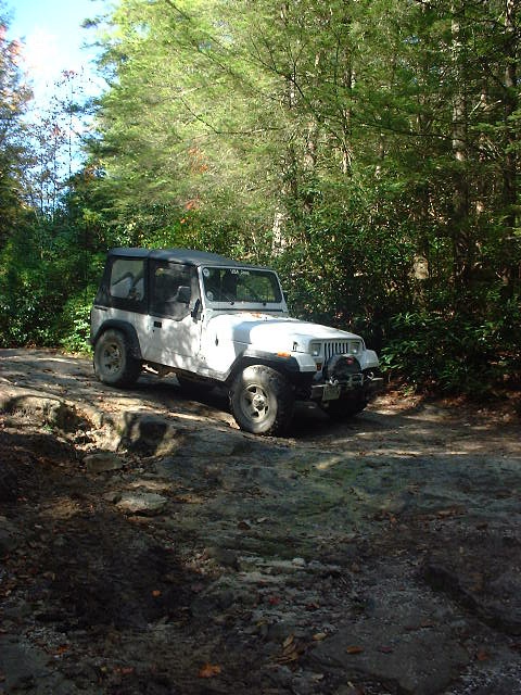
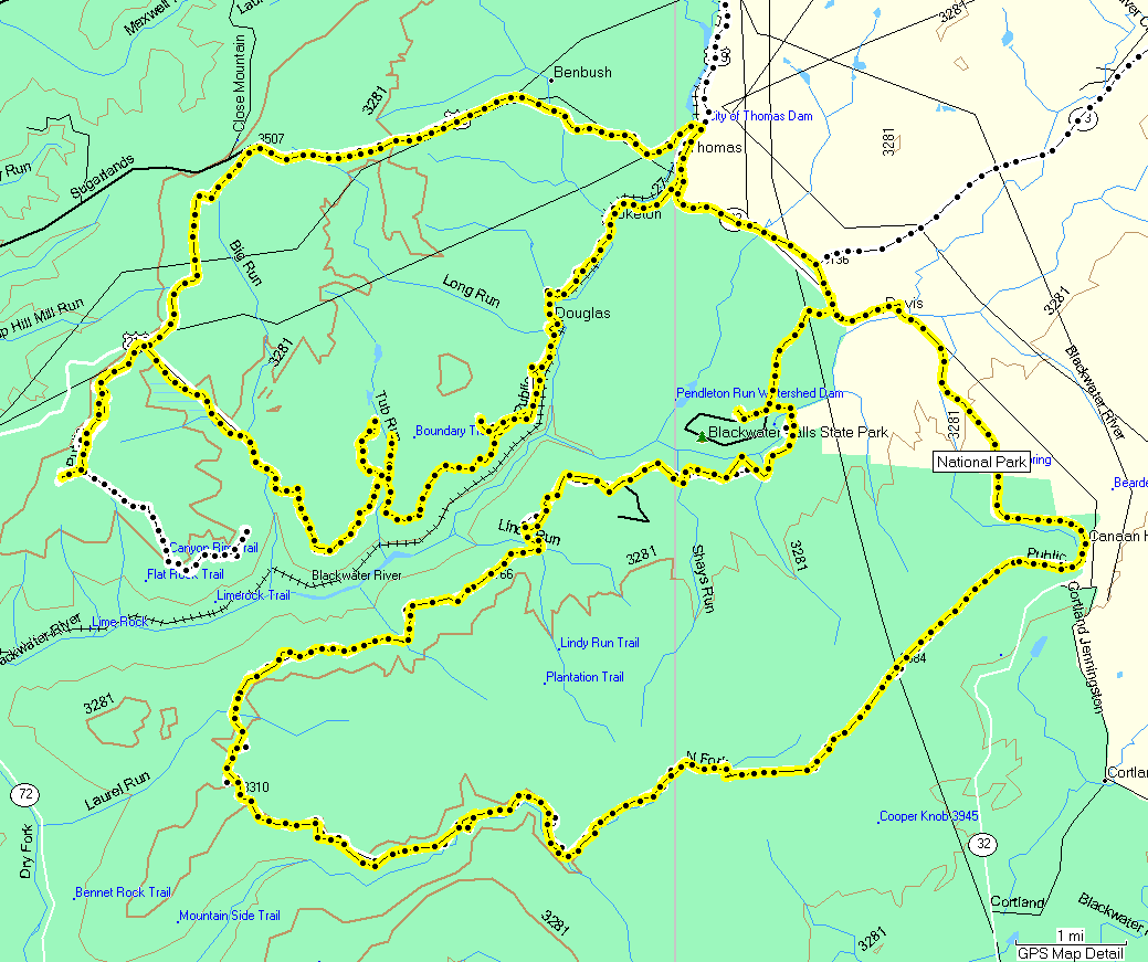
Trail
Canaan Loop Road
We took the lower entrance
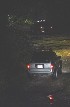
to the Canaan Loop road and drove around to where the riverside campsite was
located. The road was dusty and the riverside camp was occupied. We continued
in the same direction and soon came to another spot that offered some off-trail parking
and plenty of nice tent sites. The group agreed so we pulled in and set camp.
     
The kids took their bikes
down and started working the trail while I got everything set up.
 
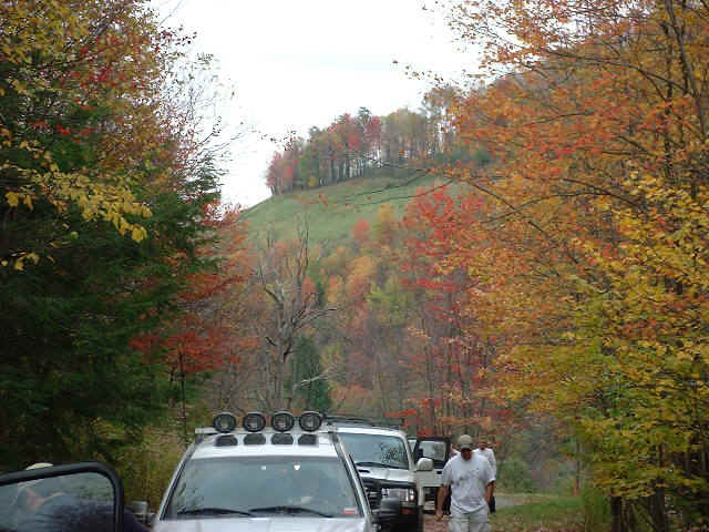
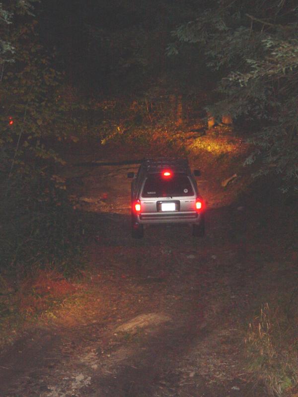
Blackwater Canyon/FR
18
Everyone took their time and
then we had some lunch. After we all had finished, we got back on the trail, this
time headed for Blackwater Canyon and FR18. When we got to the end of pavement near
the spot on the map called Douglas, We stopped to disconnect and air down.
    
     
This move was mostly to give
a better ride but also in anticipation of any wheeling we might do. Then we moved on
down the trail.
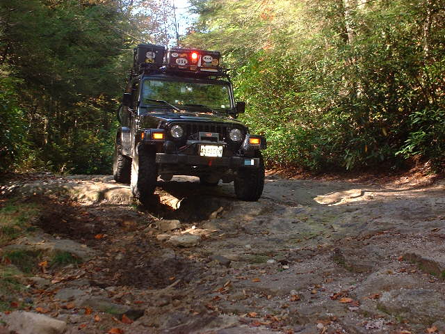
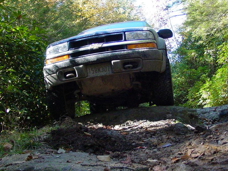
Pretty soon we reached the
spot where the trail goes up to a clearing. The first part is a little rough and requires
some finesse to get past.
 
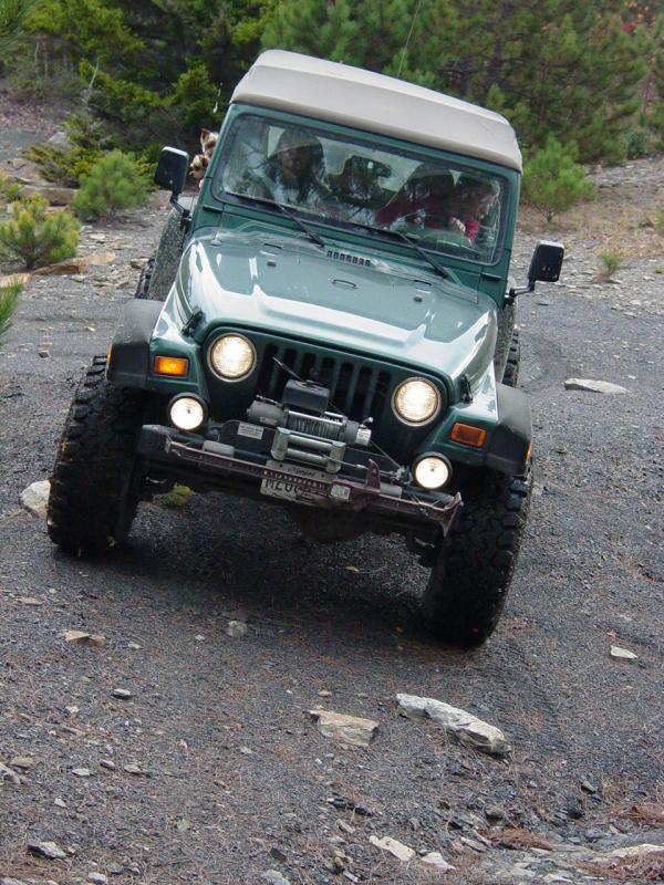
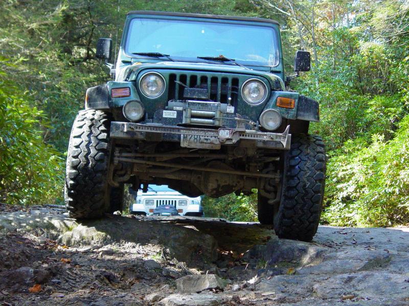
I went up the same way as my
last visit, and Jeremy commented that he had not expected me to make it that way.
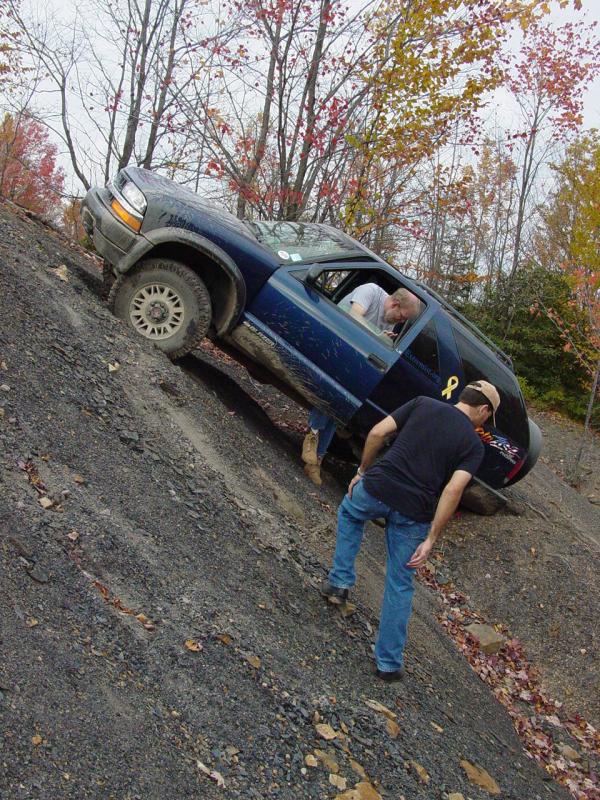
Gil drove straight up the
ruts and found he'd need to switch on his ARB.
  
 
Jeremy took a line on an
angle across the ruts and made it with some spotting.


Keith chose the same line
and followed us up.
 
Mike and Donna, and Ian
opted to go ahead to the outlook and wait for us to come back down from the clearing.
After threading through some
narrow trees and over a couple fallen saplings, we reached the clearing.

We played follow the leader
to an area with some rough spots and climbs. I went the same way as last time,
preferring not to tempt fate.


Keith opted to climb one
hill and found himself lodged on a rift. We didn't winch him out, honest.


Movie
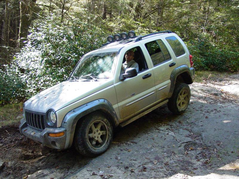
Jeremy drove up on a mound
and lots of pictures of his KJ were made in a true off-road setting!


Then we backtracked out the
way we came, with each taking the same line out from the entrance that they had taken
coming in - except Gil and Sherrie who chose to straddle the ruts and come down from on
high.
 
Movies
 
 
We continued down the road
and reconnected with Ian, Mike and Donna at the outlook.


The kids crawled all over
the outlook area and at one point Tom decided the railing was not meant for him. One
of the others spoke to him and I turned to see him outside the railing on the edge of the
rock. He was not in any danger but he was definitely one step away from a very high
fall. I got him back on the right side of the railing and explained to him about
staying there. He told me he likes climbing rocks... Great!
We determined that we had
about 21 minutes until sunset at 6:47 pm and just enough time to reach Olson Lookout tower
for the sunset. So we took off in that direction. I caught up to a pick-up
truck moving slowly and patiently (yeah right) waited behind until they pulled over to
stop for something. I stopped at the intersection with 717 for the rest of the group
to catch up then turned up to the tower.
Olson Lookout Tower
I got there with the kids
just in time to climb up for the last 10 seconds.
    
 
Ted was gung-ho but Tom got
a little iffy when we got to the first landing and decided to go back to the ground.
Keith agreed to accompany Ted to the top so up they went. Tom decided that maybe he
would try to go up a couple landings after all. We went one or two past where Donna
had decided to stop, and we took a look around at the twilight horizon. It was
beautiful, even if we missed the actual sunset.
   
The folks at the top
discovered the observation deck was open and peeked inside for a quick look around.
Meanwhile, Tom decided he'd had enough and walked back down with me. Soon the rest
of the gang made their way back to terra firma and got loaded up to leave.


We drove down to pavement
and followed it back into Davis where we stopped at the grocery store for last minute
supplies. I bought some drinks for the the kids and me, and marshmallows were
acquired for the campfire later.
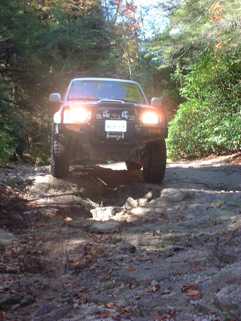
Canaan Loop Road II
Jeremy took point for the
drive back into camp so he could try out his newly mounted roof lighting without scorching
those in front of him. At my direction we drove a little too far south for the
entrance to the Canaan Loop, so backtracked to the upper entrance and drove out to the
camp. A couple spots on the road provided mild entertainment.
We reached camp a little
after 8:00 PM, and located it by GPS coordinate. Everything was untouched and we
quickly had a fire going. We cooked up supper and took it easy for a while. The kids
got some marshmallows and then went into the tent to unwind and go to sleep. I
stayed by the fire and relaxed in that way that a warm fire on a cool night can make you
do. Pretty soon I hit the sack, no doubt snoring a streak to the delight of my
fellow campers...
Sunday
We all got up late in the
morning and had a leisurely breakfast. Keith provided a musical backdrop to our
activities. I made oatmeal for the kids and me, along with coffee for the thermos
and breakfast. Then I got Ted's help packing everything up.


Movie


Movie
We would break camp before
hitting the trail. This activity kept everyone busy for the better part of two
hours.
   
Finally the last was stowed
and we hit the trail for Dolly Sods Wilderness Area. The air was cool and dry; the
sun was shining; and there was not a cloud in the sky. The weather could not have
been better.
The drive back out was a
little different than the day before. I was still aired down though I did put a few
pounds of air back in the tires to accommodate the load of our camping gear. Along
the way we took pictures of the little rough spots that we passed over.


We passed a number of people
who had driven in to the first part of the loop to look at the various scenic spots along
the canyon. We continued to pavement and stopped at a wide spot to regroup and plan
the afternoon. We agreed to drive on and have lunch a little later, though my kids
were so hungry that I made them lunch on the spot to keep them happy and quiet.
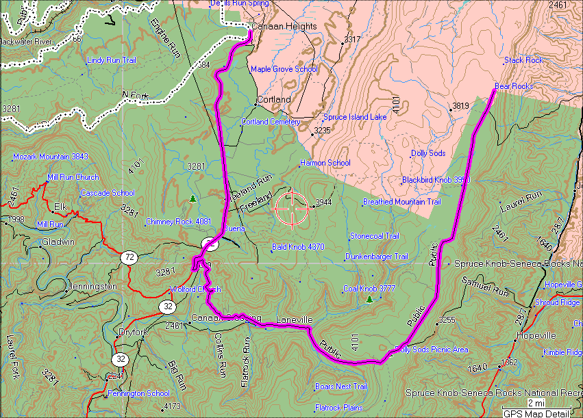
Dolly Sods

The drive to Dolly Sods took
us through the Canaan Valley.
  
  
It could not have been much
more beautiful. The road descends into the valley and then passes through a pretty
resort area. A ski lift is visible in the distance, and several shops dot the
landscape. The edge of the wilderness area can be seen to the left of the far side
of the valley.
We reached our turn-off and
dropped down into a hollow then followed a winding road back up the side of the
ridge. Pretty soon the road turned to gravel and continued deeper into the
woods. There was plenty of traffic and no doubt there were many people out for a day
of sight-seeing just like us.
We stopped at a picnic area
to have lunch. By that time I am sure that everyone was really tired as it had been
nearly two hours since our last stop.


The night before, I had
given the kids each 25 cents to buy something from the gumball machines at the grocery
store. They each bought little chain necklaces. Now Tom discovered that he had
lost his and that the world was going to end. So I spent some time helping him
compose himself then went looking for it. We eventually found it in the Jeep under
the driver's seat. I took the time to air up and reconnect since I knew we were done
wheeling for the weekend. Even though I was pretty well off the side of the road,
the traffic in both directions made it a little dangerous so I managed to keep the kids
out of the road while I worked.
When everyone had finished
eating and getting ready to go, we hit the road again. In a mental lapse, I mistook
the first pavement we encountered as the exit from Dolly Sods and considered going back
and driving out on pavement. That was a mistake and had we gone that way, we would
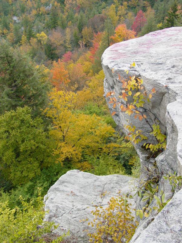
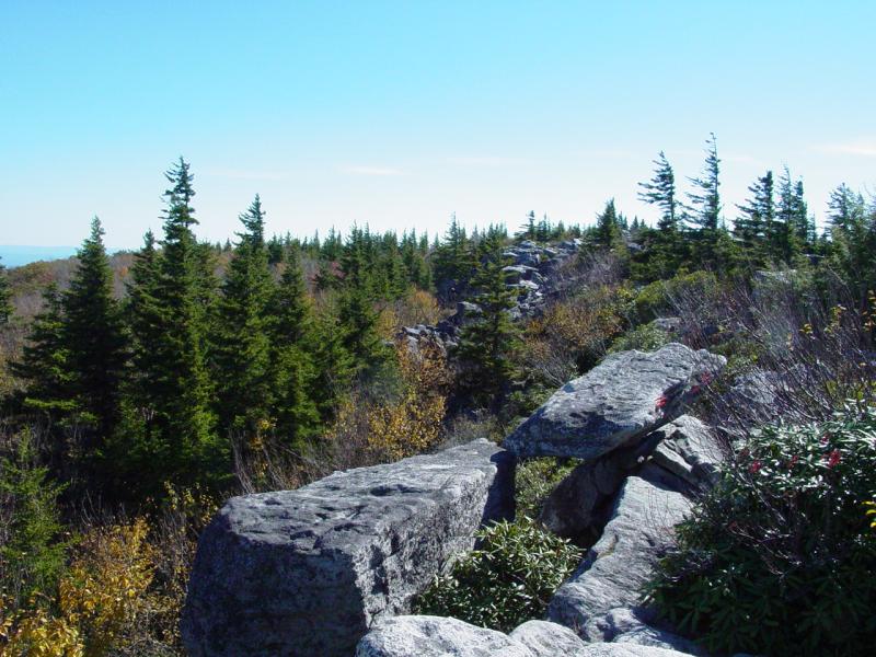
have missed the entire point of going here in the first place. We emerged at the Sods to
find a huge tundra with incredible views, lots of different plant life, and some intense
rocks.
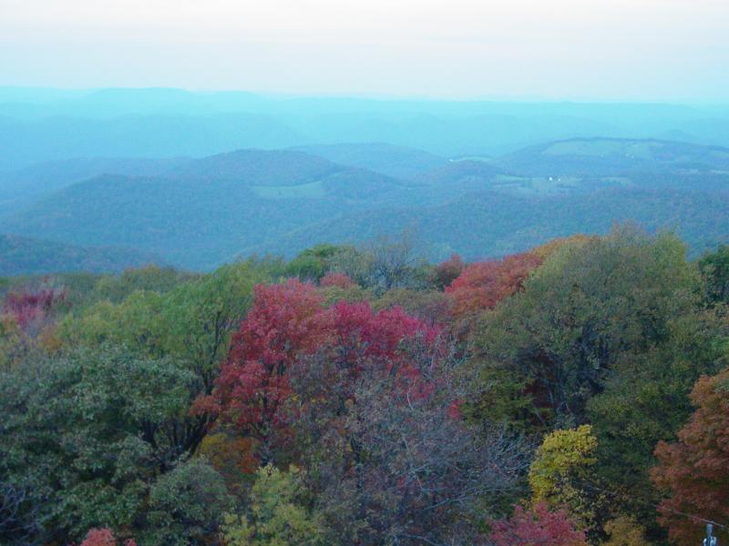
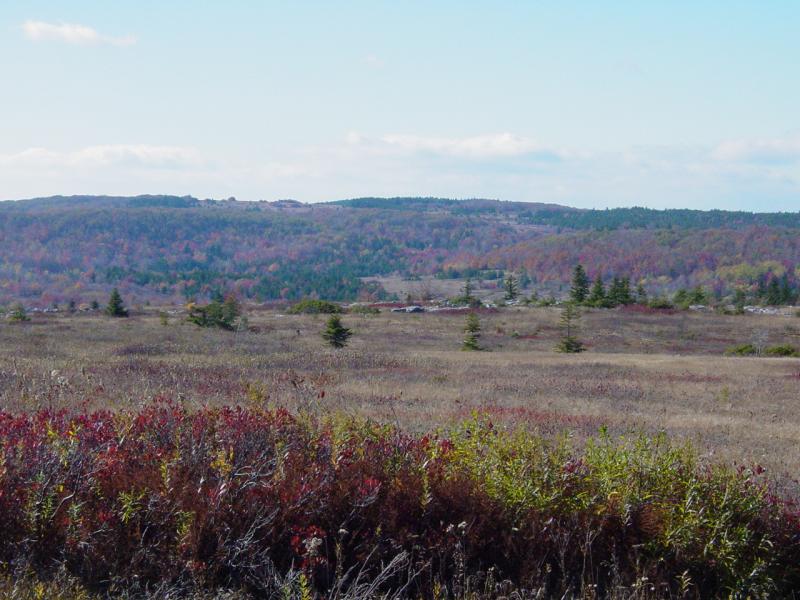
We stopped at a scenic
outlook and walked to the edge of the east side of the area. The view was
tremendous. Lots of pictures were taken.


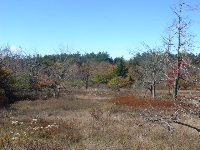
I took the kids and hiked a
short distance over a rocky trail to another outcrop of rocks where Tom reiterated his
love of rock climbing. I was spending my time split between enjoying the scenery and
watching for him to attempt a base jump with no parachute. One of these days I'm
going to have to untie the apron strings but he's only five so I have a few more years to
go...
The kids and I took some
pictures and then hiked the short distance back to the parking area.

Movie
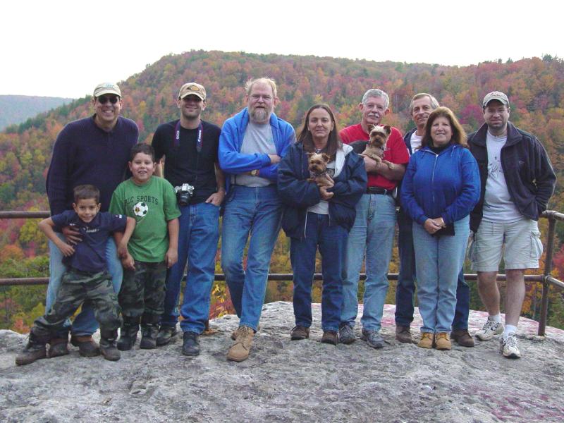
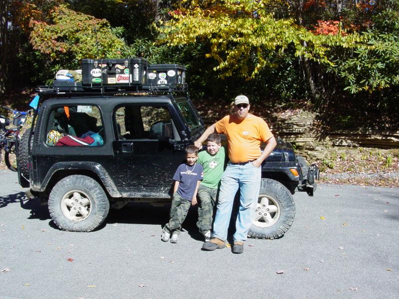
Teddy wanted to take a
picture of the group so we herded back together and he took the picture.
 
Then we got back on the road
to go. Once again I thought we were at the "end of the trail" and wanted
to head back south when in fact the route planned led north. Jeremy called it to my
attention and soon I was going in the correct direction.


We came to the parking area
for Bear Rocks, and the road leading down and out of the park area.
  
Epilogue
By then we'd run up against
the late hour of the day and most people wanted to head home. So we drove down the
gravel road to pavement and got on the road for home.
My GPS picked a less
traveled route parallel to Rt. 93 and we drove north through some really pretty country
south and east of Keyser. Along the way, Gil and Sherrie split off to head east and
connect with Route 50. We continued north and tied into it a couple miles west of their
planned location. There we made a pit stop, then headed west and north through
Keyser. The remaining members of the group opted to drive straight home while me and
the kids stopped at Denny's in Keyser for dinner.
We got a terrific waitress
and had a great meal. Then we loaded back into the Jeep and continued on our way,
blasting up Rt. 220 and Rt. 68 in good time. Then we hit Hancock...
As soon as we turned on to
Route 70 we came up against a traffic backup.
I quick check with the
drivers on CB CH 19 revealed that the backup was all the way to mile marker 20.
Since we were somewhere above mile 40, I decided that it really was going to suck to stay
on the highway. I had the laptop tracking our progress connected to the GPS so I
zoomed out and panned a little and found a promising side road that would eventually get
us to Route 40. I could have stayed on the highway a couple exits and got directly
on Route 40, but nothing was moving.
So we got off and after a
couple jogs, turned onto Slabtown Road. It descended into a valley and went straight
across and into Licking Creek.

By now it was completely
dark. There were no street lights and we were the only vehicle in sight. I
noted some wet tire tracks coming out of the creek on our side so I made the mildly risky
assumption that the vehicle had forded the stream from the other side.
The water was flowing from
left to right and appeared to be shallow as the outline of the rocks was defined by the
flowing water. I decided to put the Jeep in 4-LO and drive very slowly forward
anticipating any sudden drops into deep water. I was driving so slowly that if the
nose started to drop I could stop and back out.
But the depth of the water
did not increase and though my exhaust burbled like a Chris-Craft, we drove across and up
the bank on the other side. I had already set an auto-route that promised to take us
all the way to Hagerstown so I reviewed the turns on the laptop map and decided it worked
on paper. We drove directly to Hagerstown and once there, crossed under Route 70.
The traffic was heavy but
moving at normal speeds. The truckers that responded to my queries indicated there
were no more back-ups headed East so we got back on the highway. The kids slept
through the whole detour. It was fairly interesting, though I would not recommend it
for everyone.
After that it was a pretty
quiet ride home, except for the heavy traffic on Rt. 270. We got to the house and
left everything on the Jeep. In the morning the kids helped me unload and put stuff
away before they went to school and I went to work.
This was an incredible trip
- the weather was great, the foliage was the best I have seen in years, and the camping
and company were top-notch!
|
