![]()
Prologue
Jackie Cooper planned this run for the O.C.C. to get out and see the fall foliage. The word was passed through the message board and a long list of attendees was assembled. Ultimately there were over 38 vehicles and probably three times that many people who showed up. The weather was perfect (clear, sunny, and warm).
I had recently learned that the stream crossings were no longer allowed and passed on this info. The same District Biologist that told me about the crossings also referred me to a side trail that is allowed for motorized travel, so I prepared a GPS route to enable side exploration if time allowed.
Muster
The group met at Wendy's in Manassas off route 66 at exit 47B, at about 8:30.
We hit the road about 9:00pm and arrived at the beginning of the trail about an hour or so later.
Trail
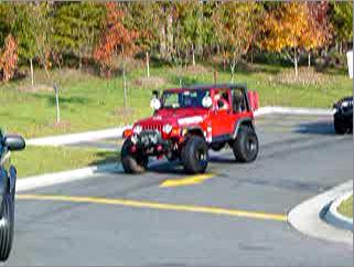
Once we drove down Route 29 it was just a short hop to the turn-off. A little ways up that, a small group of people had assembled to wait for us. This was the actual transition to dirt that everyone had been waiting for. At first it looked very tame, with nothing but regular, well-graded dirt and sand.
After airing down and disconnecting (for the sake of ride comfort only), I wandered down the line making a few images of people as they got ready. My kids had gone missing so I walked back up the line in an effort to locate them. I soon found that history had repeated itself with Tomi in a state of high anxiety over an encounter with a dog. He was crying and had the attention of several people. Ted was close by, but not apparently terribly concerned. Tom had no war wounds and despite claims of being bitten, I suspect he may have simply been jumped upon or even perhaps licked, and there were no marks of any kind. I got him calmed down and we took our place to listen to the driver's meeting.
We started up the trail with assurances from Jackie that 4-LO was not needed, but let's use it anyway to keep the speed down. She was, of course, correct - I might even hazard to say that one could conceivably make it through the whole day without 4WD, but there were lots of times where it was a lot easier to go slow using 4-LO.
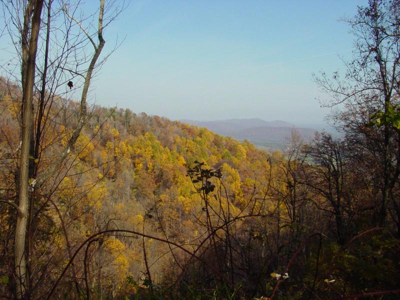
The trees had changed and there was plenty of color to see. The trail was dry and only scattered mud-showers were encountered. The balance of the trail ride was dusty, more so once we reached Rapidan later on.
There are several trail branches all along the way, many clearly posted "private property". Suffice to say that even without taking any of the branches, its an interesting ride with plenty of mild "moments" for all but the most hardened trail riders. The biggest attraction is the view, but better stop, put it in neutral, and crank the parking brake before taking it in.
12:58 p.m.
We broke for lunch at a wide trail junction between Blakey Ridge and Rapidan Wildlife Management Area. It was a great spot for such a large group and everyone had a great time eating and socializing. There were lots of cameras in evidence and plenty of film was used up, all along the trail.
After lunch, we crossed into Rapidan Wildlife Management Area. We were in good company with all manner of regular road vehicles. With the road surface intended for all vehicles, the people we encountered were driving a random sampling of 2WD fare, with no great off-road vehicle presence save our own group.
But the road was rough, with lots of erosion and rugged spots - no challenge for a Jeep, but plenty thought provoking for anything with limited clearance. And it was choppy riding. We wound our way up past the two spots where bridges span the Rapidan.
Epilogue
The group terminated their exploration of new territory at the end of the road where a gate prevents passage, and took a short hill-climb into the woods. As the turn around was not suitable for a large group, newcomers were extended the opportunity to try it.
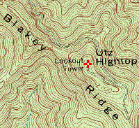
While this was going on, Ron and I pre-ran a section of trail described to me by the District Biologist. We found it littered with trees from recent storms and in need of some cleaning up before it can be followed to its destination. Ron and I doubled back down the trail after clearing one fallen tree that allowed us to go up the same steep hill I have reported on other trips to this area.
Then we made tracks to the pavement and Route 29. We encountered people from the group here and there as we made our way back to pavement via Route 609. I split off when I spotted a gas station that had cheap gas and air. I aired up while the kids visited the rest room and played in the dry storm basin. It was another great day on the trail with O.C.C.!
Blakey Ridge / Rapidan Wildlife Management Area GPS Data
Update 1/5/2008: GPS Data now provided in GPX format for easy transfer to your GPS!
Purchase GPS Waypoint data and access to topographic maps of this trail using Pay Pal!
GPS Waypoint data is now available for a moderate fee ($10.00 U.S.).
This contribution allows us to maintain this web site, collect and maintain GPS waypoint data, and periodically verify its accuracy. All GPS Waypoints have been verified in the field.
If you would like to purchase the coordinates for this trail, simply complete the two questions below and click "Buy Now" to pay for your purchase using Pay Pal.
For a free sample of how our GPS data is presented to our customers, click here.
Back to Off Road Index
Shop for Jeep Toys and Books | See the Toy Jeeps
Photos, Layout and
Design © 2001-2008 Paul M. Provencher All Rights
Reserved.
Contents of this Web Site may not be used without written permission.
Visits Since 11/04/2003
Last Updated 02/09/2008 02:05:40 AM -0500
812 4/6/06