The first time we came out
here, it was just Hugh and me. I had done some research and documented the trails in
the Garret, Savage River, and Potomac parks. We had quickly discovered that the
Garrett State Park "trail" was basically a developed gray stone road servicing
campsites. The Backbone Mountain trail was a nice trail. But we never had time
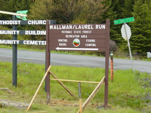
to investigate the Potomac State Park Trail.
So when Hugh called on
Friday to go out, I suggested we complete the recon and check out Potomac State Park.
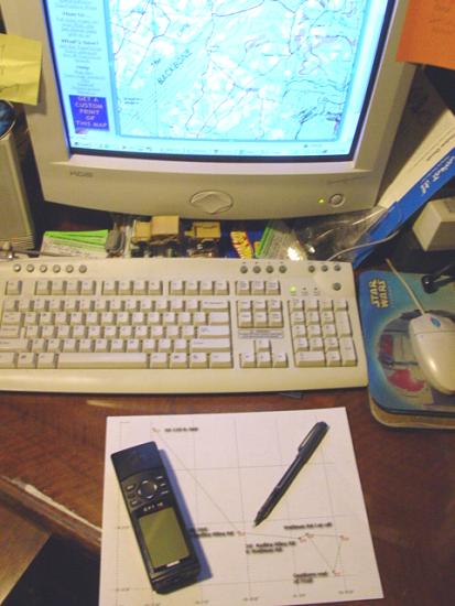
Later that night I dug out my research, GPS tracks from prior trips, and did a
quick refresher. I have not written extensively about this part of my trips.
The planning can take several hours, perhaps spread over several separate sessions.
But I always do careful research to gather detailed information about the places I
travel. I generally study the topographic maps, create and load waypoints into the
GPS, create a GPS "Route" that will act as our map on the trip, and print copies
of both the route and topo maps that I have created and studied.
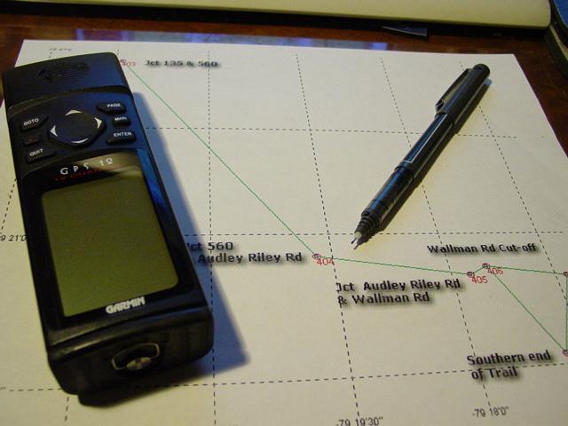

By the time I hit the road
for the trail, I have a pretty good mental picture of the map, have the GPS loaded with
everything needed to navigate, and have pretty much everything I need for a successful
outing. I can't imagine jumping in the Jeep and going out to a previously unexplored
region without this level of preparation. I am sure that unplanned trips that fail
have often failed due to lack of planning. That could always happen to me too, but I
think it is less likely. I can honestly say that I have never gone on any trip
without this planning, even if I am not leading the group. I trust people, but I
also want to be prepared...
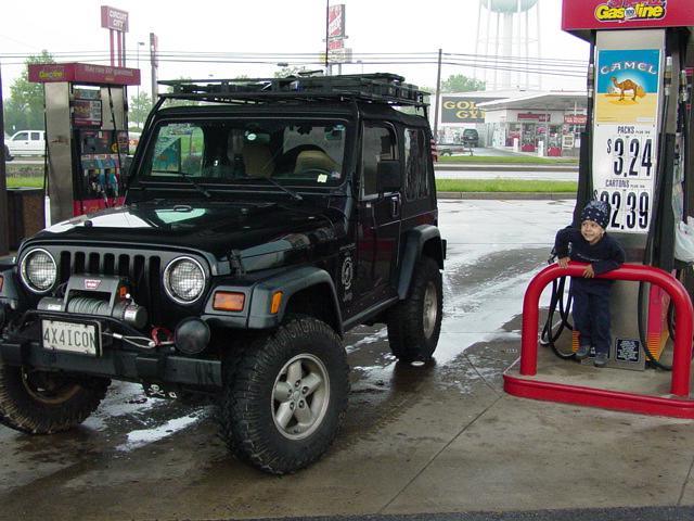
Anyway, I dragged Tomi out
of bed at 6:00 am with my usual whispered "Do you want to go 4-Wheeling?"
Too bad he doesn't get up that fast on school days! Everything else was ready
by that time so I got him dressed, shuffled him out to the Jeep and we hit the road.
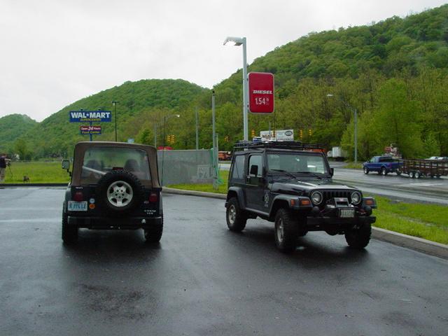
We made our usual stop at Sheetz for gas and provisions. We also stopped at
Sideling Hill Exhibition Area for a "pit stop".
I laid out a route
to the trail entrance the night before and loaded it onto the GPS. This put us on
the road traveling directly to the trail with no false steps. Ah planning.

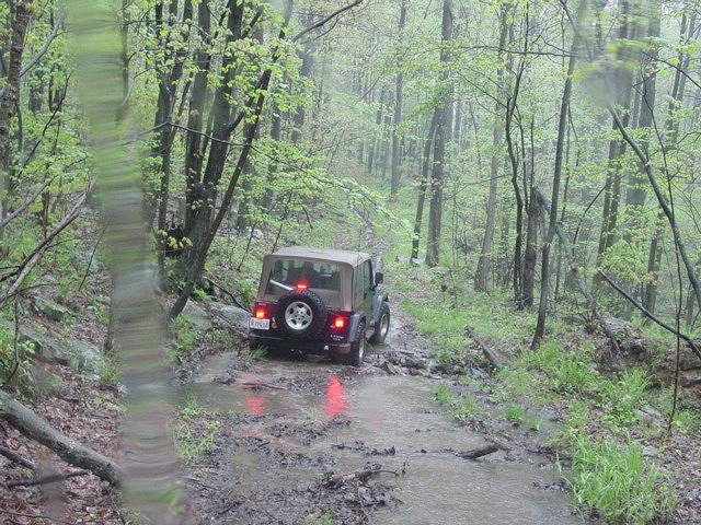
We drove off the road, assessed the trail
and decided not to air down or disconnect. The trail just didn't warrant it.


It was a rainy day and we spent it
driving around all the little trails and spurs that formed a rich network of mostly mild
terrain. At the very southern tip of the trail, which is at the bottom of a steep
series of switch-backs, we found our egress to the river gated. We turned around and
headed back up the trail, with just enough traction to get up without winching.

We took a side trail and soon encountered
a fallen tree that got me hung up. A gentle tug on the strap and I was back off it
and ready to go. A little further up another side trail and once again I got hung up
on a fallen tree. This time I just jockeyed back and forth until I was able to clear
it. At the same time, the mess that I had been struggling with had been neatly
stacked by my thrashing and Hugh simply drove over it like it was no big deal.

Another spur took us to a large meadow
that was bordered by split rails. It was very picturesque. If it was not for
the downpour, I would have taken more pictures. We backtracked to the main trail and
made out way out to the access road. Once there, Hugh headed for home.
Tomi and I went back via the road that
passes Backbone Mountain. I found a trail that drops into the woods so we followed
it until we came to a gate. Dead end. We went back to the road. So we
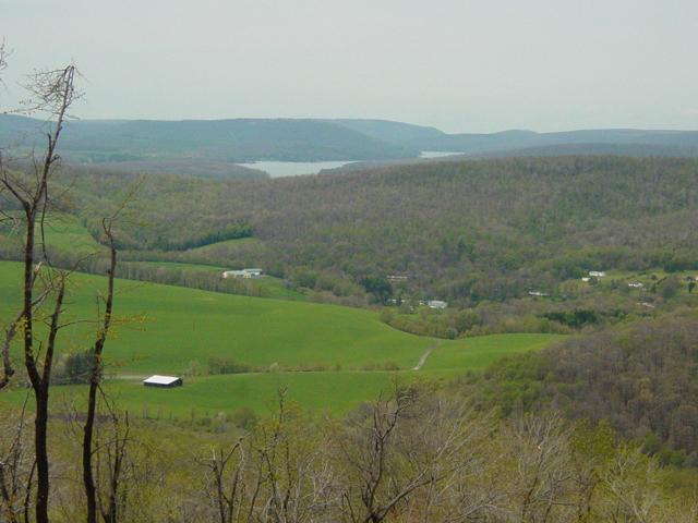
drove up the road and made a quick stop at the Backbone Mountain Scenic Outlook.

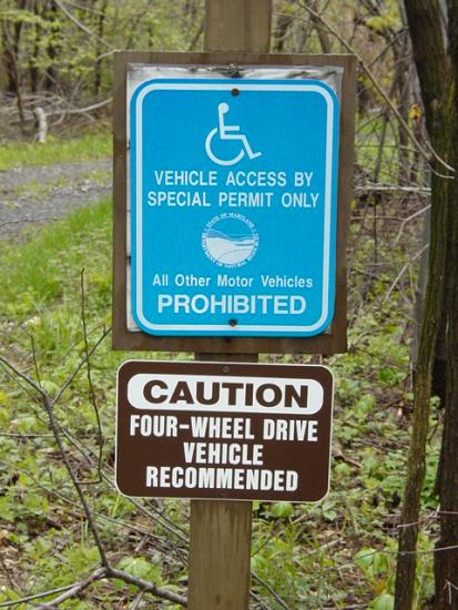
Further up, I found the other Backbone
Mountain trail, complete with a sign at the entrance.
Updated info 6/29/04:
Near the spot where we went down to the railroad grade is Hitchcock Tunnel
and near that, Strecker, a switch location. I found this article
on
the web and archived it against loss:
Mountain Subdivision - 17 Mile
Grade
The whole area was devastated by the ice
storm we had last winter. All the trees were broken and knocked down. It was
clear that a lot of work had been done to clear the trail. Did I say
"trail"? It is a dirt road, made all the more ironic by the sign at the
entrance.
Soon the road hit a "T"
junction so we went first right to the dead end at a gate to private property.
Doubling back we passed the road we came in, and continued to where the road
crosses into a meadow where some large construction equipment appeared to be in use
building a road. It was all parked and idle so I drove on the rough sand track
heading for pavement. Then I noticed that the ground felt soft. I could tell
that we were driving in some wet ground that we could sink into. So I kept moving so
that I could get as close as possible to the heavy equipment should I need to anchor a
winch cable...

We made it all the way to the bulldozer
and then had to thread our way around it and other equipment to get to pavement. I
think we were lucky to get out without getting stuck.