Continuing
with the exploration of Maryland Department of Natural
Resources
ORV
Trails, I loaded the family into the Jeep. As the
general consensus is that these trails are little more than
forest roads, I decided going solo (no companion vehicle)
would not be risky (at least beyond any risk that I NORMALLY
take). This proved to be a valid assumption but as
always, I was prepared
for just about anything.
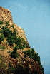
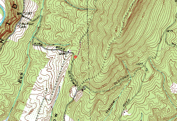
View from Exhibit Center
We drove out
Route 68 to Sideling Hill. There, we stopped at the
Exhibit Center to take a break and climb the steps to
the observation deck where visitors can view the cut made
into the hill for the road construction. We had lunch
under one of the little trees and enjoyed the view of the
valley to the south-east.
After lunch,
we loaded up and hit the road down to
Green Ridge State Park Headquarters where I picked up a
sketch map from the bulletin board area outside the office.
Back on the road and down two exits to one of probably
several entrances to the park. The road instantly goes
from pavement to gray stone.
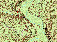
Entrance to Pic Lic Rd
We drove along
turning right onto
Pic Lic Road, then followed it to the end. There are
primitive campsites along the road on both sides.
There are some pretty good views, but no open trails.
It turns out that aside from the nice ride, we wasted time
that we could have used later to complete the east side of
the ORV trail loop that we left unexplored.
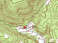
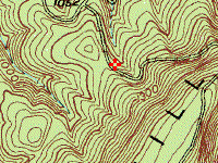
Intersection of Pic Lic and Williams
At the
end of Pic Lic Road we went left onto pavement at Williams
Road. We went down Black Sulfur Spring to Wallizer Rd
(George Road on USGS maps). After a bit we came to a
group camping area (G-1) set off the road a bit. The
porta-john was a welcome, if not exactly fresh, sight...
Off to one side was a well defined two-track trail leading
up a hill. I walked it off with my
handheld CB (so the kids would
not get nervous) and found it passable.
So we climbed
that hill to the end of the trail. It just dead-ends
near the top of the hill. It's tight with one section
where a full-sized truck would have trouble fitting through.
It was fun but very short. It turned out to be the
only place on this trip that I would need 4-Wheel Drive...


At the
end of Wallizer (George) Rd, we connected to Green Ridge Rd
and followed it for a while. It came to an
spot where you could park and take in the view. There
was a small meadow with a fence, and a nice view of the
ridge to the west. We stopped and took a break.
The kids got out and stretched, played with their toys in
the sand and had something to drink. I was beginning
to think that this "ORV trail" was going to turn out like
the Garrett
State Park trail, quite disappointing overall. But
since we were out here, it didn't make sense to give up
until we had at least looked around some. And it was a
nice day so what the hey...? I took some pictures of
the kids and the view and then we got underway.


We turned onto
Kirk Road, choosing to head east into the park and try to
find "the trail". The road looked promising,
descending down into the woods and getting rougher than
anything yet seen (on this outing). We went
around a couple bends and came to - ta da! East Valley
Road with a sign saying
"ORV Trail PERMIT REQUIRED"! Could this be...?

Have Sticker, will "Wheel"...
Well, yes,
it's the trail. But.... To be fair, it's
beautiful country. Anyone driving a 2-wheel drive
vehicle on here would probably get some funny looks.
They might also drag their bumper a few times. They
might even spin wheels here and there. But they will
probably get through without much trouble too... We
made the best of it and rode along enjoying the scenery.
We came upon a group of ATV's and spoke to them about the
trail. They agreed that it was not real challenging
and encouraged us to continue north a ways where it "gets a
little bit more rough". We did just that and found
that the trail was a little bit more rocky but still I had
not engaged 4-wheel drive...

Near the end
of the west loop, we stopped for a break and a stretch.
There are a couple trail spurs that branch off that beg to
be explored another day. We rehydrated and continued.
East Valley Road Exit
We made our
exit from the trail at the northern-most point since Maria
had had enough and it was getting late. We got back on
Route 68 and drove into Hancock where we stopped at the Park
and Dine Restaurant, washed the Jeep across the street,
stopped at Wal*Mart in Frederick, and went home.
The trail was
"OK" - a nice mild Sunday Drive for anyone who wants to take
someone out who perhaps has not been "off-road" before.
But if you are looking for a fix for your 4-WD-jonesing,
this will not be the cure. In fact, you will be so
hungry for some action that the power lines that you cross
under will be calling your name... We did NOT go on
them even though by the time we saw them, I was sorely
tempted...
Not content
with missing half of the trail loop, I went back out to see
the rest. We could not resist making another stop at
Sideling Hill for lunch and a walk up the steps and over the
bridge that crosses the highway.
Once back on
the road and into the forest, I avoided tramping around the
roads I took the previous week and headed straight for the
exit from the ORV trail that I located last week (Waypoint 128). But when I got there I once again
screwed myself by thinking that the unexplored eastern
portion of the ORV loop had more to offer than the portion I
had already hit. But ignorance is bliss so we went
along hoping to find "the trail"... We found a great
lookout point that we stopped and checked out. It was
all I could do to keep the kids from falling off...
Then we went
down Stafford Trail to Old Town Road. This looked
promising as before but turned out to be unchallenging, but
pretty. When we reached Old Town Road, we continued
southwest and then turned northwest up Mertens Avenue until
we got to the outlook at the intersection with Stafford
Road. Tomi was sleeping so Teddy and I got out and
checked out the view.

I may live to
regret it but in one of the wistful moments I swept my hand
out and told Teddy that "all that land is yours", meaning
that since it's public land holdings, that he too, can claim
it as his own, along with everyone else. He
expressed a need to visit the rest room (I guess kids see
right through the adults) and as luck would have it, there
was a porta-john in the Group 7 camp area that met our
respective needs.
After that we
went up Stafford Road to the power lines and stopped to
marvel at the impressive drop to the southeast and the less
imposing but nonetheless awesome drop to the northwest.
Once again, the trail descending on the northwest called to
me but I remain as resolute about taking it since it is not
legal and in any case looks very treacherous.
We continued
on Stafford Road and back-tracked our way all the way to the
exit from the ORV Trail (WP 128) where several groups of
ATV-riders were loading and unloading. I stopped and
asked one group where the trails were. They told me
that any side-trail is legal for 4x4's. I found
this a little surprising because they are all marked with
little "No ATV" or "No Motorcycle" stakes, using the
universal slashed red circle over the prohibited vehicle.
None are marked "No Jeep" so this gets me to wondering.
But rather
than take the word of a self-admitted first-timer, I hauled
all the way back to the Ranger Office and asked.
Penny, the person staffing the station, told me that yes, if
it "looks like a road" and is not marked, or not marked to
prohibit a Jeep (4x4), then it is OK. Sheesh.
She also told me that 4x4's do not need the
DNR permit and sticker. I
don't know about that. And the trails with the stakes
prohibiting certain vehicles also would be hard to enter
past the stake in many cases. So Penny gives me info
that is music to my ears but I remain skeptical.
Update:
On subsequent visits to the park, I spoke with Penny again
and she denied telling me this, and indicated that all
trails so marked (No ATV's or No Motorcycles) are off limits
to everyone... I guess the safe thing to do is to stay
off of them.
Update:
10/22/03 The current Green Ridge web site clarifies
that registered vehicles (such as Jeeps and other 4x4's) are
not required to have DNR stickers.

