Prologue
I
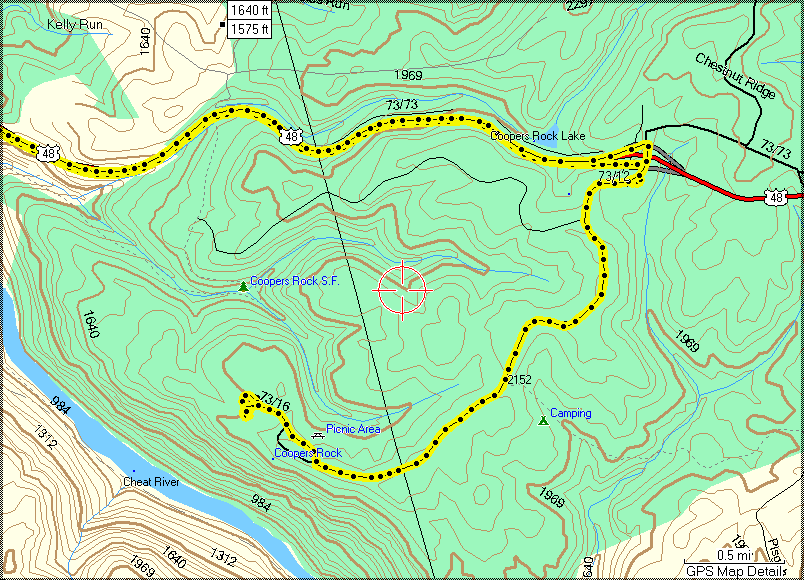
placed a reminder on my calendar for the upcoming Geocaching
meet-and-greet that was scheduled to be held at Cooper's Rock.
I was planning to go with Maria and the kids if things worked out on
our schedule for that weekend. It turned out that Maria and
the kids did some touring in New York so I was free for the weekend.
Coincidentally, Mike suggested going to the event and then spending
the afternoon out shooting, perhaps visiting several covered bridges
in Pennsylvania. It sounded good to me so I sat down and
plotted a course for the caches after the event.
Muster
Mike met me at my house and we
drove over to the event together.
Trail
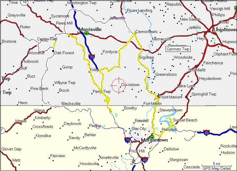
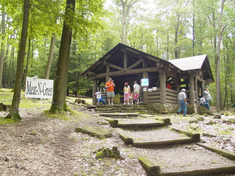
2nd Annual Great Meat-n-Greet at Coopers Rock
There was a decent group pf
people at the event. Well organized, it offered a number
of activities for all ages. Just about everyone there was
engaged in some form of geocaching related activities. We
mingled for a while.


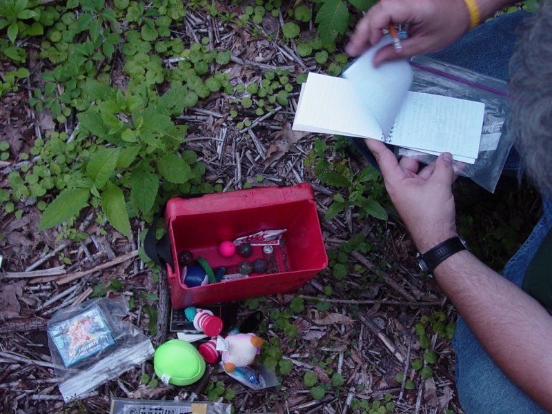
I logged some travel bugs
that I harvested from the boys and my caches the night before,
and discovered some travel bugs and coins that were on the table
in the pavilion.


We grabbed a bite to eat and
after checking out, hit the road for Pennsylvania.
The Bridges of
Greene County (PA)
Once we got off the highway
near Morgantown, we enjoyed a nice afternoon on the back roads
of south-western PA.
The Bridges
of Green County #
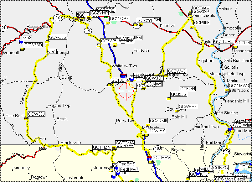
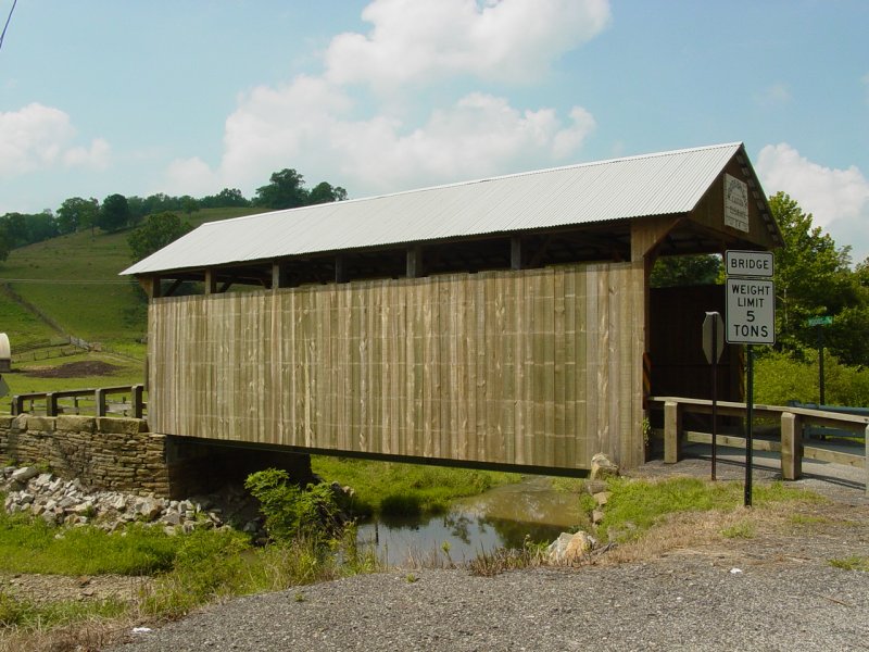
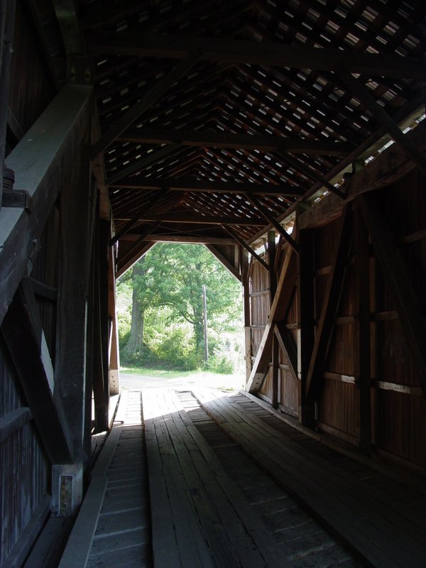
GCW33J - The Bridges of Green County #4 - King Bridge
Our first stop was at
King Bridge.
  
We looked around for
a few minutes and Mike found the cache.

The bridge is nicely
restored with many of the original structural members
still in place.
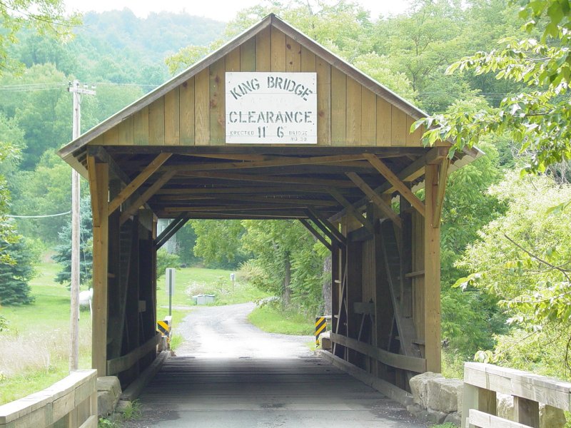
As we left the bridge
to continue our drive, I could not resist stopping to
take this photo that was evocative of recent exploits...
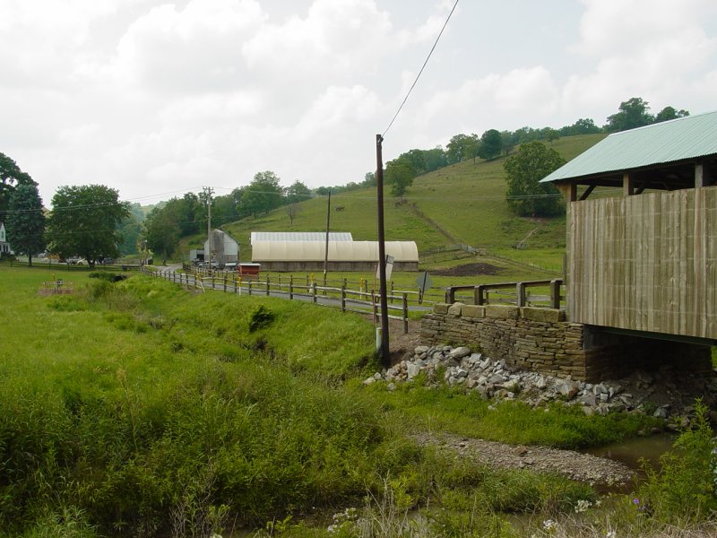
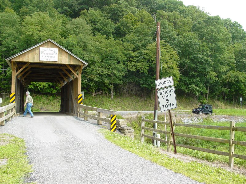
GCW33G - The Bridges of Green County #3 - Wood's Bridge
Soon we reached our
second cache location. This bridge was vexing - we
did not find the cache. It's probably there but
our careful inspection of the bridge (constrained by the
guidelines of the cache creator) focused our attention
on easily accessible portions of the bridge.


Beyond the bridge lie
a farm. But for the modern signs and power lines,
and maybe the vehicles, this farm looks much as it might
100 years ago.
Mike still looking
for the cache...
We concluded our
search with a "DNF" and headed out for the next cache.
When we stopped at this point, I terminated navigation
of the route I had planned for the day. That in
combination with the way the GPS works caused me to miss
turning left and driving over this bridge to our next
destination - another bridge - so we missed two bridges
and ended up in Waynesburg on our way to another bridge.
I spotted a couple of caches and suggested we try them.
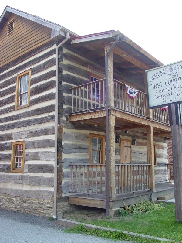
GC11R5X - Log Courthouse
The Log Courthouse
stands out in the center of town even though the other
buildings are not recent. This building has a very
"frontier" look and feel to it. The cache hide was
quite clever, but Mike and I managed to find it after a
few minutes of looking around.

Nearby was another cache
so we drove over and gave it a try.
GC11RC8 - Think Tank
I knew I was in
trouble when we pulled up to this one. There are
so many places to hide something small on a tank that I
wasn't very confident I could find it, if the first
several places I checked did not give it up. The
sign asked that we not climb on or under the tank so
with those constraints we searched for about 20 minutes.

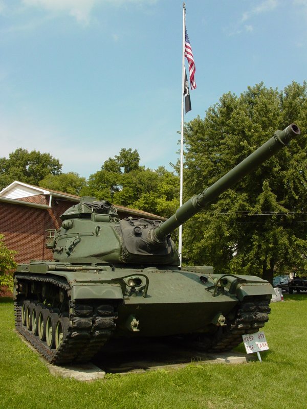
No dice! We
left this one behind without finding the cache!
GCZWEJ - Up, Up, and Away!
As I drove along,
another cache surfaced on the screen and appeared to be
easily accessible. So I turned off and up the road
to the top of the hill amidst a cemetery. I soon
located the cache.
  
The view was
spectacular though the atmosphere was very hazy so
picture taking of the distance was not worthwhile.
I imagine this would be a beautiful place to visit in
the late fall or winter!
After this cache, we
drove along and it soon became apparent that the GPS
route was unsatisfactory. The unit had
inexplicably decided to ignore the via-points in the
route I had loaded and was trying to take me to my final
destination (HOME). As we still wanted to visit
some bridges, we ignored the routing and worked our way
back to I-79 and then headed back North.
GCVJXJ - Country Overlook
Just before we got on
the highway we stopped at this place to check the cache
out. I soon figured out it was atop a hill behind
the truck stop. There were lots of bushes and
thick growth on the side of the hill and an easy path
did not make itself available to me. So with Mike
sitting in the Jeep I decided to bag this for another
day when the bushes were dead.
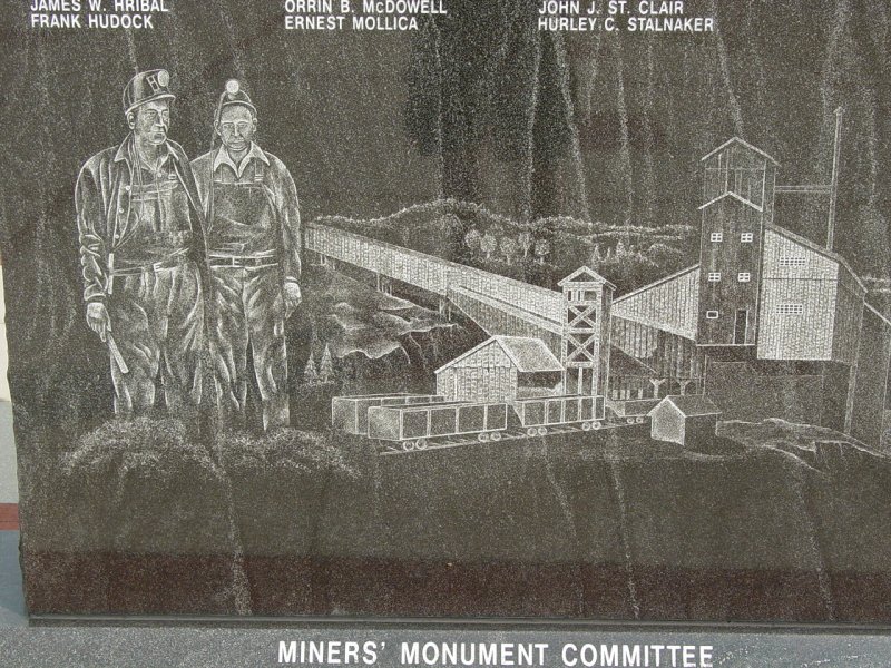
GC7CF3 - Coal Miner's Monument
Up the highway we
stopped at a welcome center and visited this monument.
It describes one of the tragic mine accidents that
happened directly under this spot. I spent a few
moments thinking about the people who lost their lives
here, and took some pictures of the monument.

 
Then Mike suggested a
few caches that he knew, so we went to them.
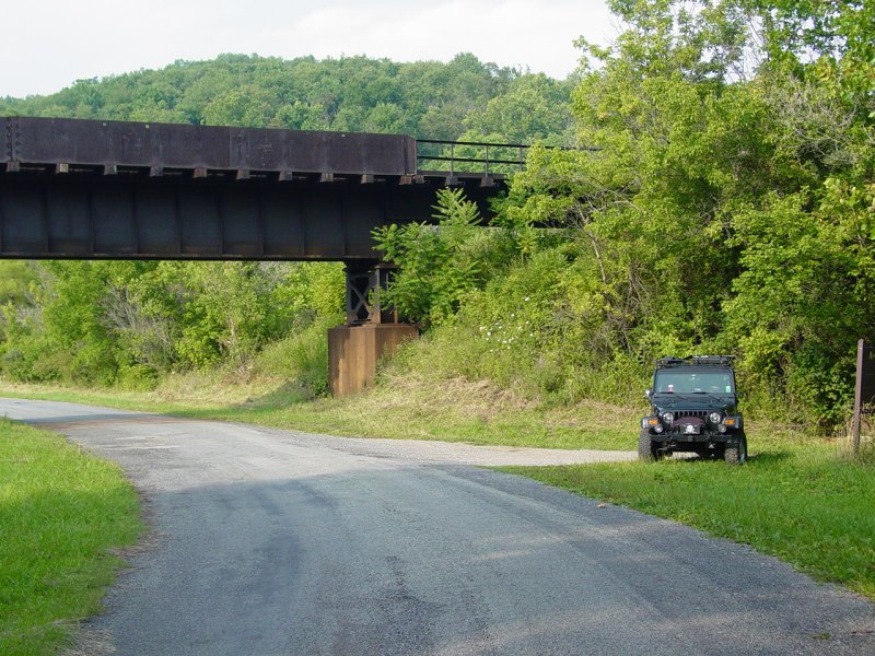
GCP2MD - I-79 TB Rest Stop
Just off the highway
is a convenient cache for travelers to exchange travel
bugs. Nice and easy. It looks like the area
is in a state of change so this place may look different
as time goes by.

Mike waited while I
visited the cache and signed the log. He's already
done this one.
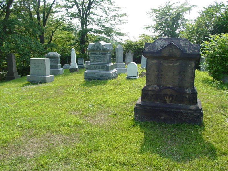
GC10AND - Hoka Hey!
We stayed off the
highway for the rest of the afternoon. Nearby the
travel bug cache, was another cache on a well concealed
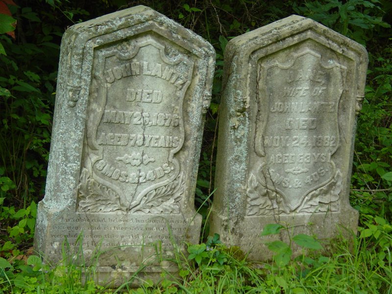
wildlife management area near where Whiteley used to be.
We parked in the WMA
parking area and I hiked up to the Whiteley cemetery.
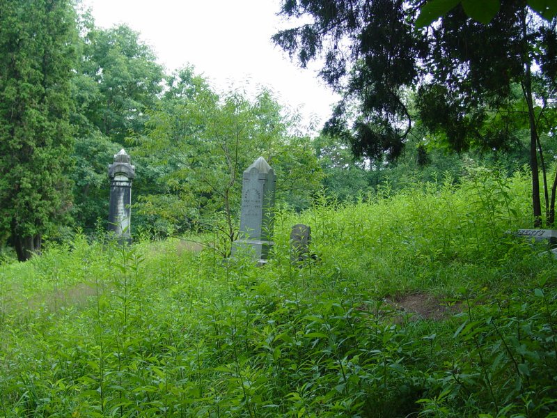
 
After a few minutes
search I found the cache. The stones are quite old and
the area appears abandoned.
  

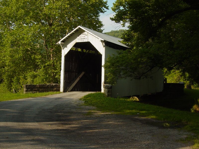
GCW33P - The Bridges of Green County #7 - White Bridge
We continued to the
next of several covered bridge caches. This one
was quite interesting and perhaps one of the more
photogenic bridges on our trip. We spent some time
locating the cache and making photographs.
 

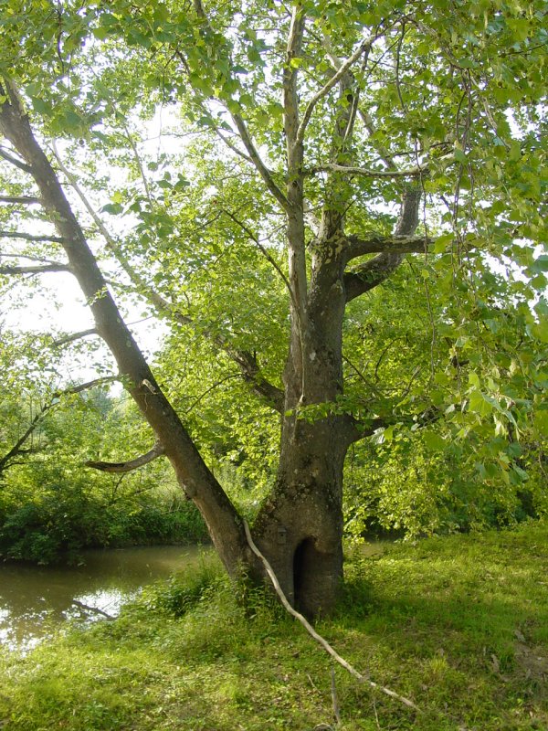


GC10BC0 - SGL 223
As close as we were
to this cache (walking distance from White Bridge), it
made no sense to pass it up so we walked out to it and
logged a soggy find. The meadow had been mowed and
it was a nice walk along the stream back to the Jeep.


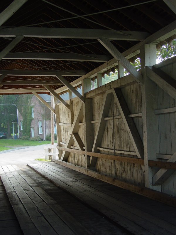
The Bridges of Green County #6 - Carmichaels Bridge
The last bridge
on our route was Carmichaels. We parked nearby
and spent some time looking for the cache and making
images. This is a very busy bridge so we also
dodged quite a few cars!
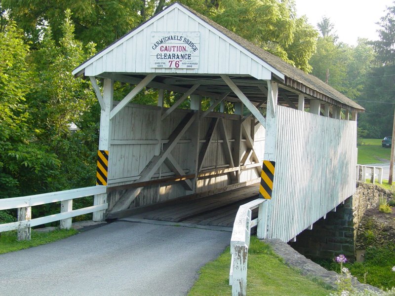


The whole town
(Carmichaels) was very interesting. There are lots
of old buildings and still lots of signs of life.

One more cache was
close so we drove the short distance and took the short
walk.
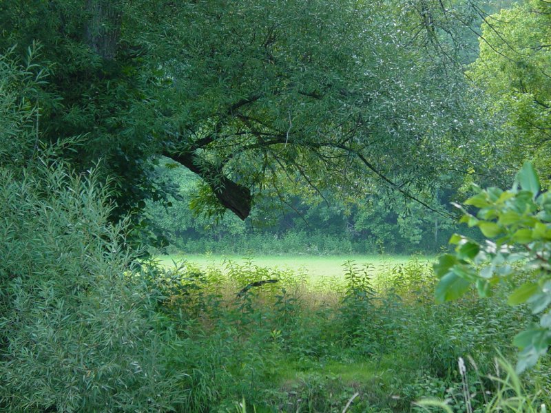
GCT4AV - Laurel Falls Point Cache
One of the things I
am discovering as I go in search of geocaches is the
wealth of local spots that don't make the tourist lists
but still have something to offer. It's good that
they don't all become famous because they would lose
their charm. We walked down to the cache through a
newly created recreational area complete with a new
pavilion and some interesting benches. It appeared
they were still working on the ground in preparation for
opening sometime in the near future.
The cache was pretty
easy to spot. Mike did the honors.

   
I had spotted a Fox
Den pizza place on the way in so suggested stop there to
eat. After we had something to recharge our
batteries, we drove the back roads to Point Marion, PA
where the road crosses the Monongahela River. An
old waypoint that I had put on my data base almost two
years previously popped up. It was my mark for
Walnut Hill. I had heard this was a spot where
local people when 4-Wheeling so I drove up to the top to
see what I could find.
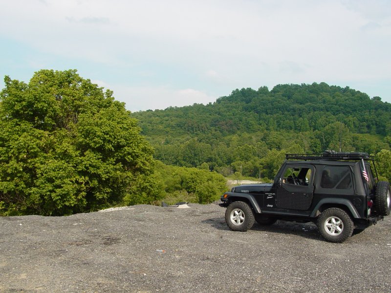
Walnut
Hill, Point Marion
The most likely
4-wheeling was a spot that looked like an area that was
being developed for a while but work had stopped.
It was not the kind of 4-Wheeling I like to do
(trespassing and mud holes are not good elements...) so
I figured we'd just turn around and go back down the
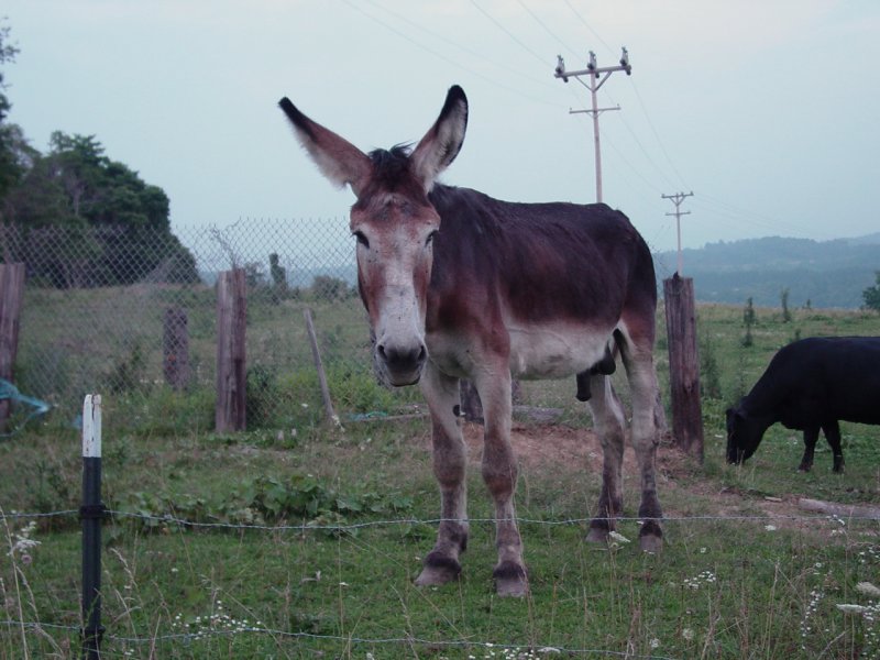
road on our way. But this curious fellow was
standing by the road watching us and I could not resist
stopping to chat with him and to make a couple images of
him.
    
I was also interested
in exploring the northern passage over the Cheat River
and a way to get home that did not require me to go all
the way down Route 119 to Exit 7 on Route 68. It
appeared on the map there were some options but because
it was late, we went down 119 and then to the house.
Epilogue
This day marked the most
geocaches I have found in one day. We really enjoyed the
bridges though we still have a few left to visit.
The next day I took an
exploration and found the northern route from Point Marion to my
house. I had a couple of false starts as roads that run close
to Cheat Lake end at gates or at the geographic boundary where the
high ground goes down to the river and the road was never connected
to the other side.
All it all it was a very full
weekend with many new places seen!
|
