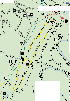
The "trail" really doesn't
start until you get into the State Park a little way. We came to the
first branch in the road where Fifteen Mile Creek Road branches off to the
left, and Sugar Bottom Road branches to the right up the hill. We drove
along there past campsites, and over to Black Sulphur Road (left) and down
into a hollow where one of the Group Camp sites is located. It was full
of campers and many people were scattered around the site, and up and down the
stream fishing.
So far the weather had been
good for us. It was sunny and mild with no wind to speak of. We
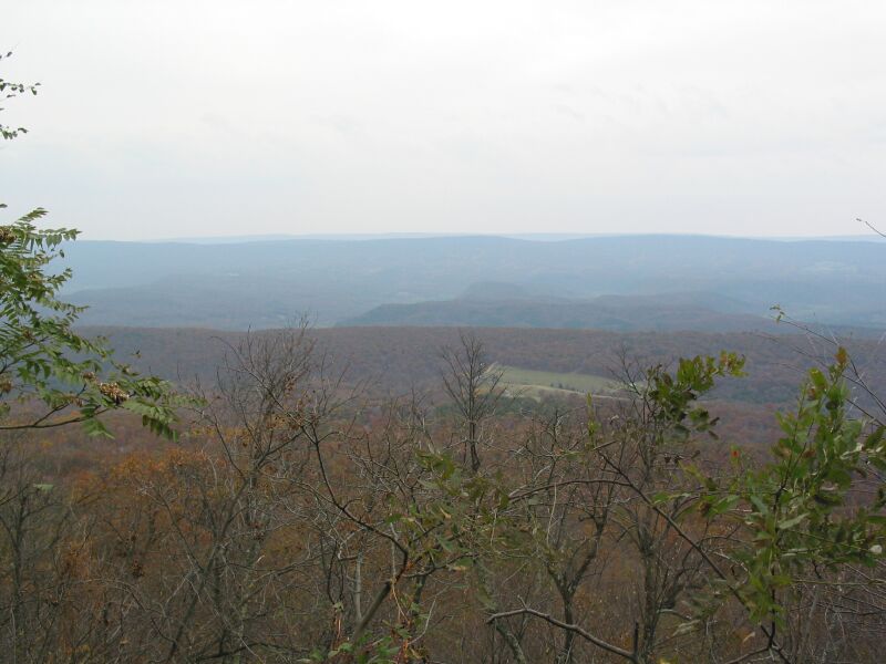
keep moving and soon reached Green Ridge Road. From there we drove until
we came to the spot where the power lines cross and you can see in both
directions for some distance.


It's always tempting to run
power lines. The steep hills and the rough trail are almost too much to
pass up. However, as is most often the case, the trail following the
lines is off limits for vehicles so we need to content ourselves with enjoying
the view. I explained that we'd be dropping into the valley a little
further south, and then running part of the trail before climbing up the ridge
and soon showing up at the power lines where they cross in the distance.
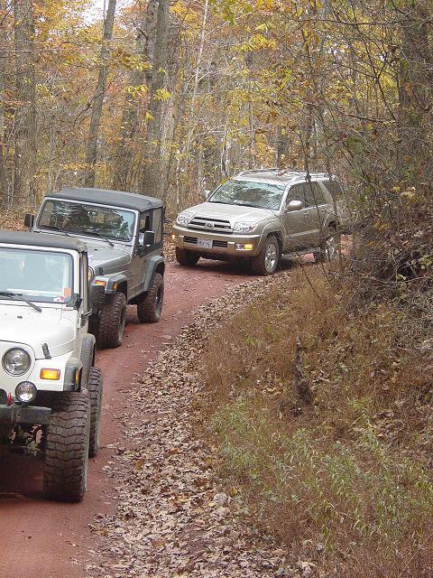
We continued down Green Ridge
Road and turned east onto Mertens Avenue. Soon we came to a junction
where the OHV trail runs north and south. I wanted to run the entire
length of the trail as well as explore the high ridge line, so I led the group
south onto the OHV trail. At this point we encountered a large group of
people driving ATV's and all their tow vehicles. From this point on we
would be contending with ATV's sharing the trail with us. It was for the
most part uneventful. We were crawling along and the ATV's usually had
enough warning to avoid us, and plenty of room to go around.
This part of the trail is
very mild and is mainly a scenic alternative to pavement. But there are
spots where one must concede to the terrain and choose a line to avoid
dragging the undercarriage. This makes for some interesting driving for
stock vehicles and those new to off-road travel.


We did find one spot that
offered an alternative to the flat of the road, so a few of us took the
opportunity to cycle our suspensions.

Jim
Soon we came to the lower end
of the trail where it meets with Kirk Road. It is marked with signs and
features a triangle-shaped intersection. There was some confusion about
the western branch because the cut-off was marked with the "No Jeeps"
international symbol. Carl and I drove a ways down Kirk Road looking for
the crossing that I had remembered from a previous visit. We found the
spot but it was dried up so we reversed direction and returned to the
intersection and the rest of the group.


We continued south-west for a
few more minutes and soon came to Stafford Road. It turns north-east and
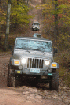
heads up the ridge. The trail was noticeable more difficult. Some
of us were thrilled to get a little bit more challenging wheeling.
Keeping in mind that some sections of the road would threaten damage, we
spotted Steve through one eroded section, and took our time climbing to the
top. This was the first time I had been able to get down to this end of
the trail and I must say, it may be the best section of the whole OHV area in
this park. Well worth driving to it.
We drove up the foot of the
ridge, stopping along the way to take pictures of each other and to enjoy the
weather.


Steve


Rob
Movie: Carl playing in the ruts and rocks


Carl


Paul and Steve
We started looking for a
place to have lunch. I was hoping
the spot we'd
stopped at one time near Group 7 site was close by but it was still a ways
up the ridge so I stopped at a small turn out that had a picnic table and a
view through the trees. Carl parked on a stump and everyone got some
lunch. I got the kids something to eat and gave thanks for the great
weather and so far an uneventful trip.


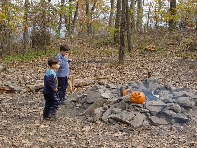
After lunch, we got back on
the trail. We soon came to the top of the ridge and after crossing
Mertens Avenue, reached Group 7 camping area. There is a porta-john
there. We found a recently abandoned fire, a well-carved pumpkin, and
multi-colored wax residue from a large candle burning session. Happy
Halloween! The kids got a big kick out of the pumpkin while the adults
had a rest break.


We ran the top of the ridge
until we came to the spot where the power lines cross. At that point I
remembered that the power lines were on the northern section of the OHV trail
that ran in the valley below, and that if we wanted to run the rest of the
trail, we'd be better off backtracking and going down to the valley, then
running it north from there.
It was tempting to descend
the power line hill. I noted that there were no signs marking it
off-limits but Carl did find the post that is used for all such signs, though
there was no marking on the post. This coupled with the recollection
that the descent (or climb depending on your direction of travel) was quite
steep in spots, was enough to make me realize that we'd best not take this
"short cut" as it represented a risk for all of us, and was probably illegal
anyway. I walked down the trail a good ways to where it dropped steeply
away and chalked it up to safety and rules.
We doubled back the along the
top of the ridge back down to Mertens Avenue where we followed the switchbacks
down the side of the ridge until we reached the valley and East Valley Road
where the ATV riders tend to base themselves. On the way down, we noted
entrances to the power line trail marked with the ubiquitous international "No
Jeeps" symbol. That pretty much confirmed that this area was off limits.
At the trail junction, we
turned onto the northeastern section of the OHV route and followed it along.
We soon passed under the power lines and observed a post and rail fence on
both sides of the trail, making it redundantly clear that this area was out of
bounds. Stretching up to the ridge was a wonderful hill climb that we
will not be climbing.
Shortly after that I noted
the same side trail I had explored previously. It was marked closed for
motorcycles and ATV's but the "No Jeeps" marking was absent. So I
suggested that Steve save his new Toyota from pin striping. He parked
and hoped in with Carl, then we went up the trail until we reached the point
of no return. The trail gets very steep and climbs the side of the ridge
over leaves and loose rocks with a narrow path between many trees. It
was pretty clear that some of us might have a chance of making it, but it was
not something that we really needed to do this day. We opted to turn
around and save it for another day. We backtracked to the main trail and
Steve picked up his truck.
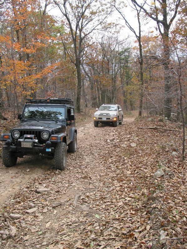
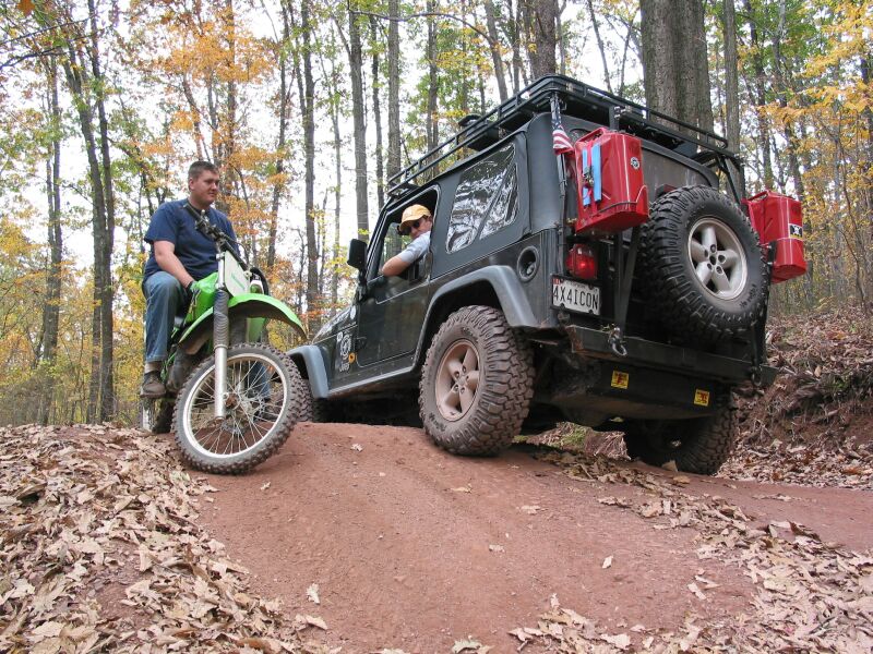
As we continued along the we
ran into a few ATV's. I had spoken to many of the drivers as they passed
us on the trail all day long, advising them how many vehicles were behind us
and just passing the time of day. One guy was very interested in our
Jeeps and was seen several times as we went along the trail. We also saw
his friends driving a four-wheel drive pick-up truck. Finally, the ATV
driver told me that they had been waiting for us to come along to this rock
that the pick-up had tried to climb but could not. He was wondering how
our Jeeps were set up ("Do you have lockers?") and whether or not we'd be
going that way.

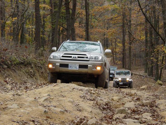
We did plan to run the rest
of the trail to where it meets up with Fifteen Mile Creek Road. And I
vaguely remembered a spot where there was a bald rock adjacent to the trail,
near the end of the trail. So I told him we were going there. He
soon had all his friends rounded up and we continued down the road in a rather
curious group of Jeeps, SUV, Pick-up, and a variety of ATV's and motorcycles.
I guess we were going to be the entertainment for these guys.
Our pace is typically slow so
after perhaps 10 minutes, the same guy I had spoken to came up to the front
and went ahead. I figured he'd gotten bored with the pace and was going
to the rock to wait for us to arrive. We continued another 5 minutes at
this rate and he returned to check on us. He told me that the rock was
just ahead. I was thinking "Lambs to the Slaughter" for a flicker but
reminded myself that this was a stocker run and nothing I had ever seen on
this trail was capable of much carnage. Even the mud puddles were nearly
dry this day.
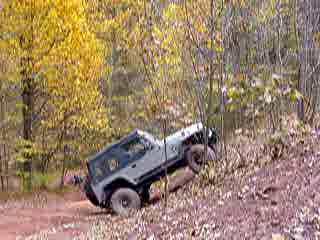
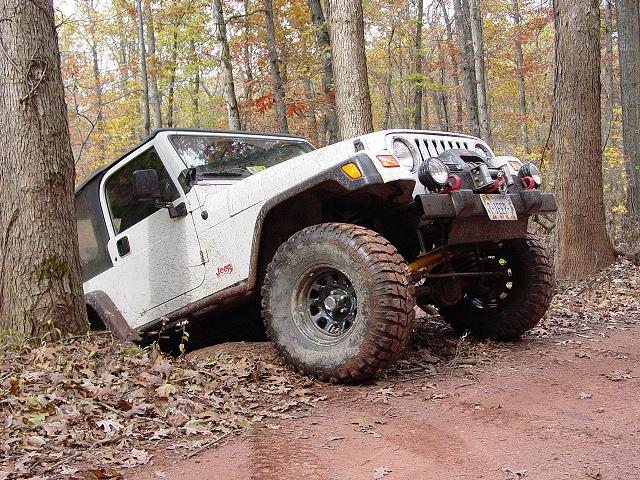
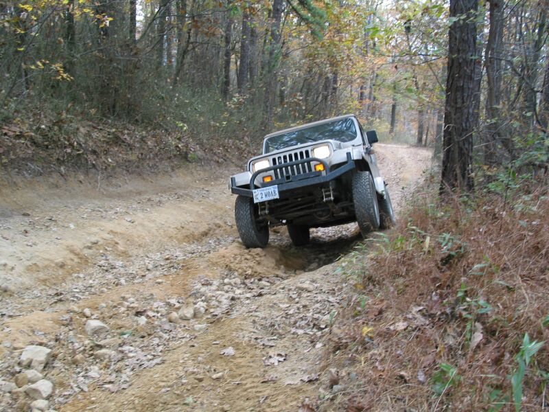
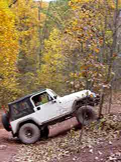
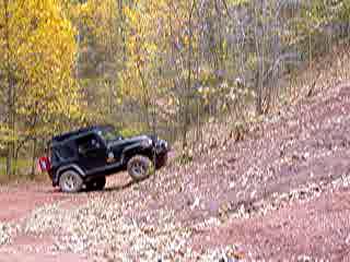
Around the bend I spied the
motorcycle rider and the rock on the side of the road. It was the one I
remembered, and indeed there was a steep way up to one side. I went
right down to the spot, positioned myself on the rock, and then crawled up to
the top. The worst thing about the rock was that it was quite steep at
the bottom but soon got less so, and even with a little bit of off-camber
slope, was not particularly difficult or scary.
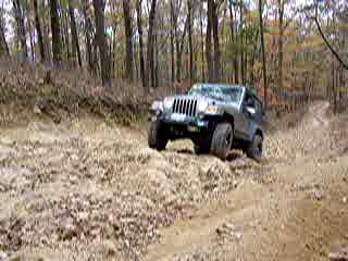
The rest of the group showed
up and a gallery of spectators soon assembled. Carl and Jim each went
up.
"Showboat Carl" crawled it
beautifully, went back down, and with the motorcycle rider as a passenger.


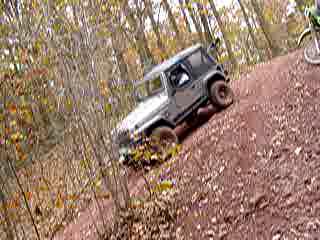
Jim got lined up and then
lifted his right front wheel as he positioned to climb up. He had not
disconnected. A few people noticed and excitement went through the group
of onlookers. (I screwed up the movie by holding the camera sideways at
the beginning - don't watch it if you get sick easily - I rotated it correctly
after a reminder from my 6-year old and the rest of the movie was OK)
Movie:
Jim climbing (after he lifted a wheel...)
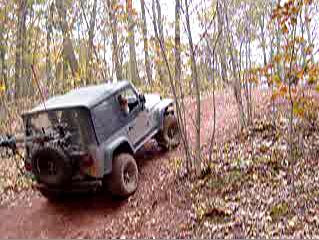
I made another run up the
hill, jokingly asking "Someone said there was an obstacle around here...?"
Movie: Paul Climbing

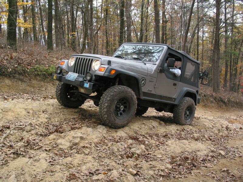
It's funny - I don't think of
my Jeep as being that extreme, and of course, it isn't. But there are a
lot of people driving bone-stock vehicles that have not yet built them at all,
so to them, it looks pretty wild. It was fun for a change to be in that
position, though a bit strange considering all the people I know who have
really "big Jeeps".
These pictures and movies
never give a good impression of how steep some of the obstacles really are.
Here is a movie of my mountain-goat kids climbing the hill after we finished.
Notice how steep the climb is for them on foot.
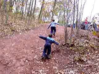
Movie:
Kids climbing the rock on foot...

After some chat, we continued
down the trail until we got to the main road again. Carl and I aired up
and reconnected.


Rob and Steve hit the road
for home. Jim stuck around and kept us company and the kids played in
the dirt with their Hot Wheels cars.