Prologue
While looking for some exploring to do while I was home in Massachusetts in the winter of 2002, I checked
out the New England clubs online. On one of the ride boards, someone was trying to
get interest in a trip to Maine. It was a little different from what I have
experienced with my club and the people that usually come with me. This leader
wanted to make it competitive with the winners left standing and the losers left
behind. I think there was some jest in that, but the destination intrigued me.
Some folks in Maine had made a winter trek to a pair of abandoned locomotives
in the Allagash Wilderness. This is ghost town stuff. I have never
really had the western ghost town experience so the thought of two huge locomotives in the
remote wilderness might be the closest I would get to anything like that.
Naturally, this meant that I would spend hours trying to
pinpoint the location of the locomotives on a map so that I could determine whether
or not a trip of some sort was feasible. I put all my research skills to bear and
soon had located the locomotives, at least in theory, on the map. Ironically, when I
finally had enough data to be able to look at the right region on the map, I discovered
that the map itself marked the spot with the humble annotation "2
locomotives". In a way it mocked me for all the research I had done, but at the
same time the location was so far away from anything I could have seen without doing the
research that I was pleased to find it marked in this way, and pleased that I had done the
hard work that made me familiar with the surrounding area through which we would travel.
The research pointed me to our stepping off point, Greenville
Maine. It lies at the southern end of the great Moosehead Lake.
This by itself is a worthy destination, and no doubt my interest will probably be tempted
by this landmark which is but a stopping point on our trip. One surprise that came
from my research was the rediscovery of Henry David Thoreau's writings about The
Maine Woods. I had done a search on North Maine Woods to get information
about our access to the wilderness area and his book came up. I got distracted by it
and soon had read the account he wrote of all three trips. I was a lost cause.
While his stories are over 150 years old, the beauty and mystery of the region that he
described made me more committed than ever to go see this place where some remnants of the
wild might still remain. Thoreau's accounts also provided great insight into the
landmarks, conditions, and even the feelings of this place. I would read all three
stories two or three times over while following his trips in my maps. It was almost
mystical to see him chart his course and see it on a map that shows our destination for
this trip. It reminds me a little of reading the J.R.R. Tolkein's Trilogy of the
Rings and following Bilbo and Frodo's travels in the little map provided in the books.
I have no illusions that much of Thoreau's Maine
has fallen to modern times. And I am somewhat resigned to the fact that much of the
wilderness that remains is heavily regulated, probably to the benefit of people who wish
to see something of it in an unspoiled condition. I am perversely pleased that the
area we want to travel to is so remote that we must bring extra fuel with us. For
what would an expedition be if frequent gas stations along the way prevented us from truly
reaching the wilderness? It makes clear that in modern terms, the stakes are a
couple notches higher than a trip to the local forest where, though we might walk a
half-day to get out, we would never be far from "civilization". Not so
here. The trip will require a measure of self-reliance that will be softened by
modern technology and convenience, space-age navigation, and good homework. But
Murphy's law applies to everyone, so remains some excitement that the unexpected could
bring a new dimension to the trip.
A full nine months of planning has gone into the
trip. I purposefully limited the knowledge of the trip to a close circle of people
with whom I have had repeated positive outdoor experiences. I was unwilling to share
this with anyone who would become a dependent or a liability, anyone who did not respect
the wilderness and her power. I was unwilling to share this with anyone who did not
perform on their word, for surely if things go wrong, trust becomes the most important
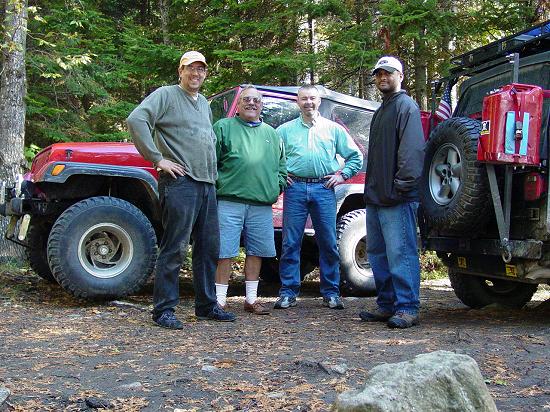
item in our bag. And so it was that I invited people with these qualities and
strengths. Over the course of the planning period, most of 2003, several people
signed on and later signed off. For the most part the problem with a trip like this
is that the planning is far in advance of the event, and requires a commitment of a weeks
time for the trip. This by no means was easy for me. I found it difficult to
choose a week that worked for everyone, and in the end selected a week that provided the
opportunity for good weather, great scenery, and that fit into the calendar of those who
were at that time signed on. In future this week may well prove to be the best time,
but in any case, the date will be set very much earlier so a wider audience can be invited
early in the planning.
I learned a great deal about Maine in the months
that I spent planning for the trip. It was amazing to look at the maps and see that
the Native American names of many places had stayed in place and were still
preferred. It was interesting to see how the paper industry still controls one of
the largest privately held pieces of land in our country. I never thought of Maine
as a land of lakes, having spent my life enjoying the coast and the every eastern portion
of the state. Now I see better the mystique attached to anyone who holds the
distinction of "Maine Guide".
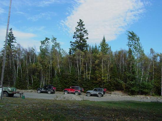
So with plans put in place for outfitting vehicles and
people, and with a date set, we locked down our plans and staged for departure. Our
road trip will take us to Massachusetts where we will pick up my father, New
Hampshire, where Carl will spend the night with his brother, then to Ellsworth
where we will pick up Carl's father. The last leg of our road trip will land us in Greenville,
Maine where we will step off into the wilderness and travel up the western side of Moosehead
Lake, into the North Maine Woods at the 20 Mile Check Point. We
may make a brief stop at Pittston Farm. Then we will work our way up to the
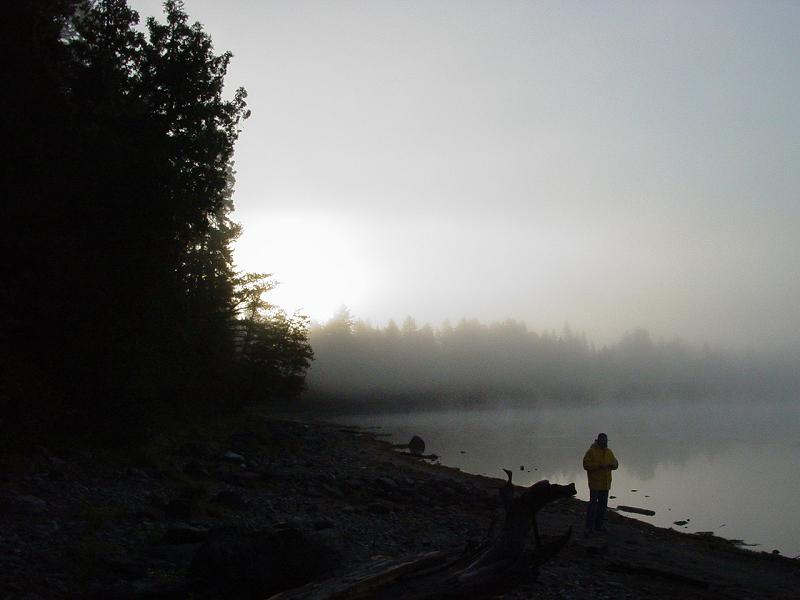
area around Allagash Lake where we will make camp and explore the vicinity for a
day or two. After a visit to the trains, and perhaps to the Ice Cave on Allagash
Lake, we will explore as we go, no doubt with the self-encouraged delusion that we are
the first to come to these places...
Navigation
Plans being what they are, and me being who I am, it
would not be enough to put five or ten waypoints into the GPS and leave the rest to
chance. After studying the maps for almost ten months, I became familiar with the
places surrounding the trains. There is a labyrinth of roads and trails. On
some maps, they are shown better than others. I studied two different series of USGS
topo maps, the DeLorme's Maine Atlas and Gazetteer, and DeLorme Topo Zone
on CD. It is very valuable to have as many sources as possible. One might be
tempted to think that a map is a map is a map. That is not the case, and any one of
the maps I used had shortcomings that were made up for by the others.
Once I had determined where we were going, how long we
were staying, I spoke with the Allagash Wilderness Waterway ranger and got some
local insight. I learned things that I couldn't possibly see on the map, for
instances which roads would provide us with the most driving challenges, where we could
not park, and the nature of the woods near where we wanted to hike. With all this
information, I began the very tedious process of recording waypoints, naming them with a
scheme that would cross-reference them to the DeLorme's Atlas that we'll be using,
entering them into the GPS, creating routes, and finally verifying each and every one to
confirm that it was recorded and entered correctly. In all there are nearly 100
points that will be used in our navigation. When I got to the validation step, I
found that there were about six marks that had been entered incorrectly. As it
turned out, three of them were critical marks as they represented the location of camp
sites for which we have fire permits. I am happy to report that the errors were easy
to spot and correct. The final review of the waypoint plot compared to my annotated DeLorme's
confirms that there are no more errors. This certainly is taking something to the
extreme, but when it comes to knowing where we are in a place like this, I just can't see
any other way.
Provisions
We started out with the food planning at the
beginning. The process accelerated when I refined the itinerary and thus determined
the number of days we would be in the woods. From there, I just took the approach of
seeking food that would be nourishing, tasty, light-weight and compact, packaged in
individual servings, packaged in paper, and things that were ready to eat, or mixed with
water. This enables us to conserve weight and burn our trash. It allows us to
have some individual flexibility as to what we are going to eat for each meal, and
minimizes the possibility of leftovers. Our noon meals are designed to be eaten on
the trail so do no require cooking. The large proportion of these provisions for
four days of meals for five people fits in one of my trunks. This approach also
significantly reduces and possibly eliminates the need for refrigeration.
Complications - Hurricane Isabel
Just when I thought I had all the plans completed, and
everything pretty much laid to rest, a hurricane developed and began its swing in from the
Atlantic, setting its course for the Outer Banks, and promising to deliver a whack to my
home town just for spite. For days the weather reports were doom and gloom.
The news reports trumpeted urgent recommendations of emergency preparedness. You get
used to the dire sounding reports of an impending sun shower, given that the great
majority of longtime natives to the region do not know real hardship when it comes to
weather.
Being a Yankee, with the "when I was a kid I walked
10 miles in the snow to deliver my papers, and it was up hill both ways..."
mentality. That's actually true for me, so I do tire of the bogus weather
paranoia. Be that as it may, there was no denying the infrared satellite images of a
huge storm system lumbering in from the ocean, ready to make good on everyone's
fears. So I reluctantly decided to look at my provisions for the trip as the
best kind of readiness should the worst happen. If the weather wreaks destruction on
my home, I will be forced to abandon my trip or at the very least get a late start.
There is no way I could justify leaving my wife and kids with no power and no way to cook
or get water. Real survival always takes precedent over pretend, for surely one
component of this trip for me is the need to prove I can survive in sub-rural conditions,
stink notwithstanding.
9/19/03 11:27AM
The storm has blown through. We were left with a
carpeting of fallen twigs, and one large limb broken on one of the trees near our driveway
- not threatening the house.
     
The entire crop of acorns appears to have fallen
overnight. We lost power from 12:45am until 8:45am. It is on with some
temporary outages. Our neighbors did well too - parking the vehicles in the field
overnight proved worthwhile. I called the group and everyone else made out OK as
well. If the power stays on and the weather holds - we'll be good to go.
9/19/03 6:59 PM
I was mistaken. Carl did not have power. I
guess he told me, but somehow I missed it. He is in a holding pattern right
now. JJ is all set as am I. If Carl does not get his power back, he does not
plan to make the departure. I am thinking that I should go ahead with JJ anyway in
the hope that Carl will get power back and catch up to us in Ellsworth or Greenville.
If he falls behind by much more than a day, I think he might miss the trip. I
am torn because I almost don't feel right about going without him, but at the same time,
we are in such a high state of readiness it doesn't make sense not to go.
Stupid Moves
On the way home from getting the last of the food for the
trip, I came upon a road that was closed to through traffic. So I went around the
sign and continued. Since my house was just up the way, I felt OK and considered
myself local. A little further up there was a yellow tape across the road. I
decided to do a little wheeling and went off into the woods to go around it. As I
came back down to the road, something didn't feel right so I stopped and got out to take a
look. A branch the size of my leg was jammed between my tie rod and my front axle
housing, and was pinched on my drag link. Knowing the legendary weakness of these
components, I decided brute force was not the answer. Instead, I took down my Hi-Lift for what is probably the fourth time in three
years. I jacked up my front end until the front axle housing was hanging free and
easily removed the tree branch, all the while very conscious of the precarious perch that
my Jeep was upon. Then I jacked it back down and put the thing away. The
Hi-Lift comes through again. I continued up the road a little way and came to a spot
where there was a power line low on one side, but with plenty of room to go under on the
other side. So I did. Maybe it's bad karma?
So right now things are looking a little bleak with the
possibility of Carl not coming...
Packing
I did my best to balance my packing with taking care of
the storm mess. I got the yard picked up enough so that Maria could drive the car in
and out of the driveway without having to run over the fallen debris. I checked all
the trees and found one that was badly damaged but not in any immediate danger of falling
on anything. Then I turned my attention to the Jeep and loading up.
After several camping trips, the routine for loading is
well established, and indeed, most of the gear I needed was already organized into trunks. Several trips had refined the
organization and location of the contents so aside from packing two trunks with duplicate
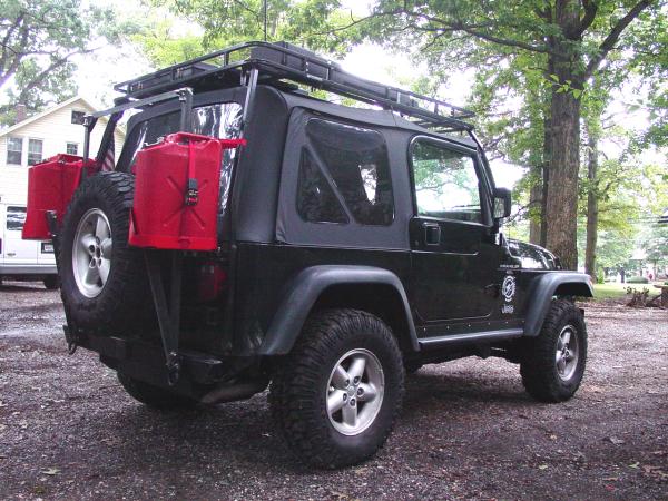
quantities of food, the packing was pretty straight forward. The dual gas can rack
that I had built earlier in the week was a minor interference since it must be bolted to
the tub and prevents the rear from opening easily. But that too was becoming routine
after many test-fittings and the realization that it would be a factor in any packing
activities. I allowed for my father's gear, which by his account would consist of a
duffle bag, sleeping bag, and a couple of clothing items carried in hand. With the
packing and double checking out of the way, I got to bed around 11:00 PM, and did my best
to get a good night's sleep.
The Trip - Daily Journal
Due to the number of images, the rest of this story will
be broken up by days, starting with the road trip to Massachusetts. For the
account of each days events, just click on the link to open a new window. When
you're done reading it, close the window and return here to select another day.
Saturday,
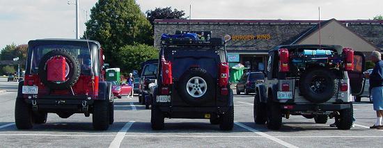
September 20, 2003 - Road Trip to Templeton, Massachusetts: Paul and JJ
drive to pick up Paul's Dad (Leo) in Massachusetts
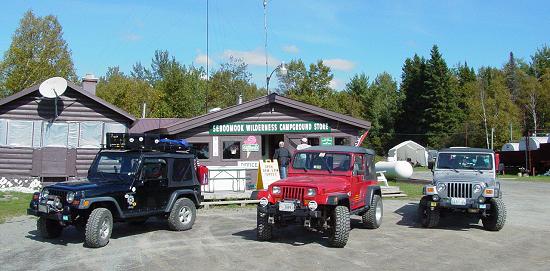
Sunday,
September 21, 2003 - Road Trip to Greenville, Maine: Paul, Leo and JJ meet Carl on
the road and drive to Moosehead Family Campground in Greenville, Maine, with
some interesting stops along the way. Once camp is set up, excursion number 1, the Trip
to the B-52 Crash Site commences...
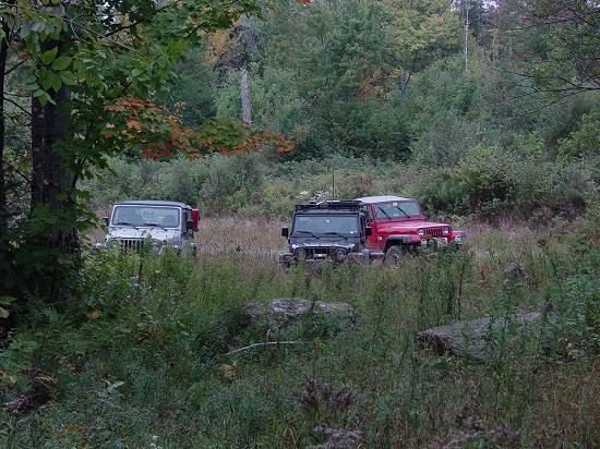
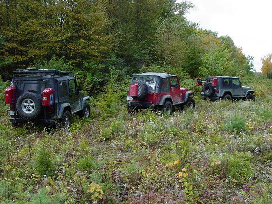
Monday,
September 22, 2003 - Road Trip to Round Pond Campsite: The expedition breaks
camp in Greenville and steps off into the wilderness. Some wheeling, much
dirt road driving, and second camp at Round Pond.
Tuesday,
September 23, 2003 - Hike to the Ice Cave: Excursion number 2 takes the
group to the Ice Cave on Allagash Lake, and a visit with the proprietors of Loon
Lodge.
Wednesday,
September 24, 2003 - Hike to the Trains: Excursion number 3 takes our
fearless crew to the Trains on Eagle Lake, with some navigational
"moments" and unparalleled wilderness beauty.
Thursday,
September 25, 2003 - Unstructured Explorations: Excursion number 4 leads to
explorations of marked but unused logging roads, a visit to the Eagle Lake Ranger
Outpost, and some more off-road exploration and Carl's flat tire.
Friday,
September 26, 2003 - Breaking Camp: The group breaks down camp on Round
Pond and retreats from the wilderness, with stops for JJ's Fan disintegration, Carl's
windshield crack, and the return to civilization, and the road trip to Templeton, MA.
Epilogue
Saturday,
September 27, 2003 - The Road Trip Home: Paul and JJ's run for Maryland
and Virginia, with stops to work on JJ's cooling system.
Off
Road Index | Shop for Jeep Toys and Books | See the Toy Jeeps
|