2:00 p.m.
The trail is a recently graded forest
road that runs down from Route 33 and along the side of the reservoir. Not
far from where we entered the trail, we encountered a couple at a dry stream crossing,
driving a Honda Civic. It was clear they were not going to negotiate the streambed
so I made for the right side of the trail to go around them. The woman was out of
the car and had a "please stop" look on her face so we did. She explained
that they were there looking for two friends that had gone missing the night before and
were "wandering around" out here somewhere... Well this does not sound
good... They themselves were not well prepared. They had a cell phone
("No Service") but I saw no signs of a map and certainly no signs of a worthy
vehicle. In truth they could probably make the trail with the Honda but it would
have been a nasty, grating ride at best. They told us there was a search party.
But they said they had no radios, and no way to contact anyone.
I don't know what to say here. We
left them where we found them. They weren't stuck, the road was a few hundred yards
away, with no branches between where we found them and the way out. I supposed we
could have spent all afternoon poking in to every dead-end trail that was out there trying
to find their friends, and in hindsight, that is exactly what we probably should
have done. Hindsight being what it is... But with their assurance of the
search party, I guess at the time it did not seem at all callous to keep our plans and
move on. Now I wonder... I found this advice from the Forest Service about
how to be safe in the forest. Take a minute to read it...
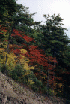
We continued along the trail and wound
along up to the top. It was at times mildly off camber. So mildly so that it
would not matter a bit unless the surface was slippery. I think this trail is
probably passable most of the time, but it is very narrow and has some tight switch-backs.
There are a number of turns that I failed to mark with waypoints.


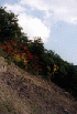
We followed the most well defined trail
(the one with bulldozer tread marks on the edges...) all the way to the top. Near
the top we saw a large bird flush out and move down a few trees. It turned out to be
a very large owl. So we "crawled" up to where it was and proceeded to
watch it for a while with binoculars. It was as interested in us as we were in
it. The kids were mesmerized, and Maria later called it the high point of her day.
3:00 p.m.
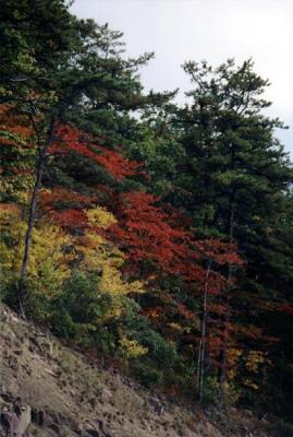
Flagpole Knob (Slate Springs Mountain
summit) was just as pretty as it was on the last trip. We parked and turned the kids
loose to run around and play on a little path there.

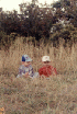

We snacked, took pictures, made some
video, and took in the view. A pair of women came along driving a two-wheel drive
mini-SUV. One was sort of spotting for the other, and walking a dog. They
came right up and we talked for a few minutes. They took out their other dog and
walked them both. I gave them some trail info, along with the advice not to attempt
the trail beyond Meadow Knob, since it seems a bit tricky for someone with only 2-Wheel
drive. They were a little bit better prepared than the last people we encountered,
with a DeLorme's map.

We finished up our visit by walking along
down one of the trails that reaches the summit from the south side. It too has been
closed with a berm, and much evidence of trash that I found too disgusting to retrieve and
take with us... With the Jeep loaded up, we headed out to Briery Gap Road and down
the mountain.