Breaking Camp
We took our time getting up and made some breakfast, with
coffee and hot chocolate. Then we took down the campsite and packed our vehicles for
the trip into the woods. This stop was just a waypoint to span the gap between the
road trip on pavement and our main camp for the week, in the wilderness. I had
originally had us driving all the way there on Sunday, but realized that it was risky to
be on the road for such a long day and arrive at a previously unknown location to set up
camp in the dark. While we may have lost 1/2 day, and spent some money on the
campground, it made more sense and everyone was in agreement.
      
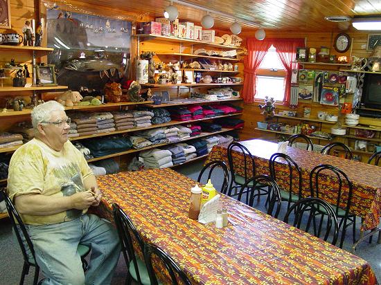
Next we stopped at the stores at the Indian Hill Plaza
and picked up a few odd items that we felt were lacking in the menu or outfitting. I
picked up some oval magnets that show a moose outline on a yellow background. I gave
each of the guys one. We decided we would stop here again on the way home to get
things for everybody back home.
 
Carl picked up a hatchet cover that we used to protect
Leo's hatchet. I replaced one of my water containers that had a broken cover.
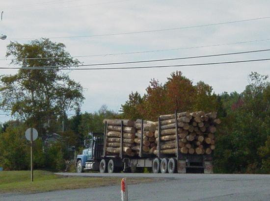
We picked up some food, then hit the road. But not before one of the lumber trucks
went rumbling by, giving a preview of what we would be facing in the woods. They are
huge, travel fast, and in most cases barely yield. Indeed, the rules of the road in
the North Maine Woods state that you must yield to them under all circumstances.
I activated the GPS route that would take us into the
wilderness and lead us to our camp on Round
Pond. I had spoken last week with the North Maine Woods folks,
secured a fire permit, and been referred to a few camp sites in the area of our intended
explorations that would fit our needs. Round
Pond was our number one choice for a camp site because it was directly on the
pond, close to our objectives (Ice
Cave and The Trains) and because it was an improved site (outhouse, picnic
table, fire ring).
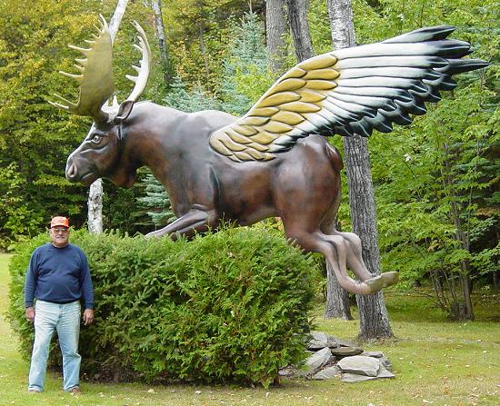
The first part of the drive took us west of Moosehead
Lake. It was a paved road like any other though the scenery was quite
beautiful. The leaves were starting to turn so everywhere we looked, it was very
pretty. We came upon a large statue that I suppose depicts a play on words. I
called it the "Moose
Fly", though I am not sure if it has a name or was meant to illustrate
something else. In any case, we stopped to take a couple pictures.
  
Pretty soon, we got to the end of pavement, right after
crossing the bridge in Rockwood.
We drove a couple more miles and then decided to air down a little in the hope of
smoothing out the ride. We went down to 20 p.s.i.
     
That worked well and the road seemed a lot smoother.
We stayed aired down for the rest of the week, only airing up when we returned to pavement
on Friday.
Next, we came to the 20
Mile Checkpoint. This was our official stepping off point into the
woods.
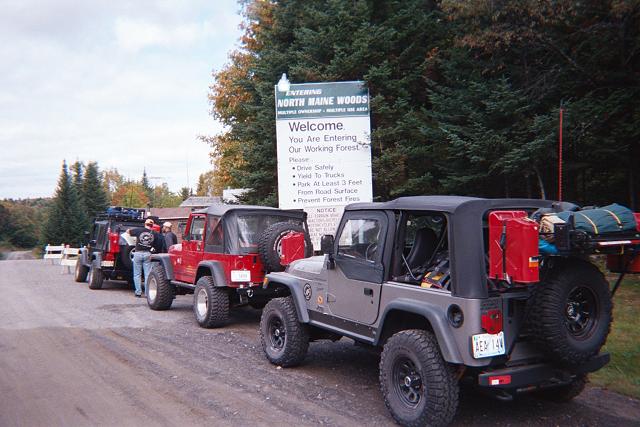
Here, the North Maine Woods company manages access to the
wilderness, charging fees for day and camping use, and verifying trip plans so that
travelers do not go out into the area uninformed or unprepared.
     
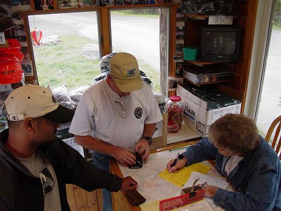
Our plans were found to be in order and our maps deemed
up-to-date. The folks manning the checkpoint were very helpful and friendly.
They confirmed that we had correctly identified the site of the Ice
Cave and told me which roads to use to access the hiking trail. They also
confirmed the train location and agreed that we had found the general area to hike in to
them. Later in the week we would learn that our starting point for the hike to the
trains was not well chosen (my bad) and our experience described in due course will
explain why.
We told the man at the checkpoint that we were looking for
places to drive our Jeeps that were challenging. He suggested that we take the
closed road that cuts off the corner from Pittston
Farms over to Seven
Mile Hill. He said it was washed out but we might enjoy it. He also
suggested we drive down past Raymond's
Store at Northeast Carry, and poke around down there for more trails.
It was confirmed that we could get gas at Seboomook
and Northeast
Carry for sure. This was reassuring since we hoped to do a lot of exploring
and did not want to be limited by the range provided by our gas cans and tanks.
With all the registration and fees taken care of, we got on
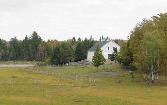
the road and went up to Pittston Farm (link to
web site). Here we found a working farm from another century. There were
very few hints of modern times. The people inside were very welcoming, and we got to
meet the exotic birds that live there.


After a few minutes chatting with the moose in the ante
room, we got back on the road and doubled back a few miles to take the cutoff to Seven
Mile Hill.
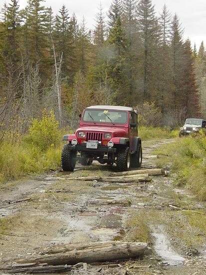
The
road (link to where road reconnects main road) was marked closed, as promised,
and the first few feet offered some erosion to encourage us that this road might require
4-LO. Leo expressed his desire that we not spend a lot of time "screwing
around" and suggested we get to the camp before it got dark. He was right but
this road or roads like it was part of the reason for the trip so I asked him to humor
us. As it turned out the road was pretty tame by our standards but there were some
spots that definitely would claim regular vehicles.
 
Soon after returning to the main road, we came upon Seven
Mile Hill camp, and stopped for lunch.

I had made some sandwiches with pita bread and chicken from
foil pouches, We drove up to the picnic table and had a nice relaxing lunch.
We found a tidy outhouse a few feet up the path into the woods, and made good use of
it. After discussing whether or not we could make it up the steep hill in front of
the camp site we decided not to mess up the grass and continued on our way. We came
to the road that leads to Seboomook
Wilderness Campgrounds, and the sign promising gas (Mobil). So of course we
had to drive down there and see what we could see.
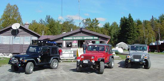
 
The store had a good selection of things one would need out
in the middle of nowhere. They were out of ice cream but we were not yet so far from
civilization that it much mattered to anyone. I picked up a sticker to add to my
trunks, and we asked about rough roads. We were encouraged to continue on our way to
Northeast
Carry and we would be rewarded.
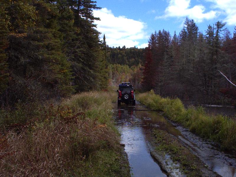
We got going again and drove for quite a ways, poking in to
a couple of roads that lead off to the right, trying to find Loop
Road. They all petered out into the bush. We made a stop at Roll
Dam where we found many campers and lots of people, most likely fishing as it was
also a boat landing. We talked to some of the people there and found one guy from
Massachusetts.
    
Convinced we knew where we were on the map, we continued
east and took the side road down to Raymond's Store
near the Northeast
Carry. We found a tidy little place with a warm couple with great senses of
humor. I discovered that they even had the Super Siphon in stock and selling
for the same price I had ordered it on the web. Ironically, I could have bought it
here, saved postage, and had it for when I needed it. As it was, mine was still
somewhere in the mail when I left home for my trip and I was forced to buy one of the
cheap Wal*Mart ones... I took the opportunity to top off my tank, even though
the price was 30 cents more than in town. It just seemed like a good idea to have as
much gas as possible. JJ and Carl opted to pass.
  
We got back on the road and found Loop
Road. It was very picturesque, but didn't provide any challenging
wheeling. I was a little disappointed that we had gone so far out of our way seeking
some off-road terrain, but happy that we had found these places where time moves a little
more slowly, and nature is so close to hand.
 
We connected with the Golden
Road, a superhighway of a dirt road. I found myself flying along at about 50
m.p.h., leaving a long dense trail of a dust cloud behind. I flew down to our
planned turn north at Ragmuff
Road. There I stopped to wait for Carl and JJ. Once they caught up, we
continued north in much the same fashion, interrupted from time to time by
"whoop-dee-doo's" where drainage pipes had been installed across the road and
the dirt burying them created rises that would get you airborne if you hit them at speed.
At the junction of Caucomgomoc
and Loon Lake Roads we stopped to check the map and chat a bit, not to mention
get a pit stop. A few people came along the road and stopped to talk with us, making
sure we were not lost, in need of assistance, and of course to ask about our plans and our
vehicles. There is a cut-off here that I would have liked to have taken, but the map
does not precisely match what we found, so I opted to keep to the road that did match the
map and we drove up Loon
Lake, on the west side of Caucomgomoc
instead.
  
Just as we reached the Caucomgomoc
Lake Checkpoint, we had our first encounter with the lumber trucks. One
popped out of the intersection, took the road and passed us close on the left, traveling
in the opposite direction. "INCOMING!" was about all I got out before it
came to JJ and Carl. We would have many close calls all week. They should
forget about the moose signs and instead have lumber truck signs! I managed to
squeeze off a picture of the truck after it passed, so close all you can see is the stack
of timber on the back!
 
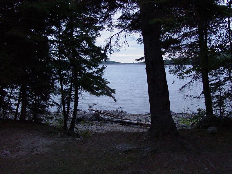
After that, we made all the correct turns and soon were
rewarded with arrival at Round
Pond Campsite, as planned. The site was everything we could have hoped for
and we unanimously decided to stay here without checking any of the other
alternatives. We set about erecting tents, exploring the waterfront, locating the
outhouse, and getting a fire started.
Although named a pond, Round
Pond is quite large and would be thought by many to be a lake. Because of
the size of lakes in the region, it would be considered small by comparison.
  
The wind coming off the pond was cool and we soon decided
that with the rain promised for tomorrow, we had better erect some sort of windbreak
around the picnic table if we were to have a sheltered spot for our meals.
    
Carl dragged a huge tree out of the woods with my help and
everybody got to work on it, sawing it up and splitting it for firewood. Meanwhile,
I got the provisions organized and started cooking a meal. We had some cheese pasta
with Spam, and some hyper-concentrated Kool-Aid. I mistook the
"Serving Size" info on the back of the package and incorrectly translated it
into mixing directions. Thinking it would take five packages to make a gallon of
Kool-Aid, I mixed it up. To say that it was super-sour would be an
understatement. I used up five meals-worth of it in one mix. We didn't realize
it until we had drunk most of it. We could have diluted it and used it but it was
too late. Live and Learn...
Expecting rain on Tuesday, we all set up our tents so as to
avoid getting wet if possible. For me, that meant putting a tarp over the
tent. Since I was expecting high winds off the pond, I spent a lot of time securing
the tarp so it would not blow around, and would provide extra protection on the side that
faced the pond. My attention to detail was rewarded all week as the inside of the
tent stayed bone dry through two or three rain storms, and the tarp stayed put with the
minor exception of two small tent stakes that require resetting after one storm.
That night, we sat by the warm fire and marveled at the
stars. The woods was full of sounds from birds, most notably the Loon, whose lonely
song echoed around the lake. We talked about all sorts of things, and made plans for
the day to come. Pretty soon, one by one, we went to our tents and went to
bed. I was thankful for my warm sleeping bag and secure tent, even though it was
pretty warm outside. It was a great night for sleeping!
Tomorrow: Wheeling
and The Ice Cave!
Waypoints
|