![]()
Daybreak
Dawn came without bringing the rain. But it was in the air. Sooner or later it was going to rain. We got up and got the coffee and hot water for chocolate started, then Carl cooked some fried potatoes, onions and sausage. It was so good he got hooked into making another batch. It really stuck to our ribs!
Conversation turned to the weather and our plans. It looked like the rain would come later, and it made no sense to spend the day waiting for it. So we decided to set out in the direction of the Ice Cave on Allagash Lake and see if we could get there before it rained. With breakfast finished and camp secured, we got in the Jeeps and headed up the road towards Little Johnson Pond and the trail entrance to the Ice Cave. We spotted some promising side roads so we branched off in search of some wheeling. What we found was one of many gravel pits that are everywhere. Most contain shale that is quarried to do road repair. We took the opportunity to play a little in one that marked the end of the road to Frost Ocean.
After that, we doubled back and continued further down the road, only to find it was a dead end. I broke out the map and found our location on it. I also took a walk and discovered a trail that led into the woods, well marked with tracks of moose. The trail was not going to be wide enough for our Jeeps and didn't lead where we wanted to go, so we went back to the main road that led up to Little Johnson Pond. Once we reached the pond, we followed an erosion cut into the woods toward the pond. It was passable but would have involved some extreme wheeling at the end, and probably was not meant for vehicles, so we just parked and walked down to the pond.
Carl broke out his fishing pole and made a few casts while JJ skipped stones and I borrowed Carl's toilet paper. We spent a few minutes there and then went back to the Jeeps and up the road a few hundred yards to the trail head for the Ice Cave.
I should comment at this point that when I say "trail head", I am not talking about well marked parking lots with bulletin boards and signs. I am talking about a spot on the side of a dirt road that is a little less grown in, with a slight wide spot, and maybe a hint of a path into the woods. The only way we knew we were at the trail head was by the corresponding waypoint on my GPS and some map orienteering. Without these tools, we would have had great difficulty locating our trails. Even with the GPS, map and compass, we were to have difficulty, but I digress...
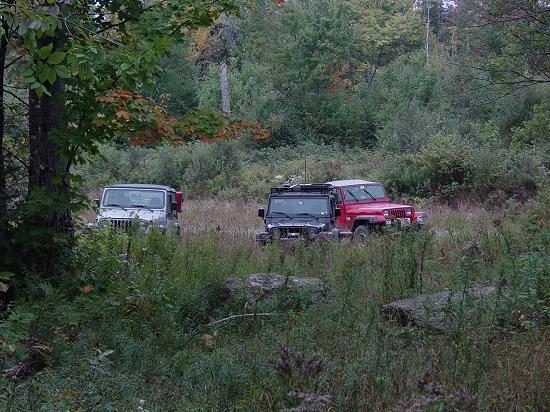
We parked the Jeeps at the trailhead near Little Johnson Pond and got out. I suggested we bring our lunch (it was about 10:30 AM) and Carl thought we could eat when we came back. I stuck with bringing the food and Kool-Aid (now a much milder grape-flavored blend). I put the map, GPS, and some extra clothes in the day pack, donned my blaze orange hat and vest, and we hit the trail.
For a good distance it was easy walking along what amounts to a grown-up cut through the woods. These roads are used in the winter by loggers and grow up in the spring and summer with grass and small saplings. The trail we were on trended downhill and eventually reached the woods. The trail closed in and became an old road that had grown up. Most of the trees on the road were between five and ten years old. It looks as though the road is being allowed to disappear. The trail was not too hard to spot but at times was hidden under the low growth and could only be perceived by the relative size of the trees, and by checking under the brush for signs of a path.
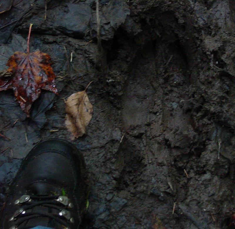
Fortunately we had very little trouble keeping to the trail and indeed hit all of the waypoints I had marked for stream crossings, and junctions with other trails. Along the way, we followed the tracks of a moose. It preceded us for the entire walk and appeared to be quite large. In a way, I kept hoping we would meet up with it and get some pictures. But we were not so lucky. All I got was pictures of tracks of a very large animal.
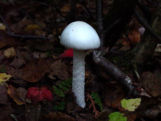
There was no shortage of other things to look at along the way: signs of old logging operations; stunning plant life; mushrooms, and all sorts of birds.
Pretty soon we came to an area where the trail became less distinct. About that time I noticed a hint of a trail branching off to the left. After losing the trail I came back to this branch and found a sketch of a path that went through an area with lots of fallen trees and grown up ground cover. It headed in the correct direction to the Ranger Station on Allagash Lake so we took that path and soon emerged from the woods at the outhouse for the Ranger Station. It may be that the road we walked may have been a road to the Ranger Station at one time. These days it appears that the visitors to this location come by water, using boats launched on the north side of Allagash Lake.
The Ranger Station was tidy and well kept. It appears to be recently used and showed some signs of habitation. A couple radio antennas were on the roof and a decaying picnic table was out front. In the back, a boat is on the ground underneath a long decaying log. That boat has not been used for some time.
We broke out the food and had lunch. If I remember correctly we had peanut butter and jelly sandwiches, and all sorts of snacks and the grape Kool-Aid. It was cool but after the hike, at times through some tough undergrowth, we had all worked up a sweat and took off our coats and stuff to let it air out and perhaps dry a little.
After lunch, we packed up all our stuff, not wanting to be obliged to return here if a better path back to the Jeeps presented itself. JJ located the path to the Ice Cave behind the cabin and soon we were all walking along the southern shore of the lake toward the Ice Cave. This path took us through a beautiful evergreen grove. The scent of the trees was very clean and fresh. People may bottle it but the real thing is beyond compare.
This trail was at times hard to follow but visible beneath the low growth if you took the time to look. All things considered, it was some of the easiest walking we would enjoy the entire week.
In due course, we reached the campground on the shore of Allagash Lake, near the site of the Ice Cave. It was incredibly tidy, having been recently raked, without a trace of litter or forgotten property of any kind. On the whole, this was typical of our entire trip: We found no trash of any kind left behind. It was most refreshing to come to these places and see nothing of previous visitors except evidence of their cleaning after themselves and the structures that they borrowed during their visit. In a way I am not surprised for these places are not easy to get to and attract the sort of people who value the wilderness. If these places were easy to reach, I have no doubt that our experience, should we have chosen to bother, would have been far different.
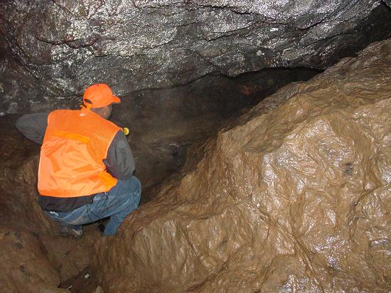
It took us a minute to find the path that led to the Ice Cave. By walking around we found a sign and then the path past the outhouses up a steep hill to the cave. Just about the time I needed a break, we reached the cave. It appeared to be nothing more than a hole in the ground, with a shaft leading down some 30 feet or more into darkness. The entrance was a bit wider and allowed you to climb down for a better look at the tunnel, but my first reaction was "No Way!"
Carl didn't even hesitate. He put down his pack and walking stick, borrowed my little flashlight, and went right in.
He went down the shaft and called up that there was a large chamber inside with room enough for several people. Finally I was convinced that getting muddy and dirty might be worth it. I still had reservations but since he had not had trouble going down, I might as well go too. I don't remember if JJ went before me or not but soon we were in the cave with Carl. Leo decided to stay topside, which made me feel better if anything happened to us below, though I am not sure what he could have done for us, so far away from anything.
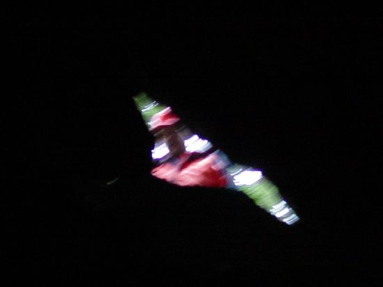
From below, it seemed like a long way back out, and indeed, it was a tricky climb. While it did not require ropes, the footing was slippery and hard to find in the dark. I looked up and could see Leo at the top, the picture a little blurry, and zoomed in so you can tell it's a person, but hopefully you get the idea.
We were later told that the reason it is called the Ice Cave is because the rocks look like ice when a light is shined on them.
Once we had a chance to poke into all the crevasses and satisfy our curiosity, we climbed out and saw daylight again. With everyone back topside, we hiked back down to the lake and then retraced our steps back to the Jeeps.
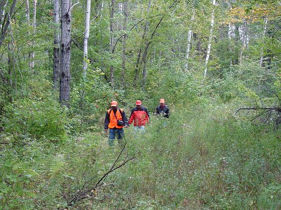
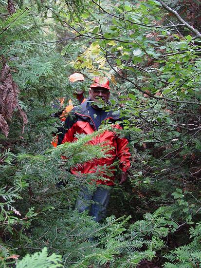
To give an idea of the "trail" we walked, consider this photo, showing a fairly typical situation - notice that the trail is not immediately apparent.
This just made the experience more rewarding for me because I knew that we were not walking the same path as a couple hundred other people that day, week, year, or even perhaps, decade. It was not truly unexplored, for certainly there was a path, and at one time a road, but its time was almost over and soon it will fade into the floor of the forest. In two years time, I do not expect this trail to be visible in many places. I guess that's what GPS tracks are for...
I didn't take nearly enough pictures of the vegetation that we encountered, but there were some incredible things to be seen. Here are but a few:
Our hike took most of the day. We finally got back to the spot where we parked the Jeeps. JJ was relieved to find that his keys were still in it, and that no one had driven it away!
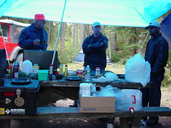
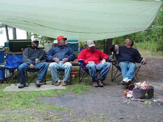
From here, we backtracked to the camp and found an interloper! Carl was the first back and announced on the CB that someone had set up camp with us! Meet Buzzy! (see photo, below right) He came in from East Millinocket to spend a couple weeks away from working in the paper mills there, to do some hunting and fishing and camping.
He let us use his chainsaw to finish cutting up the firewood, and we got a rip-roaring fire going. Then he broke out the beer and we sat down to enjoy the fire. Unfortunately it got colder and the rain came. So after sitting under the tarp hoping the rain would stop, one by one, everybody headed back to the tents for the night.
Return to Deep Woods Expedition: Maine Index
Photos, Layout and Design © 2003-2008 Paul M. Provencher All Rights Reserved.
Contents of this Web Site may not be used without written permission
Visits since 9/30/03
Last Updated 02/08/2008 05:11:58 PM -0500