![]()
10/3/2003 8:00PM Due to the sensitive nature of the train site, the danger to inexperienced individuals involved in accessing the site from land or water, and the desire to prevent those who are looking for "easy access", I have chosen to not to publish GPS navigation data for this location. I wish that everyone who would visit the trains would be as sensitive to their preservation as those who have gone before. I do not wish to contribute to their early demise by making it easy for unscrupulous or careless individuals to get to them. Please accept my apology for the diminished value of this account.
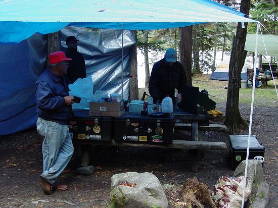
The Big Trip It rained all through the night but by morning we were left only with a little bit of cool air, wet trees and a sky that looked like it was trying to let the sun through. We got breakfast going and organized everything for our trip to the trains.
This trip was planned with the hope of experiencing the wilderness in the most wild state possible in the modern age, on the North American continent. Clearly there are more wild places left in the world, and certainly there may be more wild places within a couple days drive of Maryland. But Maine was the most accessible destination for me and allowed me the opportunity to include my father, so I chose it with no reservations. The tantalizing prospect of hiking to abandoned locomotives in the remote woods was what originally prompted me to plan and execute this trip. The accounts I read left me with no illusions. I knew there was the possibility that problems could arise and that we would quickly find ourselves in over our heads. At one point in the planning, it looked like we might have to access the trains using canoes and accounts of the wild nature of Eagle Lake in bad weather weighed heavy on my decision to press harder and get permission to hike instead. (More about the Trains)
This choice would result in challenges that I expected but had hoped to avoid. Careful planning had revealed at least three different routes to the trains, not counting water routes. There were three trails that showed up on four out of five maps that I consulted. They were all equal in terms of what was revealed on the map: dotted line trails depict walking paths, usually fairly distinct and easy enough to follow. I chose the trail that was the shortest walking distance on the map, thinking this would make our day easy enough, and provide an interesting route to our objective. I wanted wild, but I didn't want to get lost, hurt, or delayed to the point where we'd spend the night in the woods. My father (Leo) is in pretty good shape, but he's over 70 years old and like anybody, has his limit. I too can handle a pretty long day, and have spent considerable time in the woods, but spending a cold wet night there is not my idea of fun.
So I thought I had covered all the bases. We carried extra food. We had map, compasses, GPS, water, and the benefit of my months of studying the maps. Surely, this would be another hike, no less interesting than the trip to the Ice Cave the day before, no more difficult. I could not have been more wrong.
But we set off from camp not knowing what lay in front of us. I don't know what we would have done if we could have looked ahead and seen what was in store. Would we have done it anyway? Would we have changed how we acted? You can never predict the future or change the past. We were on a course with fate and it would soon have us tight in its grip.
Our trip to the "trail head" started much like the previous days. We got on the road and drove east to the route that travels north along Chamberlain and Eagle Lakes. Along the way we had another close encounter with a logging truck. Trust me, you do not want to crash with one of these things. We were fortunate to be able to warn those behind us, and to climb in and out of the ditch to avoid them. I feel sorry for people without radios, high clearance, and no 4WD...
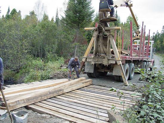
Once past the moving obstacles, we hit a more stationary one: Bridge Construction. We came upon a crew who were close to finishing a bridge repair. They appeared to be a bunch of French-speaking Canadians.
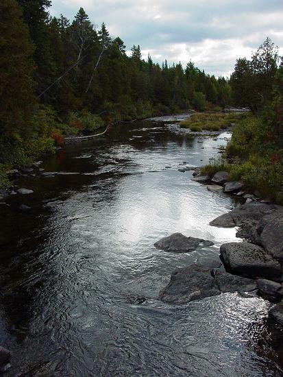
They told us it would be about an hour, so we backtracked a few miles to another stream and stopped so Carl could go fishing. It was a beautiful spot, no more or less than any of the other places we had seen during the week. The water was crystal clear and running. Leo found that it was not so cold and decided to bathe. He dropped his clothes and waded in while Carl got ready to fish.
JJ explored the stream on both sides of the bridge and found some crayfish in a hole that looked like it had been drilled for some purpose.
Pretty soon, we saw the bridge crew pass by and waved us on as they continued south down the road. Carl finished fishing and soon rejoined us at the Jeeps. We drove up the road, over the newly rebuilt bridge, and promptly found the trail I had marked that would take us to the trains. It turned out to be a "winter road" that Mike at Loon Lodge had described to us. It is a winter logging road that goes east to Chamberlain Lake and then follows the western shore south for some distance.
It appears on the map to start headed south and then bears east for a while, crossing a stream then continuing a short distance where it runs out. But less than a tenth of a mile further east, another trail that runs along the side of Eagle Lake continues south to the trains. This is the route that I planned, mapped and studied in preparation for our hike.
I reasoned that we could hike the short distance between the end of the trail headed east and connect with the trail that heads south to the trains. We could also opt to follow the stream due south to where it meets the railroad grade and follow the tracks to the trains in the east. The distance was less than 2 miles so it seemed like a piece of cake. I was wrong.
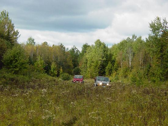
The beginning of the trail was so wide open that we were able to drive the Jeeps in for some distance. The only obstacle was deep ruts with water in them and a little bit of mud in the bottom.
Fortunately there was a bottom and it was pretty hard so we were able to drive without getting stuck, all the way to where the stream crossed the trail. This was where our fortunes changed.
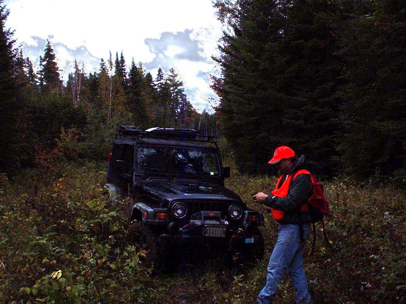
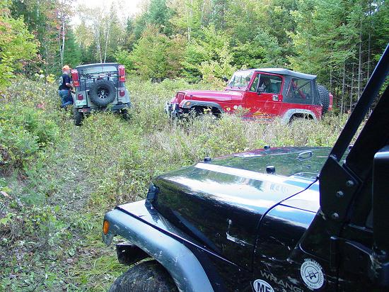
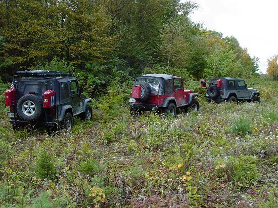
At the stream crossing, the water was wide, muddy, and deep. It quickly became clear that we would not be driving through the stream east to the trails end. A short distance before this, the trail branched south so we doubled back and followed that branch but soon hit deep mud again. I drove into it but stopped moving forward. I was able to wrestle myself back out, so decided that we'd best leave the Jeeps at the branch in the trail and go on foot.
I reasoned that this road south might roughly follow the stream and we could walk down to the railroad grade and then head east to the trains. And in the end, that's basically what we did. Well, more or less...
The first part of the walk was pretty easy. We had some spots where we had to go around swampy areas but the moose that had gone before us preferred the dry ground too so we were able to keep moving forward with minimal difficulty.
Pretty soon the ruts dispersed and the trail narrowed down to a path. This brought no special concern as the trail to the Ice Cave had done the same thing. It was still easy to follow and was headed in the correct direction according to Map, Compass, and GPS. It was all good.
There were some really pretty trees and vegetation to look at, making the walk like a trip through paradise. We stopped to admire some of the larger trees, and to look at things we had seldom seen. It really is beautiful out there.
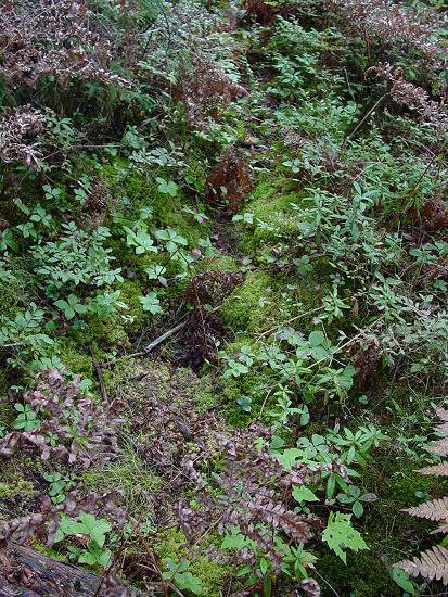
One of the most striking things is the ground cover. It is so deep, lush and untrodden. There are all manner of lichens, moss and fungus. There are low berries, all kinds of seedlings and saplings. You almost feel bad walking on them, but they are so abundant that there is no other choice unless you were to turn back and stay away completely.
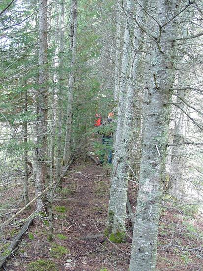
We came to the end of the road and into a grove of evergreen. I thought I made out the path continuing to the left, but owing to the density of the low growth and the constant need to use my hands for balance, stowed my camera. It would be a couple hours before I could once again take it out.
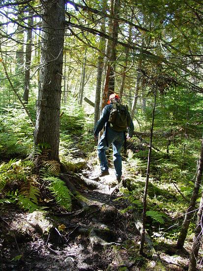
Within a few dozen yards, we were surrounded by black growth, (brush wood, or thicket). It almost seemed to move in of its own volition and surround us, like a moving entity. We lost the path completely but decided we could make a GPS/Compass hike of it and by maintaining our course, reach the railroad grade, where we hoped to find easy walking.
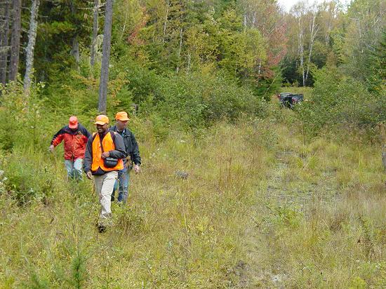
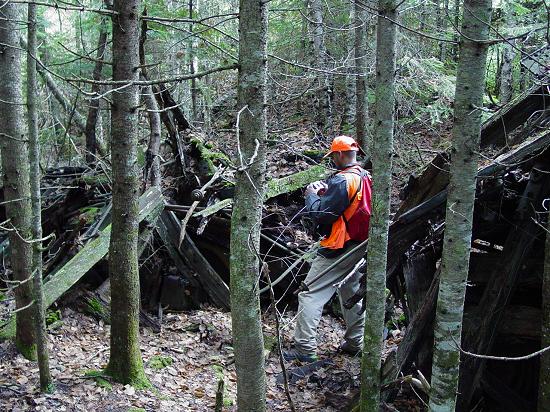
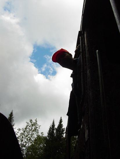
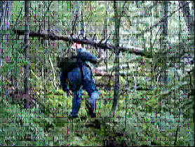
This was easier said than done. The walking was so difficult that progress was measured in feet and inches. This is not conducive to GPS use. In order for the GPS track to be useful, you need to be moving right along. Under these conditions, you don't get a useful indication of movement for several dozen feet. By that time, if you are walking the path of least resistance, as we ended up doing, you found yourself off course and in need of correction. So we climbed over ancient fallen trees, covered in several inches of moss, all lying on a bed of decades of pine needles. At times the growth was so dense we could not see each other five feet away. This is all the more amazing considering we were all wearing blaze orange. We wore it so as not to get shot by hunters and it ended up at times being the only way we could see each other.
We walked through these thickets of fallen trees in dense growth for almost two hours, trending south, slowly arcing to the east. We got separated by several yards for a time, and had to regroup. We managed to find our way to the railroad grade just about the time that everyone was about to give up. I know we would have kept on going, but I have a feeling, our objective may have changed from reaching the trains to getting out of this wood.
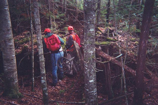
We reached the railroad grade exactly where I plotted it on the GPS, much to everyone's relief. But we were not out of the woods yet. We began hiking east on the railroad grade but it too was grown up and very difficult. There was some evidence that people had walked this way from time to time but the path they made faded in and out around the more difficult sections, each group probably taking their own "go around" leaving no clear path.
I was pretty optimistic but growing tired of the rough path I had chosen for our hike. My confidence in reaching our objective was intact, and I knew I could find our way back to the Jeeps, but I was not pleased with the prospect that our afternoon might include more terrain such as we were leaving behind in the morning. At one point, I left the railroad grade to break out into the open where the stream I mentioned earlier crosses the tracks. It was a much needed relief from the pressure of the close quarters forced upon me by the trees and the rigidity of the tracks.
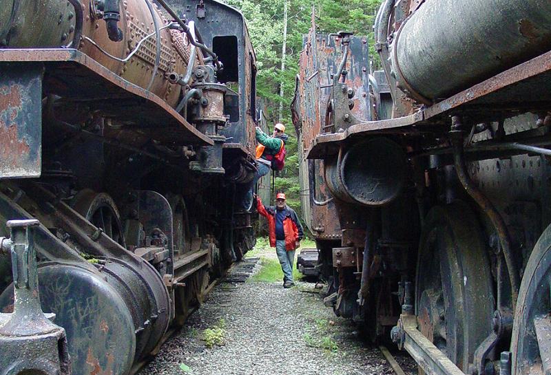
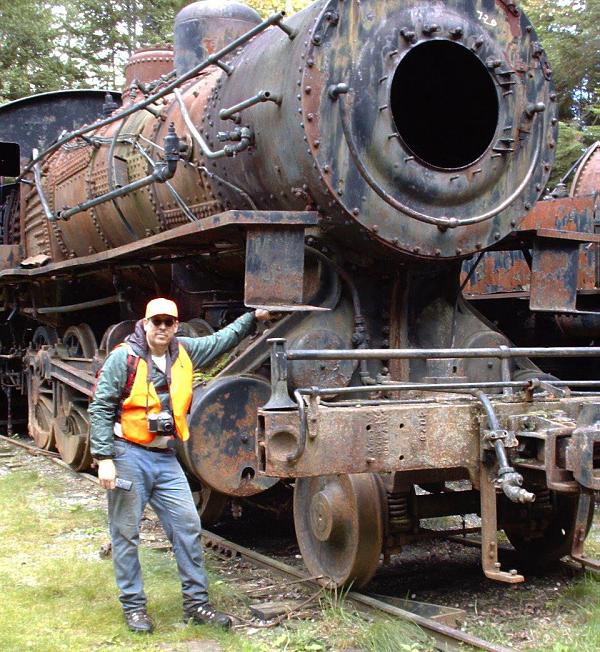
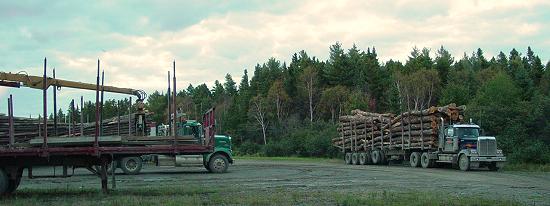
Now the tracks opened up a little bit and we found tons of railroad cars and their parts, strewn about the sidings and in all sorts of positions. Some of the guys mistakenly thought we had reached the trains. I knew from previous accounts that we were getting close but that this was just the appetizer. The difficulty of the morning was lifting in anticipation of finally reaching the trains.
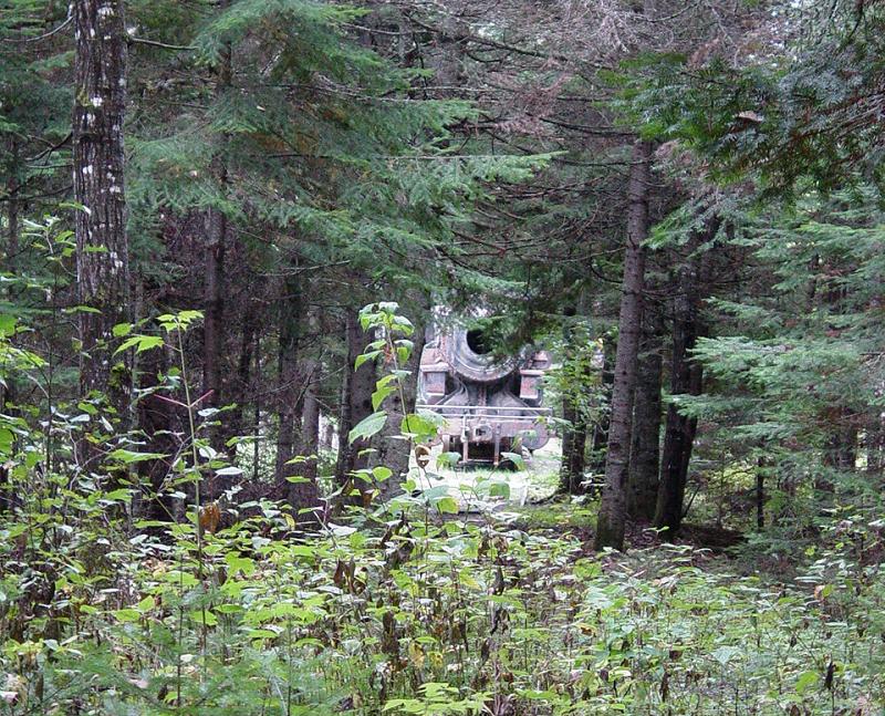
The track split off in a couple different directions at this point, and we had some discussions about which branch to follow. I knew from reading other accounts that the tracks lead directly from the rail cars to the trains, so I managed to convince my still wary friends that we should stay on the track that I was following. Right about this time I noted a trail that went off at a 90 degree angle to the north from the railroad grade. It struck me that this was probably the north/south trail that ran beside Eagle Lake, and marked it on my GPS for use when we made our return walk later. And as if to redeem me, there in the distance, through the trees, stood the unmistakable mass of a train, right where I had marked it on the GPS.
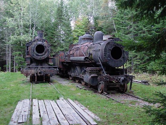
The energy level in the group surged. I could feel the excitement as each person in turn made out the hulking apparition in the distance. What's more, the train appeared to be located in a large clearing! Sure enough, we reached the trains to find that they had been placed on tracks and a clearing around them appeared to be maintained in a decent state, with grass and neat piles of railroad ties. We had reached them!
It was late but we had not yet eaten lunch. It would have been impossible in the black growth anyway. And I think everyone was so involved with getting through the walk that food was far from anyone's mind. We broke out the sandwiches and goodies, and grape Kool-Aid, and had lunch. Everyone was soaked through and through from the sweat of the work we did getting through the black growth. All my clothes were soaked. As cool as it was, it felt good to get those clothes off for a while. Everybody was hungry and soon lunch was gone except for plenty of goodies that we could use later if our walk back didn't go well...
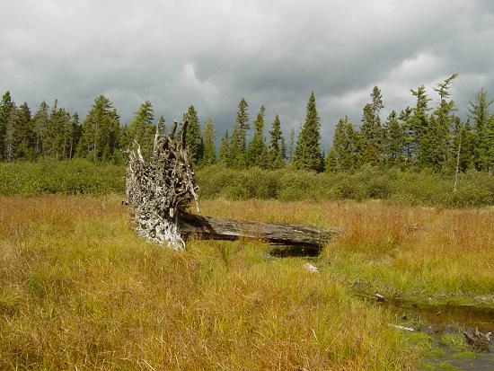
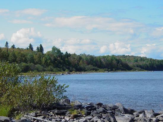
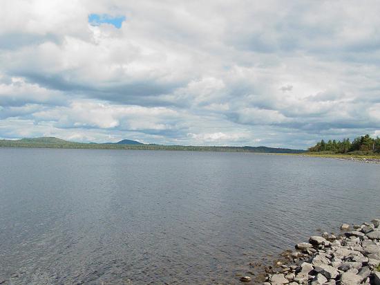
After eating, I took a walk to the shore of Eagle Lake. I wasn't prepared for the size and beauty of it. The water spreads out for a great distance. I can only imagine the things that this shore has seen in the last few hundred years. Now, it was peaceful with only the clouds reflecting the water with ripples from the wind.
There was a lot more train junk all around the site, and the path of the Tramway went off to one side of the clearing where the trains are located. It appears that the entire operation was abandoned all of a piece and left behind to sink into the ground. It is an awesome site, an awesome sight.
We got our stuff together, cleaning all the pine needles out of our clothes. I put my wet shirts back on, and my coat on top of that. We then entertained discussions about which way to go back. We followed a slip of a path through one of the junk piles, but it faded in and out and I was not convinced it lead anywhere productive for our purpose. I chose to walk back along the tracks to the GPS mark I had made where the trail headed north, and soon Carl, who had persisted with the other path, met with me at the point where the trail crossed the track he was following.
This trail was distinct and well traveled. It was very clear that this was the preferred land route to the trains. There was no way to ascertain this during planning from the maps, and none of the accounts I had read described taking this route. I learned a valuable lesson about relying too heavily on information without some sort of "on the ground" verification. We went through hell on earth in the morning for nothing, as we could have been on this easy trail.
Be that as it may, we would reap the benefit of finding it to our advantage and using it to walk back out. As I said before, I knew this trail to follow the western shore of Eagle Lake, headed north where it provided access to the road we had parked the Jeeps. I was hopeful that we would find a path leading west to the road where the Jeeps were on. I had even marked that location on this trail and put the waypoint on my GPS when planning the hike.
We walked along this beautiful trail and discovered that a previous user had marked their way with paper towel scraps, like the bread crumbs in Hansel and Gretel. It was almost humorous but at the same time reassuring that someone else had passed this way somewhat recently. I noted that the paper towel was the type that was much like cloth so the markers could have been there for a year or two.
When the morning was well behind us, I thought I would get a reaction from Leo and JJ about the mornings walk. I should caution you to turn down your sound and send the kids in the other room before watching this clip because my Dad was very candid. He didn't know that I was making a movie and said what was on his mind. Like always, he didn't hold back. That's what I like about him.
Movie
We came to a branch of sorts and there, acting as a pointer, was a steel sleigh runner. We walked the path less traveled and soon decided the other path was definitely the way to go. Soon paper towel markings confirmed our choice that we were at least on the same path that the wandering person before us had chosen, for better or worse.
|
A Slight Glitch...
|
Return to Deep Woods Expedition: Maine Index
Photos, Layout and Design © 2003-2008 Paul M. Provencher All Rights Reserved.
Contents of this Web Site may not be used without written permission
Visits since 9/30/03
Last Updated 02/08/2008 05:12:51 PM -0500