Prologue
Note: This trip report is broken
into four pages because of the huge number of images.
Links to each day's report are provided at the top and
bottom of each page.
I received a message via e-mail from Chris Shontz:
-----Original
Message-----
From: Chris Shontz [mailto:cshontz]
Sent: Monday, September 11, 2006 3:41 PM
To: ppro
Subject: wv destination recommendations
Importance: High
Paul,
A small number of regional members of the Expedition Portal
forum are
planning to go on a weekend camping trip to the Dolly Sods
area in WV on
10/13-16. We would like to establish a primitive base-camp
in a remote
location from which we will explore drivable trails
(naturally), do some
hiking, and possibly other outdoor activities.
Since you are well-traveled, can you recommend a remote
location (or
possible location) in the Dolly Sods area that would be
well-suited for our
encampment, accommodating 5-10 vehicles with tents?
We are generally looking for locations within the confines
of this map.
http://www.fs.fed.us/r9/mnf/general_info/forestmap.html
If you're interested, this is the thread that pertains to
the trip - it
starts to solidify on the last few pages.
http://www.expeditionportal.com/forum/showthread.php?t=1485
Any info you could provide would be great. Of course, you're
more than
welcome to join us! :)
- Chris
|
I know Chris from a trip I took with him and some
folks from Pennsylvania. We did
one trip to GWNF
in 2002 - the first trip that I had taken the boys camping. It was
good to hear from him and the idea sounded interesting. With the
trips I had already made to the Dolly Sods area I was confident I could
steer them in the direction of things he was describing. We traded
email and I posted to the group message and pretty soon we had nailed
down a date.
Weekend Adventures Magazine has a great description of Blackwater
Canyon.
Muster
I resolved to watch the weather closely the last week
before the trip. Not too surprisingly the weather predicted for
the weekend was cold, going down into the high-twenties overnight and
not getting out of the thirties during the day. I ran through the
specs on my camping gear, mainly the sleeping bags and confirmed that
they were rated down to 0° (zero degrees) Fahrenheit. This meant I
could be pretty sure the kids and I would be warm at night. Then I
made sure we all had proper daytime wear - long underwear and layers of
clothing we could peel off as needed, along with wind-breaking outerwear
for our time up on Dolly Sods.
This time of year is my favorite, and the last few
years I have spent this time in Blackwater Canyon or Canaan Valley.
I wanted to be sure we could be comfortable outdoors the entire weekend,
so this was my primary focus during preparations. I looked at the
diet as well and made sure we had plenty of protein for long-term
energy, and lots of carbohydrates to keep our internal fires burning.
I charged lots of spare batteries for the GPSrs and
camera. I knew we'd be hiking and making lots of images and didn't
want to run dry in the middle of the weekend. I packed by battery
charger as a further hedge against dead batteries. I should have
checked my flashlight because it went belly-up on Saturday night.
Too many hot days inside the Jeep I guess...
10/13/06 I
pulled up the rather comprehensive collection of data I have for my
GPS and loaded it up. I added a few
hundred Geocaching waypoints as well to support us in the event we went
close to any caches. I loaded the supporting data in my Blackberry
- the only real reason to bring it since there is very limited cell
coverage in the area we camp.
I went through the camping gear carefully, working
the checklist and adding a few
items that I wanted in consideration of the cool weather. I ran to
the grocery store for a few last minute items. When the kids got
home from school, we packed the clothes and finished loading up the
Jeep. It took on the
usual over-burdened look, with three trunks,
three camp chairs, the ground pads, and cooler all bristling off the
roof rack.
Trails
October 13, 2006
| October 14, 2006 |
October 15, 2006 |
October 16, 2006
10/13/06 Road-Trip
I selected the auto-routing feature of the
GPS-V
and intervened when the course it gave took us a little further East
than we like, and routed it down Brandonville Turnpike from
Bruceton, through Terra Alta where it turns to Aurora Turnpike, and
thence for a short hop on Route 50 to Route 24, and down Route
219 to Thomas.

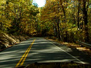
(Movie of part of the drive)
Pretty soon we had completed the two hour drive.
We made a brief trip into Davis to visit the grocery store to pick
up some lip balm, S'Mores supplies, and wood. We also got Hot
Dogs and Rolls for dinner.
Chris had already arrived the campsite earlier in
the afternoon and done some scouting on his own.


We reached at 5:50pm
the campsite that I
had first stayed in 2004.

  
We found Chris just leaving a
forwarding note on the side of a strange temporary structure that
was set up in the exact spot that I had set up my tent.

It
appeared to be a plywood-walled enclosure with a blue tarp roof.
We said our Hello's and he explained how he had found the
structure when he arrived and decided to move to another campsite
down the road.
As we were talking, the owners of the structure
came along and explained how they come every year, they are hunting,
they had problems with their tents being slashed, etc., etc., so we
wished them well and drove down the road to the site Chris had
chosen.
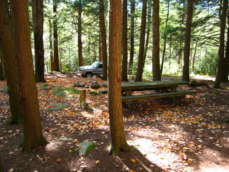
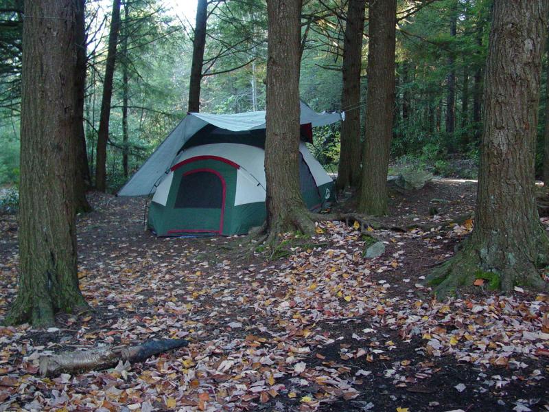
Chris had done well. He picked the primitive
picnic site at the trail head for the
Canyon Rim Trail - precisely
where we would want to start our hike to the Canyon Rim Cache.
 
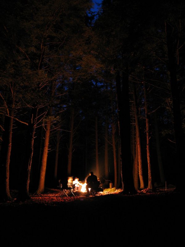
The boys and I got the tent set up and then helped
get a nice warm fire started.
We sat and talked for a while and then the kids
went to bed.
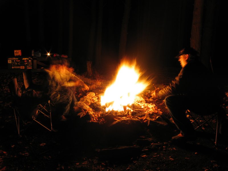
 

Chris and I talked some more and then Chris took
his Jeep for a ride to recharge his battery (from running his
fridge ) while I turned in for the night.
On Saturday...(click
for Saturday)
October 13, 2006
| October 14, 2006 |
October 15, 2006 |
October 16, 2006
Chris Shontz
Photos in high resolution and more:
This is the lot:
http://www.flickr.com/photos/cshontz/sets/72157594334335200/
Pictures that
pertain to ppro:
http://www.flickr.com/search/?q=ppro&w=19972326%40N00&z=t
Pictures that
pertain to jim65wagon:
http://www.flickr.com/search/?q=jim65wagon&w=19972326%40N00&z=t
You can also view
the approximate locations for each picture on a Google map by
clicking on the following links. Please be patient and allow
these pages to load completely. There is a large amount of photo
and track data being processed.
Displaying
w/out track lines: (faster performance)
http://ixplor.us/map.php?u=cshontz&s=72157594334335200&f=expo_wv_1006_4.gpx&c=7200&r=0
Displaying
with track lines: (slooow performance)
http://ixplor.us/map.php?u=cshontz&s=72157594334335200&f=expo_wv_1006_4.gpx&c=7200
October 13, 2006
| October 14, 2006 |
October 15, 2006 |
October 16, 2006
|