With three GPS
units loaded up (one with street maps, the other two with the tracks for the trails) we
set out. He joined me and the boys in the Jeep. His wife and mine drove the
Durango. We stayed in contact with some little FRS radios that the kids got for
Christmas. We made our usual stop at
Sideling Hill
Exhibit Center. We
managed to find the property after a side-trip through a very curious campground.
Rob and his wife
spent some time looking at the property while the kids played by the water and Maria and I
talked about the dream of owning vacation property. When we finished, we loaded up
and drove back to pavement and set a course for a late lunch.
The Garmin V led
us to the saddest Fox's Pizza Den I have ever seen. Maria urged us to find another
place to eat so we moved on and soon reached Keyser where we landed at Denny's and had
something to eat. Maria and Lucky had to get back to home early for plans they had
that evening so I gave them directions (220N/68E/70E/270S) and they went on their way.
Rob contacted the
Real Estate agent and got an address for the piece of property he wanted to look at in
Green Ridge. Since I didn't know he was going there, I did not have the track
loaded. But having been there plenty of times, I
was confident that we could find our way around. I was right to a point...
We entered the
park past the Boys Camp. I had chosen to drive the full length of Green Ridge Road
all the way down to the southern end of the trail system then enter where I could run back
north taking in the one rough hill in the park. We overshot the turn-off and ended
up at Route 51. No big deal; we turned around and came back, where we took the turn
and soon got 4-LO. The road was not bad, but I quickly lamented my decision NOT to
air down and disconnect. I have come to drone as if hypnotized when people ask me
why I'm airing down: "Because it improves the ride and reduces body rocking and
roughness." I forgot my own mantra and soon found the travel much more
uncomfortable that I recall. Owning to time limitations I decided to tough it out.
We came to the
hill climb and discovered it had been graded! No more erosion "v".
No more random piles of large loose gravel. No more of anything that would make the
hill seem even remotely challenging. We quickly reached the hill that took us so
much time in January. It was nothing without the snow, and almost forgettable
without the rest of the rubble.
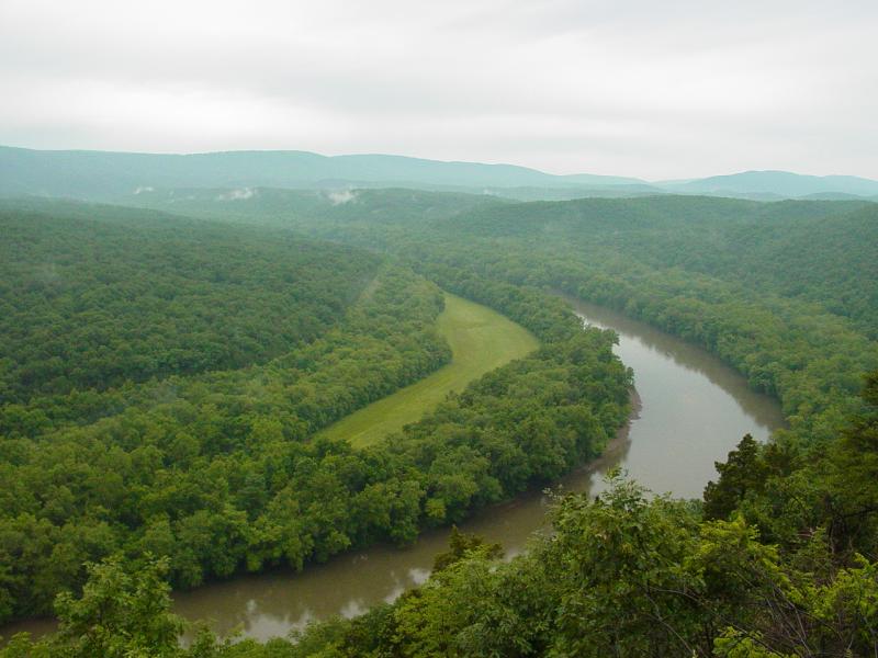
Pretty soon we had
reached the top of this section of the ridge and drove along, stopping and the convergence
of several roads where a nice little lookout spot gave us a few minutes peace to look out
over the park. The kids signed the trail log with glee. Then we reboarded the
Jeep and continued on down Mertens Road, now heading toward the Potomac in search of the
land that Rob had come to see.
I had only once
come down on this side of the park, and only had run Old Town Road a short distance.
This time I headed due East toward the river and the network of roads that wind
around there. I was soon to thank myself for keeping my
DeLorme's Street Atlas on board. Even with the
GPS providing road names and compass points, the strange
effect that the serpentine river had on my instinctive navigation skills caused a small
amount of disorientation.
We drove out to
the river, then turned North by West and thought we'd follow the road along the edge of
the river, such as it was, eventually reaching Little Orleans. There we hoped to
find the uncharted road on which the property was located. Instead I got fooled a
couple times and we did a little backtracking. I turned on tracking of one of the
GPS 12'ss and soon I was back on the map. We poked in to all the cul-de-sacs and
found some intriguing campsites and boat ramps.
About this time it
started to rain heavily. The trail got messy and several spots looked menacing
because of the muddy water. But there wasn't anything that caused delay. We
drove down the boat ramp on Bonds Landing. Rob cautioned we might risk sliding into
the Potomac but we managed to keep dry. The crossing over the canal was suspect
because the water of the canal was lapping on the water of a mud puddle, making the
crossing look a lot worse than it really was. Again, no problem. We drove down
one road and found an outlook with an incredible view, but the kids insisted on playing on
the steep hill (complete with cliff to the river) so we moved on...


Returning to
Kasecamp Road we continued our explorations. We drove for a while with detour to a
beautiful camp with a nice yard. Not the property we were looking for but very
attractive indeed. We hit Waypoint 130 (Old Town Road and Dug Hill Road), continued
on Old Town Road into Little Orleans. We stopped at the little store there and asked
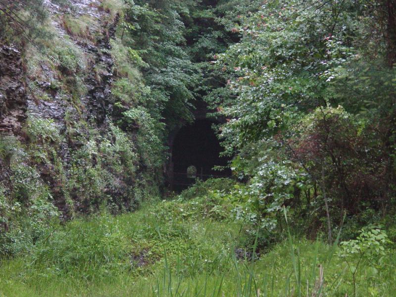
for directions to Grouse Ridge Road but didn't get any. Along the way we found an
abandoned railroad tunnel that was blocked off to prevent access.

So we started
working all the branches and punched into the C&O Canal Park, a residential section,
and finally encountered a local bird-watcher who gave us directions. The road was a
couple turns away at that point. She saved us some time, though I suspect we would
have soon found the road.
The trail down to
the property was eroded and gave us some mild wheeling. We walked to the property
and found it to be a nice little spot, but the woods had several decades of dumping on it,
and Rob decided it was not something he wanted to take on.


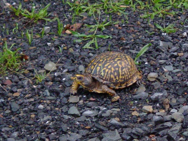
Tomi
spotted a turtle so we stopped to visit. The turtle insisted that we take a picture
and feature it on the web site. Here's its 15 megabits of fame:
We drove out
through a trailer-park/campground area that was very interesting. By now it was
sunset so we headed out to pavement and made our way home. It was a peaceful day
with mild wheeling at best.