Prologue
Still licking my wounds from missing Camp
Jeep and maybe yearning for a taste of the thrill I got on Dictum, I discussed with Maria
taking a short day trip. She had plans for Saturday with some old friends from work and we
worked out that the kids could come with me on a ride Saturday. I shot a note off to Hugh
Long asking if he wanted to go hit the trail. He said "Yes, if it rains." Hugh
has taken up powered paragliding and has been grounded due to the rain. I told him that
the weather forecasts called for "scattered thunder storms" and he suggested we
go run State Line...
I don't know what got into me, but that
sounded like a good idea so we made a plan to go run State Line. I kept checking the
weather and it kept looking like rain. Finally, I decided that I should probably try to
get a couple more people to go along because rain on State Line is pretty much a formula
for disaster. I figured we'd run the trail to the power line, someone would have
reservations about continuing (probably me) and we'd turn around and come back. No
problem. If trouble arose, we'd have a couple vehicles to stay behind and a couple to go
get help.
I posted a notice on the OCC board and
soon I had Joel signed up. I called Carl and he agreed to join us. Bill sent me an e-mail
message indicating interest and we were all set. Hugh called to say that a friend of his
was stuck in the woods and he was going to get him out. I was committed to the trail ride
so Hugh decided to help his friend and I decided to stick with plans to run State Line.
Muster
I made "hardcore" plans to have
the group meet at Sheetz in Haymarket by 7:30am. This is by no means an easy feat for me.
It means getting up at 5:00 am to pack lunches, camera, tools etc, get the kids and myself
ready, and be on the road by 6:30 in order to make the 1-hour drive to Virginia. But I
managed to scrape myself out of bed and do just that. On the road, we raised Bill on his
cell phone, and about the same time got Carl on the CB. We all collected onto Route 270
and were soon headed south and then west for the Haymarket Sheetz.
At the appointed hour we were still about
two miles shy of the meeting place so I got on the CB and gave a yell. Joel was on time
and waiting for us at Sheetz and answered the call. We rolled in to Sheetz soon after that
and, after getting gas and "stuff", got back on Route 66 head west for the
trail.

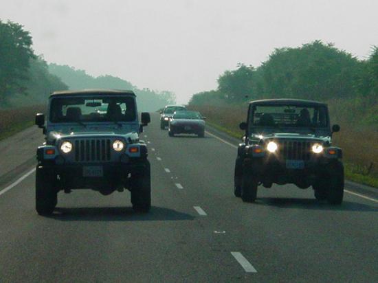
The road trip went fast and was easy. We
connected to Route 81 and drove a couple exits down to Route 55, where we headed west to
the trailhead. Since memories of my trips to State Line are still quite vivid, and since
my GPS track from the first trip was conveniently active in my GPS, we found the trail
head with no trouble (the name is a dead give-away anyway...) and were soon airing down
and disconnecting.
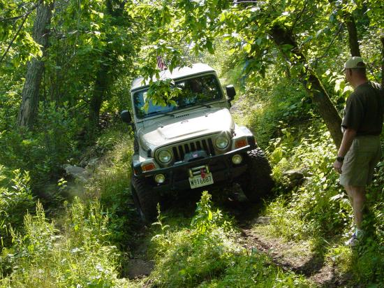
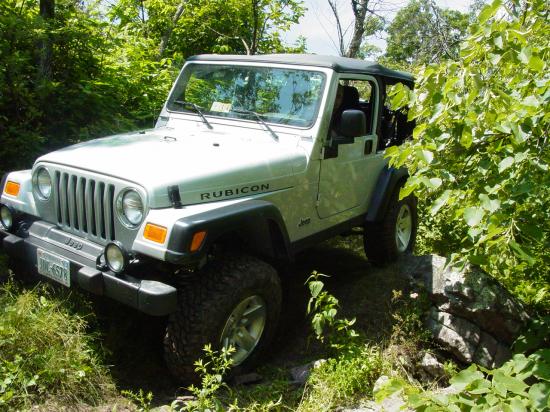
This was an interesting trip because
everyone was locked front and rear, lifted, running aggressive tires, and experienced.
Bill and I had winches, and everyone was going to have fun. One way or another... The kids
got sprayed with bug spray, and I doused myself as well, and then set about to airing down
and disconnecting.


It's getting pretty easy to get that part
of the job done. I love the naysayers who mock automatic tire deflators and quality
disconnects. We were done with that task so fast that we were on the trail in no time. I
have absolutely no regrets about the money I spent on that equipment. As often as we go,
the time saved adds up pretty fast if we had to do it the hard way.
Carl had surprised me with a receiver
hitch plug ("Jeep") and a Camp Jeep hat. It was very thoughtful and nice
to have at least a hint of the event I had missed. Carl also hinted that he had
something for everyone and promptly produced mini-bungee cords that are the perfect length
for holding seat-belts out. The reason for this is that when the vehicle is past a
certain angle, the seat belt no longer wants to be pulled out and put on. It becomes
locked and unusable until the vehicle is once again relatively level. So by using
the bungee to wrap around the sport bar and hold the seat belt out, we can get in and out
of the Jeep and be able to use our seat belts. I took a cue from this and also
secured the rear belts for the kids by looping them through the provided retainer on the
booster seats. We were able to use our seat belts all day long because of Carl's
thoughfulness. Many thanks!
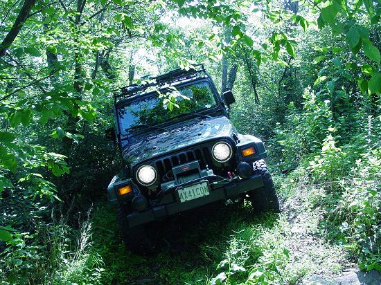
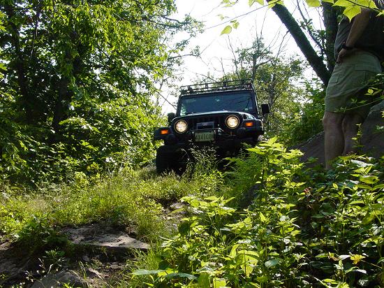
Trail
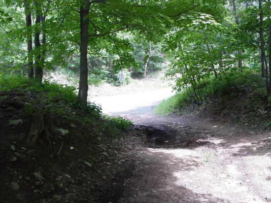
It's funny how grass changes things...
No, not that kind silly! The trail does not see much use and gets grown in pretty fast. In
some places it can be hard to see the trail, but that just makes it more pleasant.
The first time I ran this trail, it looked much
like it did today, except perhaps at the more difficult obstacles. And the effect it had
on me this time was very calming. The road does not look extreme, has no hard edges, and
makes you feel like it's just a little walk in the park.

We met a single driver who was coming out
as we went in. He graciously pulled off to let us go by. I passed the time of day with
him. He said he had hiked to and stayed at the Kephart shelter. I'll have to look it up on
the trail web site and see where he went. I was much more at ease this time than the other
trips I have made.


That lasted until we got to the power
lines. A few hundred yards before the power lines, you get your first little taste of
off-camber driving. It's not so bad that you want to turn back. Then there is the little
rock slope that you must climb just before you reach the power line. It puts you even more
off-camber, then an easy little hill. I took all this in stride and really enjoyed the
ride. The top was up, the A/C was on, and the kids were getting along with each other.
Life was grand...

Then we got out from under the trees,
into the open, on the narrow ridge back that spans the gap where the power lines run up
and down the ridge. They disappear in the distance in both directions, far below. Far, far
below... When we came up here in February, 2002, it was much more bleak - the bushes were
bare, the grass was flattened down and brown, and the rocky road that makes the steep
ascent past the power lines was very easy to see. So was the steep drop off on both sides
of the trail. When you see the road signs that say "Low Shoulders", you know
you're not supposed to drive off the pavement. They don't make a sign to describe what
waits for you if you drive off the trail here...
In
February 2002, I had some real fear tied up in
driving over this section of trail and climbing up past the power line. You could see the
valleys below on both sides, and it looked that if you slipped off the trail, you would be
a goner. Today, the bushes were lush, the grass was tall, and the trees were full of
leaves. The sun was shining and a hint of a breeze was blowing. The bugs were out in
force. Looking at the trail, you are fooled into thinking that you have a wide swath to
deal with, and there will be forgiveness if you get off the main path. The fact of the
matter is, there is no more forgiveness today than there was that cold day in February.
But my mind feels more at ease, and I find it very easy to climb the trail and continue on
without a care. I did keep a little voice back there reminding me not to get too confident
or relaxed, but I did not feel the same pressure that I did last time I was here.
Complacency?

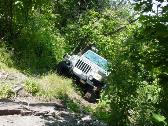
As we continued up the trail, the
off-camber angles become more frequent, more extreme, and last for longer stretches.
Actually, it pretty much stays off camber for the rest of the way to the end, with only a
few spots of relief. And even then, you're just trading one hardship for another.


We came to the spot that Jackie once
referred to as the "bad hole". The lower side of the trail is so grown up you'd
have a hard time recognizing it from the pictures taken on my first trip out here. The
hill just beyond that goes steeply up, slightly off camber, then breaks wickedly to the
left, is still a bit tough, but thanks to the dry weather, very do-able.
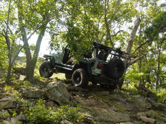
We worked our way to the spot where the
trail goes very off-camber for several hundred yards, at least 30 degrees, and here and
there more so, when a uphill-side rock must be traversed. In the midst of this lies a hill
that must be climbed and descended, with a very steep break-over point at the top. Several
people have met their nemesis here. I got stuck on the downhill side; Mark ended up in the
boulders on the uphill side, and several more have told their tales of woe here.


Carl has done this trail before and
showed his familiarity with this obstacle. I got out and walked ahead to make a few
photographs. As usual, they do not do the terrain justice. You must drive to the approach
while 30-degrees off camber. Then you must turn up hill over a rock on the high side of
the hill, putting you about 35-degrees off camber. Then as you ascend, there are more
rocks on the uphill side of the path, and you must either go up on them, or risk sliding
off the loose rocks that your downhill-side tires are riding over. And there is no trail
below the loose rocks. Just a deep drop-off and a tangle of trees and bushes.
Making it to the crest of the hill, you
must go to the uphill side of the trail, get more off-camber, and then turn downhill to
get over the rock at the top of the little hill, blindly turn down hill, still off camber,
still with no place to go if you start sliding sideways, and drive down a steep rocky
rutted hill. Without misplacing a tire, without slipping down the hill into the hole where
I so unceremoniously removed my steps and wrinkled my rockers on my first trip.
Then when you get to the bottom, a fin of
rock sits across the trail at an angle that makes your front end slide away from the trail
and into the woods. Going into the trail, this rock is almost a non-issue because it just
pulls you further up the hill away from the low side of the trail. You get into the side
of the hill with your sidewall and pretty much keep moving. Coming out is another story
altogether. Carl made it up and over, down and past the fin with no problems.


Next I drove the same path. I worked hard
to keep my wheels on the desired line, modulated my speed without using my brakes, and did
my best to keep my steering pointed where I wanted it. The Jeep constantly sought the low
side of the hill and I struggled successfully to keep it in the tracks and moving where I
wanted it to go. This is an argument for on-demand lockers instead of the
"automatic" lockers that I have. The Jeep simply wants to slide sideways off the
hill because the locked wheels do not give great lateral traction. This was one spot where
I wanted to turn my lockers OFF.
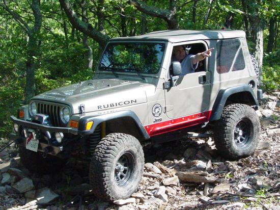
Somehow I got up and over the break-over
and back down the other side. I even overcame my discomfort about the angle on the trail
and parked my Jeep.
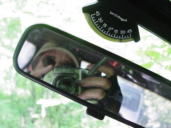
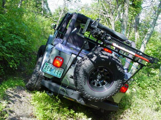
It was sitting at about 28-degrees. It
was not a great feeling but the vehicle was stable and not at any risk of sliding sideways
or tipping over. In case you ever doubt that my photographs accurately depict the
angles of the vehicles, compare the image of the parked Jeep to the one of the
Lev-O-Gage and mirror next to it (above). The
picture of the gauge was taken when the Jeep was parked as shown in the photo. I
promise you, if the Jeep is tipped in the photo, it was really tipped that way on the
trail!


Movie (1.7 MB)


The kids got out and we watched Joel and
Bill make there way over the same ground.
The trail continues along, still
off-camber and passes through some more rocky spots that require good choice of line, and
avoidance of some leaning trees that have claimed windshields, cab tops, and all manner of
other vehicle parts. All of this keeps me alert and busy, but my anxiety level is pretty
low.
I forgot how close we were to the end of
the trail and followed Carl almost down into the rock garden at the end. I realized it in
time and was able to pull up off the side of the trail so that others could get by and
play in the rocks and on the obstacles that people like to play on.
This section of the trail is responsible
for so much carnage that I don't play on it. I am happy to watch anyone who wants to work
through the boulders, avoid the trees, climb the rocks, turn around between more trees and
a cliff, and come back out the same way. Naw, not for me. If anything, it's too much work.


I watched Carl after he got up the rock
(very nicely done by the way...) working really hard to get turned around. It was a lot of
work with some fairly risky maneuvers along the way. By the time I get to this point on
the trail, I've used up my adrenaline; need food and drink, and a break to let myself get
relaxed again. The last thing I need is an excursion on a sheet metal munching, fender
flair fouling, axle-breaking romp.


Finally, Carl got turned around and came
back down off the rock. Bill came up next and was not able to repeat the smooth, one pass
swipe that Carl had executed. Eventually Bill got up the rocks when he changed his
approach and took a little more risky line than he had started with.


Movie (9 MB)
Bill worked hard to get turned around and
punctured his soft-top in the process. More carnage for the "rock garden".


Joel and I passed, and the gang sat down
for an early lunch break. The kids were pretty well behaved through all, though they did
start playing vulture around Barb and Bill's cooler... Don't feed the animals!


We got them fed and through it all, they
were great - the footing is pretty rough in this area and I was quite pleased to see that
Ted and Tom were able to deal with it.
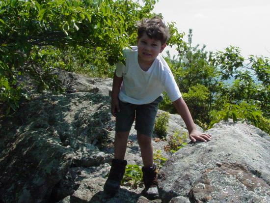
They stayed far away from the cliff,
except for one supervised rest room break when I accompanied Ted, and we took a look from
the brink. Although it was hazy, it was still a beautiful view. If not for the hot sun, it
would have been a pretty place to sit for lunch.
With lunch pretty well finished, I loaded
the kids up and we headed back from whence we came. Now sitting on the low side of the
vehicle, the feeling of being off-camber was a little more intensified. I used the dash
grab bar or the passenger door loop to hold onto to help me stay leaning a little uphill.
This made it easier to tolerate the steep off-camber angle, and made me think that having
my weight more to the center would reduce the risk of flopping over. I doubt it would make
a difference, except maybe if I started bouncing my way along. I had no plans for that...
When we came to the angled rock fin
sticking out of the ground, I made a couple abandoned attempts to get over it then gave in
to the best line for me and got more off-camber than I like. It worked to get my front
wheels over. I still had to get my rear wheels over without falling off the trail to my
left. I was successful and found myself staring up the hill with the break-over at the
top. The side of the trail on the low side is loose rock and dirt. I knew I had to stay on
the trail or risk a repeat "stuck" performance.
I climbed to hill and disappeared from
Carl behind me. He was calling me on the CB to ask if I wanted/needed a spotter. I was too
busy to let go of the wheel and answer him. I had to complete the entire obstacle and
leave my Jeep parked on a 30-degree side-hill before I could answer that no spotter was
needed, I was all set.


I did some spotting here and there for
Carl and Joel. Everybody made short work of this obstacle and we worked our way back
closer and closer to the trailhead. Everything was going well.


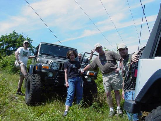
When we got to the power lines, it seemed
a shame to just drive on out without appreciating the view. So I parked just before
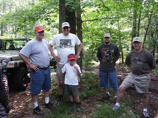
re-entering the trees, and got out to take some pictures. Tom had fallen asleep but Ted
was ready, willing and able to join me in hanging out with everyone. Barbara suggested a
group picture and Ted was more than willing to oblige by taking one.


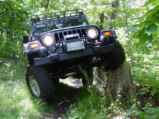
We wrapped up our sightseeing and
polished off the rest of the trail. I stopped briefly along the way to "ramp" a
stump popular for this purpose. I was able to get onto the top of it. Then I discovered
that my flex was fairly decent, my tires compress a great deal when aired down to 12 psi.,
and my front tires stuff pretty deeply without rubbing.


But when I got ready to back down, the
Jeep started to continue forward over the stump, which would have involved dropping off it
from three feet in the air, and probably impaling the Jeep on it, or at least raking the
body up against it. I was able to avoid it by some long-practice heel and toe, a hand from
Carl to stabilize the Jeep a tad, but it was a little nerve-wracking. I got the pictures;
I think I will leave the stump to others in future...
The rest of the drive to the trailhead
was nothing more and nothing less than a nice drive in the country. We thoroughly enjoyed
the scenery all along the way, and found the trail to be at its most beautiful for our
visit. The kids have never been better, and I enjoyed the company of some of my favorite
people. While the weather was on the hot, humid side, I didn't mind it much.
Epilogue


We got aired up and connected in
respectable time, and one by one we headed out on our separate ways. Bill and Barbara, and
Joel hit the road first. Carl waited for me and I took up the rear. I am definitely going
to have to get a heavy-duty compressor to go with my heavy-duty on-board air plumbing. I
am airing down to low pressures (~12 psi.) and the airing up is taking painfully long
these days.
We drove back to the highway and
discussed going to Auto Outfitters in Manassas for some stuff that Carl needed for his CB.
Unfortunately, when I called them, they did not answer so I suggested that we continue up
Route 81 to the truck stop that Hugh and I had visited some time ago. He agreed and we did
that. He was able to get the antenna he wanted, but came up short on some of the hardware.
But the kids had fun checking out the stuff for sale and generally keeping me on a short
leash.
After we paid for our stuff, hit the rest
rooms, we got gas and drove the rest of the way to our neighborhood where we went to the
Jeep wash. I swear Carl's Jeep was just as clean going in as it was coming out. Well, with
the possible exception of his tires. We're both sick when it comes to washing the Jeeps.
I'm not sure which one of us is worse, but we sure to spend more than our share of time
and money at the car wash. I am more convinced than ever that a pressure washer may very
well be one of the next Jeep accessories I purchase!