Prologue
On June 1,
I received the following message from my friend and co-worker Mike:
Hi everyone,
Wanted to drop you all a
note and see if you'd be interested in a little group
geocaching/canoe excursion.
As most of you know, I'm
the primary owner (instigator) of the WV DeLorme
Challenge cache. When we were putting that cache
together, we noticed that one page in particular had
only one cache - "Slopping at the Trough". I'm not sure
how many of you have been in that neck of the woods, but
if you have you probably want to go back. If you haven't
then you really need to get out there! Check it out at
this link then finish reading this email - so far there
are only 3 logs for a find of this cache:
http://www.geocaching.com/seek/cache_details.aspx?guid=415d6c93-6827-4a08-b6eb-eec6526d87c6
Here's the idea that I
came up with:
-
We will leave early
-
We will travel down
and back as a group
-
Everyone will be
responsible for getting their own equipment (canoes,
PFDs, paddles, etc. Bring it or find an outfitter.)
AND knowing how to use it PROPERLY.
-
We will do the float
trip as a group
-
Bring your own lunch
-
Find the cache
-
Do the happy dance
-
Paddle out
-
The rest of the
details are still a bit fuzzy ...
If interested:
-
all correspondence for
this trip will be done by replying to this email so
everyone gets a copy, I can add new folks easily,
and no one gets dropped off the list.
-
First, I'd like to
know who would be interested in a minimum Saturday
day trip, maximum Sat-Sun trip with the canoe trip
happening on Saturday.
-
Next, let me know your
1st and 2nd preferences for a weekend trip between
July 29 and Aug. 27. Right now I'm thinking the
majority (and my wife) will rule. 8-)
Share your thoughts,
questions and concerns by replying back to this email
for group input, I'll moderate as needed.
I thought this would be a
fun group of folks to take the trip and have a good,
safe day on the river as well. I see this as a group of
folks who enjoy the outdoors getting together to share
something fun. I'd like to keep the size of the group
reasonable (12-16 max, not 30-40) to keep the logistics
manageable.
Look forward to hearing
from you all.
Best,
Mike
GC:ScoutingWV
|
This
sounded like a great idea so I indicated my interest right away.
Shortly after that, Mike heard from the owner of the Geocache with the
following info:
Hi Mike,
'Almost missed your email because it got buried in my
inbox. I'll attempt to answer your questions.
First, there are two outfitters in the
immediate area that rent canoes: Eagle's Nest Outfitters
on US220/Rt. 28 just downstream from Petersburg and the
Trough General Store located at Harmison's Landing along
the Trough Rd. about 10 miles upstream of Romney.
Although I haven't rented canoes myself, I've used the
Trough Store many times for shuttle service. Great
folks.
The stretch of river I like to float
begins at the public access immediately below the bridge
at Old Fields on US220/Rt. 28 and ends at Harmison's
Landing (called Sector on USGS topo). This is about
12-14 miles and is an easy one-day float, but there're
many camping spots along the way if you want to camp.
Another possibility is to float further downstream about
4 more miles to Camp Wappacoma along the Trough Road.
This is a private campground with pretty nice
facilities. Boy, a hot shower after spending a day on
the river is like paradise to me!
The river through these areas is
pretty mild, provided the water is at normal levels. The
roughest shoal is immediately above the railroad trestle
at the trough's entrance. If you hang to the right and
keep off the ledge, you'll be fine. I speak from
experience - on one of my earlier treks down the river
some 15+ yrs. ago, a friend and I decided to go down the
middle of the shoal over the ledge. Water was running
about 4 ft. high. Needless to say, my trusty Grumman
(now retired) submerged in the aeriated water. My canoe
received a gash along the waterline by a sharp rock much
like the Titanic's wound. However, thanks to a ready
supply of aluminum and duct tape, we were on our way
after about six beers. It doesn't get any better than
that! I do recall that it was Old Milwaukee beer, at
that. Also, that experience caused me to invest in dry
bags. I've never had to sleep in a wet sleeping bag
since. I guess we all learn something from our stupid
mistakes.
If you have any more questions, just
let me know. I hope you try out the South Branch and
especially make a go for my cache. You won't be
disappointed.
-Jim Pierce aka JaboIam
|
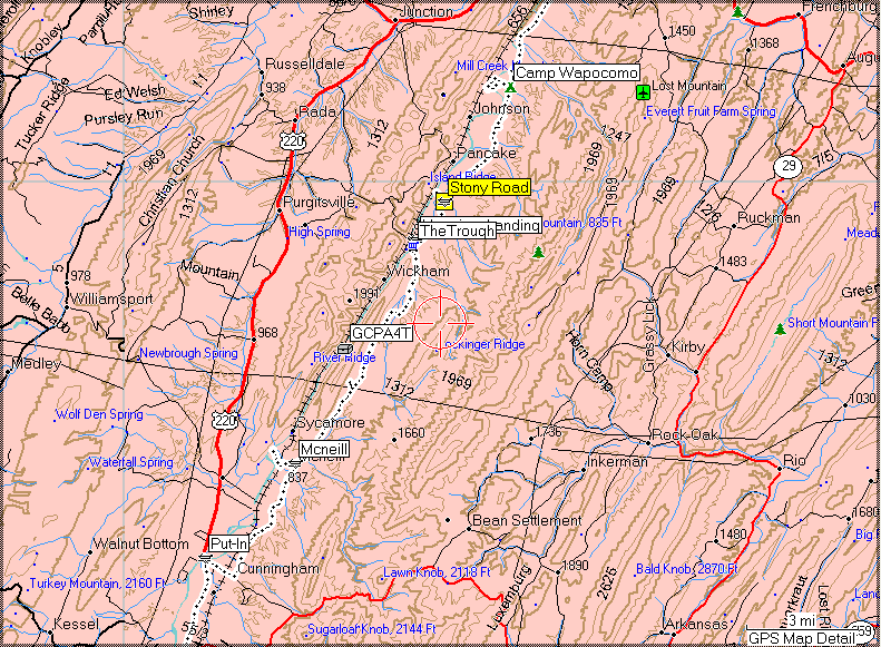
After
reading Jim's very helpful note, I spent some time on the maps, to
locate the important places he mentioned.
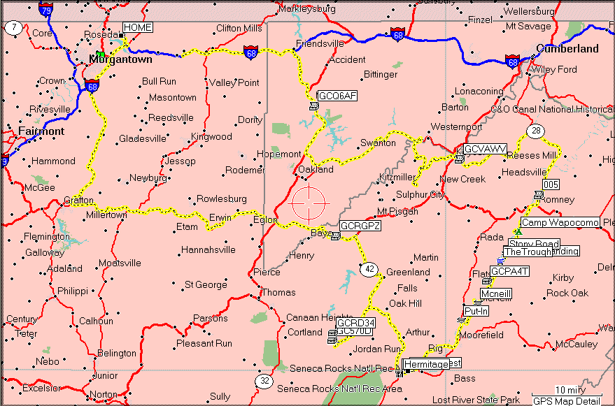
I marked them with
waypoints, and did some routing plans to get down to the campground and
to the outfitter locations. I also marked the put-in spot Jim
mentioned.
I had a
little trouble finding the campground at first because Jim used another
spelling, but eventually I figured it out and soon had a complete layout
documented.
I went
over it with Mike and we decided to do a pre-run to check out the
outfitters and campground, and get a sense for the logistics of moving
the canoes in and out of the river. Not to mention we wanted to
see for ourselves how the river looked, and perhaps even hit a few
Geocaches while we were at it...
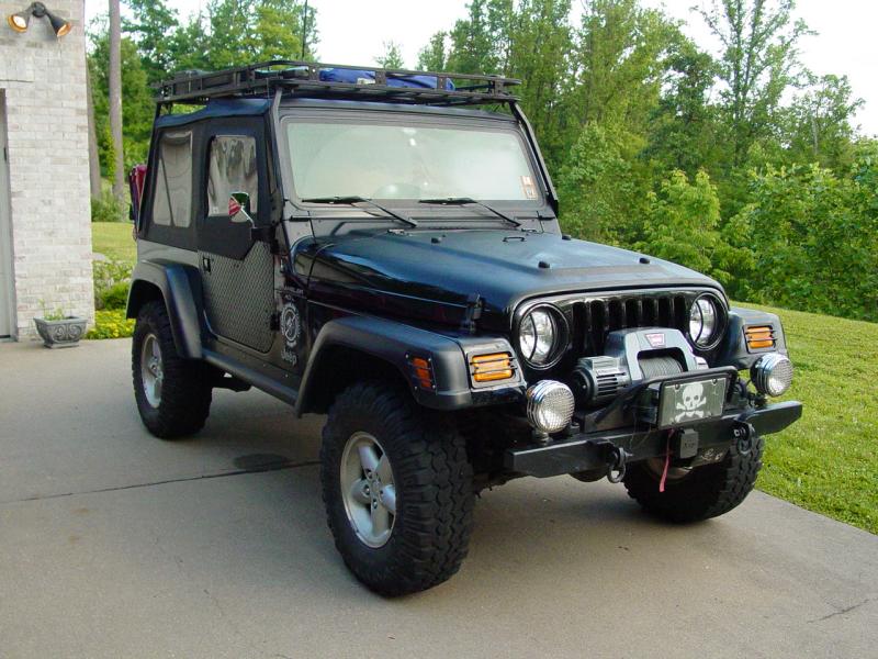
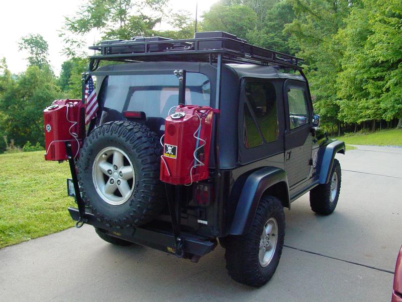
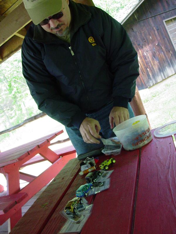
Muster
The night
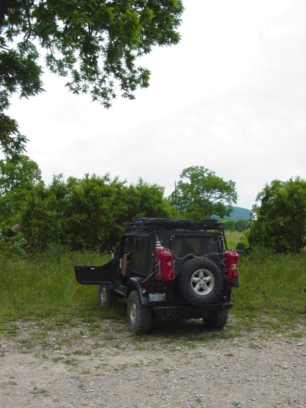
before we left I reconfigured the Jeep for fair weather and our light
travel gear. I also fitted the half-doors and uppers anticipating
some time during the day without them installed. I also attached the gas cans so
we could concentrate more on the location than finding a tank of gas.
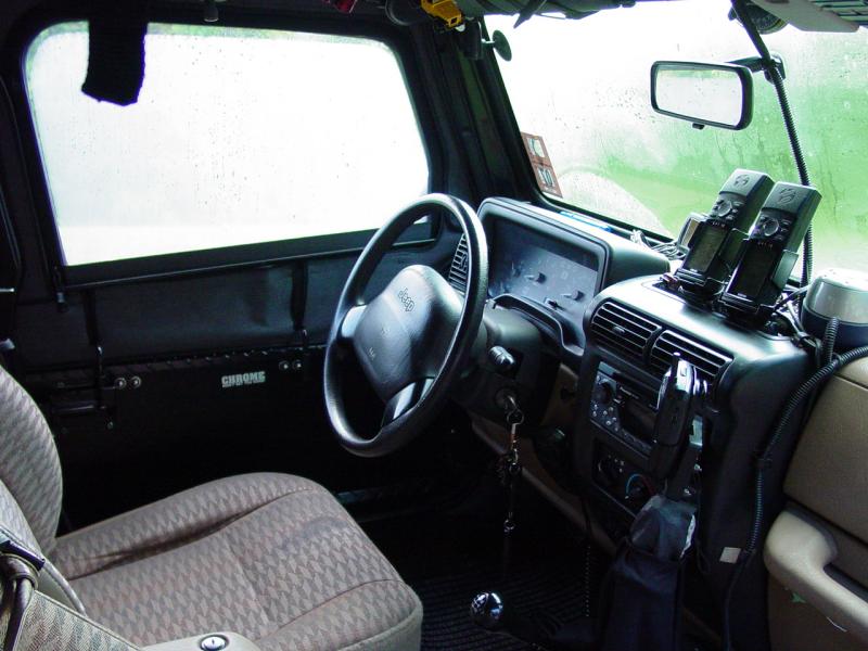
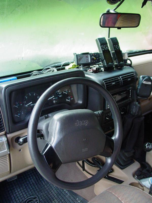
While
the layout of the cab was left as usual, I seldom show it, so here is a
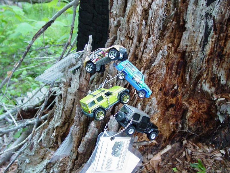
shot of the way I set up the GPSr's and other stuff. For
those who need to know why there are
three GPSr's, read this.

Mike
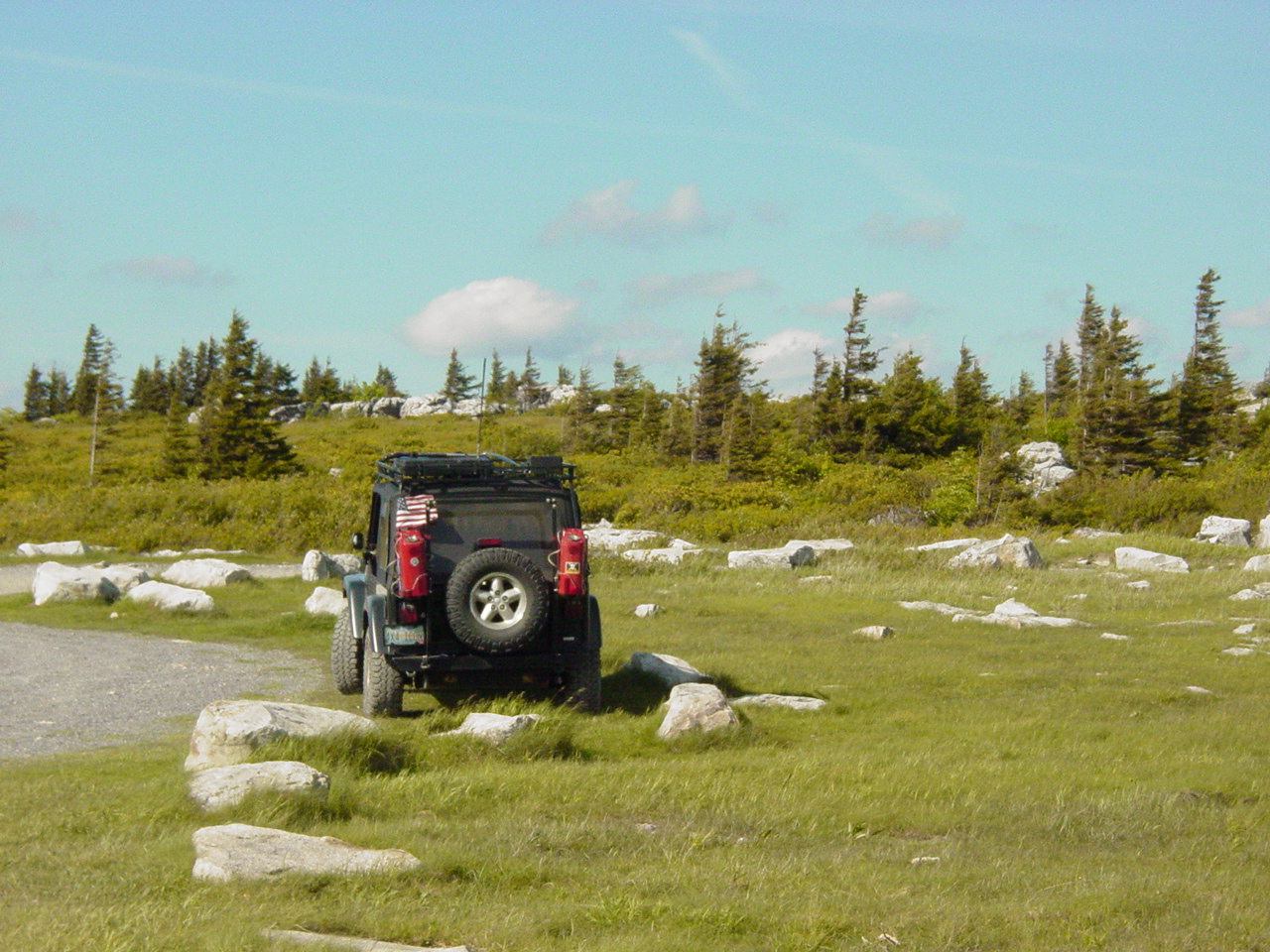
arrived at the planned time (0700) and we hit the road.
Trail
I had originally planned to drive out
Route 68 to Cumberland and then head south. But after we'd been on
the road a little bit we came to the exit that does down by Deep Creek
Lake and agreed it would be a nicer ride to go that way instead.
So the Jeep left asphalt and we exited the highway at Friendsville.
We drove along, with a stop to remove the
door uppers and stow them in the back seat. We reached Deep Creek
Lake. I noticed last time how much it had changed since the time
in 1993 Maria and I went there. Come to think of it, we've changed a
lot too!
 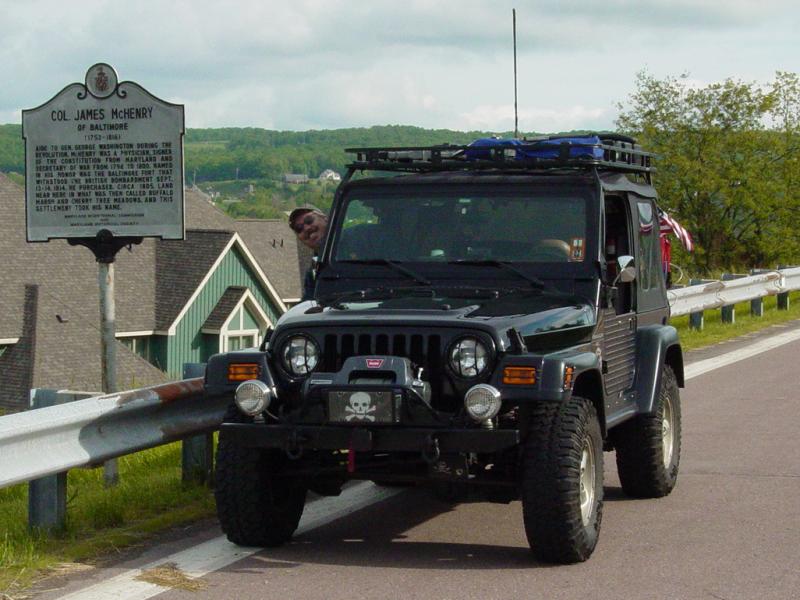
I was pointing out to Mike where Maria and
I had taken this photo (above) and he indicated that the
McHenry McMicro was there! So naturally we stopped. He's
already logged it but I took the opportunity to get it too. Note
Mike sticking his head out the window so as not to miss a photo op!
Interesting - I'm still driving a black vehicle with oversized tires and
driving lights. The more things change, the more they change the
same...

Mike had recently visited Ted's first
geocache ("The
Evil Black Cache") and retrieved
Ted's Jeep Rescue. So he logged it through this cache and I
took a picture of the first ppro Jeep Club Reunion.

Then we continued on our way. I had
added a couple potential side trips to our itinerary. We happened
to be very close to
Backbone Mountain so I swung down the trail to the entrance to see
if the gate
was open. It was not, but we had a nice short ride on the gravel
road leading in and out to the gate. And interesting personal
history note: Backbone Mountain was the first place a I used a GPS
- that was back on June 24, 2001 - almost five years ago.
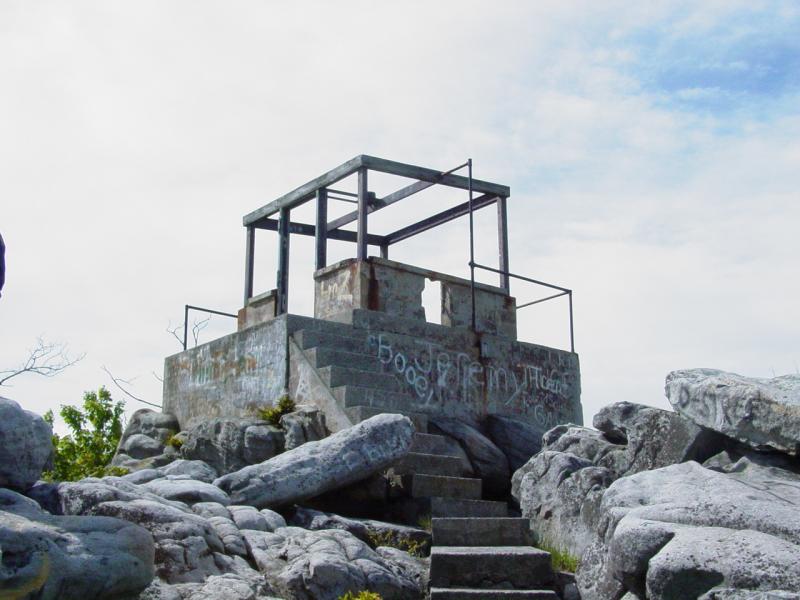
Another side trip was a visit to Pinnacle
Lookout Tower near Keyser, WV. I was curious to see if
Allegany Wildlife Management Area
trails were still closed. They were. But we drove up to the
lookout tower and took in the view. It was very windy and
temperatures were in the 50's so we didn't stay long.
   
We drove into Keyser, got a little
off-route owing to the bridge running over the street we wanted (display
on the GPS is not real good at showing overlays) but once on track I
noticed a geocache adjacent to the road. We took the slight
side-trip and soon
found the millmeadow cache. It was a real nice park in a part
of Keyser that I have not visited in many trips. Shame on me!
   
After that we settled into the drive down
to Camp Wapocoma. We wove our way through Romney, and pretty soon
we reached the campground. I was pleased that I managed to locate
it on the map to within one hundred feet for I could not find any
detailed directions and had triangulated on what I found combined with
Jim's estimate. Close enough for horseshoes and hand-grenades!
Wapocoma Family Campground
We found the campground large, bright,
shiny and clean. The campground hosts were very personable and
gave us good info about rates, booking and so on. The camp store
has a good selection of items that campers need, and there is plenty of
parking.
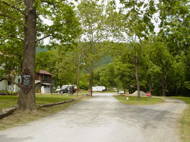
The main road
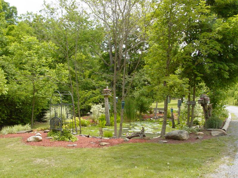
Pretty Lily Pad Water Garden
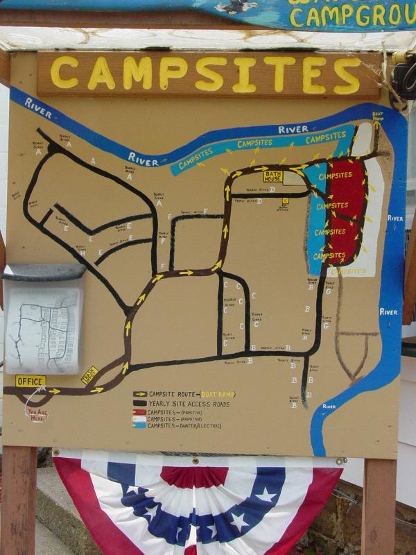
Campsite Map
 
Wapocoma Family Campground Info
Sheets
  

We thanked the hosts and took a drive out
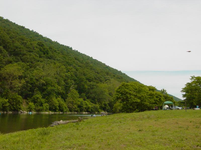
to the campsites. It's wide open with the river on two sides.
 
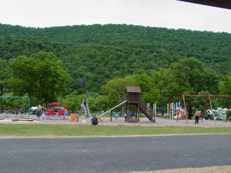
There is a nice playground for the kids.
  
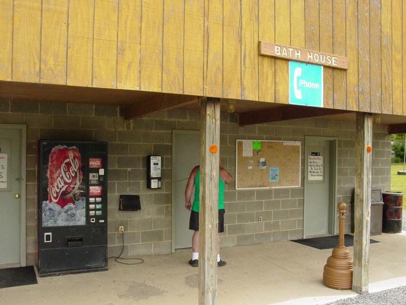
The Bath House is good, certainly not a
5-star hotel, but lots of room, clean, and hot water in the showers.
 
Here's a shot of the campground entrance.
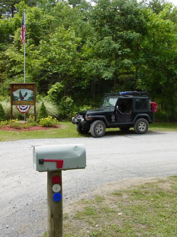

The campground checked out so we headed
down the road to scout out places to put in and take out the canoes.
We can even take them out at the campground though it appears the extra
miles from the outfitters will cost extra and the time to get there
might be more than we really want to spend on the river.
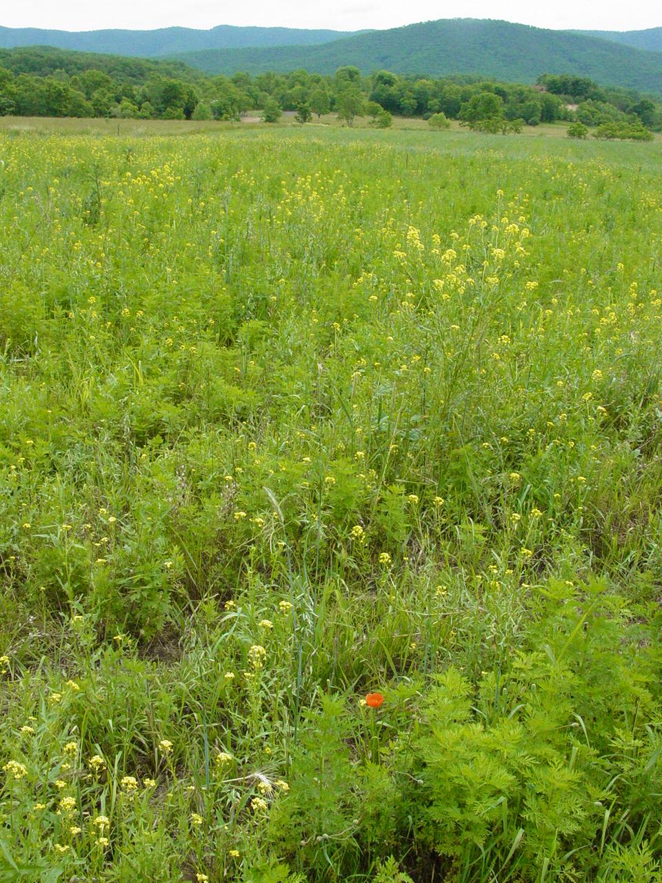
The first place we checked looked good and
the field we drove through to get to it was beautiful.
  
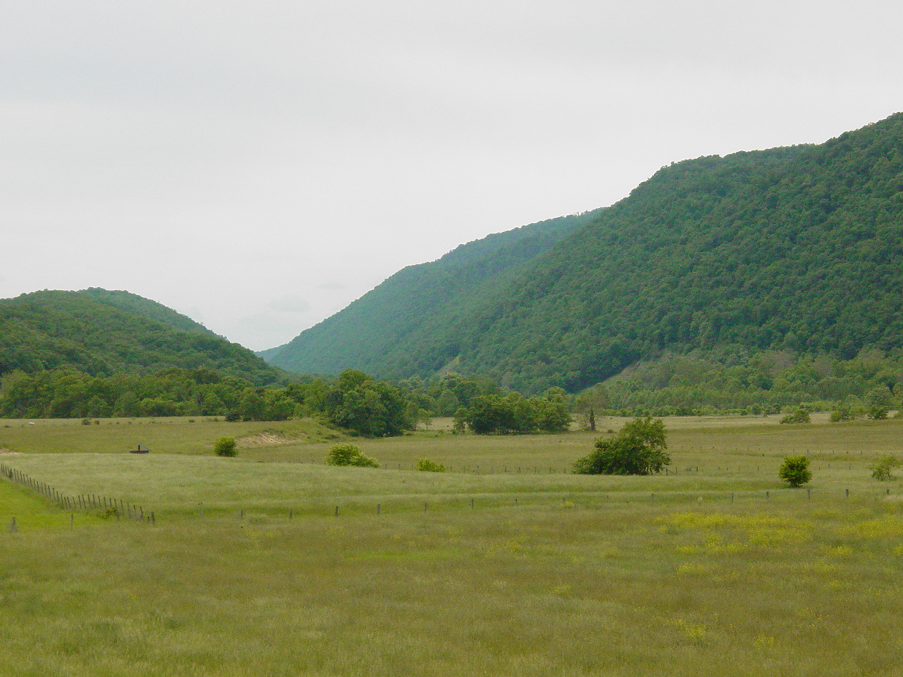
Back on the road we passed some nice
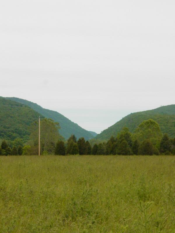
scenery and our first glimpse of the Trough.
 
Trough General Store
We reached the Trough General Store in
good time, first checking out the take-out area down by the river.
This is likely to be the place we end our canoe trip - right at the
canoe outfitter. But I am getting ahead of the story.
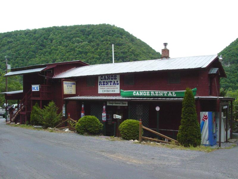
 
 
Trough General Store Flyer
We met the owners and
their parents, from whom they bought the operation some years ago.
Together they have been at it for some time. We enjoyed a nice
visit and also observed them going about their business of getting a
group ready to go out. The operation looked well-run and
efficient.
 
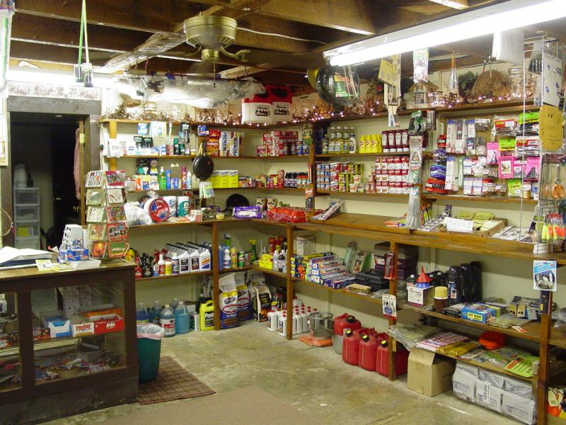
I broke off and went
inside the store to have a look around. There seems to be a good
assortment of stuff available, again to meet the needs of the campers
and hunters in the area.
   
We got a few flyers, prices and schedules,
said our "Good-Bye's" and hit the road again to check out the put-in
spots upstream of The Trough.
I had this crazy idea we could reach
Slopping at the Trough
cache by land. When it appeared on the map, I started watching for
roads off to the right (we were driving south) and soon I found one.
It went up into the woods so I dropped the Jeep into 4-LO and off we went.
Pretty soon (too soon) we encountered some tree fall. There were
ways to get around it, but thinking about it a little more, and looking
at the map, the top of the ridge and the river level were a great
distance apart so any road that went down the other side (if there is
one) is probably a couple miles long. We still had a few errands
to make. So I turned the Jeep around
and backtracked to the road.
We soon came to McNeill's Public Landing.
To get there, we drove
through a field complete with a very territorial bull. I was
waiting for him to mistake the Jeep for the new bull in town but
fortunately he just strutted around making sure we knew who was boss and
we took our time getting past him and his harem.
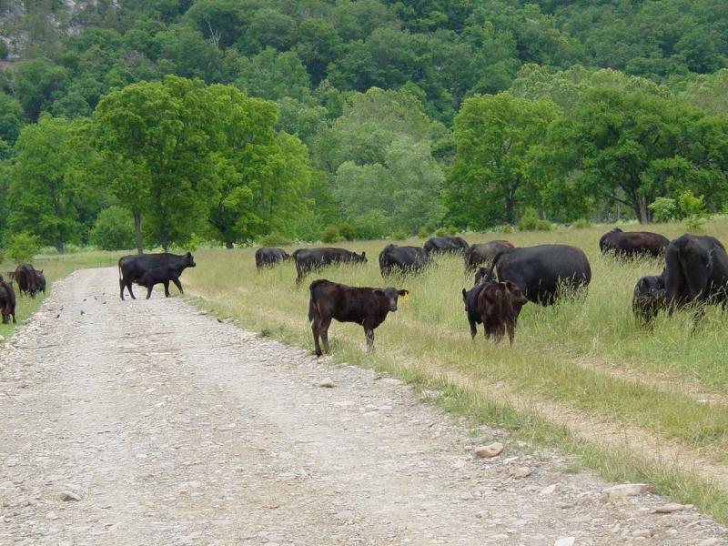
 
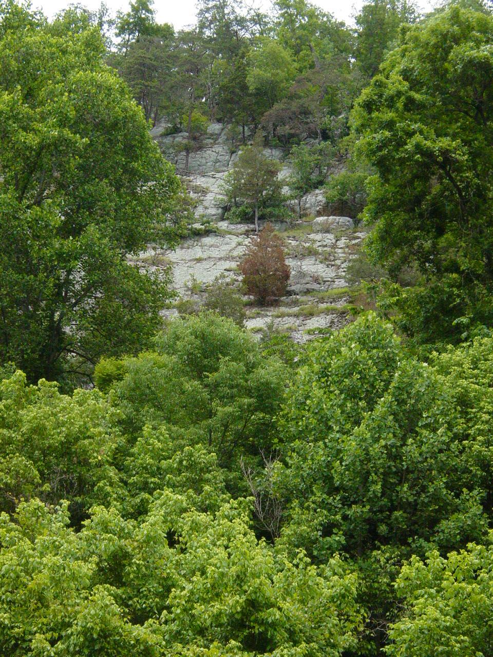
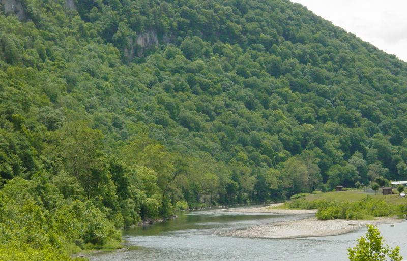
In the distance we could see The Trough.
The river at McNeill's landing is nice.
The banks on the western side of the river are steep and high.
"Sheer cliff" pretty much comes to mind...

It's a little bit tough footing but the
adults will have little trouble and can help the kids.
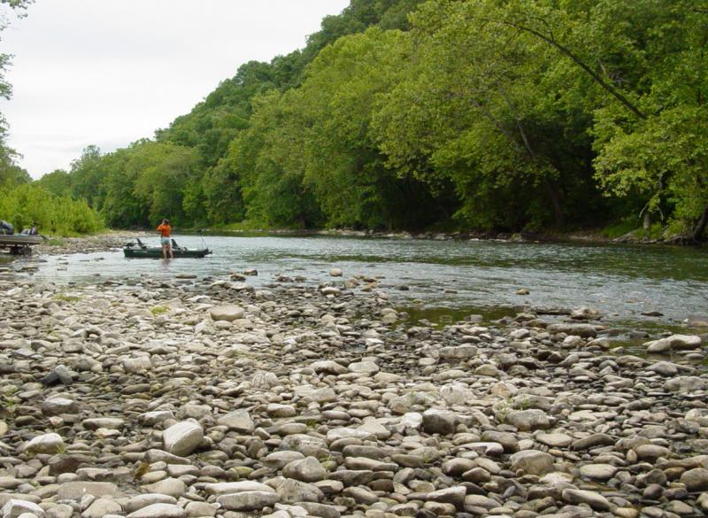
 
We won't really need the parking for the
group using the shuttle service but for those with their own canoes, the
parking is plentiful.
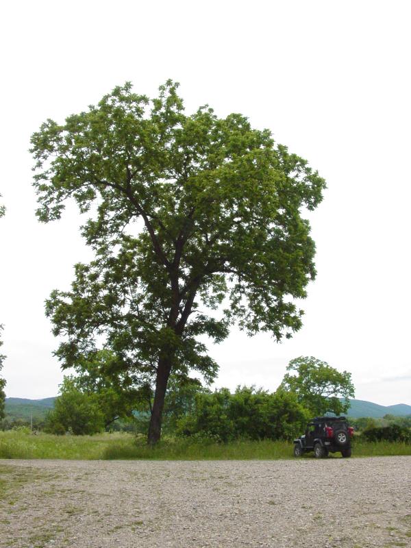
Time for some fuel. The Super Siphon
comes in real handy!
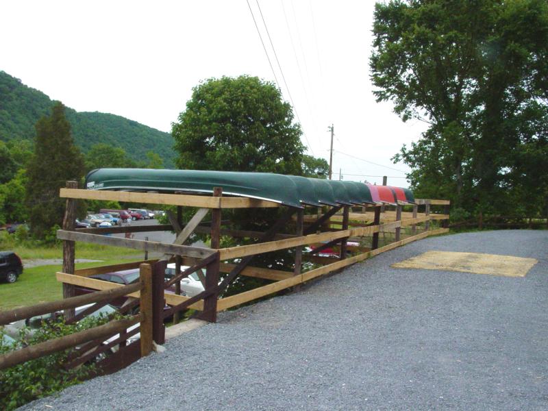
The Trough General Store shuttle vans with
canoes came to launch two groups while we were checking out the area.
They went by and down the road a little ways where they put in.
I drained the spare gas cans into my tank and we
talked for a few minutes. Then we buttoned everything up and got
back on the road. We drove to the put-in location near the bridge
on the way to Eagles Nest Outfitters. We wanted to check out one
more set of options to make sure we understood the choices available to
us.
The put-in spot at the bridge by
Cunningham Lane was nice, though quite distant from our objectives.
We continued to Eagle's Nest Outfitters
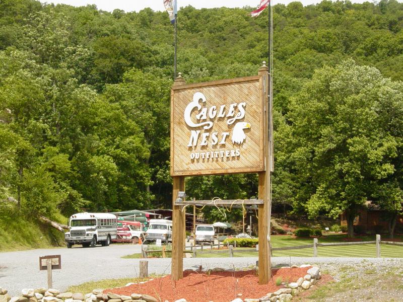
We inquired about the canoes, shuttle
service and terms, got prices, brochures and thanked them for their
time. They also have a nice operation. For our group there
seemed to be some disadvantages if we were to use Eagle's Nest.
They are farther away, would put us in farther away from our objective,
and they were a little more expensive. They also would charge more to put
us in closer to our endpoint. We thanked them
and headed into Petersburg for some late lunch. The Hermitage was
closed (Sam S. recommended it to us) so we went to another small place
and had steak and cheese sandwiches. Good stuff! On the way
out of the area I refilled all the tanks with gas.
After lunch, we got back on the road
headed in the general direction of home. I saw a sign for Dolly
Sods and asked Mike if he wanted to make a detour? He was in, so
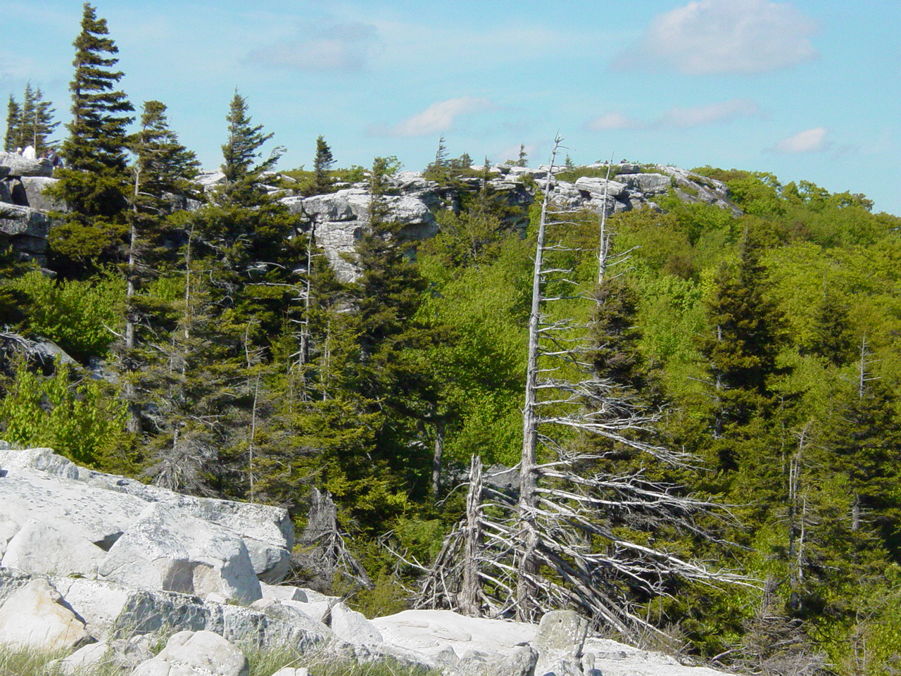
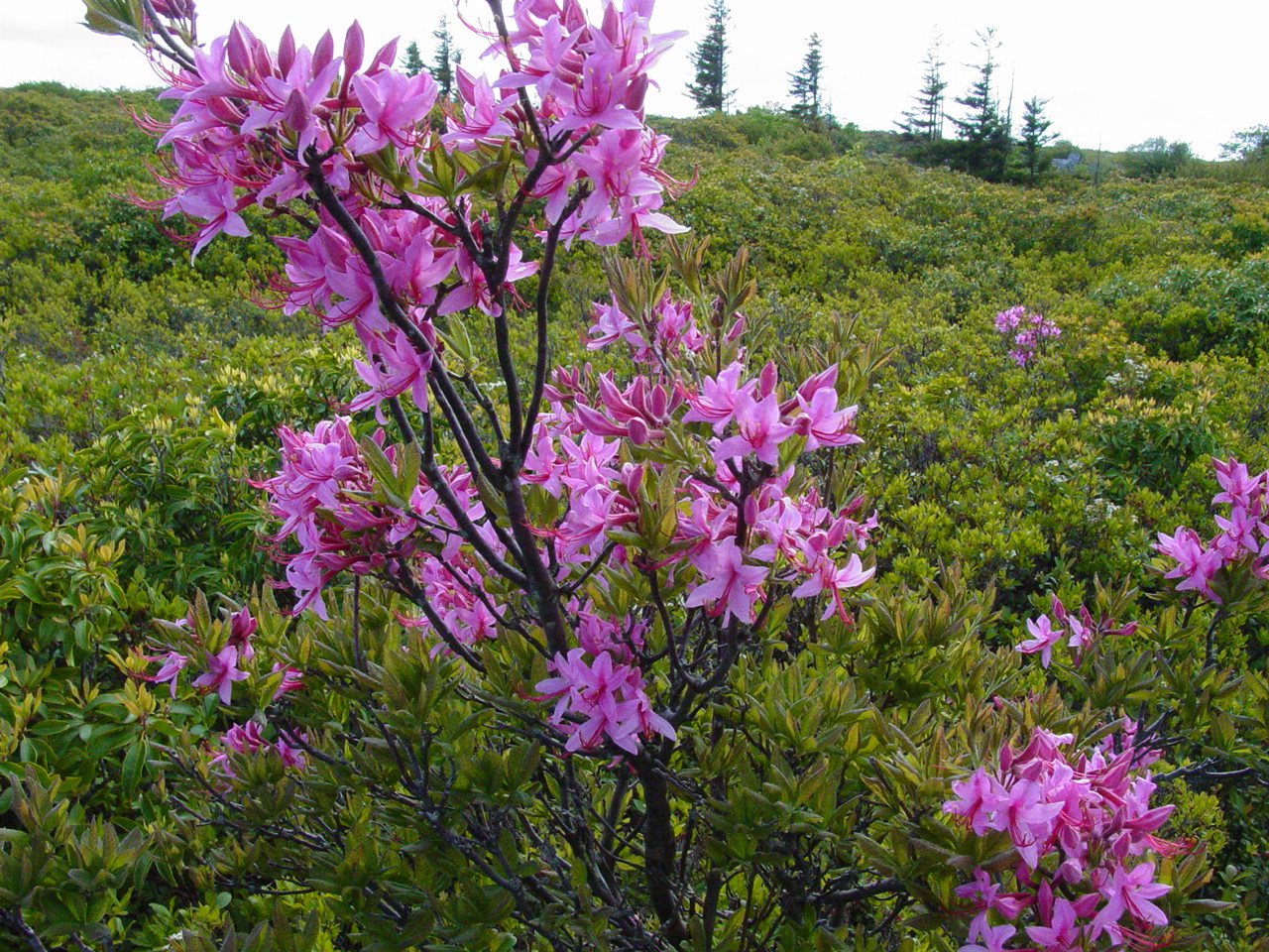
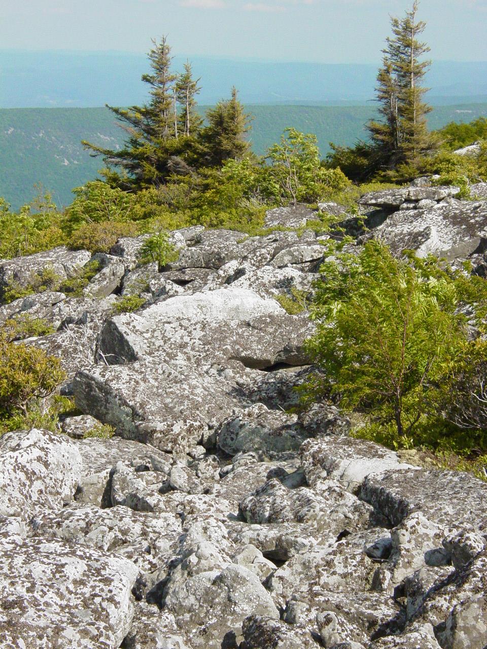
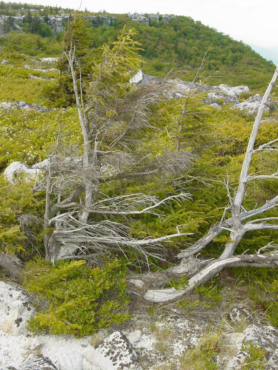
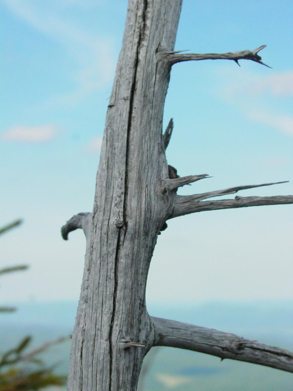
we shot off and soon reached the summit at Bear Rocks. As always,
the natural splendor was in full bloom. The plants were flowering,
the air was clear and crisp, and the sky was almost too blue to believe.
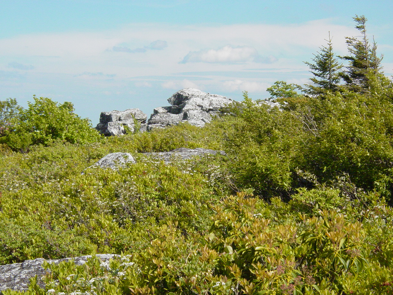
We took the opportunity to head over to
the site of another Geocache -
Dolly Sods. This one was to elude us. The location is
described as "8 feet below the edge". We got over the edge and
close to the precipice but could not put our hands on it. While
frustrated that we could not find it, we still enjoyed the location.
Mike and I both spent some time making photographs and just taking in
the views.


Refreshed from our visit to Dolly Sods, we
backtracked down and hit the road for home. Along the way we
visited one more cache,
Fort
Ogden.
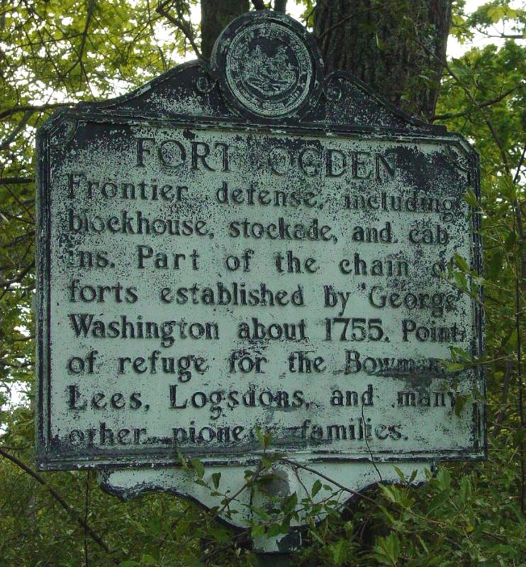
We really had to push through some ground
obstacles to reach the cache but once there found it quickly and took
care of business.
 
 
Epilogue
After
visiting the cache, we stuck to the road and soon reached home.
Mike shifted his gear to his truck and we parted company. It was a
very full day. We found a few caches, identified our
outfitter, campground, and laid out the basics of our planned trip for
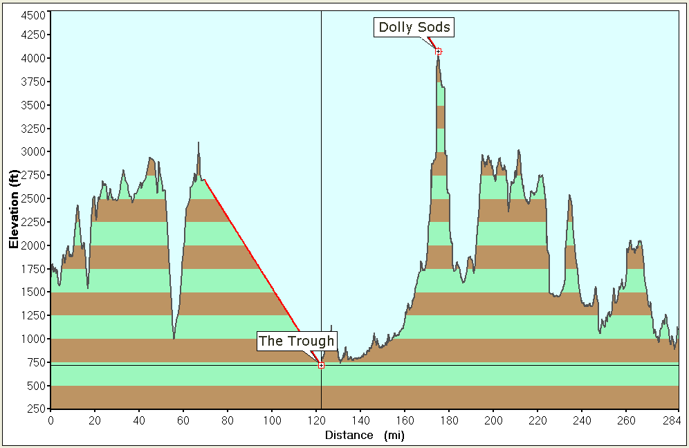
August. It was a day well spent. We had some ups and downs
(see the chart below) - it was all good!
|

