![]()
![]()
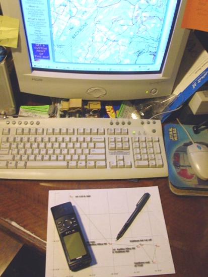
My GPS
Trail...
|
|
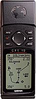 |
6/29/2001 - GPS 12 (my first GPS)
|
|
|
|
 |
|
 |
|
![]()
GPS 12 | GPS V | GPSMap 76CSx | Why Three GPSr's? | Palm m100 | MapSource Software | Satellite Antenna
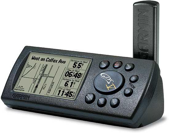
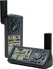
Garmin GPS V
Update: 6/1/04
Well that lasted a long time! I just got a second GPS 12 thinking that would be the answer to my limited track and waypoint capacity... Actually, getting another GPS is a case of opportunity knocking. My friend Bill decided he didn't use his GPS enough to keep it. I guess he knew of my interest in them and offered to sell me it along with all the stuff that he had to go with it. We struck a deal and I added a third GPS to my list of electronic devices. Garmin V
I tend to imagine capabilities of things that I don't own. Sometimes I have a pretty accurate set of expectations about a device and sometimes I do not. I expected this device to do things my GPS 12 does not. I was right about the mapping and auto-routing features - they do work as I expected they would. That's not too surprising as my friend Jim has a GPS V and he has used these features to my benefit many times. What I expected and didn't get was significantly better satellite reception, increased track log capacity (well yes and no...) and more map storage capacity than Hugh's eTrex.
|
GPS 12 | GPS V | GPSMap 76CSx | Why Three GPSr's? | Palm m100 | MapSource Software | Satellite Antenna
|
There are a number of reasons why I choose to run three GPSr units. Here are a few of them.
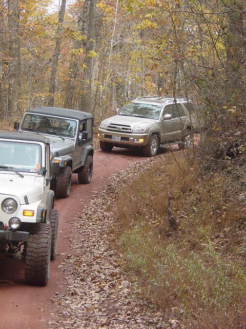
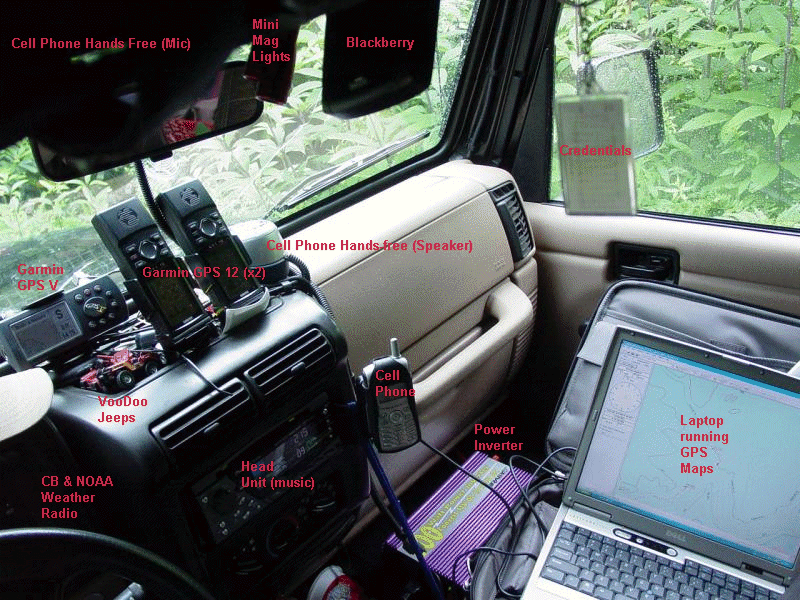
Running these three units gives me the following benefits (all at one time) Take an example. Trail Guide at Camp Jeep. The trip to the location is 5 hours long each way. There are three major trail systems on the way there (Big Levels, Shoe Creek, GWNF). There are over 20 Camp Jeep trails. The event lasts four days (not counting at least three pre-runs). There are hundreds of points that I need to be able to locate. I want to be able to:
One unit just can't do it all (unless I bring along my laptop and spend big time loading and storing data). With this set up I achieve all my goals and have comprehensive map and destination data at my fingertips at all times. Here's how it breaks down: Garmin GPS 12 - reloaded track points 4026 - 7026 (previous trips) - waypoints 1002 - 2002 - routes 65 - 105 - displays color map page during trip (tracking on, detailed street and topo and marine maps loaded) - provides auto-routing during road trip portion of activities - provides look-up and auto-routing to points of interest (restaurants, services, etc.) Basically, I started with the GPS 12. I bought a second on eBay to increase the number of waypoints and track points I could reload for trail rides. Then I bought the GPS V to do more advanced mapping and routing. Then I got the GPSMap 76CSx to increase memory, signal reception, and for color display. I found that having them all available provided a vast amount of data at a glance.
They also supply deep
support for my waypoints and tracks, and a way to provide nearly every member of my family
a GPS if we decided to go out on foot. The kids are learning to use them and I find that
they can be invaluable in a number of situations. Also, as I tend to consider them a
critical system for the type of excursions we do, it's important to have at least one
back-up system...
|
GPS 12 | GPS V | GPSMap 76CSx | Why Three GPSr's? | Palm m100 | MapSource Software | Satellite Antenna
|
Satellite Coverage
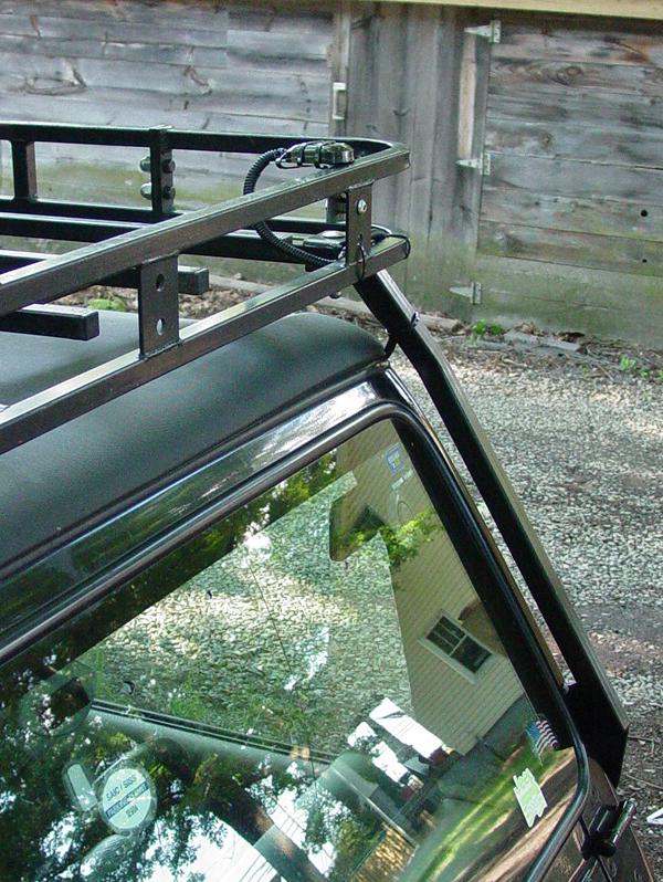
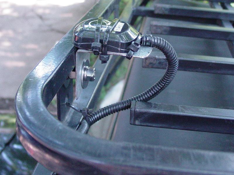
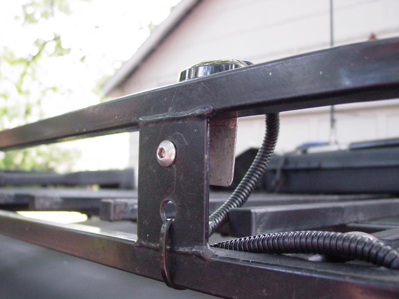
I spent a few minutes doing some research on the web and the recommendations for mounting a patch antenna like the one I have were pretty simply. Put it someplace where it has a 360-degree, unobstructed "view" of the sky. For me that could only mean one thing: Roof Rack.
I dug around in the garage and found a piece of heavy-gauge metal, bent at 90-degrees and galvanized. I took out a grease pencil, traced the footprint of the antenna on it, transferred that to the vertical section, then cut it down to size with my hand-grinder. Then I put it up on the roof rack where the light brackets are meant to go, located the hole for the bolt with my grease pencil, then drilled the hole. Boom-a-dee-boom-boom-boom. Antenna bracket. Next I had to figure out where to run the cable. That was pretty easy. There is one small spot at the front corner of the top where it meets the windshield that there is a gap large enough for the cable to pass without being crushed. I released the top and fed it through. Then I covered the cable where it would be exposed with some wire harness covering.
I attached the antenna bracket to the roof rack. Since I wanted the flat area of the bracket to be flush with the top surface of the rack, this meant that the gap behind the mounting surface normally used for lights needed to be filled. I put an extra pair of nuts between the mount and the antenna bracket. By chance it worked out nearly perfectly.
I mounted the antenna to the bracket. The antenna has magnets embedded in the base, but that doesn't make me feel very confident, so I ran a few wire ties around it to keep it from wandering. I don't think the plastic will interfere with the signal. Then I wire-tied the cable behind the roof rack frame as best I could to provide some protection from tree branches, and to keep it from whistling when I drive.
I have some extra cable to stash inside the cab. And I have to refine this attachment system because, as it stands right now, I will have to cut three or four wire ties each time I want to raise the rack to lower the top... Wire ties are cheap and I always have them with me, along with my favorite side-cutters, so it's really more nuisance than anything else. And I think in normal use, roof rack cargo will not like the antenna bracket or cable...
The satellite reception results were pretty good. Where the accuracy was running about 42 feet on the internal antenna, it increased in accuracy to 15 feet. I had three or four satellites locked with the internal antenna; 8-10 with the external one. This bodes well for satellite reception in the woods. Tracking With regard to the tracking capacity, this unit does have greater capacity than the GPS 12. Whereas the GPS 12 will store 1024 track points, the Garmin V will store 3000. But it organizes them into 10 tracks, each with a maximum size of 250 points. (I'm not sure how the remaining 500 points are used but...) I have found this to be problematic because many of my recorded tracks from the GPS 12, while segmented into smaller chunks, in some cases exceed the maximum of 250 points per segment. This means using tools to reduce the resolution of the track to squeeze it down to a size the Garmin V will swallow. In addition to this, I have found the Garmin V does not record as many track points in automatic mode as the Garmin 12. This means that the tracks resemble routes with a few extra points, but often do not have the fidelity of the Garmin 12 tracks. They tend not to be very precise as I have come to expect from the GPS 12. Memory And finally, the map memory capacity is only 19 MB. This is astounding. I can use that up just with the three maps needed to cover the route from home to work, with little left over for any exploration outside that range. On a recent trip to West Virginia I was able to load the maps needed, but had to make judicious choices so as to balance map coverage with memory usage. In the process I was unable to load one of the commuting map segments and therefore had to reload the whole mess after my trip. And loading maps takes about an hour if you load to capacity.
General Observations With these limitations in mind, I abandoned my plan to sell on the GPS 12's and rely solely on the Garmin V. I am not yet confident the lower track resolution will meet my off-road needs. With experience I should be able to reach a conclusion on this point but my first trip was not very reassuring. My present plan is pretty basic. I will keep the GPS 12's installed in parallel with the Garmin V. The Garmin V provides excellent routing and points of interest search capabilities that are very useful on pavement. I have found it to be reliable for locating addresses and other things that I routinely had to look up on MapQuest or Yahoo! Maps. The big benefit is that on the road, I do not have access to those assets. The GPS 12 will provide track recording and track loading capabilities. I will record high-resolution tracks that I can manually trim down for use in the Garmin V if I wish. I can use the GPS 12 with my existing collection of tracks. The Garmin 12 track display is much easier to see in the Jeep and is consequently more off-road friendly than the needle-fine track display on the Garmin V. I'm not saying it couldn't all be done with the Garmin V. It's just that my needs probably exceed the limits of either device and I'm not willing to sacrifice anything in either direction. In practice, I have found that having them all available is very handy. For example, on the first trip with all three units, I loaded tracks for two different trail systems on the two GPS 12's. I loaded the maps for the road trip on the Garmin V. I used the Garmin V for routing to the road destinations (we went to look at some property at a certain address and the Garmin V took us right to it) and the GPS 12's to provide track mapping for the trails we went on. Without the GPS 12's, I would not have had room for the tracks, and would not have been able to record a new track without wiping out the ones I was using. Without the GPS V, I would not have been able to get routing to our pavement destination, and would not have been able to look up new destinations (food, fuel, and another property address). Perhaps this demonstrates an insecurity on my part with regard to navigation? I think not. Time is at a premium, and these days, so is fuel. And the trail is no place to get lost with two little kids. So maybe this is overkill, but I can't begin to describe how great it was on my last trip to have all the trail tracks I could want, directions to and from the trail, the ability to look up our dining selection and go directly there, AND record tracks for new details that we picked up along the way. Would I recommend the GPS V? Absolutely. If you spend most of your time on pavement, want mapping capabilities and auto-routing, and want the ability to look things up on the fly, you will absolutely love the Garmin V! |
GPS 12 | GPS V | GPSMap 76CSx | Why Three GPSr's? | Palm m100 | MapSource Software | Satellite Antenna
Palm m100
See detailed write up on the Palm m100 page here
|
GPS 12 | GPS V | GPSMap 76CSx | Why Three GPSr's? | Palm m100 | MapSource Software | Satellite Anntenna
MapSource Software
|
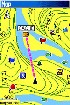
Some MapSource Map Software
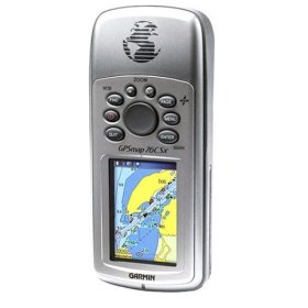
Garmin GPSMap 76CSx Handheld GPS Navigator
|
GPS 12 | GPS V | GPSMap 76CSx | Why Three GPSr's? | Palm m100 | MapSource Software | Satellite Anntenna
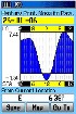
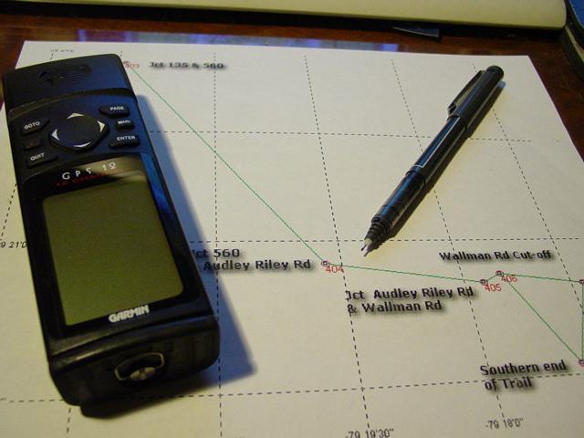
| Trip Data You may order a GPS unit or accessories online here. This will provide the high-tech navigation that makes moving in unfamiliar territory very easy. It should be remembered that GPS is very reliable when it is available. Just remember that batteries wear out, electronic devices can get broken or lost, and believe it or not, GPS can be unavailable either because of weather, war, or other conditions that make the satellite signals difficult or impossible to receive. You should still have a compass and good maps in your vehicle. TopoZone and Trip Planning Combine this with TopoZone.com and you can really get your trips laid out and your route planned in advance. I have gone to many trails that I have never been to before, and so far (knock on wood) have not gotten lost. I just sit down, go to TopoZone, locate the trail from whatever info I have (sometimes nothing more than a street name, or landmark name, and a state), then mark the trail entrance, trail junctions, and any other landmarks (like a river crossing or a mountain summit). With this loaded into the GPS, I can tell if I am near a turn, then with my DeLorme map (or printouts from TopoZone), I can orient myself and stay on course. The track lets me backtrack out if things get too hairy... |
||||||||||||||||||||||||||||||||||||||||||||||||||||||||
|
GPS Data GPS Waypoints and Map Coordinates for all of my trips are available on this web site. Each trip report has GPS info associated with it. Sample GPS Data Page
GPS Waypoints Green Ridge State Park Waypoint List
Trip
Reports (Note: Actual GPS data pages will contain live links to actual trail
reports
GPS Waypoint Data Green Ridge State Park Waypoint List Purchase
GPS Waypoint
data and access to topographic maps
|
GPS 12 | GPS V | GPSMap 76CSx | Why Three GPSr's? | Palm m100 | MapSource Software | Satellite Anntenna
Return to Jeep Specs Page
Photos, Layout and
Design © 2001, 2002, 2003, 2004, 2005, 2006, 2007 Paul M.
Provencher All Rights Reserved.
Contents of this Web Site may not be used without written permission
Visitors since 5/29/07