Due to the number
of images and the length of the narrative, this trail log is broken into several pages.
Prologue
and Muster | Trail/First Climb
| Lunch |
Second Climb |
Third
Climb | Fourth Climb |
Bump in the Road |
Meadow Knob |
Last Hurrah!
Prologue
It was time to go on a trail
ride. I looked at the calendar and noticed that the days following Christmas were
available. I kicked around some dates with Carl, Jim, and since he was coming to
visit, my father. We ended up deciding that Saturday the 27th was the best.
Ironically, it turned out that I had gone on
a
trail ride on exactly the same date two years ago. Steve V-B and I had gone up
Flagpole Knob via FR225. We reached the summit by 1:30 pm and subsequently descended
via Dunkle Hollow and then ran Kephart. It sounded like a good route to repeat and
with the anniversary date, I decided to call the run the "Second Tri-Annual Top of
Harrisonburg Ridge Run". A big name for a little stocker run. I posted
the ride info on the OCC and GWNF4WD message boards and started taking sign-ups.
About a week to go, I got
some feedback via one of the message boards:
"Flag Pole
Knob has about 8 inches of snow on it. The layer underneath the snow is pretty much a
sheet of ice. I would not recommend hitting it without chains or studded tires. We had to
turn around after just not being able to make it up the solid sheet of ice on the steep
hill leading to the field. - TJ"
This meant that what is
usually a pretty easy trail with only two spots that are even moderately challenging would
be a bit more challenging. I did some poking into this report and found out that the
hill in question was one of two spots that are fairly long and steep but usually not a
problem. It was certain that if we found conditions as described, we would be
turning around to come back down the way we had come in. I was willing to accept
that since the view up to this point was still worth the trip. The weather leading
into the weekend was warm so I expected some of the snow and perhaps ice would abate.
I posted a notice announcing
the conditions and warning that things would not be as easy as first thought, but that
stock vehicles were still welcome. The sign-up sheet continued to grow and by the
time we were set to go, we had 20 people signed up. This was going to be a
large group. Everyone indicated a high level of readiness, so I decided we'd give it
a try. I also pushed back the start time so I would be able to pick up my father and
go have breakfast with him and the kids. I am sure that many folks were very glad to
start an hour later. Fortunately, our activities on the trail did not get so out of
control that I regretted this decision, but it was close...
Muster
My father and mother were
staying out in Harper's Ferry with friends and wanted to eat breakfast in a small
restaurant near there. So at 5:00am, my kids and I set out to pick him up. By
6:10 am we had picked him up and gone to the restaurant. It was closed so we took a
cross-country route to Leesburg and stopped at the IHOP for breakfast.
Once we finished up there,
we shot down Route 15 to Route 66 and thence to the Wendy's where everyone was
meeting.


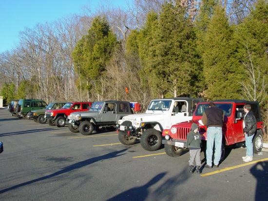


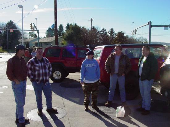
I arrived just in time,
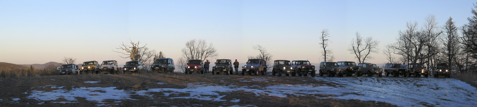
about 8:30am and found 14 vehicles and many more people ready to go. I gassed up,
and soon we were formed up in a column traveling West on Route 66.
We motored non-stop to the
Sheetz in Harrisonburg where we hooked up with a half-dozen or so more vehicles.


Once we had taken on
supplies and fuel, we reformed the column and got on Route 33 headed West. We snaked
through downtown Harrisonburg. Somewhere along the way we lost Charles, so Carl went
back and retrieved him. After a bit we reached a good spot on Union Springs/FR225
and stopped to air down, disconnect, and have a brief driver's meeting. It should be
noted that this popular spot has been heavily modified to prevent access to the hill.


I don't usually do anything
formal for a drivers meeting. But with the reports of trail conditions being
sub-optimal and the ride being billed as a "stocker run", I wanted everyone to
know that the entire group was staying together no matter what, and that if any obstacle
was more than an individual wanted to tackle, we'd all turn back as a group.
There aren't really any
obstacles on this trail under normal conditions. But if we encountered something
tough because of the snow and ice, we'd not have a bypass at our disposal. This was
going to be "reality 4-wheeling". We were trying to reach the summit of
Flagpole Knob and there was only one way to get there. If it was too much for any
one person, we would not be forcing them to take chances and risk their vehicle or
personal safety. We thought this would be a sunny ride up a dirt road with a little
bit of ice here and there. We got more than we bargained for...
Continue
to the Trail ...
Prologue
and Muster | Trail/First Climb
| Lunch |
Second Climb |
Third
Climb | Fourth Climb |
Bump in the Road |
Meadow Knob |
Last Hurrah!