Please note: The stream crossings shown are no longer open for motorized traffic. Please stay on the bridges.
Prologue
This trip started out with planning for a two-day weekend in West Virginia. After I had done some research, I started calculating the time that would be devoted to the activities. It turned out that due to the travel distance, very little time would be available for any kind of exploring. And with the weather being very winter-like, there was a good chance that most, if not all the trails we were seeking could be difficult or impossible to travel. So I reluctantly decided that a two-day weekend would be skipped in favor of a one day trip to something closer.
About the time that I was reaching this conclusion, another group had made plans to go riding out near Rapidan Wildlife Management Area. They had some more difficult terrain in mind, and suggested 31-inch tires and lockers. Since I have neither, and since trail carnage was not my goal, I decided not to go on that ride, but thought that it might be good to revisit this area again, especially since it is so close, and even with some snow, might still be possible without any carnage.
Originally I started out with four people expressing interest but by the time we finalized the trip everyone but Jim C. and I had found their schedules full. So Jim and I made plans to meet.
Muster
I left Route 66 and headed down Route 29. I stopped for a quick topping of gas, and met Jim at the junction of Routes 29 and 15 just south of Route 66 near Gainesville, VA. He was there when I came along, we exchanged some chatter on the CB and headed to the trail head. Just before we reached the trail, we topped up again, and I bought some food for lunch.
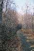
Trail
After missing a couple turns, I got myself off auto-pilot and we got on track and made it to the trail. We drove up the road a few hundred yards, disconnected, and aired down. Since the last time we came, it looks like the area just off pavement has been cleared in preparation for some kind of development.
I was fortunate to be able to remove my sway-bar connectors easily. Jim spent a couple minutes on his and had much better luck once he used some WD-40. The air coming out of the tires made me wish for some Oasis deflators... Oh well, Christmas is coming.
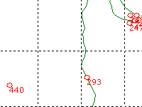
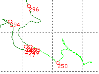
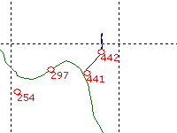
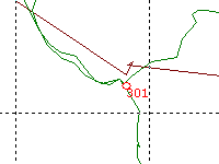
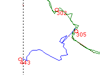
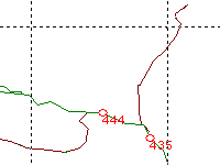
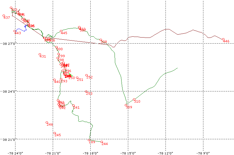
Once all this was done, we started up the trail. I had retrieved my GPS track log from the last trip out here and uploaded back into my GPS. My plan was to use it to keep me on the trail, and to add to it with any new trail branches that we explored this time out. That worked out pretty well. There were not that many trail branches open to us, but there were a few turns that we took for the first time that can be seen on the map.
Last time I was disappointed by how "easy" the trail was. Generally speaking, the trail wasn't any harder. But the surface had a strange quality. I want to describe it as the off-road version of "black ice". For highway drivers, black ice is just moisture that has frozen on the pavement but may not be visible. The unwitting driver happens along and, if the surface is not level, or if the road takes a bend, the car tends to go places not planned by the driver. This can lead to some bad outcomes (guard-rails, ditches, roll-overs, etc.) On the trail, we found what looked like packed dirt, with ruts and tire marks that looked recent. In reality, the surface was a 1/4-inch thick coating of mud that looks like packed dirt, and underneath, frozen dirt. The result is just as bad as black ice.
Since no one had traveled the trail for at least a few days, there were no fresh muddy tracks to clue us in. I noticed it as a slippery feeling when we first started out. Later, it was the primary reason for us turning back, part-way down a steep slope. More about that later...
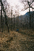
We continued up the trail, noting closed trail branches. Most, if not all of the property on either side of the trail is private and most access is prevented by gates and the ever-present "NO HUNTING, FISHING, TRESPASSING" signs.
There were several puddles that had frozen over with ice. We could tell no one had been through this morning because the ice broke as soon as we drove over it.
While looking at one of these side-trails, we were overtaken by a hunter. Since he was traveling slow and I was out of the Jeep, I waved. He stopped and we talked. He told us that the trail was private, the land was private, and related his concern about the Jeep clubs ruining the road with their big tires. He pointed to Jim's '31's. I was amused to notice that he had the same exact '31's on his F-150 but thought better of commenting. Instead we passed the time of day. I admired the beauty of the area, asked about how his hunting was going (he had a rifle with scope on the front seat and a couple dogs in a kennel in the back). He also told us there was a $2500 fine and 12 months in jail for trespassing. The hunting book he show me to illustrate this clarified that this was not simply for trespassing, but for HUNTING on private property without permission of the landowner. So again, he was stretching the truth a little. It didn't really matter because we were not trespassing on any private property and the trail itself is a county road. Eventually he talked himself out and left us. A little way down the trail we passed him walking two small pups who were probably out on a training hike.
Not long after this we found another trail heading off to the left and down a steep hill. The entrance has a portion that's about 27 degrees off-camber. While not comfortable, we had no trouble going past this and down the hill.
We came to an electric fence that separated the trail from a field that opens up just below.
So we made 30-point turns and climbed back up the hill. It was steep enough that it was challenging but not so steep that it was impossible. Only one spot other than the off-camber section posed any concern - a shelf that drops off between two trees. Here, it is just high enough that I was concerned about being able to get up onto it coming back uphill. When I got to it, I just bumped up on it and used a little momentum to get over it. Past that it was pretty easy to get back to the main trail.
Eventually we came to a trail junction of sorts. The trail continues Northwest and another branch goes to the East to Gallihugh Mountain. Since it was close to lunch time, we decided to find a high point to stop and eat.
A trail branching off from this intersection went up into the woods towards a higher elevation so we decided to see if that would take us to good lunch spot. Once we climbed the initial portion, the trail incline tamed down a little but the trail got gradually more narrow until we reached a fallen log that had been sawn just enough for ATV or foot traffic. Jim walked beyond this point and returned to report that the trail continued to narrow with more fallen obstacles. So we did a couple 44-point turns and headed out the way we came.
Back on the main trail, we decided to return to the Gallihugh Mountain branch after lunch and then went up to a branch off to the left that took us to a nice overlook. We stopped and ate lunch.
After lunch we started to continue on this but it soon narrowed down too much for us to continue.
I suspect it is the other end of the first side trail that we explored. So we backtracked to the main trail and headed back to the trail junction and down the trail towards Gallihugh Mountain.
Part-way down, the "brown ice" made its reappearance. The Jeep was sliding down the hill faster than the wheels were turning. I found that I had to apply the gas to get the wheels turning fast enough to keep up, and thereby regain some control over my direction of travel. I was able to get it reigned in and pulled over without totally losing control and without hitting anything. I wasn't even that shook up, but I realized that if the trail was any more tricky, it could have been a lot worse. Fortunately Jim had stayed back a ways and was able to get to where I was without too much drama.
We drove through the saddle between the mountains and found what looked like a logging operation to our left. So I turned up into it and followed the trail up the hill until, once again, I started to feel that "greasy" feeling. It was very difficult to get turned around without sliding sideways on this moderate slope. I was very relieved to be facing down hill and still be right-side-up.
Jim wanted to see how far he could make it up the hill and went a little further than I dared. And he too lost traction and started to slide back and sideways. He ended up backing his way down, going pretty much where gravity wanted him to go. We had to clear some downed branches so he could continue backing down the hill, and get turned around. It was a tense couple minutes before we were both able to back track out to the trail again. Just going back down where we had gone up was harder than expected, but no damage was recorded.
Back on the main trail we went several hundred yards further East. The slope increased and I found myself plowing along again, faster than my wheels were spinning. This time I was coming up on a switchback and knew there was no way I would make it. Fortunately the apex of the turn was graded and clear and I had a nice "landing zone" to slow down on. Once again Jim had stayed far enough back that disaster was avoided and we were both able to stop without any trouble. We negotiated the switchback and continued down. A little way beyond this, the trail took another turn to the left, with a right fork going back up hill. We stopped here to assess our situation. The uphill branch led to some private property so we didn't need to explore that. The downhill branch deteriorated even more than the ground we had covered, with some precipitous drops waiting for us to slide off the edge...
We decided to try and go back up the hill and, only failing that, would we attempt to continue down. I went first. I decided that momentum would be an element of my strategy. The way I saw it, there was very little in the way of traction, so crawling probably would not work very well. On top of that, my Pirelli Scorpions don't clear mud that well at slow speeds so I figured that if I wanted any traction, I was going to have to go fast enough to clear the tread of mud as I went. So I went up to the top of the uphill fork, turned around, and put the Jeep in 3rd (4-LO of course). Then I just stormed the hill.
My plan worked. I held pretty good traction, even if it was a little dicey here and there, threw lots of chunks of mud, and clawed my way to the top of the switchback where I decided to keep moving (sideways) around the corner and up the hill - no sense in losing momentum if I didn't have to. Once I got to an easier section, I eased up and went back to crawling in 2nd, talking to Jim on the CB, and watching for him to emerge from around the bend. He came up with no problem and we continued back up to the main trail junction. This was a fun side-trip but it was cut short by the conditions. Later this year when the surface firms up again, we'll have to follow it down to the main road.
With this excitement behind us, we continued along the main trail we had left earlier and soon came to a side trail that went down to the East, with a flat area at the bottom.
After checking to see if there was any brown ice, we descended to check it out. The hill was steep but did not present any real trouble. As straight as it is, it wasn't too bad. At the bottom we found signs of a campsite and a trail that continued off down the hill to the North. I decided to follow it down but soon came to some fallen logs and beyond that on foot, an extremely steep and narrow path not fit for Jeeps. I backed all the way out and we went back up to the main trail.
Not long after that we came to the entrance to Utz Hightop. It was gated and all we got to see was the fire tower sitting up on the hill. It looks fully operational and is probably used in the fire season. We took a couple pictures and kept going.
The main trail is easy but well eroded. With the brown ice still threatening to mess us up, and the ice puddles here and there, we took nothing for granted. We passed the spot where a large landslide had obliterated the trail. This had been repaired but was still very nerve-wracking. It is very narrow, and the drop is straight down. To add insult to injury, this section of the trail had more than its share of ice. I was glad to be past this.
But no sooner than I thought we were out of the woods, we came to a narrow spot that was badly eroded with a nasty drop on one side, and ice all the way across the trail! On the edge of the trail there was a low berm with some softball-sized rocks frozen to the ground and partially embedded in frozen mud. I wasn't sure they were support the weight of a 4400-pound Jeep sliding sideways on the ice. But the ice patch was not very long and we could tell that at least one axle would be over dirt at all times. So Jim spotted for me and guided my passenger side wheels right up against the berm (so I would not be able to slide sideways) and I crossed without any hint of slipping. I did the same for Jim and we moved on.
Just around the corner we came face to face with a red Wrangler coming up the trail. Even though he had the right of way, he backed down a good ways to a switchback where there was room for us to get past. I stopped and greeted them. The passenger decided she'd had enough when I told her of the ice up ahead. I commented that it was passable and beyond that, it was pretty good going (provided you stayed on the main trail...).
So we went past and pulled up ahead when Jim announced that they had turned around and were now following us. When they pulled up we talked some more. They had decided to turn around. It was probably a good idea. They were alone; did not appear to have any recovery gear or provisions, and maybe the final deciding factor, were running stock tires that might not have worked for everything that lay ahead even on the main trail. I invited them to visit this web site and contact me for info about the club. I hope to see them in the future and give my thanks for letting us by - we would have had to back up over the ice patch if they kept the right-of-way they were entitled to!
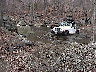
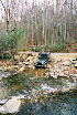
Once they passed, I poured some coffee and then we drove the little ways to where the Rapidan Wildlife Management Area starts and this trail ends. We kept rolling and drove on up to the first bridge/ford. The road up until this point (and well beyond) is frequented by all manner of vehicles so no special comment is required.
At the first ford, I went down and crossed. On the other side I thought I would get cute and pose on a rock with my front wheel. It was a bad idea and I tweaked my bumper in the process.
Jim said "Good excuse for a new bumper." Later, at home, I would fix it instead, using the clamping power of my Hi-Lift jack and a couple of pieces of wood as spacers and to protect against clamp marks. Still, I regret damaging it. There was no reason to put a tire on the rock and I should have been happy that I could cross the river. Jim came through and had several bangs and clunks before reaching the other side. He found that he had dented one of his rear control arm brackets. "Good excuse for a long-arm suspension", he said.
Just on the other side is a road that goes around the side of the mountain. We started up the road and were passed by a pick-up traveling in the opposite direction, loaded with freshly cut logs. We thought it strange but figured that they probably belonged there and it boded well for our ability to pass the road where they came from. Well that pretty much was the case except the small matter of the gate that barred further travel.
It was so narrow at the gate that we had to back down a good ways to a switchback that had some space for parking. We took a snack break there. I managed to step in a dog's bowel movement. My Vibram-lugged soles did a great job of keeping this aromatic mess embedded until I found a stream to rinse it away.
Prevented from any more westerly travel along this route, we back-tracked to the main road and went further North.
We navigated the second ford without incident. Along the way we found a trail off to the right side that was not gated or otherwise labeled. We followed it into the woods and up the mountain a short distance.
After a nice little hill, it dead-ended at a nice campsite. We took some pictures on the way in and out, and returned to the main road. Continuing roughly north on the main road, we reached the gate that closes the trail off from Hoover Camp. A quick turn around and we were headed back.
On the right we spotted a campsite that had a river ford and beyond, a trail that went up into the woods. I crossed the ford that was relatively deep.
Jim followed and we went to the end of the trail. It continues up the convergence of two ridges but several large fallen trees prevent driving. Indeed, walking was not without problems. So we doubled back and followed the road back to pavement.
Epilogue
Once we got down in the valley, we stopped to connect our sway bars. It was messy business, with the mud covering everything. It was cold and it was getting dark. And the road did not have a shoulder so we silently agreed to save the airing up for a gas station.
When we reached Route 609, we took it to Route 29, rather than the more easterly route followed the last time we came out here. Somewhere along the way we stopped at a Sheetz and got gas and air. Then we stopped in Manassas off Route 234 for Chinese food and the Jeep Wash.
The Jeep wash was great - once I relocated it. This would be the third time I've been to this one so it was kind of embarrassing that I drove right past it... I was surprised and pleased that the unfriendly sign had been removed. It took longer than usual to get clean, even when I thought I had done a good job, the sun came up the next day and showed me a Jeep still not clean enough. We finished that went to eat. The Chinese food was good.
This trip was great. We covered some old territory and some new side-trails. We found it easy to respect the "Keep Out" signs and still had fun.
Back to Off Road Index
Shop for Jeep Toys and Books | See the Toy Jeeps
Blakey Ridge / Rapidan Wildlife Management Area GPS Data
Update 1/5/2008: GPS Data now provided in GPX format for easy transfer to your GPS!
Purchase GPS Waypoint data and access to topographic maps of this trail using Pay Pal!
GPS Waypoint data is now available for a moderate fee ($10.00 U.S.).
This contribution allows us to maintain this web site, collect and maintain GPS waypoint data, and periodically verify its accuracy. All GPS Waypoints have been verified in the field.
If you would like to purchase the coordinates for this trail, simply complete the two questions below and click "Buy Now" to pay for your purchase using Pay Pal.
For a free sample of how our GPS data is presented to our customers, click here.
Photos, Layout and Design
© 2001-2008 Paul M. Provencher All Rights Reserved.
Contents of this Web Site may not be used without written permission.
Visits Since 1/12/2002
Last Updated 02/09/2008 10:49:46 AM -0500
1074 4/6/06


