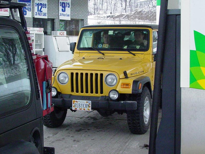
After my fingers started working again,
we backtracked a short ways to the trail entrance. We braved a small drift and found
the gate open. From here we were blazing trail - nobody had cut tracks yet.
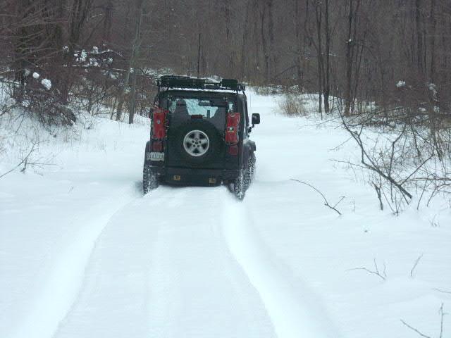
Fresh snow! Right away I could see
that we'd have to be careful not to go past a point that we would later have trouble
climbing back up. Mike later told me that he would not have even started going down
the hill in the first place. It reminded me of my first trip with the TJ in
March 2001 when we drove up Second
Mountain and I followed with blind faith the people in front of me through mud holes I
would never have considered.


The trail got steeper but I found that I
was not slipping and could feel positive feedback so determined that we would probably
have no trouble coming back up later. Just the same I modified my trail clock to
restrict us to one hour of travel downhill, leaving a generous five hours to return up the
hill and still have daylight.

I reasoned that we'd need every minute of
it if we ran into troubles and had to start winching at a rate of 8 feet a minute...
Since I've been on the trail twice, I had
some good GPS data and considerable time with the map. I also had the benefit of
time on the trail so I was quite familiar with the routes we had traveled last year at
this time.
I was less certain of the lower area that
Hugh and I had visited in April of 2001. The main reason for that was that I did not
have GPS data, there are lots of side trails, and frankly, I wasn't paying close enough
attention that day. I had a suspicion where we had been, and I knew for certain
where we had ended up down at the bottom because of several distinct landmarks that showed
on the topo maps. But our 2002 trip had failed to find the correct trail. I
was hoping to correct that today, but was coming to the conclusion that our severe time
limit might make that impossible. The conditions just weren't something I wanted to
take lightly, especially with only two vehicles on hand.


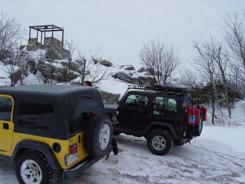
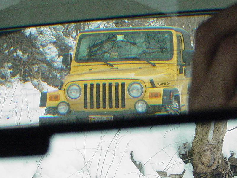
We reached the same trail branch as last
trip and I made a brief foray into an area that turned out to be a false start. I
back-tracked out while Mike tried to do a donut in the clearing.
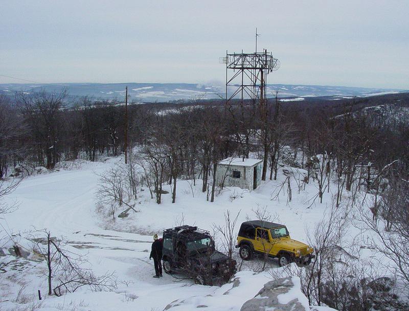
This is where the trail ride
ceased being a stocker run and started being a "lockers only" run.
As we started descending to the dead-end we had visited last time I had a hunch that
getting back up was going to be troublesome. I wasn't worried we'd get out - I was
just concerned how long it would take. We reached the bottom of the trail in about
ten minutes. We took a quick break and then I suggested Mike take the point and go
back up the hill to the clearing.


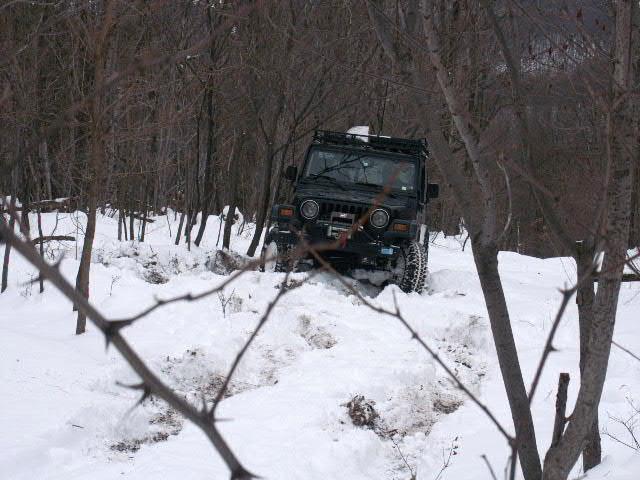
The very bottom of the hill
was littered with small boulders hidden by the snow, and a rut that made the approach into
a kind of a "V" that forced you up against the boulders. Mike got snagged
at first and had to back off and make another swipe at it. He managed to get by
pretty cleanly and sawed his front wheels all the way up the hill and out of sight.
It was clearly one of those hills that you don't stop half-way up. When he was
pretty much out of view, I started moving.
Right away the boulders at
the bottom gave me fits. As soon as I got to them, all forward progress stopped.
I had to make several attempts at it until I was going just fast enough to hump
over them but not so fast that I'd break something. I was rewarded with success and
soon was able to reach the top and the clearing, having caught up to Mike a little way
from the top, where he was working a rough spot in the trail. It had taken us 20
minutes to get back up - roughly twice as long as it had taken to go down.


We stopped here for lunch.
While we were eating we talked some and I suggested that we drive a bit more but
keep in mind that we'd probably be heading back up and out in half an hour or so, if we
encountered more tough going. I wasn't too concerned about the climb back up from
here but the trip to Flagpole and our retreat
in the darkness a few weeks ago was still fresh in my mind and I had no intention of
repeating that again anytime soon.
After lunch, we tried the
next branch and soon ran out of trail, though the main reason for stopping was mainly that
the trail needed a little cleaning and it was too cold to break out the chain saw and bow
saws and start in with that business. It would have been futile anyway
because the trail was headed straight for the sheer face of the ridge several hundred feet
straight up. Let's face it - my winch cable just isn't long enough!
We got turned around and
doubled back a short way to another spur. I walked it off a few yards and found it
too was growing in and pointless. I returned to the Jeep and we headed back the way
we had come. When we got to the main trail I felt that we still had some time and
suggested we turn down the next lowest trail spur and head down a little further.
Somewhere along the way I exercised a limb loper on some twigs that had come down and
blocked the trail.
This is where things started
to get interesting. I could tell that this was the section of trail that Hugh and I
had traveled that first time out and knew that it would be making a sharp descent in a
couple spots. I also knew there was one dead end that we had encountered. I
didn't want to waste time going down that dead end. So I took a little extra time at
the trail junctions looking at the map to make sure we took the correct branch.
We managed to avoid the dead
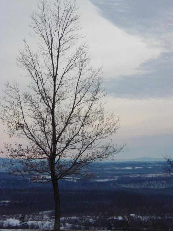
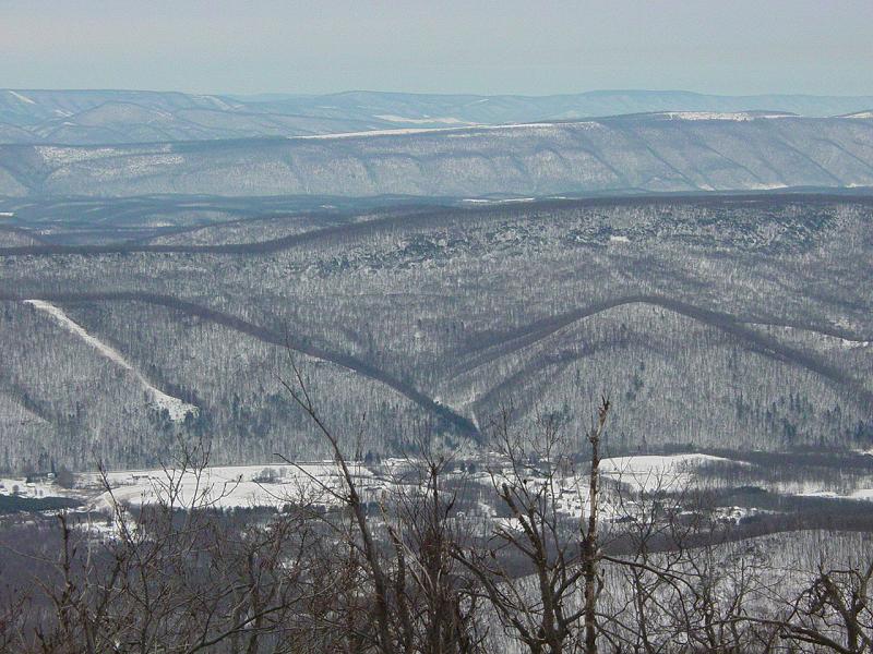
end and travel roughly north along the side of the ridge line. The view was
fantastic but I let John take care of that while I kept the Jeep from getting more
familiar with the several hundred-foot drop to my right. Soon we started a series of
switchbacks that eventually lead to a multi-pronged branch.
One branch went straight
down like a black-diamond ski trail. We weren't going there... The trail
continued a little further and started a descent that curved steeply and switched
back. Walking it off on foot, it became clear that these were the trails we'd
traveled. It also became clear that today was not the day to go any
further. Both were too steep and I am certain we would not have been able to climb
back up them. In the interest of sleeping in a warm bed that night, I reluctantly
decided to turn around and head back to the the road. I figured that we'd probably
have plenty to keep us occupied for at least another two hours anyway, and a life-or-death
epic was not necessary for us to have "fun".
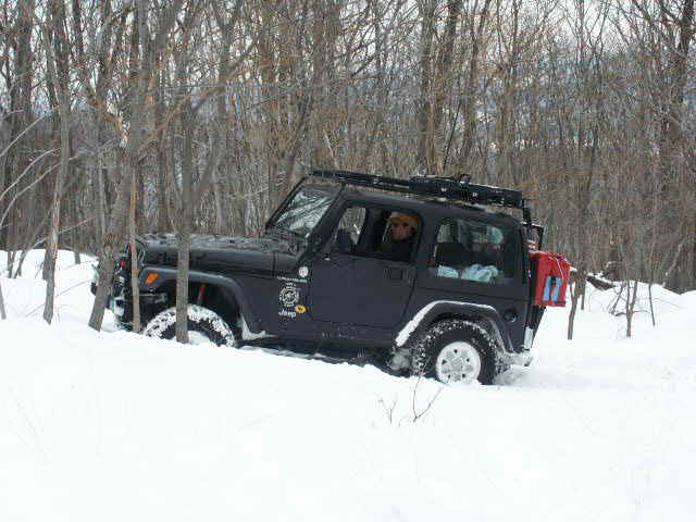
As Mike had not yet
descended down this, I simply warned him to be careful not to slide off onto the trail
branch that pointed straight down the hill. I wasn't sure but it looked like once on
it, there would only be one direction of travel: DOWN! He got backed up and
turned around and headed out of sight. Since I had passed the "death
trail" before stopping, I had to back up past it to get back to a place where I could
turn around. The trail I was on emptied into it and as I passed, I got sucked down
into it. I found myself all twisted up in the trees and brush, but fortunately not
sliding uncontrollably down the hill, and with no damage to the vehicle or contents.
But I was not getting out easily...
Since I still had a tenuous
grip on the main trail, I "crabbed" the Jeep sideways by sawing the steering
wheel to-and-fro a few times. This got me to a place where I managed to back up
almost to the trail, but the trees on the high side soon got in the way. I tried to
go forward a bit and get my rear pointed in the right direction to go past the funnel
sucking the Jeep downhill.
It didn't work and I ended
up 20 or 30 feet down the steep hill. I tried but could not back up. In about
15 feet the trail get even steeper, and I had serious doubts that I would be able to keep
the Jeep from going out of control. So I shut it off and got out for a minute to
collect my thoughts and decide what I was going to do. Mike and his family had been
called on the CB and showed up on foot for the fun a few minutes later.

With my nose pointed
straight downhill and my winch on that end of the vehicle, I was not going to be able to
use it to get out of this unless I got the Jeep turned around. My first thought was
to anchor the winch to a tree off to one side or the other and drag the front of the Jeep
around at a 90 degree angle to the hill but that quickly got thrown out. I noticed a
small area that I might be able to nose into and get turned around.
In order to do it, I was
going to have to rely on a loss of traction, and some gravity to swing the back end of the
Jeep around. Controlled loss of control. A lot like riding a sled down a steep
hill. You get to pick where you want to go, but only in the most general sense.
I got in the Jeep, nosed it
into the spot, then broke loose the back wheels just enough that the rear end of the Jeep
slid all the way around and got me facing up hill. A pirouette on a slippery
slope... It was not as bad as I had expected, but I did have to pry the car seat out
of the crack of my...never mind.


Next we got the winch fired
up and John pulled cable up the hill to a good-sized tree straight ahead.

He got to the tree with a
few feet of cable left to spare. We put a strap around the tree, rigged cable and
then put tension on it and started winching. Mike and his wife took all the pictures
from here on out. As I told them later, my sphere of awareness was concentrated on
the alternator gauge, the winch cable, and a measure of forward motion.

I stopped a couple times to
let the battery recover and we re-rigged the cable once to deal with it piling up to one
side of the spool. When I got to the top of the spur, we ran the cable to another
tree 30 feet up the main trail and continued winching until I had enough traction to
drive.

Then Mike and his wife
started walking back to their Jeep while John and I re-spooled the cable and stowed the
gear. Then we started up the trail with the intent of continuing to pavement.
It went great even though we
had to make a couple runs to get past a few spots. The winch stayed spooled for the
rest of the day, but I was very thankful that it was up there when we needed it. We
used momentum to make it up one troublesome spot and John remarked that the ride was like
that of a mechanical bull. I thought that summed it up pretty well!
The last stretch up to the
top was uneventful and quite pretty. Mike let me go ahead.
Despite the cold, it was a
great trip in the woods. I regret that I didn't take more pictures but the driving
(and winching) really consumed me this time out. At the top of the trail we came
upon the game warden who was laying in wait for any illegal ATV drivers who might come
along.
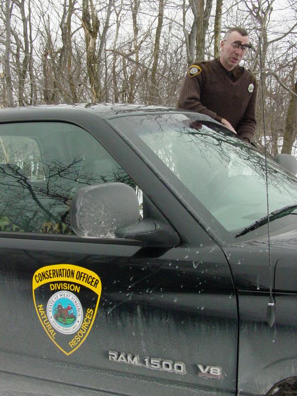
He had decided not to follow
our tracks down the hill for fear of not making it out... I think his fears were
well founded as we barely made it out in a couple spots and I attribute our success to
lockers and gnarly tires. I can't say for sure if the game warden's Dodge RAM 1500
has lockers or not, but his A/T's only had about 4/32's of tread depth left - definitely
not great snow tread.
We had a nice visit with
him. He confirmed that the trails were legal for us, but commented that he would
like to see them closed because it would make it better for the hunters...