Prologue
GWNF is a great place to go
trail riding. But after a couple years of going there, I was interested in going
elsewhere. I thought about what's open this time of year and realized there were not
many choices. I didn't want to chance State Line; Peter's Mill is a waste,
except maybe in a blizzard; and Green Ridge, for all practical purposes was just as pretty
but unchallenging.
Then I remembered
Nightingale Pond, back behind Dan's Mountain, near Barton. And Pinnacle near the
Allegany Wildlife Management Area in Keyser. When I started looking back, I found
that Hugh and I last went out there on December 16,
2001! I was surprised to see that it had been a little over a year since our
last visit. That would need to be corrected.
Carl and Jim had gone out
there on a snow run without me and had a good time. It's the kind of trail system
that is very pretty but not hard. Fortunately I expected snow in that area and was
hoping it would be interesting...
The
first time Hugh and I went out to Keyser, we managed
to go around to the northwestern section of the wildlife management area and explore a
couple trails near the Pinnacle lookout tower. But we ran low on time, our travel
companions were losing interest, and we decided to bag it. I was still interested in
seeing what those trails had to offer. I spent considerable time studying the maps
and found that the trails below Pinnacle theoretically connect to the trails near the gas
wells through a tenuous connection to the trail that runs down the steep hill that Hugh
and I could see from the bottom of the hill we descended last time out. I suspected
that the hill was very steep and probably a challenging, dangerous thing to attempt.
I resolved that this trip would investigate these theories and also explore the connection
if everything fell together.
On a side note, my
Indoor/Outdoor thermometer had been acting up so I decided it was
time for a new one. After some experimentation
with the probe placement, I was able to get the readings to be reliable and
accurate. The difficulty comes from locating a spot outside the Jeep that is away
from engine heat and also out of harms way. I finally located the outdoor probe
behind the front bumper. The main reason for mentioning the thermometer is because
of the nature of the weather we had on our trip...
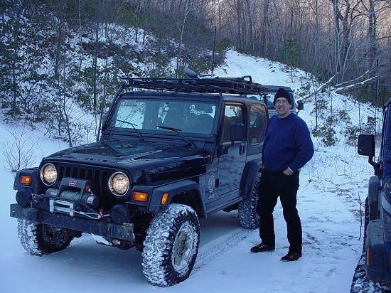
Muster
I wrote to our little band
and attempted to entice Jim, Carl and Hugh into the trip. Carl was quick to sign up,
Jim had to pass, and Hugh did not check back in until Saturday night. I finally sent
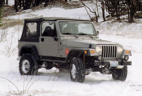
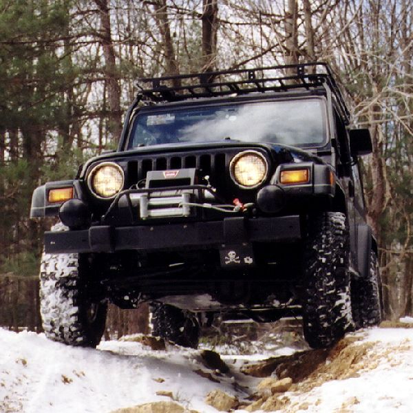
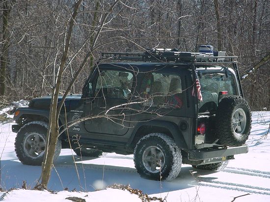
out a picture in hopes of teasing Hugh into coming along.

He took the bait and soon we
had made arrangements to meet at the trail head. I love the
GPS. I simply gave Hugh the waypoint for the trail
entrance, told him we'd be there at 10:00am and let nature take its course.
Carl and I met a couple
minutes after 7:00am, rolling on route 270 North. We conversed all the way up to
Frederick where we stopped at Sheetz to top up our tanks, and indulge Teddy and Tomi in
the purchase of "caandy" and drinks for the trail. With these items
suitably stowed, we jumped onto Route 70 and headed West.

The drive out included a
stop at Sideling hill where we visited the facilities and took in the view.

At this point I should
probably mention the temperature. It started out at 6:00am at 16 degrees (F) and by
the time we got to Sideling Hill at
about 8:00am, it had climbed to 17 degrees (F). Yes, it was darn cold out
there. I managed to get the kids to wear their thermal underwear and am eternally
grateful that they did. Combined with the other layers and good footwear and
overcoats, we managed to keep everything nice and warm all day, with the possible
exception of faces and lower ear-lobes.


Carl and I drove directly to
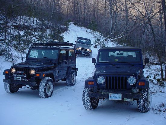
the trail entrance for Nightingale Pond, arrived at the stroke of 10:00 as planned and
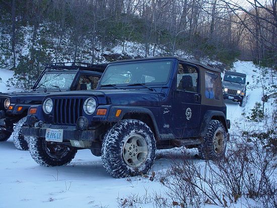
found Hugh and Shea, who had just arrived, waiting for us at the appointed mark.
This is cool! A few minutes before we came into sight, Hugh raised me on the cell
phone. This is nothing like the old days of no cell phones and no GPS! I can
only imagine the hit-or-miss experience we might have had.
Trail
Nightingale's Pond / Dan's Mountain
We drove up the road to the trail proper.
The road winds up the side of the mountain and passes several rural farm houses and
a strip mine. It's quite pretty and, with the sun shining and the air so crisp, we
catch several good views on the way up.
When we get to the trail, I pulled in a
few yards to get out of the way of the road. I figured I would go up a ways but soon
drove into a deep mud puddle and decided it would be better to air down and disconnect
before getting into any serious wheeling...


I popped on my
Trailhead Automatic Tire Deflators and
disconnected my swaybar. The time spend the day
before cleaning up my sway bar disconnect and gloves was rewarded with a relatively easy
time. But Tomi decided that things were going too well.
The boys like to squabble. From
time to time it gets a little out of hand, but most of the time they settle it between
themselves and I don't need to get involved. I have started to turn a deaf ear to
these episodes and don't hardly notice the noise that goes with it. So I was sort of
tuning out the noise along these lines when something sounded a little more urgent.
I turned around to find that Tomi had found his way into the frozen mud puddle and now had
one water-logged boot and wet pants on one leg all the way to his knee.
In the summer, I would say "So
what?". But unfortunately, in 20-degree weather, with a good wind, things like
this lead to problems really fast. So Tomi got strapped into the Jeep (running with
the heat on, nice and warm) and his sock and boot got placed strategically near the foot
heat outlet up front. He was to stay in the Jeep with one bare foot until his shoe
and sock dried (about 2 hours). I felt bad for him, but as I had specifically asked
him to stay OUT of the mud puddle, this served both as punishment and precaution. I
do not relish the prospect of frostbite in a child of 3.
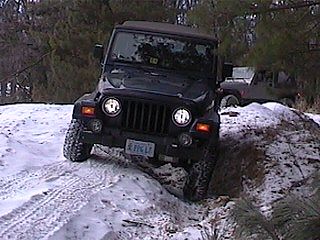
With everyone aired down and me, a bit
miffed that we had to start this way, we headed up the trail. Right from the
beginning it was clear that someone had spent some time on the trail. There were
tracks, covered by new-fallen snow, and evidence of much trail maintenance work in the
form of cleaned-up branches and so on.
We came to the
little hill climb that we had enjoyed on
previous trips. We were disappointed to find that several large trees had been
knocked down in the same storm that had necessitated the clean-up, and they had been left
in a down position, blocking the hill.
Next we turned left at the "T"
and went up the hill, past the famous
Mud Hole
of Hugh, while listening to the man himself tell his tale of humiliation and
woe. All this while flexing wildly over an erosion cut.


Then we came to
the section that was completely impassable the
first time we checked it out. It was deep and muddy... On this ride, it
was barely visible and we were all able to drive on the side and get through without any
problems. This soon led us to some fallen trees that needed clearing.
We cut up some fallen trees, I using the
new saw, courtesy of my Father at Christmas. I finally gave up using my little saw
that worked well but was just too small for as often as it gets used. Past these
trees, we came to a small hill and a snow drift.
I drove up onto the hill and down onto
the snow drift. I punched through but was able to get back up on the snow and out
into a nice meadow. The rest of the group followed but Carl found that the snow
drift had been crunched through by me and Hugh and was now difficult to get past. A
couple of runs and he was over it, and joined us in the field to play in the snow.


We spent some time driving into drifts,
up hills (Carl and I flaunted our lockers and Hugh
bemoaned the lack of same).


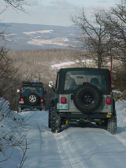
The we took a break to check out the
view, and more or less headed back the way we came. This is where the pace slowed
somewhat.


First Hugh decided that perhaps he could
go around the snow drift and through the woods back to the trail. He ended up
punching through the snow and got up against a tree. Thinking I could get back
through the snow drift and up over the hill, I went right to it. I ended up high
centered on the remaining frozen portion of the snow drift.
Carl tried to give me
the strap and found that he did not have traction. When he hit his switch for the
ARB's, he got nothing. He was "open" front and rear. Man, I am so
glad my Detroits don't do that... But he did manage to get me out of the drift.
I tried again to get over the hill by
going around the side of the drift and attacking the hill from the side. It didn't
work and I found myself stuck once again.
So Carl got into trying to figure out
what was the problem with his ARB's. I got to trying to help Hugh, and did so by
flexing his soft-top bows away from the tree as he humped past, then got deeper
stuck and admitted defeat. I figured I was now to winch myself up over the hill and
through the drift.
About this time, Hugh got tough and broke
free of whatever was holding him. A tree removed his fender extension on his
passenger side, and later he discovered that he'd dented his fender! Meanwhile, I
tried a different line on the hill and drift and almost made it. Almost. By
now I was too deep for help and switched the strap to the uphill side and Hugh.
By now we are feeling pretty
dysfunctional. It just gets better. The top of the hill where Hugh would be
trying to pull me is sheer ice. It didn't look very promising but he offered to try
anyway. Teddy had gotten restless so I let him out of the Jeep. We didn't
appear to be going anywhere very quickly and I saw no harm in it.
We put the strap on my Jeep and Hugh gave
me a couple of good solid pulls. Between him and me, I clambered over the hill and
around the drift. I stopped on the top of the hill to take the strap off. Hugh
noticed that his left-rear tire was nearly flat as a result of this air-down device
breaking off the valve stem. So I cranked up the compressor (Carl had just diagnosed
his is down due to a blown fuse) and air Hugh's tire back up.
It's at this point that I remark to Hugh
how remarkably calm and unflustered we remain. Consider this: It is in the low
20's out, we are out in the middle of nowhere; we have been stuck, had equipment
failure, and just fixed a flat tire. And it was all nothing to us. The reason
of course is that we are prepared. We have straps. We have on-board air.
We have winches if it comes to that. Well, Carl finds he does not have the required
30-amp fuse, but lockers are optional, right Carl? We even have pretty much
everything we'd need to set up camp and spend a pretty survivable night. Would it be
fun? No. But we would not be popsicles in the morning. Of course, it
does not come to that.
So Carl gives the hill a shot, straight
over the snow drift. He ends up pretty much the same way as me. Only now there
is no-one down there to pull him back. And his lockers are out for want of a 30-amp
fuse. So I moved out of the way and Hugh gave Carl "the strap".
After a couple of good yanks, Carl claws up the hill and out of the drift.
From here, we back track the way we came.
I punched through the ice and opened up the mud hole going back, but everyone else
picks a slightly different path and we all got back out without getting stuck again.
We stopped to take pictures crossing the erosion on the way down to the
"T".


Continuing past the "T", we
went by Nightingale's Pond and along the road to pavement. We navigated some rough
spots and Hugh tried to tease us into watching him disappear beneath a 5-foot deep mud
hole. There were not takers so we continued on to the spring then backtracked to the
trail head.
Benefiting from following the GPS track I
recorded from the last trip out here, we wasted no time getting back on pavement (still
disconnected and aired down) and drove around to the entrance to Pinnacle Lookout Tower.

Along the way we talked about cheap land
and retreat cabins and the like. We passed
Westvaco, steaming with strong backlighting from the sun. it
looked like a rocket taking off.
Pinnacle
The turn-off to the trail was much as I
expected, although I do not recall as much illegal dumping as we observed on this trip.
The road was not recently traveled, but there were tracks from before the last
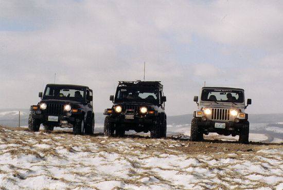
snow. We soon found ourselves parked at the top near the old lookout tower.


An abandoned and presumably stolen car
was there to greet us. In hindsight, I am surprised that none of us "ramped
it". There appear to be a few more radio towers here than before. Being
that it is winter, the smell of the dead dog is gone. Over all, this place is much
more pleasant that our last visit. But it is cold. Major Cold.
We dutifully climbed up the lookout tower, kids and all, looked around and then
retreated to the warmth of the Jeeps.


Check out the
Panorama (280KB) that I quickly pieced together from Hugh's
pictures (shown in pieces above)
I brought out my nicely printed topo map
with my dozen or so waypoints, recalled our last ride down the trails, and stated my
intention - to find the trail connection to the gas wells, probably involving the crazy
steep hill. Everyone was still interested, so off we went, back down the trail and
into the area from the main access road.


It would be a little hit or miss.
Even though I had all possible trails documented and located with waypoints, some were to
be found grown-in and unusable. Others were hard to distinguish from the newer paths
that had been cut. We also entertained a slight concern that we might not get back
up the hill, especially in a couple spots were it was deep and drifted. All
throughout the ride, we observed considerable damage to the tree tops from what we presume
to be a combination of heavy ice and high winds. The tops of the trees are broken
and twisted off. You can see it in some of the shots taken from the lookout tower.


I led, and we eventually got to the
bottom of one trail that dead-ended. I later found that in fact that was no surprise
- that was exactly what my map had shown... I just didn't pay close enough attention
at a critical moment and we turned too soon. It wasn't probably the worst thing that
could happen as it was getting late and we really did need to get back on the road to get
home in time for the club meeting.
So we turned around and back tracked out
to the road.


From there we drove in to Keyser where we
hit the car wash.


I was fortunate to get in line at a bay
that was running without the need to deposit coins. I got my Jeep really clean!
Then we went across the street and got gas and aired up. My disconnects are
getting harder to connect - the rubber ball sockets are getting wider and obstruct the pin
holes. I think it's time to contact the manufacturer for a solution.
By the time we got all this done, we were
looking at 4:30pm. There was no way would we get back in time for the meeting.
So Hugh turned for Route 50. Carl and I headed for Cumberland up 220 and 68.
Epilogue
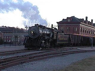
We reached Cumberland just in time to
come upon a large steam locomotive that had been taken out for some rail
enthusiasts/photographers. There was a large group taking themselves altogether too
seriously while waiting to see the locomotive drive back and forth on the rails near a
crossing.


The town is once again/still sufficiently
"small town" that we provided traffic control while the locomotive drove back
and forth across the crossing for the "gallery". The kids were at first
stupefied, then scared about the whistle. Then once the whistle had come and gone,
Teddy lost interest due to the cold, and Tomi, ever vigilant, stayed with me until I got
my photos.
From there we went to Roy Rogers and had
chicken and all the fixings, talked to a guy who saw the Jeeps, then hit the road for the
long ride home. It was a beautiful day, memorable for the cold, calamity, and great
companionship!