Prologue
Maria had friends visiting for the
weekend and she was busy showing them the town. So the kids and
I decided to go do a little Geocaching. We'd already been rained
out of our plans to go to Seneca Rocks and do some camping and hiking so
this was the next best thing. I loaded up some
film cameras and
lenses, the digital camera, and loaded the
GPS's with waypoints for four
Geocaches.
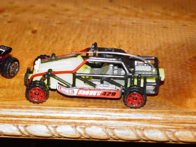
I
painted a few
Matchbox off-road vehicles for later use in the
Geocaches.
I brought them along to place in any caches that we might find on this
trip.


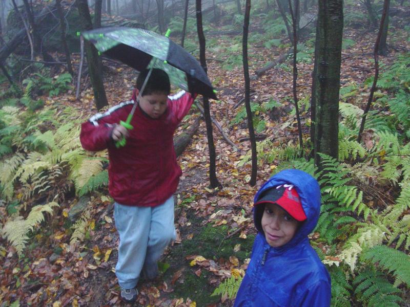
Muster
With the kids all dressed for wet
fall weather, we took a quick walk to
my Geocache and found
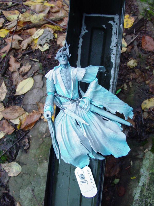
someone had visited it earlier in the morning. They had left a
cool travel bug (Ringwraith) that I decided to bring with us to drop in one of the
caches we might find.
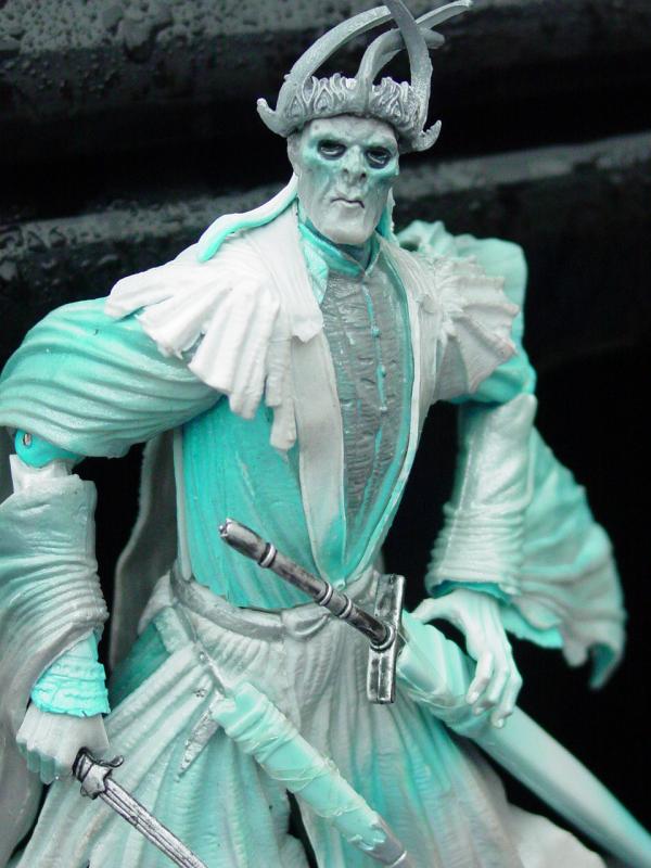

The kids
found him very engaging and insisted on getting more familiar with him
while we drove to our destination. I didn't see any harm in it so
obliged.
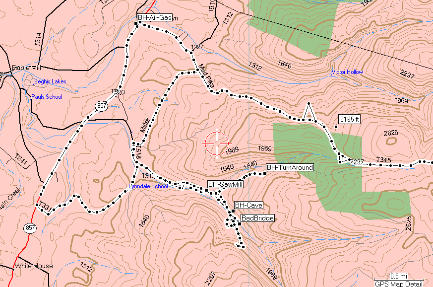
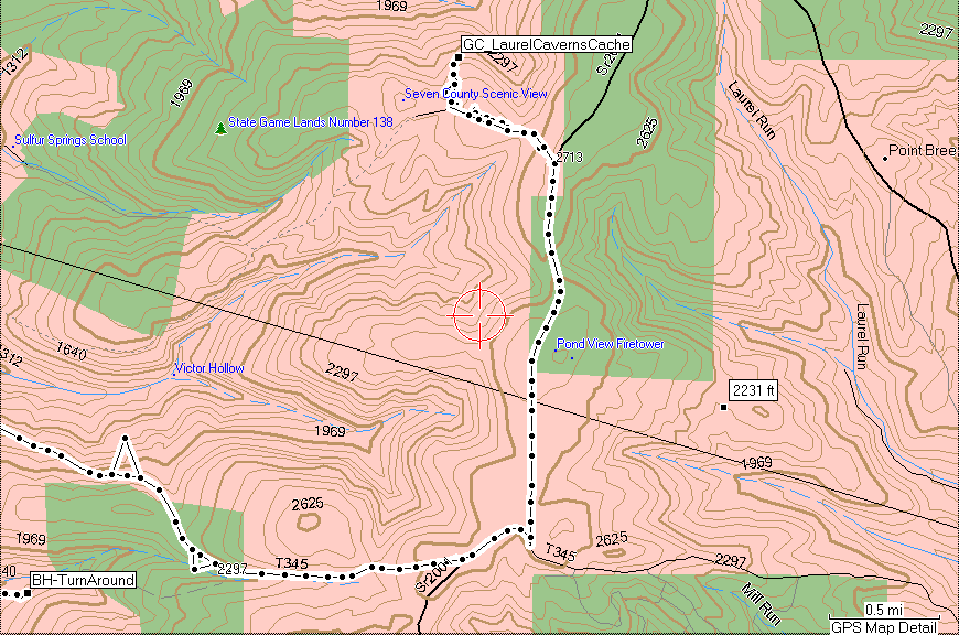
Trail
I have
found it very convenient to use the GPS
V to generate a route to Geocaches, so today was no exception.
I put in the waypoint for the
Laurel Caverns Cache and then told the GPS
to find it. The route that resulted looked great on paper so off
we went. I had planned only to drive to the caches, find them if
possible, and then come home. I was not planning to go trail
riding, even though I am always prepared if the opportunity arises.
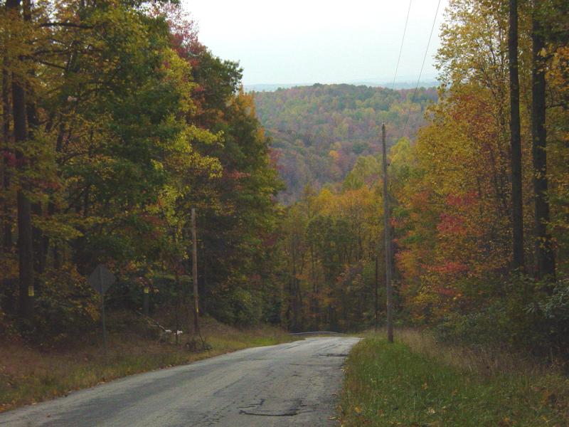
Pretty
soon we got onto a road that had a sign at the beginning that said "No
Outlet". I wasn't too worried because I figured that perhaps the
road I saw on the map was gated or something. We'd just turn back
and go around. No big deal.
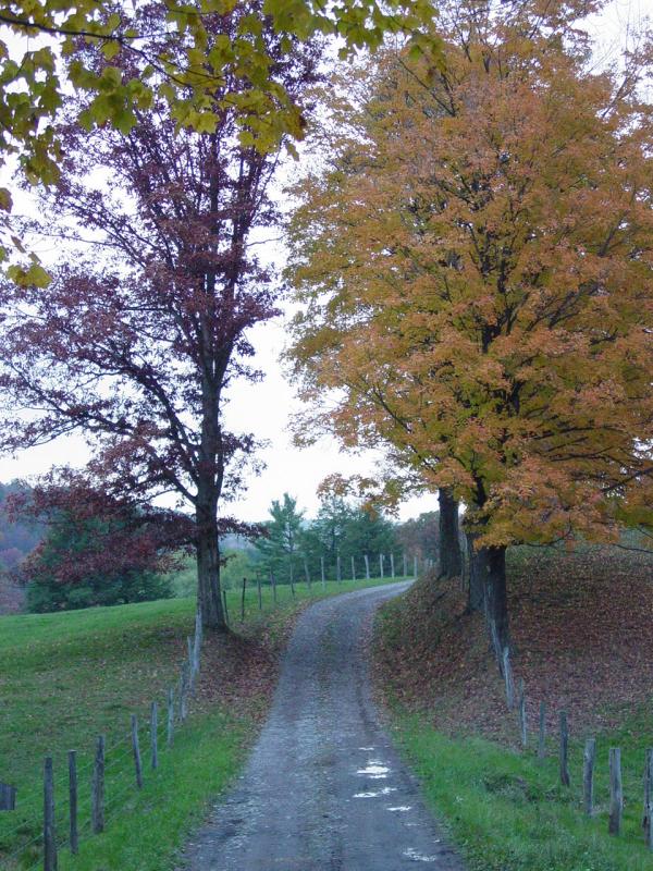
When we
got to the end of pavement (and it was quite a patchwork quilt of
pavement at that), there was indeed a gate but it was open.
Exactly where the map on the GPS said it should be was a rocky dirt road
that disappeared up the hill into the woods.

I drove
up a ways to see what it was, and found it continued out of sight,
looking not unlike any other trail we love to drive. So I broke
out the Oasis Automatic Tire Deflators
and aired down while I disconnected
the sway bar. That was easy, even in the rain with my umbrella
to hand.
Once
that was done, I got back in the Jeep, told the kids we were going
4-Wheeling after all (duh) and with 4-LO locked in, started crawling up
the hill. The trail stayed very well defined until we got to the
edge of the glen then it got a little narrower into the woods. It
looked like ATV's may run the trail from time to time but it was pretty
tight for us.
After
going a ways, I came to the conclusion that it was probably best to come
back with a buddy and poke into this some more. I managed to get
turned around and we drove back out the way we had come.
At the
bottom of the hill, I turned to the East and drove along another
well-defined trail that was calling my name. This one followed the
bottom of a hollow and gradually lead up to a very steep hill. It
was good solid ground and there was no place to fall, so I drove up into
the woods. I had to stop and break out the buck saw for a minute
to widen an open someone had cut in a fallen tree. That was easy
too.
Up past
the tree, the road switched back along the hillside. It was steep
and tight so it took me a couple point turn to get around. We
drove a little further and another tree was so low that when I tried to
go under, it gently fell down across my windshield and onto my hood.
It didn't dent or scratch anything but it meant I needed to get out and
clear it off. Again with the saw and soon we were rolling again.
We came
to another switchback. This time it was complicated. It cut
sharply to the left, the right side was very narrow with a good drop off
the steep side of the hill, and the road continued steeply up some
loose, muddy and narrow ground. To the right the old trail
continued to a wider flat area with grass. I pulled up there, got
out and checked the area, then turned around to go back down. I
didn't feel like getting crossways on this trail in the rain, in the
cold, alone, with no cell coverage, All we needed was to slide off the
side of the hill here... Even though I had left my itinerary
posted at home, and even though Maria would know to come looking here,
it would take a while for her to get really worried enough, and longer
still to muster up a vehicle that would get her here. So again, we
made a graceful exit full of new opportunities to explore with a buddy
and some sunshine.
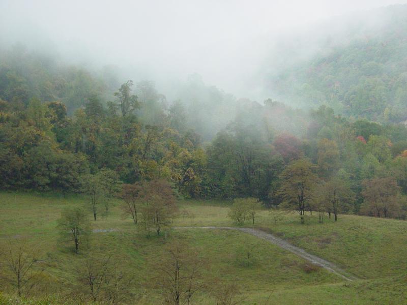
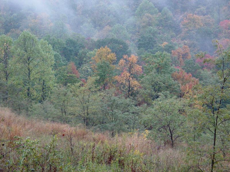
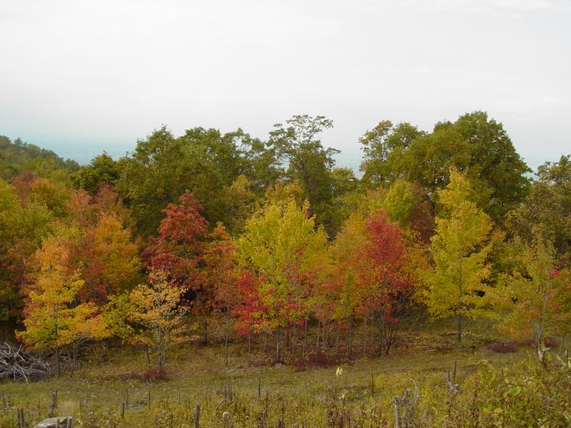
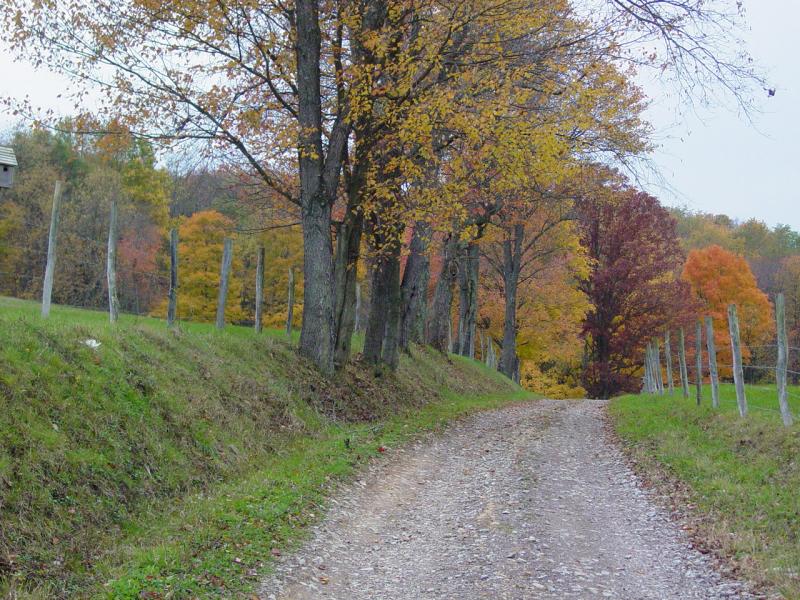
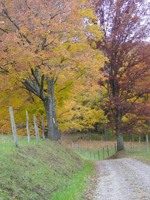
Coming
back down the hill the full beauty of the hollow greeted us. Even
in the fog and the rain, the fall leaves were pretty and the green grass
fairly glowed.
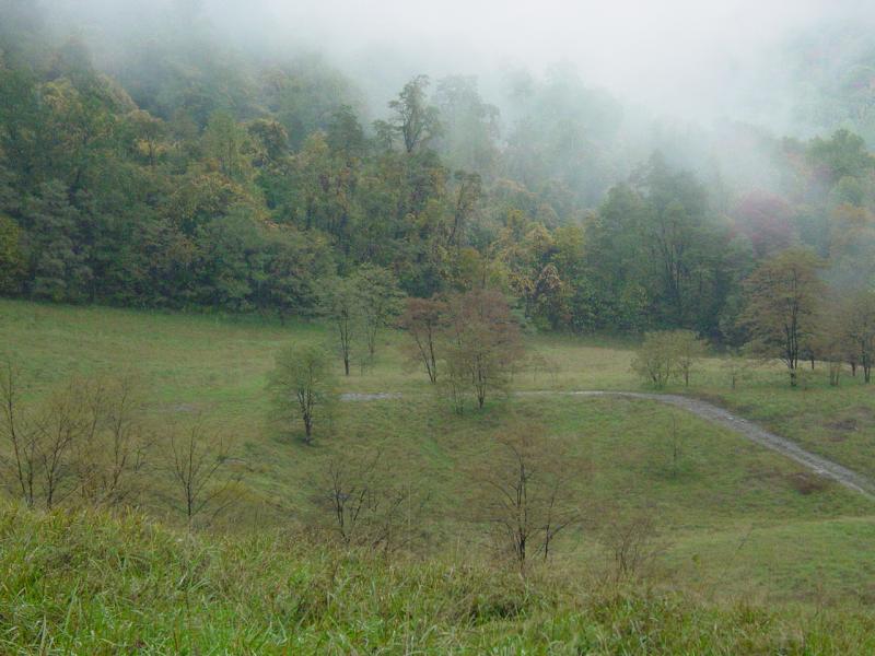


The kids
and I took pictures and made a circle around the hollow to explore it.
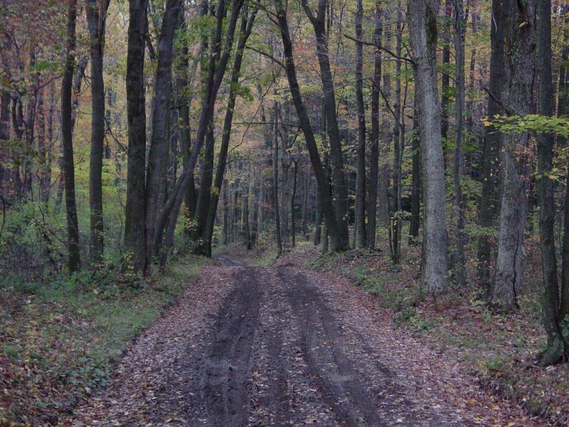
Then we took another trail to the side that led into the woods.
I was
rolling along happily when for some reason I noticed that directly ahead
lay a bridge - with big holes in it! I jabbed the brakes but it
really wasn't that dire - we were in 4-LO and still a good distance away
at our speed.
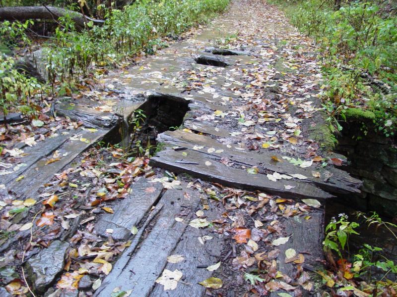
 
I got
out and took a look. I'd say it's pretty inconclusive. The
deck of the bridge is history - thin plywood or something like that.
The longitudinal supporting members were huge 12" x 12" beams that
looked quite solid. But 4500 pounds of Jeep and skid plates can
change all that in a heartbeat. The bridge only spans a 10 foot
stream but it was elevated high enough that falling through would have
kept me busy for quite a while. The way the bridge was
constructed, there was no way to ford the stream there, and really,
there was no point. It was late, and so on. So we turned
around and backtracked again.
Finally,
we'd pretty much run up against enough barriers that challenged my
willingness to take chances and I decided it was time to go back to the
road the continue on to the Geocaching.
But not
before a brief stop to check out the sawmill.
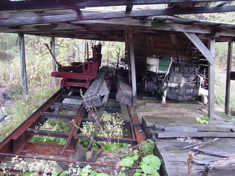


The kids reported that
they had lost the "hat" of the travel bug somewhere in the Jeep.
Great! I swear they could lose their heads if they weren't
attached. The good news was the "hat" was lost inside the Jeep so
we'd find it; the bad news was, with the rain and everything, it would
not be today... I told the kids the travel bug was not going to
leave for the next cache until he finds his hat. I was fairly
upset with them but having said my piece, I more or less dropped it.
After looking at the saw
mill we got back on the road and took an easier route to the cache.
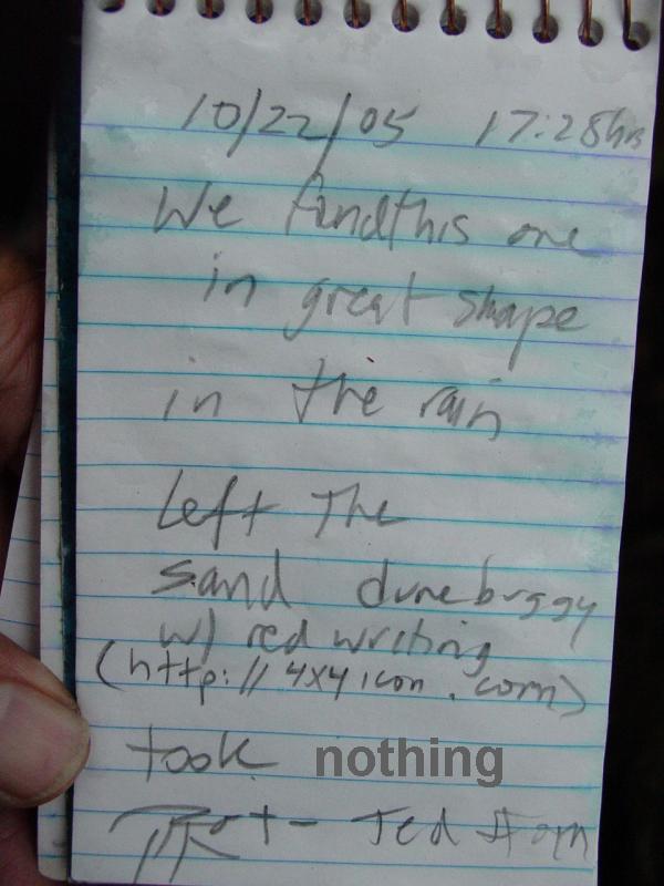
Laurel Caverns Cache
We found the location easily
and after driving around the gas well, then spending some time in the
parking lot, we hiked down to the cache location. We found it
easily and signed the log, left the Dune Buggy, then headed back up the
hill to the parking lot. I took a
Travel Bug tag but nothing was attached to it. I would have to
look it up to determine what was supposed to be attached, if anything.
I left the log like this except in place of "nothing" it said "Travel
Bug Tag".
Epilogue
The kids were wet and ready to call
it a day, so we got back in the Jeep after a short and failed attempt to
find the travel bug's "hat". Taking advantage of the level ground,
I reconnected the sway bar. We drove back a slightly different way
and reached a gas station in Haydentown where we picked up a snack, aired up, and then
headed home for the night.
This area will provide some really interesting exploring. I am
thinking Carl, Jim, and Charlie will find this right up their alley!
Update 10/23/05:
The next day, I
literally tore down the inside of the Jeep. Took the seats out, all the
gear we carry, the floor mats - everything. And there on the edge of one
of the floor mats was the "hat" of the
Ringwraith. Phew! I was very happy to find this - would not want him
going on with his travels without it! Only then could I run the
vacuum cleaner!
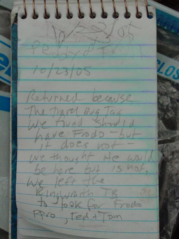
I found the Travel
Bug Dogtag in my watch pocket of my jeans from the previous day. I
had searched high and low for the stupid thing only to conclude I had
lost it. We returned to the house to look up the number and see
what it was supposed to be attached. We were surprised to find it
was supposed to be Frodo - the hero from the Tolkien trilogy - Lord of
the Rings. How strange Frodo would turn up missing when we had a
Ringwraith along with us to go Geocaching... We will go back to
Laurel Caverns Cache and see if we can find Frodo in the cache.
Muster
Having found the "hat"
for the Ringwraith, our interest in deploying him rebounded. I
herded up our stuff, loaded the Jeep and called the kids. They
were all too happy to oblige. We headed out, this time bypassing
our off-road route and going directly to the Laurel Caverns parking lot
and the cache.
  
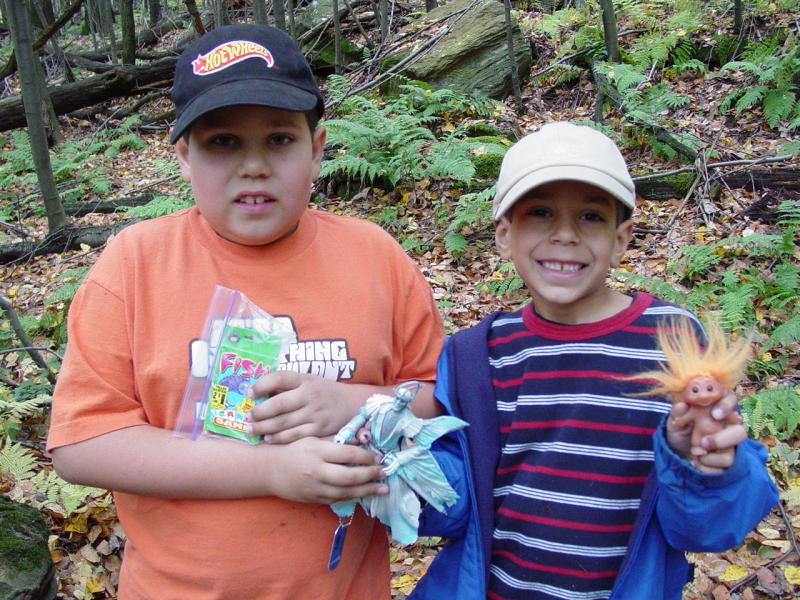
Geocache Trail 2
Ted and Tom placed cars
in the cache and retrieved the Troll and Go Fish game.
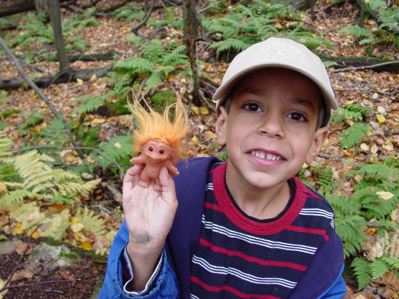 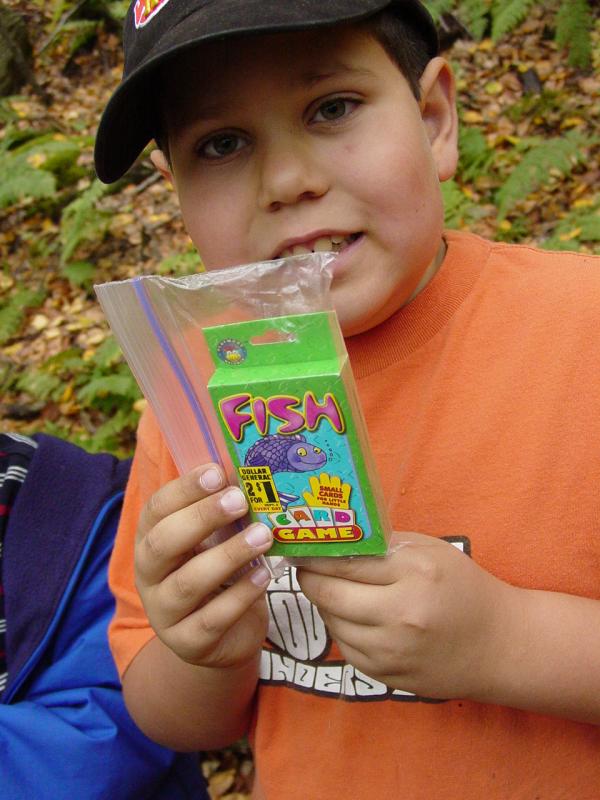
I placed the
Ringwraith travel bug.

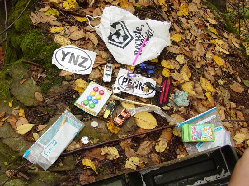
 
There was no sign of
Frodo, so I retained the travel bug dogtag so I could report the
unfortunate incident and get instructions from the owner of the tag.
Life is stranger than fiction sometimes...

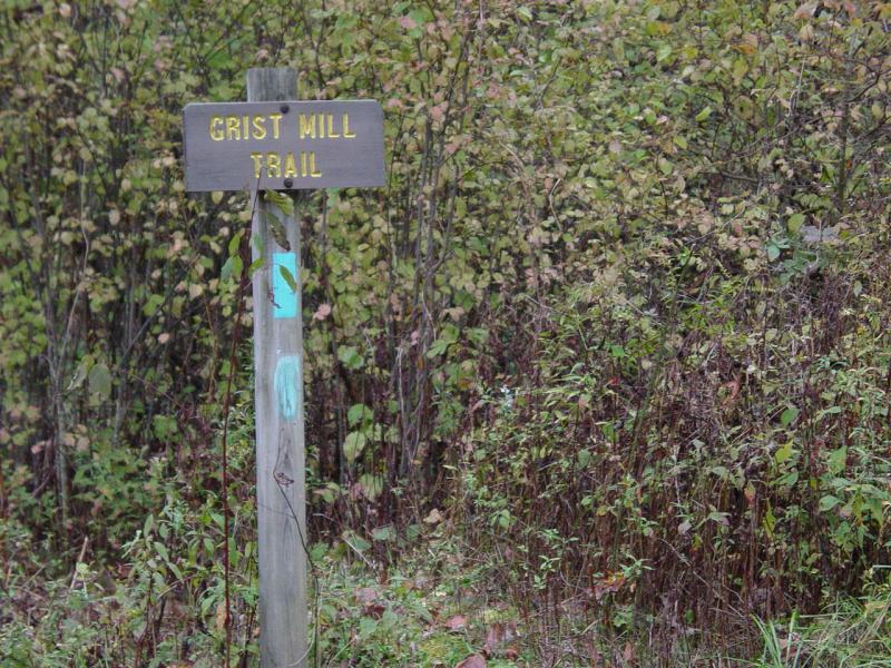
Geocache Trail Part 3
We then made tracks for
the Grist Mill cache nearby.

As I like to approach
using the GPS, I routed to a mark I had made that looked like a good
parking spot. When we reached it, I found that it marked a
crossing that no longer had a bridge. I walked it off and found it
was now a ford so we crossed. Once again we were 4-Wheeling.
On the other side, I stopped to check and found that the cache was not
really going to be any easier to access from here so we crossed back and
continued on down the road.
When we got to Quebec
Run Recreation Area, I stopped to read the cache instructions. It
made reference to the trail head we noticed but I thought we needed to
go up onto the other side of the area and come down so we took a little
side trip up and around Sumey Road.
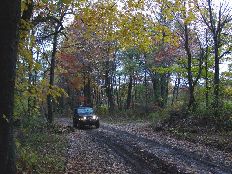
I made a few photos
on the way in, and we passed the PA Bureau of Wildlife rangers.
  

They gave a pleasant
wave as they passed, showing no concern about us going in, even at the
late hour. We drove in until we were even with the cache waypoint
but found it was no closer than from the other side at the trail head.
I took a poll and the kids voted they didn't want to walk the .6 mile to
the cache and out. And anyway we would have had just barely enough
time before sunset anyway so it seemed pointless.
We backtracked out.
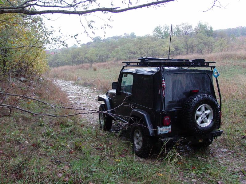
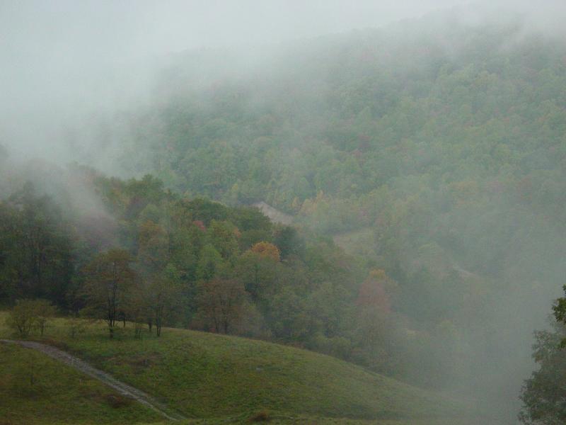
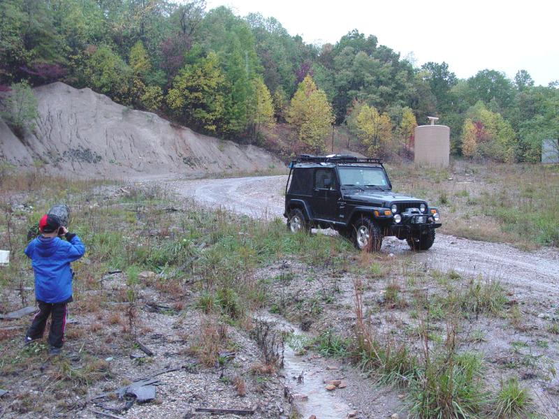
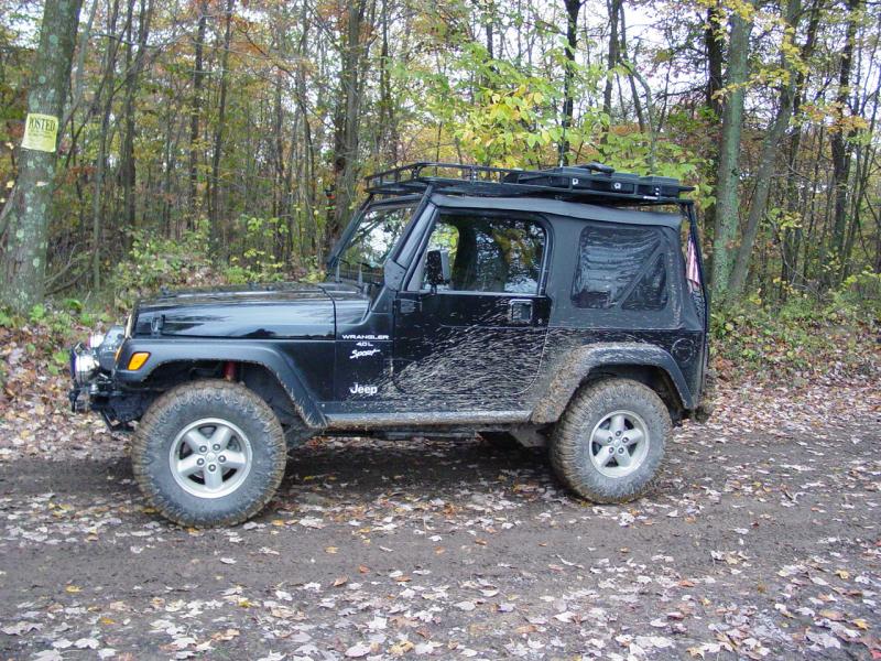
I stopped to make some pictures of the Jeep.

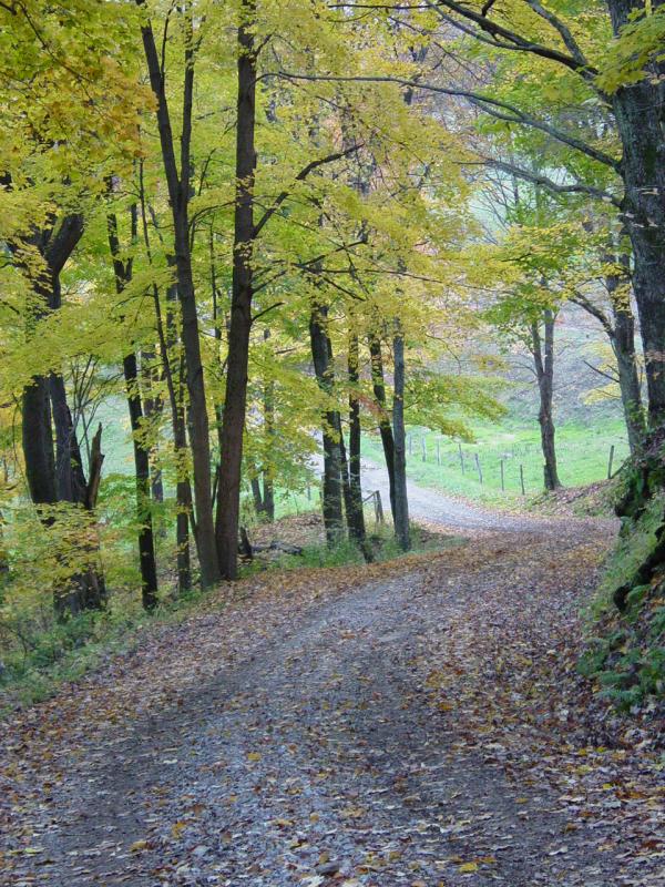
A little further down
the road I stopped and made pictures of the area. It was very
nice, reminded me of home this time of year.
   
 
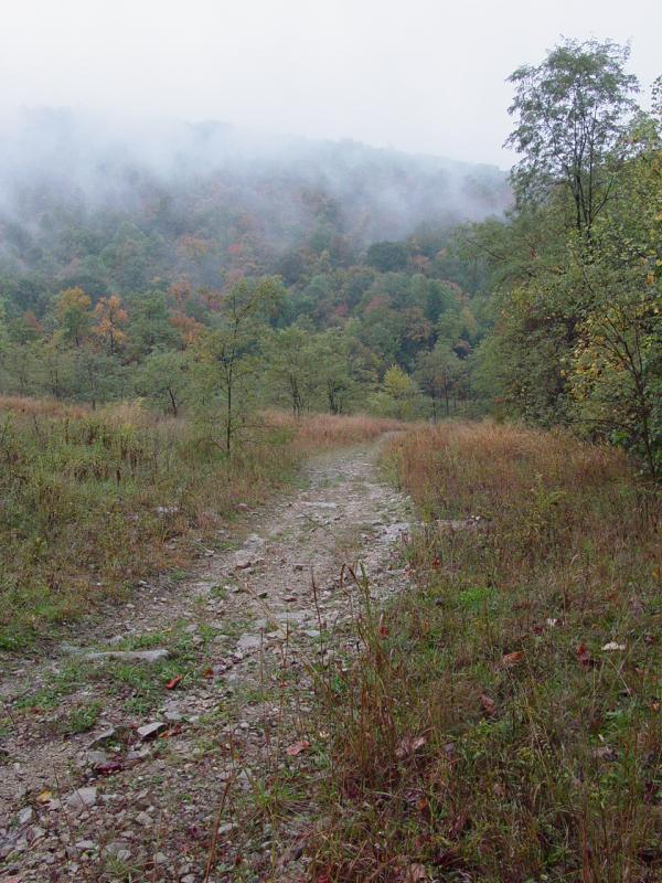
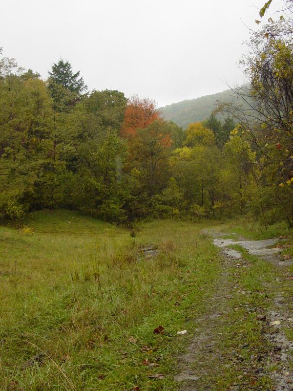
Then we headed back
up the road and on our way out of the area. I took a couple
pictures, one of the trail head and another at the intersection of
Quebec and Skyline.

Trail Part 2
Ted mentioned the cave
that we had located on the map in the vicinity of Brownfield Hollow.
I figured since it was within feet of the road we'd been on the day
before, we would have time to scout it out.
We turned into the
road that leads in, and drove up to the point where the GPS said the
cave should be. It was not immediately obvious but since the road
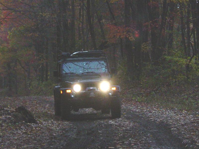
was so interesting, I continued in. It was dusk so I put on the
bright driving lights. This would be the first time I had used
them in the woods at night and I must say, they really made the going a
lot easier.
I spotted a trail
that lead off to the left so I turned in. Almost immediately it
got really steep. Thinking it was not much steeper than some of
the stuff I had driven out at Oakridge, I continued up. And it got
steeper. And steeper. And it was narrow and tight with some
sharp turns and then some washed out spots with large stones.
Now when you are
going up a hill in a Jeep in the dark and all you can see is sky, it
seems really steep. We had not aired down; not disconnected, and
we were presently in 4-LO 1st gear. So when the tires started to
lose traction, I got a little worried that we might not be able to
continue up the hill. There was no place to turn around and it
would have been a bitch to back down this hill. So I eased up on
the throttle and the tires caught some more traction. We managed
to claw our way to a less steep area where I could turn around easily.
Phew!
I talked to the kids
but mostly I was trying to catch my own breath. It really wasn't
that bad but it was a little more extreme that I had expected or wanted.
Turned around, I crawled back down the hill in 1st. At the bottom
I turned left and continued up the hill. It got a little bit
steeper and then tight again. But it was too interesting to leave
behind.
We got up a pretty
steep section and then found it weaving in and out of tight spots, going
around some washed out sections and finally following what looked like a
regularly traveled ATV trail. That meant that it was pretty narrow
and all the trail maintenance that had been done was only wide enough or
high enough for an ATV.
Eventually we came
upon a fallen tree that I had to cut out of the way with my
buck saw. I can't emphasis how
useful this tool has been. On this particular trip it was a life
saver. We would have had to turn back which would have been a lot
harder than pressing on.
We were flying on
instruments by this time since it was dark.
I was using the
GPS to keep us on a course pointed
towards the other road. The trails we found on the map all appear
to go through and come out on pavement to the north of where we went in.
Today I had marked where one of these trails came out on the other end
and now that little bit of homework was paying off because I could see
that mark and we were headed more or less right for it.
The kids were getting
a little bit anxious but we were definitely headed towards the road and
the waypoint so I assured them of the distance to pavement and that we'd
be fine. Worst case we'd turn tail and go back the way we came.
That's the beauty of the GPS. There is no way in hell we would
have attempted this at this time of day without it. As it was, I
would say it was quite an adventure, and in these liberal times, I
suspect many would think me a fool.
But let's consider.
I have cell phone coverage. I am within .3 mile of pavement.
I have a CB. I have GMRS, FRS radio. I have food and water
for a day, warm blankets, fire materials, recovery gear, the
temperatures are not going below 45 degrees, the kids are dressed for
winter, I know exactly where I am. There is nothing to fall off
of, and the trail, while tight and difficult, is unlikely to leave me
broken or capsized. Still, I am questioning myself for being here
alone. Oh well, that just makes it more of an adventure...
We spent some more
time sawing, this time a larger log. I was hoping to myself that
this was to be the end of the trail work since I really wanted to get
back to pavement and go home. Finally we got to within sight of
the road. I could see cars passing in both directions. Then
we encountered another fallen tree. This time it blocked our
ultimate exit. So I got out one more time and cleared it off.
Finally we were back on pavement.
Immediately the kids
recognized the stretch of road we had traveled twice in the last two
days. We were all happy to be out of the woods and headed safely
home. The trail is terrific. And well worth the work I did to get
through. Again, this is right up some of my friends alley!
Epilogue
Like last night, we
stopped and washed the Jeep. The kids played while I washed four
tons of mud out of the chassis and off the body. I spent a dollar
washing the chunks out of the bay to leave it clean for the next person.
Last night when we got there we had found a mud pile that would have
made a Mudder proud. I discovered the probably cause on this
evening: a guy with two ATV's on a trailer washing up. Not
that I have anything against ATV guys - after all, the trail I was
washing off my Jeep was courtesy of them!
Off
Road Index | Shop for
Jeep Toys and Books | See the
Toy Jeeps
|