Prologue
This trip was thrown
together in response to several people's wish to go riding. Jim C. started it up by
signing up me and Hector A. Next, Mike M. weighed in and at about the same time,
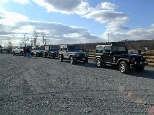
Roscoe P. We agreed to meet at the Sheetz in Haymarket, off Route 66.
Muster
I left home at about 6:30am
and reached the Sheetz exit just at the appointed hour of 7:30am. Behind me, Mike M
checked in over the CB and we rolled up to
Sheetz at the same time. Jim C. and his neighbor Jim rolled in right behind that,
and Hector A. minutes later. By 7:50am we had all taken on fuel, food and so on, and
hit the road, west for Harrisonburg where we would meet Roscoe P.

We reformed at McDorman's
where we took on more supplies and met up with Roscoe. Jim C. had his son Dylan, Jim
had his son, Jim, and Hector had brought a couple friends. Roscoe and I had our
air tanks as co-pilots... After a couple more famous Ham
Sandwiches had found new homes, we hit the road for the first trail entrance.
Trail
Old Long Run
By now this trail has become
very familiar for most of us. For Hector and Roscoe and Jim, it was the first time
out. The rest of us had done this trail at least once. We stopped at the
beginning of the trail to air down and disconnect.
This went pretty smoothly. Jim C. discovered he was missing a bolt on the bracket
of one of his disconnects and saved the important parts that were still there in his
pocket. I guess this means he drove all the way back to Leesburg with no stabilizer
connectors. Mike M. decided not to disconnect. I aired down to about 25
psi. I had calculated that this would allow me to air up using my
on-board air tank without much help from the compressor.
Some of us lowered our CB antennas and then we were ready to roll.
There was almost no water on
the main parts of the trail. The first obstacle, and optional side hill, gave us a
chance to warm up for the day, and to some extent "qualify" us for what lie
ahead. It might be said that if you can navigate the hill both ways, there is
nothing on the trail that will be any more difficult - at least nothing mandatory...


Everyone made short work of
the hill and we were soon back on our way. We had some fun at the crossings.
After the first few, we came to a couple sections where the trail blends into the river
for a few yards.


There is an easy way and a
hard way. On the first of these spots, I took the easy way while a couple guys
behind me took the hard way.


At the next spot where this
opportunity arose, the same spot where we had eaten lunch
a ride or two back, I noticed that it might be
possible to climb a particular rock and pass through a mild boulder field. I had a
moments pause, thinking about whether or not my newly-installed
rock rails would come into play, but crawled right
through it in 1st, 4-LO. I cautioned that this was "optional", parked,
then watched as everyone in the group took the same line up the rock and through the
boulders.

While this was going on, we
did some jockeying to make room for those as they came up the trail past the obstacle.
Mike M. very nicely backed up so that the next few would have room. In the
process his right-rear wheel climbed a rock on the edge of the trail and he
"lunched" his bumper end and found himself teeter-tottering on two wheels.
Later, when looking at the pictures he would say "I guess I should have
disconnected." Maybe Mike, but then you might have made it up over that rock
you were perched on, and who knows where that would have left you?


Roscoe on the other hand,
did a beautiful job of parking. Great Stuff. Great tire wrinkle.
The rest of the trail was
pretty routine. The river had just a trickle of water in it - just enough to make it
pretty, and to make the rocks slippery if you were on foot.


But the trail remains very
passable to stock vehicles as long as the driver is paying attention.


We reached the top of Old
Long Run, near Gauley Ridge, at lunch time. Jim C. suggested a small field on top of
a hill. Sure enough, there was a road that went up into the field where we found a
bright, sunny clearing that was surprisingly warm after the dark groves we left behind on
Old Long Run. So we all broke out the food and ate. We talked about vehicle
mods, other trips on these trails and stuff like that. Soon it became time to get
going.
Dry River
Jim C. suggested we go to
Dry River so his friend Jim could get some mud time. Since we knew that Second
Mountain was closed by the gate down near Route 33 we discussed routes back to pavement.
I would have had us going back down Old Long Run. Jim C. wisely reminded me
of FR 72, and within 20 minutes we were back on pavement down at the base of the mountain.
We trundled along to Dry River and took the high entrance that leads to the portion
of the trail shared by the river, the entrance to the reservoir, and the mud. On the
way in we noticed that the gate to the reservoir was closed.


We stopped and played in the
nearly dried up mud hole. Everyone that wanted, got a chance to slop around.
Jim missed several "Hey! Hey! HEY!'s" and managed to tweak his tailgate.
Ouch. Everyone else managed to get in and out of this place without any trouble.
On the way out I noticed a
bump stop on the trail and stopped to pick it up. It seemed unlikely that it had
been there long since it wasn't compacted into the dirt. I walked back down the line
and soon found that it belonged to Jim. Not one but two broken parts on this part of
the trip. Jim gets the Carnage of the Day award. Near the reservoir we spotted
two vehicles coming in and going up to the reservoir. One was a camo-painted Dodge
with a bed cover, and another vehicle behind it. The gate was now open. I
guess whomever it was, belonged there. We continued on our way.


At the entrance/exit we
splashed through the trail, shared by the river. Everyone got a little of the mud
washed off.
Flagpole Knob via
Skidmore Dam and Dunkle Hollow
Back out on Route 33 we went
further west and ducked in to Skidmore Dam. We followed the road down to Dunkle
Hollow. There are a number of primitive campsites along the way. Soon I
noticed a site that had a huge pile of rubbish in the fire circle. It was too big a
mess to ignore. I asked if anyone had plastic bags, Mike M. answered in the
affirmative, so we stopped and spent several minutes cleaning up the mess. I tossed
the bag in my Jeep and donated it to the cause at my local transfer station the next day.
It was disappointing to see that the trash consisted of the packaging of all the
equipment needed to go camping, all the food that one might bring if you were new to
camping, ammo boxes (empty), and several empty propane tanks. All and all, I would
say that it suggested a group that has no idea about camping and certainly no respect for
the wilderness.
Near that campsite was a
nice little hill that begged climbing. I eased up to it but realized that one part
was nearly vertical and decided that I was not interested in finding out how easy it was
to tip over backwards. So I left it alone and we headed up the trail towards
Flagpole.
Along the way we saw another
campsite even worse than the first. It would have taken the rest of the afternoon to
clean up. We left it there, sadly, and continued. I guess I got a little ahead
of the guys in back because at one point Jim C. noted being passed by a Porsche...
This portion of the trail
had many little side paths leading off to who knows where. Most were clearly marked
off limits but a few might bear further exploration on another day.


Eventually we reached the
top of the trail and turned right for Flagpole Knob. Once there we dismounted and
enjoyed the view. Not long after we got there, we noticed a column of smoke rising
from the valley. A red TJ drove up and the driver told us that the pavement route
down from here had been closed by police because of the fire.
Union Springs via
Stone Camp/FR 225
That left us two options to
get out. We could go back the way we had come up, or go down to Union Springs via FR
225. It was getting late but we decided to go down FR 225 because it is a fairly
interesting trail. We expected to get back to pavement with some daylight left.
So we drove down FR 225.
There were a few spots that required us to pick our line but eventually we reached
the bottom of the ridge and wound our way out to where the large hill is located.
Some of us aired up and reconnected. I found that I was able to just make it
around all four tires using the air tank that I had previously filled to 150
p.s.i, without
waiting for the compressor. Just as I finished, the two Jims pulled alongside to get
their tires aired up. This is where I found the limitation of my set-up. It's
only good for one fill-up from the tank. I didn't have any reserve pressure left for
them so they opted to wait until we got to a gas station. Roscoe got his tires up in
pressure enough to drive on pavement. Hector too would wait until we got to the gas
station.
Epilogue
After what seemed like a
long ride, we reached the area near Route 81, and stopped at a gas station to get air.
With four people in line, I had enough time to pump my tank back up to pressure and
get Hector's tires up to pressure while the other three guys aired up. We got gas
and met at the Golden Corral, a little ways up Route 33. There we encountered a
hoard of people lined up for the "99-cent Steak Deal" that comes with the
all-you-can-eat buffet. We were a little put off by the long lines but we quickly
got our meals paid for and got seated. Even the line for steak went fast enough to
make it worth the trouble. Spread across three adjacent tables, we ate, talked about
the day, then broke off and headed home.
I don't think I've ever had
this much fun on Old Long Run. And I don't think I've ever covered this much
territory in one day. By the time I got home, I was burned out, but I had a great
time!
Larger
Pictures from Mike
McCready | More pictures from
Roscoe
Primrose
Back to Off Road Index
Shop for Jeep Toys and
Books | See the Toy Jeeps