Big Levels: Way Points
Big Levels | Shoe Creek | Items Used | Jim Culfogienis' write-up and photos
Prologue
This trip was long overdue. Big Levels was closed at the end of December and reopened on April 1, 2002. When the topic of destination came up for this trip, both Carl and I yelled out "Big Levels". So here we are. Once we refined the itinerary and day, I went back to my notes on these areas. Both Big Levels and Shoe Creek have portions of trails we have not explored. So after reviewing the maps, I decided that it would be nice to follow a couple of open trail spurs to see what they were like. It is clear from the maps where they go, all that remained was to discover what the terrain was like and whether or not the trail there was interesting enough to visit on a regular basis.
On Big Levels, one trail goes straight up to the top of the Levels, and a couple others run a switchback, crossing the straight trail a few times. There is also a spur that leads off to the West that looks interesting. On Shoe Creek, we have twice climbed the beginning of a trail that leads north into a knob at about 3400 feet, just south of Cash Hollow. The elevations shown on the map appear to be challenging and worth checking out. So I added the waypoints to my GPS and let folks know that we'd be trying a couple of side trails.
Muster
Carl and I met at Burger King in Gaithersburg at about 6:35am, then drove down to the main meeting place along Routes 15 and 29, just south of Route 66 at about 7:30 am. This allowed us to get an early start for this far-flung trail system and the few extras that I want to run while there. Jim and Eric were waiting for us when we got there. Seth called me to say he would not make it this time, and Hector called to say he was on Route 29 and would soon be there. Hector and his friend Greta arrived shortly. We herded the kids into the Jeeps and hit the road for Stuart's Draft.
When we reached Charlottesville, we stopped to get some breakfast, sandwiches for lunch, and to attend to comfort issues. In the parking lot was a guy in a Jeep with number plate "JEEPLV" who turned out to be taking a break. Once everyone got there respective needs filled, we jumped on Route 29, down a couple lights to Route 64, and from there down Route 340 to Stuart's Draft.
Somewhere along the way we stopped to get Gas!
Trails
Big Levels
10:25am
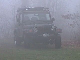
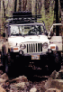
Our early start paid off with an early arrival at the trail head. This gave us an extra hour to play with. The rain held off until we arrived at the entrance to Big Levels, then dumped on us while we aired down and disconnected. Needless to say, this was not the best start to the trip. However, it must be noted that the trail is usually very dusty. I much prefer a damp trail with no dust, and Big Levels is not very difficult, so a little water made things more interesting.
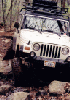
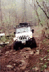
Once everyone was ready to go, we took off with Carl leading the way. He quickly reached the first obstacle. We each tackled it in turn without stopping. I think the rain probably kept folks from wanting to get out and hang around. Carl and Hector had already gotten past it by the time I got out and walked up. I got to watch Eric and Jim each take their turns going over the rock.
Eric did a great job and just snuck his left rear quarter past without whacking it. Jim just straddled it and bumped over. His new lift and tires were now initiated... I just went ahead and took the same line that worked in the past, and drove right by it. It looks like the main rock has been broken loose leaving a couple of other rocks. It was still a nice start to the day.
Next we reached the first trail junction where an erosion has cut a "V" in the trail that leads straight ahead. Carl made a few attempts to go past using the right side of the trail. He was not able to get that line to work because he lost traction with his power wheels when the axles got "crossed". He and Hector just took the trail that goes around to the right.
Eric tried the same line as Carl and had no more success. So he backed off and took the left-hand side, over the rock, and made it over nice and easy. Jim and I did the same thing, and soon we were all headed up the trail.
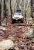
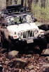
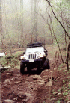
This section of the trail is nothing but a boulder-strewn, vertical cut. With the rain, it made the possibility of traction problems more likely. But to my mild surprise, no one had problems and we all crawled our way up the hill. At one point we had to clear some low-hanging deadwood so that Big Jim could get his Monster-Tire-carrying roof rack past.
12:30pm
We crawled our way to the top, where the trail comes out on a dirt track that meanders along to the south-east and eventually starts to descend into a flat area. We stopped to take a lunch break. Jim broke out a tarp and we stretched it between our roof racks to make a shelter from the rain. Everybody had a bite and we discussed our plans for the afternoon.
On the ride out, Eric experimented with the range of travel of his suspension to see if he could figure out how one of his fenders got "modified.
The test results were inconclusive.
Jim took a lot of ribbing from the small Jeeps about his lift and tires. Jeep Envy? All in good fun.
I had to relinquish my Land Rover Recovery Team status. It turns out that the sanctioning body did my 6-month audit and found that I had not recovered any Land Rovers since the last check, and discontinued my affiliation. At such time that I recover a Land Rover, I'll be eligible for membership...
Once lunch was finished, we packed up all our gear and garbage, and hit the trail again. There were lots of mud puddles along the way so by the time we reached the top of the trail, everyone was pretty well washed in mud.
We made use of the out-house near the look-out tower and took another short break before heading out to pavement.
Crabtree Falls / Shoe Creek
Since we had just taken a break before reaching pavement, we went right down the road to Shoe Creek. I just missed the turn at Route 814 from the Blue Ridge Parkway, but everyone else was able catch it. I fell in and we continued down Route 814 to Route 56. Along the way we enjoyed the scenery through the fog. From Route 56 we entered the Crabtree Meadows area on Route 827. After a drive up to the Meadow, we entered the trail.
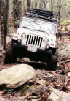
Soon we came to a small rock that sticks up out of the trail. As I was leading, I went over it and pulled up ahead to leave room for the others. Then I went back down and took some pictures of everyone climbing over the rock. It was easy, with everyone climbing right over it without a problem.
The trail eventually reaches a high point and begins a long gradual descent to the trail exit several miles away. All along the way there are little challenges, nothing really extreme, but fun driving anyway. A couple spots have optional rocks and some of us tried them out.
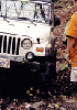
On one section, I drove part way in and then decided that I wasn't willing to tip my Jeep as close to the rock as I would have to in order to get past. So I exited the stretch and went down by the old ruins, brought the kids back up on foot and took pictures.
Eric came down and made the same choice as me.
After much examination and considerable thinking, Jim decided to come down all the way, over the rock and down the boulder field. He was able to get past all of it and came out unscathed.
While this was all going on, Carl had explored a side trail on foot and suggested it for exploration. As it turned out, it was only a few hundred yards east of the side trail I wanted to explore, and headed off in the same direction. So we went ahead and followed it.
After crossing the stream, it turned uphill and after a moment came to a substantial collapsed log structure. I could see as we drove along that this trail was headed to the same knob that tops the side trail I wanted to explore. We turned uphill from here and crawled our way to the top of a knob just south of Cash Hollow. On the way back down, Carl followed another branch of the trail which led out to a dirt road that was closed at both ends. We backtracked to the ruins and continued down the trail a little ways to where the side trail I had identified turned off the main trail.
Once we got to the place where Jim, Hector and I had climbed last time, we regrouped and discussed the trail. While it was getting late, we all still wanted some trail time, so I went to the lead and we started our ascent.
Before doing so, Jim and I climbed the difficult section that last time we had gone down.
Pretty soon, the trail made a sharp turn to the west and started steeply uphill. Not only that but it got very narrow and slightly off camber. Factor in the rain and drizzle that we'd been having all day, and the trail looked downright intimidating. My recent experience with sliding backwards downhill into a stump, ruining my back bumper were still fresh. I was very careful to feel out the traction as I started to climb the hill. There would be no turning back. And because the trail wraps itself around the side of the hill and is very eroded, there would be no easy backing up if things got bad. In short, to start up this hill was to commit to climbing it without stopping and hopefully without slipping...
Carl would later tell me that everyone thought I was crazy. Heck, I thought I was crazy. But as I moved ahead foot by foot, the Jeep held the trail, did not slip, the tires did exactly what I wanted and the Jeep went exactly where I pointed it. As the trail went further up the steep hill, it continued to hug the side of the hill and continued to get narrower. And it stayed a little off-camber. It wasn't as bad an angle as State Line, but it was considerable more narrow. And the drop off to one side was precipitous to say the least. I am thankful for the fog because it kept me from seeing how far down it was. Now, having traveled this trail, I might be ready to see it on a clear day...
Everyone hung back while I went up the trail. As best I can recall, it was only when I called over the CB that I had found a turn around spot that others began to follow me up the side. That was probably good because I do not think backing down this trail would have been easy or in the least bit fun. Even in the woods, the fog was pretty thick making visibility very limited. Shortly past the wide spot in the trail, it got narrow again and continued up. It remained tricky and demanded every ounce of concentration.
I was concerned that I might have a slight advantage. While I do not have very aggressive tire tread, I had aired down to about 15 pounds, and have a limited slip rear end. Additionally, I may have the lowest gear ratio (3.73's) in my differentials of all the people in our group. This means that I can crawl at a very low speed with less chance of my rear wheels slipping. While all of this is great for me, it meant that there might not be anyone else with this advantage, and could lead to trouble when they try to climb the hill. I was happy to find that everyone else was able to climb the hill without having trouble. All made it to within 1/4 mile from the top of the same knob we had reached from the trail that Carl found. There we encountered a large tree that blocked the trail. Cut out of it was a segment just large enough for a vehicle to pass. But the tree was at a sharp angle to the trail and surrounded by large brush.
I was able to work my way in and pivot my rock rail on the edge of the tree. This swung the Jeep into a better position to go through the cut out section of the tree, with a little help from my back wheel scooting my rear end around as it hit the tree. Jim held some large bushes out of the way.
Upon seeing this, Carl decided he'd wait for his rock rails before trying this. Eric's Discovery was a little longer and wider than my Jeep so he opted to skip it as well. Hector too was not ready for this. Jim could not resist and made good use of his lift, tires, and rock rails and joined me on the other side.
At this point we decided that Carl would lead Hector and Eric back down the way we had all come up. Jim and I would continue up the trail to the top of the knob and come back down the trail that Carl had taken us up. So Carl and crew turned around and started down the trail. I was concerned for them and hoped that they would have no troubles going back down. I risked "hovering" by recommending 4-LO- 1st gear and limited use of the brakes, even though I suspected that everyone knew better.
Meanwhile, Jim and I discovered that two large fallen trees blocked our path to the top of the knob. It looked like the trail was otherwise clear. But it had started to rain and our desire to saw our way the last 1/4 mile was not great enough for us to continue. We turned around, spotted each other through the fallen tree, and went down the way we came up. All the way, we could hear Carl encouraging the rest of our group, and checking in on our progress.
Surprisingly, going back down was no problem. I am starting to think that I didn't air down enough when I was on the Jeep Jamboree pre-run and that was what led to my problems there. I didn't air down at all when I had my problems on State Line. Suffice to say I always air down now, and go all the way down to 15 psi which is the maximum recommended by the Oasis kit for my tires and load weight.
When we had gotten most of the way down, I suggested that Carl get moving again and meet us at the trails-end. This would allow them to reconnect and air up while they were waiting for Jim and me. So he got everyone going and by the time we got down off the hill, we found that they were only a few yards ahead of us. We caught up to them just before we hit pavement. Along the way, there were erosion berms. I took them a little bit faster than usual (4 mph) and the kids had a blast getting some air in the car seats. We were all giggling like fools by the time we got to the white stone road leading out.
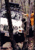
When we hit pavement, we set about the business of airing up and connecting. The kids played in the grass on the side of the road and got friendly with a local cat. Carl tried out his new Truck-Air compressor. Jim worked on getting air back into his big tires and found that he had taken a chunk out of the tree that we crossed. The chunk had wedged itself into the bead of one of his new tires. He asked me what I thought and I suggested removing the wood from the bead before airing up and driving. Since it was pretty tightly wedged, Jim swapped the tire for his spare and left it for later. Carl and I helped Hector get aired up and then we hit the pavement for something to eat.
Big Levels | Shoe Creek
Epilogue
6:30 p.m.
We made a beeline for Charlottesville and opted for the convenience and speed of the KFC buffet. Eric, wanting to get an early start home, continued on without us. My kids helped themselves to their favorites from the many choices on the buffet table. Everybody ate and we hit the road for home. This part of the trip is never the most fun but with some light chatter, and later some quiet when the kids fell asleep, we had a nice drive home. This was the best trip yet to Big Levels and Shoe Creek. Thanks to Eric for joining us and showing us all what a great vehicle a modified Land Rover Discovery can be! Thanks to Hector and Greta for the fun on the trail. And as usual to Carl and Jim for providing the Ying (stock) and Yang (monster) perspectives!
Much to my chagrin, I was not able to stop at a Car Wash along way home. A sleepy Teddy asked me if I liked my Jeep dirty now? NOT! When I finally washed my car the next day, I found twigs wedged into my tire bead on two tires. I aired down and removed them without complication.
Back to Off Road Index
|
C.O.R.E. Trip | Accommodations | Jim Culfogienis' write-up and photos
|
|
Back to Off Road Index
Shop for Jeep Toys and Books | See the Toy Jeeps
Photos, Layout and
Design © 2001-2008 Paul M. Provencher All Rights
Reserved.
Contents of this Web Site may not be used without written permission.
Visitors Since 4/21/2001
Last Updated 02/09/2008 10:33:36 AM -0500
1588 4/6/06


